The East Coast Railway is one of the 19 railway zones of Indian Railways. It came into existence on 1 April 2003. The headquarters of the zone are at Bhubaneswar, Odisha

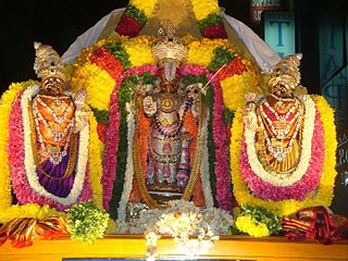
Ranganatha, also known as Ranganathar, Rangan, Aranganathar, SriRanga, and Thenarangathan, is a Hindu deity with his origin in South India, serving as the chief deity of the Sri Ranganathaswamy Temple, Srirangam. The deity is a resting form of Vishnu, recumbent on the great form of the serpent demigod Adishesha, the king of the serpents. His primary consort is the Goddess Lakshmi, also known as Ranganayaki. The two other consorts seen next to his recumbent figure are Bhudevi and Nila Devi. Most of the deities portray a 'smiling' lord in a sleeping or reclining position over the celestial serpent Adishesha in the sea of cosmic dissolution (pralaya). This is the form in which he is open to listening to all of his devotees' woes, and blesses them. Apart from being worshipped by all Hindus, this form is of particular importance to the Sri Vaishnava community. His name in Sanskrit means "leader of the place of assembly", coined from the two Sanskrit words ranga (place) and natha.

The Brahmani is a major seasonal river in the Odisha state of eastern India. The Brahmani is formed by the confluence of the Sankh and South Koel rivers, and flows through the districts of Sundargarh, Deogarh, Angul, Dhenkanal, Cuttack, Jajapur and Kendrapara. Also South Koel can be considered as upper reaches of Brahmani. Together with the river Baitarani, Brahmani forms a large delta before emptying into the Bay of Bengal at Dhamra. It is the second widest river in Odisha after Mahanadi.

Kbal Spean is an Angkorian-era archaeological site on the southwest slopes of the Kulen Hills to the northeast of Angkor in Banteay Srei District, Siem Reap Province, Cambodia. It is situated along a 150m stretch of the Stung Kbal Spean River, 25 kilometres (16 mi) from the main Angkor group of monuments, which lie downstream.

Angul district; also known as Anugul, is one of the thirty districts of Odisha in eastern India. The city of Angul is the district headquarters of Angul district.

Dhenkanal district is one of the 30 districts of the state of Odisha in Eastern India.

Angul is a town and a municipality and the headquarters of Angul district in the state of Odisha, India. Angul has an average elevation of 195 m (640 ft) above sea level. The total geographical area of the district is 6232 km2. From the point of view of area, it stands 11th among the 30 Districts of Odisha.

Athmallik is one of the sub-divisional headquarters in the district of Angul in Odisha, India and it is a Notified Area Council in Angul. Earlier it cames under the Dhenkanal District but now it is a part of Angul District. The Athmallik sub-division of Angul includes Athmallik and Kishorenagar blocks.

Ananta Vasudeva Temple is a Hindu temple dedicated to Krishna, an avatar of Vishnu located in Bhubaneswar, the state capital of Odisha, India. The temple was constructed in the thirteenth century, and the complete murtis of Krishna, Balarama and Subhadra are worshipped there. The temple dates back to the period of Chandrika Devi, the daughter of Anangabhima III, during the reign of the king Bhanudeva. A commemorative inscription that marked the foundation of the temple can be found in the British Museum's collection.

The Undavalli Caves, a monolithic example of Indian rock-cut architecture and one of the finest testimonials to ancient viswakarma sthapathis, are located in Vijayawada of Guntur district in the Indian state of Andhra Pradesh. The caves are located south west of Vijayawada, 22 km north east of Guntur City of Andhra Pradesh. It is one of the centrally protected monuments of national importance.

Odisha is one of the 28 states in the Republic of India. Odisha is located in the eastern part of the Indian peninsula and the Bay of Bengal lies to its East while Chhattisgarh shares its border in the west and north-west. The state also shares geographic boundaries with West Bengal in the north-east, Jharkhand in the north and Andhra Pradesh in the south. The state is spread over an area of 1,55,707 km2 and extends for 700 km from north to south and 500 kilometres from east to west. Its coastline is 450 km long. The state is divided into 30 districts which are further subdivided into 314 blocks.

The Jharsuguda–Vizianagaram line is a railway line in eastern India. It connects Jharsuguda,516 km (321 mi) from Howrah on the Howrah–Nagpur–Mumbai line, and Titlagarh, which in turn is connected with Vizianagaram, 820 km (510 mi) from Howrah on the Howrah–Chennai main line, and Raipur Junction, 830 km (516 mi) from Howrah on the Howrah–Nagpur–Mumbai line. There are several branch lines, like the 176 km (109 mi) line connecting Rayagada with Koraput on the Kothavalasa–Kirandul line. The line traverses Western Odisha and connects the Howrah–Nagpur–Mumbai line with the Howrah–Chennai main line. It covers small portions of Chhattisgarh and Andhra Pradesh.

The Shore Temple is a complex of temples and shrines that overlooks the shore of the Bay of Bengal. It is located in Mahabalipuram, about 60 kilometres (37 mi) south of Chennai in Tamil Nadu, India.

Bhima Ratha is a monument in the Pancha Rathas complex at Mahabalipuram, on the Coromandel Coast of the Bay of Bengal, in the Kancheepuram district of the state of Tamil Nadu, India. It is an example of monolith Indian rock-cut architecture. Dating from the late 7th century, it is attributed to the reign of King Mahendravarman I and his son Narasimhavarman I of the Pallava Kingdom. The entire complex is under the auspices of the Archaeological Survey of India (ASI), and is one of the Group of Monuments at Mahabalipuram designated as a UNESCO World Heritage Site since 1984.

Mahishasuramardhini Mandapa is an example of Indian rock-cut architecture dating from the late 7th century, of the Pallava dynasty. It is a rock-cut cave temple located on a hill, near a lighthouse, along with other caves in Mamallapuram. Mamallapuram, also popularly known as Mahabalipuram, is a small village to the south of Chennai, in the state of Tamil Nadu, India. The temple is part of the Group of Monuments at Mahabalipuram, a UNESCO World Heritage Site inscribed in 1984. This Cave Temple has many interesting architectural features of which three exquisitely carved reliefs on the cave walls of three sanctums are prominent. One is of Vishnu reclining on the seven hooded serpent, Adishesha, another of Durga, the main deity of the cave temple Durga slaying the buffalo headed demon Mahishasura, and the third sanctum has a sculpture of Shiva.
Pingua is a village in Dhenkanal district, Odisha, India.
Pramananda Acharya (1893–1971) was an Indian archaeologist known for his notable archaeological research on the history of Odisha. He was honoured by the Government of India in 1964, with the award of Padma Shri, the fourth highest Indian civilian award for his services to the nation.

A rock relief or rock-cut relief is a relief sculpture carved on solid or "living rock" such as a cliff, rather than a detached piece of stone. They are a category of rock art, and sometimes found as part of, or in conjunction with, rock-cut architecture. However, they tend to be omitted in most works on rock art, which concentrate on engravings and paintings by prehistoric peoples. A few such works exploit the natural contours of the rock and use them to define an image, but they do not amount to man-made reliefs. Rock reliefs have been made in many cultures throughout human history, and were especially important in the art of the ancient Near East. Rock reliefs are generally fairly large, as they need to be in order to have an impact in the open air. Most of those discussed here have figures that are over life-size, and in many the figures are multiples of life-size.
Kulei is a traditional Indian village belongs to Angul district of Odisha. Kulei is the 6th most populous village in Samal Barrage sub district of Angul district. The area of the village is 3 km2, making it the 17th largest village in the subdistrict. The population density of Kulei is 516 people per km2. 0.54 km2, (19%) of which is covered with forest.

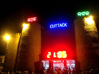
The Cuttack–Sambalpur line is a railway line connecting the cities of Cuttack with the Sambalpur, in the Indian state of Odisha.


