Michigan Avenue is a north-south street in Chicago that runs at 100 east on the Chicago grid. The northern end of the street is at Lake Shore Drive on the shore of Lake Michigan in the Gold Coast Historic District. The street's southern terminus is at Sibley Boulevard in the southern suburb of Dolton, but like many other Chicago streets, it exists in several disjointed segments.

Edgewater is a lakefront community area on the North Side of the city of Chicago, Illinois six miles north of the Loop. The most recently established of the city's 77 official community areas, Edgewater is bounded by Foster Avenue on the south, Devon Avenue on the north, Ravenswood Avenue on the west, and Lake Michigan on the east. Edgewater contains several beaches that residents enjoy during the late spring, summer, and early autumn. Chicago's largest park, Lincoln Park, stretches south from Edgewater for seven miles along the waterfront, almost to downtown. Historically, Edgewater was the northeastern corner of Lake View Township, an independent suburb annexed by the city of Chicago in 1889. Today, the Uptown community is to Edgewater's south, Lincoln Square to its west, West Ridge to its northwest and Rogers Park to its north.
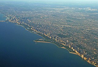
Lincoln Park is a 1,208-acre (489-hectare) park along Lake Michigan on the North Side of Chicago, Illinois. Named after US President Abraham Lincoln, it is the city's largest public park and stretches for seven miles (11 km) from Grand Avenue, on the south, to near Ardmore Avenue on the north, just north of the Lake Shore Drive terminus at Hollywood Avenue. Two museums and a zoo are located in the oldest part of the park between North Avenue and Diversey Parkway in the eponymous neighborhood. Further to the north, the park is characterized by parkland, beaches, recreational areas, nature reserves, and harbors. To the south, there is a more narrow strip of beaches east of Lake Shore Drive, almost to downtown. With 20 million visitors per year, Lincoln Park is the second-most-visited city park in the United States, behind Central Park.
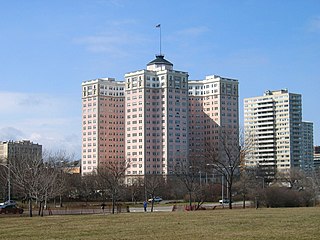
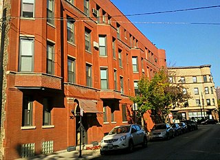
The Bryn Mawr Historic District is on the lakefront of the Edgewater neighborhood of far-north Chicago, Illinois. It extends along Bryn Mawr Avenue between Broadway and Sheridan Road. Its most prominent features are the Belle Shore Apartment Hotel, Bryn Mawr Apartment Hotel, Edgewater Beach Apartments, Edgewater Presbyterian Church, Manor House, and the northernmost area of Lincoln Park.

Clark Street is a north–south street in Chicago, Illinois that runs close to the shore of Lake Michigan from the northern city boundary with Evanston, to 2200 South in the city street numbering system. At its northern end, Clark Street is at 1800 West; however the street runs diagonally through the Chicago grid for about 8 miles (13 km) to North Avenue and then runs at 100 West for the rest of its course south to Cermak Road. It is also seen in Riverdale beyond 127th street across the Calumet River, along with other nearby streets that ended just south of the Loop. The major length of Clark Street runs a total of 98 blocks.

The Black Metropolis–Bronzeville District is a historic African American district in the Bronzeville neighborhood of the Douglas community area on the South Side of Chicago, Illinois.

The Historic Michigan Boulevard District is a historic district in the Loop community area of Chicago in Cook County, Illinois, United States encompassing Michigan Avenue between 11th or Roosevelt Road, depending on the source, and Randolph Streets and named after the nearby Lake Michigan. It was designated a Chicago Landmark on February 27, 2002. The district includes numerous significant buildings on Michigan Avenue facing Grant Park. In addition, this section of Michigan Avenue includes the point recognized as the end of U.S. Route 66. This district is one of the world's best known one-sided streets rivalling Fifth Avenue in New York City and Edinburgh's Princes Street. It lies immediately south of the Michigan–Wacker Historic District and east of the Loop Retail Historic District.

The Wicker Park District is a historic district in the West Town community area of Chicago, Illinois. It is the neighborhood bounded by Bell Avenue, Caton Street, Leavitt Street, Potomac Avenue and Chicago 'L' tracks. It was designated a Chicago Landmark on April 12, 1991.

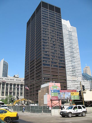
The Chicago Avenue Pumping Station is a historic district contributing property in the Old Chicago Water Tower District landmark district. It is located on Michigan Avenue along the Magnificent Mile shopping district in the Near North Side community area of Chicago, Illinois. It is on the east side of Michigan Avenue opposite the Chicago Water Tower.

The Astor Street District is a historic district in Central Chicago, Illinois.

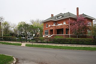
The Mid-North District or Midtown-North is a historic district in the Lincoln Park community area of Chicago, Illinois. The district was built from 1865 to 1900 by various architects. It is bounded by Fullerton Avenue to the north, Armitage Avenue to the south, Lincoln Avenue to the west and Clark Street to the east. It was designated a Chicago Landmark on August 31, 1977.

The Vinton Street Commercial Historic District is located along Vinton Street between Elm Street on the west and South 17th Street on the east in south Omaha, Nebraska. This district is located adjacent to Sheelytown, a residential neighborhood that had historically significant populations of Irish, Poles, and Eastern European immigrants. It grew along with the success of the Union Stockyards and South Omaha. It was added to the National Register of Historic Places in 2006.
The Ravenswood Manor Historic District is a historic district in the Albany Park community area of North Side, Chicago, Illinois. It is bordered by the Chicago River on the East, and by the alley south of Lawrence Avenue on the North, Sacramento Avenue on the West, and the alley North of Montrose Avenue on the south.

The Downtown Adrian Commercial Historic District is a historic district comprising the downtown area of Adrian, Michigan. It was designated as a Michigan Historic Site and added to the National Register of Historic Places on April 17, 1986. The district is roughly bounded on the north by Toledo Street, on the east by North Broad Street, on the south by East Church Street, and on the west by North Winter Street (M-52), West Maumee Street, and the River Raisin. Most of the district is enclosed by the US-223 Business Route, although the two are not conterminous.

Printers Row, also known as Printing House Row, is a neighborhood located in the south of the Chicago downtown area known as the Loop. The heart of Printers Row is generally defined by Ida B. Wells Drive on the north, Polk Street on the south, Plymouth Court on the east, and the Chicago River on the west. This neighborhood overlaps significantly with the officially designated landmark Printing House Row District to the north of Ida B Wells Drive and the South Loop Printing House District to the south of the Drive. The neighborhood includes Dearborn Station, which is also on the National Register of Historic Places.
The Lakeview Historic District is a historic district on the north side of the city of Chicago, Illinois.
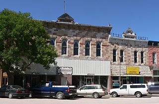
The Chadron Commercial Historic District, located at Main St. & 2nd St. in Chadron, Nebraska, is a 12.9-acre (5.2 ha) historic district that was listed on the National Register of Historic Places in 2007. It includes buildings dating from 1888 and includes Romanesque Revival, Colonial Revival, and commercial vernacular architecture in some of its 41 contributing buildings and 20 non-contributing buildings.
Fulton Market District is on the Near West Side of Chicago. In the 19th and 20th centuries, it served meat-packing, warehouse and industrial purposes, but has gentrified in the 21st century with corporate headquarters, tech industry, hotels, bars, restaurants, and retail. Randolph Street and Lake Street are the main East-West streets, and Halsted Street the major North-South artery. The district's name commemorates American inventor Robert Fulton and it is just across the expressway from the Fulton River District to the east.