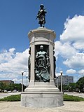
The Douglas community area stretches from 26th Street, south to Pershing Road along the Lake Shore, including parts of the Green Line, along State Street and the Metra Electric and Amtrak passenger railroad tracks, which run parallel to Lake Shore Drive. Burnham Park runs along its shoreline, containing 31st Street Beach. The community area also contains part of the neighborhood of Bronzeville, the historic center of black culture in the city, since the early 20th century and the Great Migration.
The neighborhood is named for Stephen A. Douglas, Illinois politician and Abraham Lincoln's political foe, whose estate included a tract of land given to the federal government.[3] This tract later was developed for use as the Civil War Union training and prison camp, Camp Douglas, located in what is now the eastern portion of the Douglas neighborhood. Douglas gave that part of his estate at Cottage Grove and 35th to the Old University of Chicago.[4] The Chicago 2016 Olympic bid planned for the Olympic Village to be constructed on a 37-acre (15ha) truck parking lot, south of McCormick Place, that is mostly in the Douglas community area and partly in the Near South Side.[5]
In the early 20th century, Bronzeville was known as the "Black Metropolis", one of the nation's most significant concentrations of African-American businesses, and culture. The groundbreaking Pekin Theatre rose near 27th street in the first decade of the 20th century.
Between 1910 and 1920, during an early peak of the "Great Migration", the population of the area increased dramatically when thousands of black Americans escaped the de jure segregation and prejudice rife in the U.S. South and migrated to Chicago in search of industrial jobs. The Wabash YMCA is considered the first black Y in the U.S.[7] It remains active today due to ongoing support from nearby black churches.[8] The Wabash YMCA's work to commemorate black culture was the genesis of Black History Month.[9]
In 1922, Louis B. Anderson, a Chicago alderman, had the architects Michaelsen & Rognstad build him a house at 3800 South Calumet Avenue. The surrounding area would take on the name of this house (which he had named Bronzeville).[10]
47th Street was and remains the hub of the Bronzeville neighborhood. In the early 21st century, it has started to regain some of its former glory. Gone for good is the Regal Theater (demolished in 1973), where many great performers took the stage. The Forum Hall building was built in 1897 designed by Chicago architect Samuel Atwater Treat (1839-1910) and may contain the oldest hardwood ballroom dance floor in Chicago. It filled a significant role in Bronzeville's cultural scene, being the venue for famous musicians From the 1940s and 1960s, high-rise public housing projects were constructed in the area, which were managed by the Chicago Housing Authority. The largest complex was the Robert Taylor Homes. They developed severe social problems exacerbated by concentrated poverty among the residents and poor design of the buildings. This project was demolished in the late 1990s and early 21st century. The nickname "Bronzeville" was first used for the area in 1930 by James J. Gentry, a local theater editor for the Chicago Bee publication. It refers to the brown skin color of black Americans, who predominated as residents in that area. It has become common usage over decades.[12]
The Bronzeville community features in various literary works set in Chicago, including Richard Wright's Native Son, Gwendolyn Brooks' A Street in Bronzeville, Lorraine Hansberry's stage play A Raisin in the Sun, Leon Forrest's There is a Tree More Ancient than Eden [The Bloodworth Trilogy], Bayo Ojikutu's crime novel 47th Street Black, and Sara Paretsky's detective mystery Blacklist, part of the V. I. Warshawski series.
Historical images of Bronzeville are in Explore Chicago Collections, a digital repository made available by Chicago Collections archives, libraries and other cultural institutions in the city.[13]
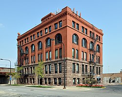
Prairie Shores
Originally a five-building, 1677-unit public housing project erected in 1962 by Michael Reese Hospital, Prairie Shores has been adapted as a market rate, middle-class community. Along with the adjacent Lake Meadows development, this was part of the city's largest urban renewal project at the time of its inception in 1946. The total project included construction of the Illinois Institute of Technology and Mercy Hospital. The development was funded under the Title I of the Housing Act of 1949, using US$6.2 million ($64.4 million today) of subsidies.[14]
Groveland Park
Of all the sections of Douglas originally developed by Stephen A. Douglas, only Groveland Park survives. Its homes are built around an oval-shaped park. Groveland Park is located between Cottage Grove Avenue, 33rd Street, 35th Street and the Metra Electric railroad tracks.
The Metra Electric District has a flag stop at East 27th Street, where trains stop either at the request of a passenger on-board, or if riders are seen waiting on the platform.[17] The CTA Green Line also serves the community area at the 35th station.
The population of Douglas climbed precipitously through the mid-20th century as a result of the Great Migration of black families to the North. At the time, African American families were primarily limited to an area known as the "Black Belt", which constitutes much of the area of historic Bronzeville. The rapid influx of new residents notoriously contributed to overcrowded and unsanitary conditions in the growing neighborhood.
Following its peak in 1950, the population of the neighborhood began a long decline as racial covenants restricting black settlement were lifted and black families sought residence in other areas. Economic decline in the 1960s and 1970s coinciding with disinvestment further contributed to the flight of families from the area.[19] Furthermore, urban renewal projects led by the Chicago Housing Authority (CHA) contributed to the displacement of over 18,000 individuals from Bronzeville.[20]
The turn of the 21st century saw the CHA enact its Plan for Transformation, resulting in the demolition of many of the public housing projects erected in the prior decades. Consequently, the population of the neighborhood plummeted at an even faster clip from 2000-2010, bottoming out at 18,238 residents.[21] Beginning in the 1990s, however, Bronzeville and Douglas began to see renewed interest from middle- and upper-income black professionals attracted to its past.[22] This trend has continued in recent times, with Douglas finally turning the corner on population growth in the 2020 census with an increase of 11.3% over the past decade.
Notably, researchers have identified that Bronzeville contains two of the 193 census tracts nationally that achieved a remarkable decrease in poverty with minimal displacement of the existing communities between 2000 and 2015.[23] This trend has been attributed to the abundance of vacant lots throughout the neighborhood, which encourage development without driving out residents.[24] Furthermore, commentators have noted that Bronzeville is unique among Chicago neighborhoods in that the majority of gentrification has been driven by the black middle class.[25]
Quincy Jones (1933–2024), record producer, musician, and songwriter. At the time of the 1940 United States census, he resided with his family at 3548 South Prairie Avenue.[28]
R. Kelly (born 1967), singer, songwriter, record producer and convicted serial child sex abuser. He was a childhood resident of the Ida B. Wells Homes.[29]
Marshall "Major" Taylor (1878–1932), professional cyclist and first African American to win a world championship for cycling. He resided at the Wabash Avenue YMCA for the final two years of his life.[34][35]
This page is based on this Wikipedia article Text is available under the CC BY-SA 4.0 license; additional terms may apply. Images, videos and audio are available under their respective licenses.