Anguilla, Mississippi

Last updated

Anguilla, Mississippi
Sharkey County Mississippi Incorporated and Unincorporated areas Anguilla Highlighted.svg
Location within Sharkey County and Mississippi
Coordinates: 32°58′26″N90°49′47″W / 32.97389°N 90.82972°W / 32.97389; -90.82972
Country United States
State Mississippi
County Sharkey
Area
[1]
  Total1.03 sq mi (2.68 km2)
  Land1.03 sq mi (2.68 km2)
  Water0.00 sq mi (0.00 km2)
Elevation
105 ft (32 m)
Population
 (2020)
  Total496
  Density479.69/sq mi (185.26/km2)
Time zone UTC-6 (Central (CST))
  Summer (DST) UTC-5 (CDT)
ZIP code
38721
Area code 662
FIPS code 28-01500
GNIS ID 692402

Anguilla is a town in Sharkey County, Mississippi, United States. The population was 496 at the 2020 census, down from 726 at the 2010 census.

Contents

History

The town was heavily damaged by an EF2 tornado on December 13, 2022. [2]

Geography

Anguilla is located at 32°58′26″N90°49′47″W / 32.97389°N 90.82972°W / 32.97389; -90.82972 (32.973889, -90.829645). [3]

According to the United States Census Bureau, the town has a total area of 1.0 square mile (2.6 km2), all land.

Demographics

2020 census

Anguilla Racial Composition [4]
RaceNum.Perc.
White 10420.97%
Black or African American 38176.81%
Asian 51.01%
Other/Mixed 40.81%
Hispanic or Latino 20.4%

As of the 2020 United States Census, there were 496 people, 254 households, and 154 families residing in the town.

Historical population
CensusPop.Note
1920 361
1930 46729.4%
1940 4935.6%
1950 60121.9%
1960 580−3.5%
1970 6125.5%
1980 95055.2%
1990 883−7.1%
2000 9072.7%
2010 726−20.0%
2020 496−31.7%
U.S. Decennial Census [5]

2010 census

As of the census [6] of 2010, there were 726 people, 266 households, and 191 families residing in the town. The population density was 868.8 inhabitants per square mile (335.4/km2). There were 301 housing units at an average density of 306.5 per square mile (118.3/km2). The racial makeup of the town was 77.8% African American, 21.2% White, 0.1% Asian, and 0.7% from two or more races. Hispanic or Latino of any race were 0.0% of the population.

There were 266 households, out of which 32.3% had children under the age of 18 living with them, 31.6% were married couples living together, 33.5% had a female householder with no husband present, and 28.2% were non-families. 23.3% of all households were made up of individuals, and 6.4% had someone living alone who was 65 years of age or older. The average household size was 2.73 and the average family size was 3.16.

In the town, the population was spread out, with 28.2% under the age of 18, and 10.2% who were 65 years of age or older. The median age was 33.4 years. For every 100 females, there were 92.6 males. For every 100 females age 18 and over, there were 76.8 males.

The median income for a household in the town was $19,712, and the median income for a family was $21,964. Males had a median income of $28,125 versus $15,833 for females. The per capita income for the town was $10,452. About 41.0% of families and 47.5% of the population were below the poverty line, including 66.6% of those under age 18 and 24.0% of those age 65 or over.

Education

The town of Anguilla is served by the South Delta School District.

Notable people

Related Research Articles

<span class="mw-page-title-main">Sharkey County, Mississippi</span> County in Mississippi, United States

Sharkey County is a county located in the U.S. state of Mississippi. Part of the eastern border is formed by the Yazoo River. According to the 2020 census, the population was 3,800, making it the second-least populous county in Mississippi, after Issaquena County. Its county seat is Rolling Fork. The county is named after William L. Sharkey, the provisional Governor of Mississippi in 1865.
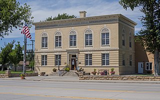
<span class="mw-page-title-main">Baca County, Colorado</span> County in Colorado, United States

Baca County is a county located in the U.S. state of Colorado. As of the 2020 census, the population was 3,506. The county seat is Springfield. Located at the southeast corner of Colorado, the county shares state borders with Kansas, New Mexico, and Oklahoma.

<span class="mw-page-title-main">Ragland, Alabama</span> Town in Alabama, United States

Ragland is a town in St. Clair County, Alabama, United States southeast of Ashville. It incorporated in 1899. At the 2020 census, the population was 1,693, up slightly from 1,639 in 2010. It is part of the Birmingham-Hoover-Cullman Combined Statistical Area.

<span class="mw-page-title-main">Vilonia, Arkansas</span> City in Arkansas, United States

Vilonia is a city in Faulkner County, Arkansas, United States. Its population was 4,288 in 2020 and estimated at4,429 in 2021, up from 3,815 at the 2010 census and 2,106 at the 2000 census. It is part of the Central Arkansas region.

<span class="mw-page-title-main">Camanche, Iowa</span> City in Iowa, United States

Camanche is a city in Clinton County, Iowa, United States, on the Mississippi River. The population was 4,565 at the time of the 2022 census.

Harmony is a town in Somerset County, Maine, United States. The population was 825 at the 2020 census.

<span class="mw-page-title-main">Colerain, North Carolina</span> Town in North Carolina, United States

Colerain is a town in Bertie County, North Carolina, United States. The population was 204 at the 2010 census.

<span class="mw-page-title-main">North Robinson, Ohio</span> Village in Ohio, United States

North Robinson is a village in Crawford County, Ohio, United States. The population was 219 at the 2020 census.

<span class="mw-page-title-main">Cole, Oklahoma</span> Town in Oklahoma, United States

Cole is a town in McClain County, Oklahoma, United States. The population was 624 at the 2020 census, up from 555 at the 2010 census.

<span class="mw-page-title-main">Earlsboro, Oklahoma</span> Town in Oklahoma, United States

Earlsboro is a town in Pottawatomie County, Oklahoma, United States. The population was 594 by the 2020 United States census. It was once called "...the town that whisky built and oil broke."

<span class="mw-page-title-main">Pulaski Township, Beaver County, Pennsylvania</span> Township in Pennsylvania, United States

Pulaski Township is a township in Beaver County, Pennsylvania, United States. The population was 1,296 at the 2020 census. It is part of the Pittsburgh metropolitan area.

<span class="mw-page-title-main">Marion Township, Butler County, Pennsylvania</span> Township in Pennsylvania, United States

Marion Township is a township in Butler County, Pennsylvania, United States. The population was 1,150 at the 2020 census.

<span class="mw-page-title-main">Elmhurst Township, Lackawanna County, Pennsylvania</span> Place in Pennsylvania, United States

Elmhurst Township is a township in Lackawanna County, Pennsylvania, United States. The population was 836 at the 2020 census.

<span class="mw-page-title-main">Bessemer, Lawrence County, Pennsylvania</span> Borough in Pennsylvania, United States

Bessemer is a borough in western Lawrence County, Pennsylvania, United States. The population was 1,073 at the 2020 census. It is part of the Pittsburgh metropolitan area.

<span class="mw-page-title-main">Otto Township, Pennsylvania</span> Township in Pennsylvania, United States

Otto Township is a township in McKean County, Pennsylvania, United States. The population was 1,518 at the time of the 2020 census.
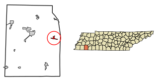
<span class="mw-page-title-main">Hornsby, Tennessee</span> Town in Tennessee, United States

Hornsby is a town in Hardeman County, Tennessee. The population was 303 at the 2010 census. The town is just east of Bolivar along U.S. Highway 64.

<span class="mw-page-title-main">Martell, Wisconsin</span> Town in Wisconsin, United States

Martell is a town in Pierce County, Wisconsin, United States. The population was 1,070 at the 2000 census. The unincorporated communities of Martell and Morton Corner are located in the town. The unincorporated community of Lawton is also located partially in the town.

<span class="mw-page-title-main">Siren, Wisconsin</span> Village in Wisconsin, United States

Siren is a village in, and the county seat of, Burnett County in the U.S. state of Wisconsin. The population was 806 at the 2010 census. The village is surrounded by the Town of Siren.

<span class="mw-page-title-main">Black Earth, Wisconsin</span> Village in Wisconsin, United States

Black Earth is a village in Dane County, Wisconsin, United States. The population was 1,338 at the 2010 census. The village is located within the Town of Black Earth. It is part of the Madison Metropolitan Statistical Area.

<span class="mw-page-title-main">Verona, Wisconsin</span> City in Wisconsin, United States

Verona is a city in Dane County, Wisconsin, in the United States and is a suburb of Madison. The population was 14,030 at the 2020 census. The city is located ten miles southwest of downtown Madison within the Town of Verona. It is part of the Madison Metropolitan Statistical Area.

References

  1. "2020 U.S. Gazetteer Files". United States Census Bureau. Retrieved July 24, 2022.
  2. NWS Damage Survey for 12/13-14/22 Tornado Event (Report). Iowa Environmental Mesonet. December 17, 2022. Retrieved December 17, 2022.{{cite report}}: Unknown parameter |agency= ignored (help)
  3. "US Gazetteer files: 2010, 2000, and 1990". United States Census Bureau. February 12, 2011. Retrieved April 23, 2011.
  4. "Explore Census Data". data.census.gov. Retrieved December 8, 2021.
  5. "Census of Population and Housing". Census.gov. Retrieved June 4, 2015.
  6. "U.S. Census website". United States Census Bureau . Retrieved January 31, 2008.
  7. "Henry "Son" Sims". AllMusic . Retrieved March 16, 2012.