Related Research Articles

Troup County is a county located in the west central portion of the U.S. state of Georgia. As of the 2020 census, the population was 69,426. The county seat is LaGrange.

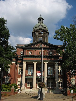
Meriwether County is a county located in the west central portion of the U.S. state of Georgia. As of the 2020 census, the population was 20,613. The county seat is Greenville, home of the Meriwether County Courthouse. The county was formed on December 14, 1827, as the 73rd county in Georgia. It was named for David Meriwether, a general in the American Revolutionary War and member of Congress from Georgia.
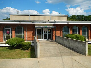
Heard County is a county located in the west central portion of the U.S. state of Georgia. At the 2020 census, the population was 11,412, down from 11,834 in 2010. The county seat is Franklin. The county was created on December 22, 1830.

Harris County is a county located in the west-central portion of the U.S. state of Georgia; its western border with the state of Alabama is formed by the Chattahoochee River. As of the 2020 census, the population was 34,668. The county seat is Hamilton. The largest city in the county is Pine Mountain, a resort town that is home to the Franklin D. Roosevelt State Park. Harris County was created on December 14, 1827, and named for Charles Harris, a Georgia judge and attorney.
Coweta County is a county located in the west central portion of the U.S. state of Georgia. It is part of Metro Atlanta. As of the 2020 census, the population was 146,158. The county seat is Newnan. Starting on Friday, November 24th, 2023, the Coweta County Sheriff's Office will make an appearance on the Reelz series On Patrol: Live, replacing Wilkes-Barre, Pennsylvania.
Carroll County is a county located in the northwestern part of the State of Georgia. As of the 2020 census, its population was 119,148. Its county seat is the city of Carrollton. Carroll County is included in the Atlanta-Sandy Springs-Roswell, GA Metropolitan Statistical Area and is also adjacent to Alabama on its western border.

Centralhatchee is a small village in Heard County, Georgia, United States. The population was 408 at the 2010 census.

Hogansville is a city in Troup County, Georgia, United States. The population was 3,060 at the 2010 census. Since 1998, Hogansville has held an annual Hummingbird Festival in October. It is located approximately halfway between Atlanta and Columbus, Georgia on Interstate 85 via Interstate 185.

LaGrange is a city in and the county seat of Troup County, Georgia, United States. The population of the city was estimated to be 30,858 in 2020 by the U.S. Census Bureau. It is the principal city of the LaGrange, Georgia Micropolitan Statistical Area, which is included in the Atlanta-Sandy Springs-Gainesville, Georgia-Alabama (part) Combined Statistical Area. It is about 60 miles (97 km) southwest of Atlanta and located in the foothills of the Georgia Piedmont.
Georgia's 3rd congressional district is a congressional district in the U.S. state of Georgia. The district is currently represented by Republican Drew Ferguson. The district's boundaries have been redrawn following the 2010 census, which granted an additional congressional seat to Georgia. The first election using the new district boundaries were the 2012 congressional elections.
Houston is an unincorporated community in Heard County, Georgia, United States. Its elevation is 833 feet (254 m), and it is located at 33°9′34″N85°8′16″W.
Callaway Stadium is a football/soccer stadium located in LaGrange, Georgia. It was built in 1958 by Callaway Foundation and is used by the Troup County High School, LaGrange High School, and Callaway High School football and soccer teams, as well as the LaGrange College Fighting Red Panthers football team. The facilities are also used by the football teams of the three public middle schools in Troup County as well. Despite its age, the stadium had FieldTurf installed in 2004 and a more advanced scoreboard installed in 2008. Its capacity is roughly 5,000 people all day long and has a press box on the home side.
West Georgia Technical College (WGTC) is a public community college in Waco, Georgia. It is part of the Technical College System of Georgia and provided education for a seven-county service area that includes Carroll, Coweta, Douglas, Haralson, Heard, Meriwether, and Troup. WGTC is accredited by the Commission on Colleges of the Southern Association of Colleges and Schools (SACS) to award technical certificates of credit, diplomas, with associate degrees being the highest level of award for which the College has been accredited.

State Route 219 (SR 219) is a 58.9-mile-long (94.8 km) state highway that runs south-to-north through portions of Muscogee, Harris, Troup, and Heard counties in the west-central part of the U.S. state of Georgia. It runs from Columbus north to a point southwest of Franklin.
Antioch is an unincorporated community in Polk County, in the U.S. state of Georgia.
Harrisonville is an unincorporated community in Troup County, in the U.S. state of Georgia.
Long Cane is an unincorporated community in Troup County, in the U.S. state of Georgia. The name sometimes is spelled "Longcane".
Mountville is an unincorporated community in Troup County, in the U.S. state of Georgia. The community was struck by an EF2 tornado on January 12, 2023. The tornado injured four people along its path as well.
Whitewater Creek is a stream in Heard and Troup counties in the U.S. state of Georgia. It is a tributary to the Chattahoochee River within the waters of West Point Lake.

State Route 109 (SR 109) is a 62.7-mile-long (100.9 km) state highway that runs west-to-east through portions of Troup, Meriwether, Pike, and Lamar counties in the western part of the U.S. state of Georgia. The route travels from the Alabama state line to at SR 18 near Barnesville. Traffic data shows it serves as the primary east-west route of both middle Troup County and Meriwether County. It is considered a medium priority route by the Georgia DOT for its entire length, except between the cities of Lagrange and Greenville, where it is considered a critical priority route. It is also the first east-west state route in west-central Georgia north of the Pine Mountain Range. SR 109 has one Spur route connecting Greenville to Gay. It was first designated on April 7, 1933 much shorter than it is today and shown in August 1933.
References
- ↑ U.S. Geological Survey Geographic Names Information System: Antioch, Troup County, Georgia
- ↑ "Troup County". Jim Forte Postal History. Retrieved September 6, 2017.
- ↑ Candler, Allen Daniel; Evans, Clement Anselm (1906). Georgia: Comprising Sketches of Counties, Towns, Events, Institutions, and Persons. State historical association. p. 65.
Municipalities and communities of Troup County, Georgia, United States | ||
|---|---|---|
| Cities |  | |
| Unincorporated communities | ||
| Footnotes | ‡This populated place also has portions in an adjacent county or counties | |
33°06′27″N85°10′12″W / 33.10750°N 85.17000°W
| | This Troup County, Georgia state location article is a stub. You can help Wikipedia by expanding it. |