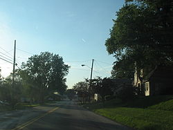
Apple Creek, Ohio

Last updated

Apple Creek, Ohio
AppleCreekOH.jpg
Central Apple Creek in the early evening
OHMap-doton-Apple Creek.png
Location of Apple Creek, Ohio
Map of Wayne County Ohio Highlighting Apple Creek Village.png
Location of Apple Creek in Wayne County
USA Ohio location map.svg
Red pog.svg
Apple Creek, Ohio
Usa edcp location map.svg
Red pog.svg
Apple Creek, Ohio
North America laea location map.svg
Red pog.svg
Apple Creek, Ohio
Coordinates: 40°45′02″N81°50′08″W / 40.75056°N 81.83556°W / 40.75056; -81.83556
Country United States
State Ohio
County Wayne
Area
[1]
  Total0.59 sq mi (1.53 km2)
  Land0.59 sq mi (1.52 km2)
  Water0.00 sq mi (0.01 km2)
Elevation
[2]
1,020 ft (310 m)
Population
 (2020)
  Total1,188
  Estimate 
(2023) [3]
1,183
  Density2,023.85/sq mi (782.02/km2)
Time zone UTC-5 (Eastern (EST))
  Summer (DST) UTC-4 (EDT)
ZIP code
44606
Area code 330
FIPS code 39-02232 [4]
GNIS feature ID2397972 [2]
Website www.apple-creek.org

Apple Creek is a village in East Union Township, Wayne County, Ohio, United States. The population was 1,188 at the 2020 census.

Contents

The village takes its name from nearby Apple Creek. [5]

Geography

According to the United States Census Bureau, the village has a total area of 0.58 square miles (1.50 km2), all of it land. [6]

Demographics

Historical population
CensusPop.Note
1870 300
1880 38528.3%
1890 42811.2%
1900 387−9.6%
1910 4003.4%
1920 382−4.5%
1930 45920.2%
1940 51011.1%
1950 5487.5%
1960 72231.8%
1970 7848.6%
1980 741−5.5%
1990 86016.1%
2000 99916.2%
2010 1,17317.4%
2020 1,1881.3%
2023 (est.)1,183 [3] −0.4%
U.S. Decennial Census [7]

2010 census

As of the census [8] of 2010, there were 1,173 people, 449 households, and 314 families living in the village. The population density was 2,022.4 inhabitants per square mile (780.9/km2). There were 485 housing units at an average density of 836.2 per square mile (322.9/km2). The racial makeup of the village was 97.7% White, 0.3% African American, 0.3% Native American, 0.7% Asian, 0.8% from other races, and 0.3% from two or more races. Hispanic or Latino of any race were 3.7% of the population.

There were 449 households, of which 35.6% had children under the age of 18 living with them, 56.6% were married couples living together, 9.4% had a female householder with no husband present, 4.0% had a male householder with no wife present, and 30.1% were non-families. 26.1% of all households were made up of individuals, and 10.6% had someone living alone who was 65 years of age or older. The average household size was 2.61 and the average family size was 3.15.

The median age in the village was 37.9 years. 27.3% of residents were under the age of 18; 8.1% were between the ages of 18 and 24; 24.9% were from 25 to 44; 26% were from 45 to 64; and 13.7% were 65 years of age or older. The gender makeup of the village was 49.4% male and 50.6% female.

2000 census

As of the census [4] of 2000, there were 999 people, 399 households, and 290 families living in the village. The population density was 1,648.3 inhabitants per square mile (636.4/km2). There were 414 housing units at an average density of 683.1 per square mile (263.7/km2). The racial makeup of the village was 98.10% White, 0.50% Asian, 0.10% Pacific Islander, 0.20% from other races, and 1.10% from two or more races. Hispanic or Latino of any race were 0.50% of the population.

There were 399 households, out of which 35.8% had children under the age of 18 living with them, 58.1% were married couples living together, 11.5% had a female householder with no husband present, and 27.1% were non-families. 23.8% of all households were made up of individuals, and 6.5% had someone living alone who was 65 years of age or older. The average household size was 2.50 and the average family size was 2.96.

In the village, the population was spread out, with 26.8% under the age of 18, 9.7% from 18 to 24, 31.4% from 25 to 44, 22.5% from 45 to 64, and 9.5% who were 65 years of age or older. The median age was 34 years. For every 100 females there were 88.8 males. For every 100 females age 18 and over, there were 90.9 males.

The median income for a household in the village was $41,574, and the median income for a family was $47,500. Males had a median income of $30,917 versus $24,226 for females. The per capita income for the village was $18,113. About 3.5% of families and 5.5% of the population were below the poverty line, including 5.3% of those under age 18 and 7.0% of those age 65 or over.

Related Research Articles

<span class="mw-page-title-main">Aberdeen, Ohio</span> Village in Ohio, United States

Aberdeen is a village in Huntington Township, Brown County, Ohio, United States, along the Ohio River 50 miles (80 km) southeast of Cincinnati. The population was 1,515 at the 2020 census.

<span class="mw-page-title-main">Warsaw, Ohio</span> Village in Ohio, United States

Warsaw is a village in Coshocton County, Ohio, United States, along the Walhonding River. The population was 624 at the 2020 census.

<span class="mw-page-title-main">Gordon, Ohio</span> Village in Ohio, United States

Gordon is a village in Darke County, Ohio, United States. The population was 245 at the 2020 census.

<span class="mw-page-title-main">Brice, Ohio</span> Village in Ohio, United States

Brice is a village in Franklin County, Ohio, United States, on the southeast side of the Columbus metropolitan area. The population was 93 at the 2020 census.

<span class="mw-page-title-main">Lyons, Ohio</span> Village in Ohio, United States

Lyons is a village in Fulton County, Ohio, United States. The population was 602 at the 2020 census.

<span class="mw-page-title-main">Metamora, Ohio</span> Village in Ohio, United States

Metamora is a village in Fulton County, Ohio, United States. The population was 566 at the 2020 census.

<span class="mw-page-title-main">Addyston, Ohio</span> Village in Ohio, United States

Addyston is a village in Miami Township, Hamilton County, Ohio, United States. Located along the Ohio River, it is a western suburb of the neighboring city of Cincinnati. The population was 927 at the 2020 census.

<span class="mw-page-title-main">Cleves, Ohio</span> City in Ohio, United States

Cleves is a village in Miami Township, Hamilton County, Ohio, United States. Located along the Ohio River, it is a western suburb of Cincinnati. The population was 3,414 at the 2020 census.

<span class="mw-page-title-main">Elmwood Place, Ohio</span> Village in Hamilton County, Ohio, United States

Elmwood Place is a village in Hamilton County, Ohio, United States. The population was 2,087 at the 2020 census. Except for a small portion which touches neighboring St. Bernard, Elmwood Place is nearly surrounded by the city of Cincinnati.

<span class="mw-page-title-main">Evendale, Ohio</span> Village in Ohio, United States

Evendale is a village in Hamilton County, Ohio, United States, within the Cincinnati metropolitan area. The population was 2,669 at the 2020 census.

<span class="mw-page-title-main">Hanover, Ohio</span> Village in Ohio, United States

Hanover is a village in Licking County, Ohio, United States. The population was 1,270 at the 2020 census. The village lies along Ohio State Route 16.

<span class="mw-page-title-main">Hebron, Ohio</span> Village in Ohio, USA

Hebron is a village in Licking County, Ohio, United States. The population was 2,326 at the 2020 census.

<span class="mw-page-title-main">St. Louisville, Ohio</span> Village in Ohio, United States

St. Louisville or Saint Louisville is a village in Licking County, Ohio, United States, along the North Fork of the Licking River. The population was 352 at the 2020 census.

<span class="mw-page-title-main">Limaville, Ohio</span> Census-designated place in Ohio, United States

Limaville is a census-designated place (CDP) and former village in Stark County, Ohio, United States. The population was 151 at the 2020 census. It is part of the Canton–Massillon Metropolitan Statistical Area.

<span class="mw-page-title-main">Navarre, Ohio</span> Village in Ohio, United States

Navarre is a village in southwestern Stark County, Ohio, United States. The population was 1,846 at the 2020 census. It is part of the Canton–Massillon metropolitan area.

<span class="mw-page-title-main">Clinton, Ohio</span> Village in Ohio, United States

Clinton is a village in southwestern Summit County, Ohio, United States. The population was 1,197 at the 2020 Census. It is part of the Akron metropolitan area.

<span class="mw-page-title-main">Wilson, Ohio</span> Village in Ohio, United States

Wilson is a village in Belmont and Monroe counties in the U.S. state of Ohio. The population was 129 at the 2020 census. It is part of the Wheeling metropolitan area.

<span class="mw-page-title-main">New Holland, Ohio</span> Village in Ohio, United States

New Holland is a village in Fayette and Pickaway counties in Ohio, United States. The population was 804 at the 2020 census.

<span class="mw-page-title-main">Gratiot, Ohio</span> Village in Ohio, United States

Gratiot is a village in Licking and Muskingum counties in the U.S. state of Ohio. The population was 215 at the 2020 census.

<span class="mw-page-title-main">Verona, Ohio</span> Village in Ohio, United States

Verona is a village in Montgomery and Preble counties in the U.S. state of Ohio. The population was 403 at the 2020 census. It is part of the Dayton Metropolitan Statistical Area.

References

  1. "ArcGIS REST Services Directory". United States Census Bureau. Retrieved September 20, 2022.
  2. 1 2 U.S. Geological Survey Geographic Names Information System: Apple Creek, Ohio
  3. 1 2 "Annual Estimates of the Resident Population for Incorporated Places in Ohio: April 1, 2020 to July 1, 2023". United States Census Bureau. Retrieved May 20, 2024.
  4. 1 2 "U.S. Census website". United States Census Bureau . Retrieved January 31, 2008.
  5. Overman, William Daniel (1958). Ohio Town Names. Akron, OH: Atlantic Press. p. 5.
  6. "US Gazetteer files 2010". United States Census Bureau. Archived from the original on January 25, 2012. Retrieved January 6, 2013.
  7. "Census of Population and Housing". Census.gov. Retrieved June 4, 2015.
  8. "U.S. Census website". United States Census Bureau . Retrieved January 6, 2013.