Arayat, Pampanga

Last updated

Arayat
Municipality of Arayat
Gen. Jose M. Alejandrino Monument, Arayat, Pampanga.jpg
Gen. Jose M. Alejandrino Monument in front of the Municipal Hall
Flag of Arayat Pampanga.jpg
Arayat Pampanga.png
Ph locator pampanga arayat.png
Map of Pampanga with Arayat highlighted
OpenStreetMap
Arayat, Pampanga
Philippines location map (square).svg
Red pog.svg
Arayat
Location within the Philippines
Coordinates: 15°08′57″N120°46′09″E / 15.149261°N 120.769158°E / 15.149261; 120.769158
Country Philippines
Region Central Luzon
Province Pampanga
District 3rd district
Barangays 30 (see Barangays)
Government
[1]
  Type Sangguniang Bayan
   Mayor Maria Lourdes M. Alejandrino
   Vice Mayor Emmanuel Bonifacio M. Alejandrino
   Representative Aurelio D. Gonzales Jr.
   Municipal Council
Members
   Electorate 74,454 voters (2022)
Area
[2]
  Total134.48 km2 (51.92 sq mi)
Elevation
55 m (180 ft)
Highest elevation
981 m (3,219 ft)
Lowest elevation
3 m (10 ft)
Population
 (2020 census) [3]
  Total144,875
  Density1,100/km2 (2,800/sq mi)
   Households
32,005
Economy
   Income class 1st municipal income class
   Poverty incidence
6.40
% (2018) [4]
   Revenue 340.2 million (2020)
   Assets 300.7 million (2020)
   Expenditure 321.1 million (2020)
   Liabilities 44.42 million (2020)
Service provider
  ElectricityPampanga Rural Electric Service Cooperative (PRESCO)
Time zone UTC+8 (PST)
ZIP code
2012
PSGC
IDD : area code +63(0)45
Native languages Kapampangan
Tagalog
Website www.arayat.gov.ph

Arayat, officially the Municipality of Arayat (Kapampangan : Balen ning Arayat; Tagalog : Bayan ng Arayat), is a 1st class municipality in the province of Pampanga in the Philippines. According to the 2020 census, it has a population of 144,875 people. [3]

Contents

Geography

Arayat is bordered with Candaba, Mexico, Magalang, Santa Ana and Cabiao in Nueva Ecija. A large portion of Mount Arayat is located within this municipality.

Arayat is 22 kilometres (14 mi) from San Fernando and 88 kilometres (55 mi) from Manila.

Barangays

Arayat is politically subdivided into 30 barangays. Each barangay consists of puroks and some have sitios.

  • Arenas
  • Baliti
  • Batasan
  • Buensuceso
  • Candating
  • Gatiawin
  • Guemasan
  • La Paz (Turu)
  • Lacmit
  • Lacquios
  • Mangga-Cacutud
  • Mapalad
  • Palinlang
  • Paralaya
  • Plazang Luma
  • Poblacion
  • San Agustin Norte
  • San Agustin Sur
  • San Antonio
  • San Jose Mesulo
  • San Juan Baño
  • San Mateo
  • San Nicolas
  • San Roque Bitas
  • Cupang (Santa Lucia)
  • Matamo (Santa Lucia)
  • Santo Niño Tabuan
  • Suclayin
  • Telapayong
  • Kaledian (Camba)

Climate

Climate data for Arayat, Pampanga
MonthJanFebMarAprMayJunJulAugSepOctNovDecYear
Mean daily maximum °C (°F)28
(82)
29
(84)
31
(88)
33
(91)
32
(90)
31
(88)
30
(86)
29
(84)
29
(84)
30
(86)
30
(86)
28
(82)
30
(86)
Mean daily minimum °C (°F)20
(68)
20
(68)
21
(70)
23
(73)
24
(75)
24
(75)
24
(75)
24
(75)
24
(75)
23
(73)
22
(72)
21
(70)
23
(72)
Average precipitation mm (inches)6
(0.2)
4
(0.2)
6
(0.2)
17
(0.7)
82
(3.2)
122
(4.8)
151
(5.9)
123
(4.8)
124
(4.9)
99
(3.9)
37
(1.5)
21
(0.8)
792
(31.1)
Average rainy days3.32.53.66.617.722.225.223.723.217.99.25.2160.3
Source: Meteoblue [5] (Use with caution: this is modeled/calculated data, not measured locally.)

Demographics

Population census of Arayat
YearPop.±% p.a.
1903 12,904    
1918 12,302−0.32%
1939 22,510+2.92%
1948 22,783+0.13%
1960 32,976+3.13%
1970 45,840+3.34%
1975 52,739+2.85%
1980 56,742+1.47%
YearPop.±% p.a.
1990 73,189+2.58%
1995 85,940+3.05%
2000 101,792+3.70%
2007 118,312+2.10%
2010 121,348+0.93%
2015 133,492+1.83%
2020 144,875+1.62%
Source: Philippine Statistics Authority [6] [7] [8] [9]

In the 2020 census, the population of Arayat, Pampanga, was 144,875 people, [3] with a density of 1,100 inhabitants per square kilometre or 2,800 inhabitants per square mile.

Economy

Poverty Incidence of Arayat

5
10
15
20
2006
9.40
2009
8.69
2012
7.28
2015
9.45
2018
6.40
2021
16.19

Source: Philippine Statistics Authority [10] [11] [12] [13] [14] [15] [16] [17]

Education

Arayat Institute Arayat Institute, Pampanga, July 2023.jpg
Arayat Institute

Schools

FvfArayatHall7464 27.JPG
Arayat Municipal Hall

Related Research Articles

<span class="mw-page-title-main">Candaba</span> Municipality in Pampanga, Philippines

Candaba, officially the Municipality of Candaba, is a 1st class municipality in the province of Pampanga, Philippines. According to the 2020 census, it has a population of 119,497 people.

<span class="mw-page-title-main">Bulakan, Bulacan</span> Municipality in Bulacan, Philippines

Bulakan, officially the Municipality of Bulakan, is a 1st class municipality in the province of Bulacan, Philippines. According to the 2020 census, it has a population of 81,232 people.

<span class="mw-page-title-main">Mabalacat</span> Component city in Pampanga, Philippines

Mabalacat, officially Mabalacat City, is a 3rd class component city in the province of Pampanga, Philippines. According to the 2020 census, it has a population of 293,244 people.

<span class="mw-page-title-main">Santa Cruz, Laguna</span> Capital of Laguna, Philippines

Santa Cruz, officially the Municipality of Santa Cruz, is a 1st class municipality and capital of the province of Laguna, Philippines. According to the 2020 census, it has a population of 123,574 people.

<span class="mw-page-title-main">San Antonio, Nueva Ecija</span> Municipality in Nueva Ecija, Philippines

San Antonio, officially the Municipality of San Antonio, is a 1st class municipality in the province of Nueva Ecija, Philippines. According to the 2020 census, it has a population of 83,060 people.

<span class="mw-page-title-main">Cabiao</span> Municipality in Nueva Ecija, Philippines

Cabiao, officially the Municipality of Cabiao, is a 1st class municipality in the province of Nueva Ecija, Philippines. According to the 2020 census, it has a population of 85,862 people. Cabiao is the 3rd most populous, one of the richest, and fastest growing municipality in the province, only behind Talavera and Guimba. If cities are included, the town ranks 6th.

<span class="mw-page-title-main">Floridablanca, Pampanga</span> Municipality in Pampanga, Philippines

Floridablanca, officially the Municipality of Floridablanca is a 1st class municipality in the province of Pampanga, Philippines. According to the 2020 census, it has a population of 135,542 people. Floridablanca is a part of the province of the Pampanga located in Central Luzon lying north of Dinalupihan, Bataan and south-southwest of San Fernando, Pampanga.

<span class="mw-page-title-main">San Fernando, Pampanga</span> Capital of Pampanga, Philippines

San Fernando, officially the City of San Fernando, is a 1st class component city and capital of the province of Pampanga, Philippines. According to the 2020 census, it has a population of 354,666 people.

<span class="mw-page-title-main">Guagua</span> Municipality in Pampanga, Philippines

Guagua, officially the Municipality of Guagua, is a 1st class municipality in the province of Pampanga, Philippines. According to the 2020 census, it has a population of 128,893 people.

<span class="mw-page-title-main">Macabebe</span> Municipality in Pampanga, Philippines

Macabebe, officially the Municipality of Macabebe, is a 1st class municipality in the province of Pampanga, Philippines. According to the 2020 census, it has a population of 78,151 people.

<span class="mw-page-title-main">Magalang</span> Municipality in Pampanga, Philippines

Magalang, officially the Municipality of Magalang, is a 1st class municipality in the province of Pampanga, Philippines. According to the 2020 census, it has a population of 124,188 people.

<span class="mw-page-title-main">Masantol</span> Municipality in Pampanga, Philippines

Masantol, officially the Municipality of Masantol, is a 2nd class municipality in the province of Pampanga, Philippines. According to the 2020 census, it has a population of 57,990 people.

<span class="mw-page-title-main">Porac</span> Municipality in Pampanga, Philippines

Porac, officially the Municipality of Porac, is a 1st class municipality in the province of Pampanga, Philippines. According to the 2020 census, it has a population of 140,751 people.

<span class="mw-page-title-main">Santa Ana, Pampanga</span> Municipality in Pampanga, Philippines

Santa Ana, officially the Municipality of Santa Ana, is a 3rd class municipality in the province of Pampanga, Philippines. According to the 2020 census, it has a population of 61,537 people.

<span class="mw-page-title-main">San Simon, Pampanga</span> Municipality in Pampanga, Philippines

San Simon, officially the Municipality of San Simon, is a 3rd class municipality in the province of Pampanga, Philippines. According to the 2020 census, it has a population of 59,182 people.

<span class="mw-page-title-main">Sasmuan</span> Municipality in Pampanga, Philippines

Sasmuan, officially the Municipality of Sasmuan, formally known by its Spanish name Sexmoán, is a 4th class municipality in the province of Pampanga, Philippines. According to the 2020 census, it has a population of 29,076 people, making it the least populated municipality in the province.

<span class="mw-page-title-main">Tabina</span> Municipality in Zamboanga del Sur, Philippines

Tabina, officially the Municipality of Tabina, is a 4th class municipality in the province of Zamboanga del Sur, Philippines. According to the 2020 census, it has a population of 25,734 people.

<span class="mw-page-title-main">Pura, Tarlac</span> Municipality in Tarlac, Philippines

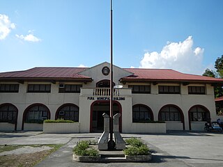
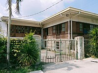
Pura, officially the Municipality of Pura, is a 4th class municipality in the province of Tarlac, Philippines. According to the 2020 census, it has a population of 25,781 people.

<span class="mw-page-title-main">Aliaga, Nueva Ecija</span> Municipality in Nueva Ecija, Philippines

Aliaga, officially the Municipality of Aliaga, is a 2nd class municipality in the province of Nueva Ecija, Philippines. According to the 2020 census, it has a population of 70,363 people.

<span class="mw-page-title-main">Quezon, Nueva Ecija</span> Municipality in Nueva Ecija, Philippines

Quezon, officially the Municipality of Quezon, is a 4th class municipality in the province of Nueva Ecija, Philippines that was named from the 2nd president of the Philippines, Manuel L. Quezon. According to the 2020 census, it has a population of 41,845 people.

References

  1. Municipality of Arayat | (DILG)
  2. "2015 Census of Population, Report No. 3 – Population, Land Area, and Population Density" (PDF). Philippine Statistics Authority. Quezon City, Philippines. August 2016. ISSN   0117-1453. Archived (PDF) from the original on May 25, 2021. Retrieved July 16, 2021.
  3. 1 2 3 Census of Population (2020). "Region III (Central Luzon)". Total Population by Province, City, Municipality and Barangay. Philippine Statistics Authority . Retrieved July 8, 2021.
  4. "PSA Releases the 2018 Municipal and City Level Poverty Estimates". Philippine Statistics Authority. December 15, 2021. Retrieved January 22, 2022.
  5. "Arayat: Average Temperatures and Rainfall". Meteoblue. Retrieved May 5, 2020.
  6. Census of Population (2015). "Region III (Central Luzon)". Total Population by Province, City, Municipality and Barangay. Philippine Statistics Authority . Retrieved June 20, 2016.
  7. Census of Population and Housing (2010). "Region III (Central Luzon)" (PDF). Total Population by Province, City, Municipality and Barangay. National Statistics Office . Retrieved June 29, 2016.
  8. Censuses of Population (1903–2007). "Region III (Central Luzon)". Table 1. Population Enumerated in Various Censuses by Province/Highly Urbanized City: 1903 to 2007. National Statistics Office.{{cite encyclopedia}}: CS1 maint: numeric names: authors list (link)
  9. "Province of Pampanga". Municipality Population Data. Local Water Utilities Administration Research Division. Retrieved December 17, 2016.
  10. "Poverty incidence (PI):". Philippine Statistics Authority. Retrieved December 28, 2020.
  11. "Estimation of Local Poverty in the Philippines" (PDF). Philippine Statistics Authority. November 29, 2005.
  12. "2003 City and Municipal Level Poverty Estimates" (PDF). Philippine Statistics Authority. March 23, 2009.
  13. "City and Municipal Level Poverty Estimates; 2006 and 2009" (PDF). Philippine Statistics Authority. August 3, 2012.
  14. "2012 Municipal and City Level Poverty Estimates" (PDF). Philippine Statistics Authority. May 31, 2016.
  15. "Municipal and City Level Small Area Poverty Estimates; 2009, 2012 and 2015". Philippine Statistics Authority. July 10, 2019.
  16. "PSA Releases the 2018 Municipal and City Level Poverty Estimates". Philippine Statistics Authority. December 15, 2021. Retrieved January 22, 2022.
  17. "PSA Releases the 2021 City and Municipal Level Poverty Estimates". Philippine Statistics Authority. April 2, 2024. Retrieved April 28, 2024.