Arwal

Last updated

Arwal
Town
India Bihar location map.svg
Red pog.svg
Arwal
Location in Bihar, India
India location map.svg
Red pog.svg
Arwal
Arwal (India)
Asia laea location map.svg
Red pog.svg
Arwal
Arwal (Asia)
Coordinates: 25°14′39″N84°39′47″E / 25.24417°N 84.66306°E / 25.24417; 84.66306
CountryFlag of India.svg  India
State Bihar
District Arwal
Population
 (2011)
  Total51,849
Language
  Official Hindi [1]
  Additional official Urdu [1]
  Regional Magahi [2]
Time zone UTC+5:30 (IST)
PIN
ISO 3166 code IN-BR
Vehicle registration BR-56
Website arwal.bih.nic.in
Son River Arwal Bihar Son River Arwal Bihar.jpg
Son River Arwal Bihar

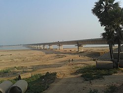
Arwal town is the administrative headquarters of Arwal district in Bihar state of India. It was earlier part of Jehanabad district. The district as formed to control the naxalism in the area. District was formed from the area of two near by districts i.e. Jehanabad and Aurangabad. Arwal has a population of 588,000. Arwal, the district headquarters is approximately 80 km south from the state capital Patna. Arwal town is situated on the right side bank of the Sone River, which is a tributary to the Ganges.

Contents

Geography

Arwal is located at 25°15′N84°41′E / 25.25°N 84.68°E / 25.25; 84.68 . It has an average elevation of 67 metres (220 ft). [3] The district headquarters is in Arwal near river (Sone). The state capital, Patna is 65 km to the north.

Language

The official languages are Hindi and Urdu. [1] The regional language spoken here is Magahi. [2]

Economy

Economy of the district is totally agriculture Based and this area does not have any presence of any Industry. Paddy, wheat and maize are the main crops. In March 2008 the Bihar government approved the construction of a bridge across the Son River at a cost of Rs. 9,742 lakhs [4] from Arwal to Sahar in Bhojpur district. The economy of Arwal depends on agriculture only. Most of the population resides in villages and are farmers. The entire district is well irrigated due to the proper arrangement of canals, except area like Kurtha, Vanshi and Karpi. There is no existence of any industry or other business centre. [5]

Population

Arwal District Population. [6]

PopulationLiterate Population
Male363497243163
Female337346157276
Total700843400439

Transport

NH 33 connects Arwal to Bihar Sharif and Farakka. NH 139 passes through Arwal connecting Aurangabad to Patna. The nearest railway station is Jehanabad at 35 km and Anugraha Narayan Road railway station at 60 km.

Notable people

Related Research Articles

<span class="mw-page-title-main">Son River</span> Second-largest tributary of Ganga river in India

Son River is a perennial river located in central India. It originates near Amarkantak Hill in Gaurela-Pendra-Marwahi district of Chhattisgarh and finally merges with the Ganges River near Patna in Bihar. The Sone River is the second-largest southern tributary of the Ganges after the Yamuna River. India's oldest river bridge Koilwar Bridge over Sone River connects Arrah with Patna. Sone river is famous for its sand across country. Multiple dam(s) and hydro-electric projects run on its course towards Ganges.

<span class="mw-page-title-main">Bihar Sharif</span> Sub-metropolitan city in Bihar, India

Bihar Sharif is the headquarters of Nalanda district and the fifth-largest sub-metropolitan area in the eastern Indian state of Bihar. Its name is a combination of two words: Bihar, derived from vihara, also the name of the state; and Sharif. The city is a hub of education and trade in southern Bihar, and the economy centers around agriculture supplemented by tourism, the education sector and household manufacturing. The ruins of the ancient Nalanda Mahavihara, a UNESCO World Heritage Site, are located near the city.

<span class="mw-page-title-main">Magadh University</span> University in Bihar, India

Magadh University is a public state university and institution of higher education in Bodhgaya, Bihar, India. It is recognised by the University Grants Commission (UGC).

<span class="mw-page-title-main">Arwal district</span> District of Bihar in India

Arwal district is one of the thirty-eight districts of Bihar state, India, and Arwal town is the administrative headquarters of this district. It was earlier part of Jehanabad district.

<span class="mw-page-title-main">Jehanabad district</span> District of Bihar in India

Jehanabad district is one of the thirty-eight districts of Bihar state, India. Jehanabad town is the administrative headquarters of this district. Jehanabad district is a part of Magadh Division, and is located on the confluence of two small rivers called Dardha and Yamunaiya.

<span class="mw-page-title-main">Siwan, Bihar</span> City in Bihar, India

Siwan is a city and nagar parishad in the Indian state of Bihar. It is the administrative headquarters of Siwan district and one of the urban settlements out of three in the district. It is located close to Uttar Pradesh.

<span class="mw-page-title-main">Magadh division</span> Division of Bihar in India

Magadh division is an administrative geographical unit of Bihar state of India. Gaya is the administrative headquarters of the division. Currently (2005), the division consists Gaya district, Nawada district, Aurangabad district, Jehanabad district, and Arwal district. The current divisional commissioner is Mayank Warwade, an IAS officer of 2001 batch of Bihar cadre. Magadh is home to the Magahi culture. People speak Magahi language here.

Daudnagar is a town and the subdivisional headquarter of Daudnagar Subdivision in Aurangabad district in the state of Bihar, India under the Magadh division. Until 1991, there was only one Subdivision in the Aurangabad district: Aurangabad Sadar. On 31 March 1991, one other subdivision, Daudnagar, was created. Daudnagar is a 200-year-old historical city and its living proof is Daudnagar has an old historical fort situated on the eastern bank of the Son River. National Highway NH139 which connects Jharkhand's Palamu district to Patna, passes through the town.

Koilwar is a nagar panchayat town and corresponding community development block in Bhojpur district in the Indian state of Bihar. As of 2011, the population of Koilwar town was 17,725, in 2,893 households. It lies on the Arrah-Patna railway route. It is one of the 14 blocks under Bhojpur district.

Khatangi is a prominent village in Bihar, India. It is situated in Sonbhadra-Bansi-Surajpur Block in Arwal district of the State of Bihar. It is located at 96.1 km distance from Arwal and at 114 km distance from the state capital Patna. It is a very old village with a population of about 5,000 people. The literacy rate is 45.56%, comprising a female literacy rate of 27.3% and a male literacy rate of 62.98%. The people here are very friendly and hospitable. The economy of this village is agro-based and agriculture remains the main source of income.

National Highway 139 is a National Highway in India within the states of Bihar and Jharkhand. NH-139 links Rajhara in Jharkhand to Patna, the state capital of Bihar. This 207-kilometre-long (129 mi) highway passes through Arwal, Daudnagar and Aurangabad.

<span class="mw-page-title-main">Obra, Bihar</span> Town in Bihar, India

Obra is a small town 15 km away from the district headquarters on NH-139 (Patna-Aurangabad). As of 2018, Obra has a population of 14,786. In the Obra block, there are 20 Panchayats each with an average of 6 villages. The geographic block is demarcated in the east and south by Daudnagar, Rafiganj, Aurangabad and in the west by Rohtas district. Situated on the confluence of the Punpun and Adri rivers, the rolling topography of the town is typical, spread on the plain of the Son river bed, known for its very fertile land.

The Laxmanpur Bathe massacre was a massacre conducted in the Laxmanpur Bathe village in Arwal district of Bihar, where 58 scheduled caste people were allegedly killed by members of the Ranvir Sena in retaliation for the Bara massacre in which 37 upper castes were killed. Laxmanpur Bathe is a village in Arwal district in Bihar, on the Son river about 90–km from Patna.

<span class="mw-page-title-main">Nehru Setu</span> Railway bridge in Rohtas, Bihar, India

Nehru Setu is a railway bridge across the Son River, connecting Dehri-on-Son and Son Nagar, in Bihar.

The state of Bihar has a number of bridges, extending from few metres to a few kilometres. The history of long bridges goes back to the British Empire when the site for the Koilwar bridge was surveyed in 1851. Since then a number of small and large bridges have crept up. Some are even largest of their kind. Mahatma Gandhi Setu, joining Patna and Hajipur was India's longest river bridge from 1982 to 2017.

National Highway 33 is a National Highway in India. It runs from Arwal to Farakka. It is a very important highway linking Bihar and West Bengal .This highway connects Major cities of Bihar like Munger and Bhagalpur to capital city patna. Sadly this is the Worst Highway of India.

Ekwari is a village in the Sahar Block of the Bhojpur district in the Indian state of Bihar. Bhojpur district is a part of the Patna division.

ShaharTelpa Panchayat is a village in Karpi Block in Arwal District in the Indian state of Bihar. It belongs to the Magadh Division. It is located 14 km south from the District headquarters in Arwal. It is 9 km from Karpi and 83 km from the state capital Patna.

Shamshernagar is a large village in the Daudnagar subdivision and block in Aurangabad district, located in Bihar, India. The town falls under the jurisdiction of the Magadh division. Situated on the bank of the Sone River, the National Highway 139 passes through the village. The Indrapuri Barrage canal is a local waterway. Shamshernagar is densely populated. It has adequate infrastructure, including a middle school, an intermediate high school, an additional Primary Health Centre, and a Regional Rural Bank (MBGB). Shamshernagar is an electrified village. and possesses a water tank for its water supply. It shares a border between Aurangabad and Arwal districts. Buses, auto-rickshaws and e-rickshaws provide regional transportation.

<span class="mw-page-title-main">Jalpura Tapa</span> Indian village in Bhojpur district, Bihar

Jalpura Tapa is a village and gram panchayat in Koilwar block, Bhojpur district in the Indian state of Bihar. Situated close to the Sone River, it is a large village with more than 12,000 residents. Population-wise it is the largest village and area-wise, it is the 2nd-largest village of Koilwar block.

References

  1. 1 2 3 "52nd Report of the Commissioner for Linguistic Minorities in India" (PDF). nclm.nic.in. Ministry of Minority Affairs. Archived from the original (PDF) on 25 May 2017. Retrieved 27 May 2019.
  2. 1 2 "About District - Arwal". Archived from the original on 31 March 2016. Retrieved 27 May 2019.
  3. "Arwal, India Page". Bihar. Falling Rain Genomics. Retrieved 10 March 2009.
  4. "
    Notice: Undefined variable: Post in /Opt/Lampp/Htdocs/Zhouyong/Icas.co.in/List.PHP on line 29
    "
    . Archived from the original on 3 March 2016. Retrieved 12 December 2011.
  5. "Arwal Sahar bridge on Sone to come soon". Jai Bihar. Archived from the original on 15 December 2008. Retrieved 10 March 2009.
  6. "District Population :: Official Website of Arwal District, Bihar". Archived from the original on 16 November 2016. Retrieved 11 October 2016.