
The Appalachian Mountains, often called the Appalachians, are a system of mountains in eastern to northeastern North America. The Appalachians first formed roughly 480 million years ago during the Ordovician Period. They once reached elevations similar to those of the Alps and the Rocky Mountains before experiencing natural erosion. The Appalachian chain is a barrier to east–west travel, as it forms a series of alternating ridgelines and valleys oriented in opposition to most highways and railroads running east–west.

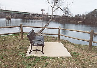
Van is a census-designated place (CDP) in Boone County, West Virginia, United States, along the Pond Fork of the Little Coal River. As of the 2010 census, its population was 211. Its ZIP code is 25206. Van was named after Van Linville, who established its post office and served as its first postmaster.

Boone County is a county in the U.S. state of West Virginia. As of the 2020 census, the population was 21,809. Its county seat is Madison. Boone County is part of the Charleston, WV Metropolitan Statistical Area. Leading industries and chief agricultural products in Boone County include coal, lumber, natural gas, tobacco, and strawberries.

Alum Creek is a census-designated place (CDP) in Kanawha and Lincoln counties along the Coal River in the U.S. state of West Virginia. It includes the unincorporated communities of Alum Creek, Forks of Coal, and Priestley. The CDP had a population of 1,749 at the 2010 census, down from 1,839 at the 2000 census.

The Monongahela River, sometimes referred to locally as the Mon, is a 130-mile-long (210 km) river on the Allegheny Plateau in north-central West Virginia and Southwestern Pennsylvania. The river flows from the confluence of its west and east forks in north-central West Virginia northeasterly into southwestern Pennsylvania, then northerly to Pittsburgh and its confluence with the Allegheny River to form the Ohio River. The river includes a series of locks and dams that makes it navigable.

The New River is a river which flows through the U.S. states of North Carolina, Virginia, and West Virginia before joining with the Gauley River to form the Kanawha River at the town of Gauley Bridge, West Virginia. Part of the Ohio River watershed, it is about 360 miles (580 km) long.
The Black Warrior River is a waterway in west-central Alabama in the southeastern United States. The river rises in the extreme southern edges of the Appalachian Highlands and flows 178 miles (286 km) to the Tombigbee River, of which the Black Warrior is the primary tributary. The river is named after the Mississippian paramount chief Tuskaloosa, whose name was Muskogean for 'Black Warrior'. The Black Warrior is impounded along nearly its entire course by a series of locks and dams to form a chain of reservoirs that not only provide a path for an inland waterway, but also yield hydroelectric power, drinking water, and industrial water.

The James River and Kanawha Canal was a partially built canal in Virginia intended to facilitate shipments of passengers and freight by water between the western counties of Virginia and the coast. Ultimately its towpath became the roadbed for a rail line following the same course.

The Main Line of Public Works was a package of legislation passed by the Commonwealth of Pennsylvania in 1826 to establish a means of transporting freight between Philadelphia and Pittsburgh. It funded the construction of various long-proposed canal and road projects, mostly in southern Pennsylvania, that became a canal system and later added railroads. Built between 1826 and 1834, it established the Pennsylvania Canal System and the Allegheny Portage Railroad.

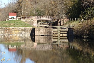
The Coal River is a tributary of the Kanawha River in southern West Virginia. It is formed near the community of Alum Creek by the confluence of the Big and Little Coal Rivers, and flows generally northward through western Kanawha County, past the community of Upper Falls and into the Kanawha River at St. Albans.
The Schuylkill Canal, or Schuylkill Navigation, was a system of interconnected canals and slack-water pools along the Schuylkill River in the U.S. state of Pennsylvania, built as a commercial waterway in the early 19th-century. Chartered in 1815, the navigation opened in 1825 to provide transportation and water power. At the time, the river was the least expensive and most efficient method of transporting bulk cargo, and the eastern seaboard cities of the U.S. were experiencing an energy crisis due to deforestation. It fostered the mining of anthracite coal as the major source of industry between Pottsville and eastern markets. Along the tow-paths, mules pulled barges of coal from Port Carbon through the water gaps to Pottsville; locally to the port and markets of Philadelphia; and some then by ship or through additional New Jersey waterways, to New York City markets.

Southern West Virginia is a culturally and geographically distinct region in the U.S. state of West Virginia. Southern West Virginia is known for its coal mining heritage and Southern affinity. The region is also closely identified with Southwestern Virginia and Southeastern Kentucky, with close proximity to Western North Carolina and East Tennessee. Today, Southern West Virginia continues to grapple with poverty and declining population. The region is located in West Virginia's 1st congressional district, which is represented by Carol Miller.

Bandytown is an unincorporated community in Boone County, West Virginia, United States. Bandytown is approximately 18 miles from Madison. Bandytown is accessible from Boone County Route 26, which is located right off West Virginia Route 85 at the Van Bridge split. The community has a total population of over 100 with approximately 70 homes.
Emmons is an unincorporated community located on the Big Coal River in Boone and Kanawha counties in the U.S. state of West Virginia. Jay Rockefeller's political affiliation with West Virginia began in 1964–1965 while he served as a VISTA volunteer in Emmons.

The Appalachian mixed mesophytic forests is an ecoregion of the temperate broadleaf and mixed forests biome, as defined by the World Wildlife Fund. It consists of mesophytic plants west of the Appalachian Mountains in the Southeastern United States.

The New River Coalfield is located in northeastern Raleigh County and southern Fayette County, West Virginia. Commercial mining of coal began in the 1870s and thrived into the 20th century. The coal in this field is a low volatile coal, known as "smokeless" coals. The seams of coal that have been mined include Sewell, Fire Creek, and Beckley. This is very high quality bituminous coal rated at approximately 15,000 BTU (16,000 kJ). The New River coalfield is named after the north flowing New River. Over 60 coal towns were once located there, supported by independent commercial districts at Beckley, Oak Hill, Mount Hope, and Fayetteville. By the 21st century many coal camps had partially or completely returned to nature. These company towns were located along Dunloup (Loup) Creek, Laurel Creek, White Oak Creek, lower Piney Creek, and, of course, the New River. The mainline of the Chesapeake and Ohio Railway ran right through the center of this coalfield, with spurs branching off in many directions, and rail yards were maintained at Quinnimont, Raleigh, and Thurmond, WV. The Virginian Railway's main line also passed through the western side of the field as well. Companies such as the New River Company, New River & Pocahontas Consolidated Coal Co., and Mary Frances Coal Co. were the largest operators in the New River Coalfield, but there were many smaller ones as well. These companies recruited native born whites, immigrants from Southern and Eastern Europe, and African-Americans from the South to work in their coal mines and railroads. The mines began to close down after World War II and today there are very few active coal mines in the field. The New River Gorge is now the domain of the National Park Service as the New River Gorge National Park and Preserve, and they have done what their budget allows to preserve the coal heritage of the area.

The Lehigh Canal is a navigable canal that begins at the mouth of Nesquehoning Creek on the Lehigh River in the Lehigh Valley and Northeastern regions of Pennsylvania. It was built in two sections over a span of 20 years beginning in 1818. The lower section spanned the distance between Easton and present-day Jim Thorpe. In Easton, the canal met the Delaware and Morris Canals, which allowed anthracite coal and other goods to be transported further up the U.S. East Coast. At its height, the Lehigh Canal was 72 miles (116 km) long.

Lehigh Gorge State Park is a 4,548 acres (1,841 ha) Pennsylvania state park in Luzerne and Carbon Counties, Pennsylvania. The park encompasses a gorge, which stretches along the Lehigh River from a U.S. Army Corps of Engineers flood control dam in Luzerne County to Jim Thorpe in Carbon County. The primary recreational activity at Lehigh Gorge State Park is white water rafting.

The Wednesbury Oak Loop, sometimes known as the Bradley Arm, is a canal in the West Midlands, England. It is part of the Birmingham Canal Navigations (BCN), and was originally part of James Brindley's main line, but became a loop when Thomas Telford's improvements of the 1830s bypassed it by the construction of the Coseley Tunnel. The south-eastern end of the loop was closed and in parts built over, following the designation of the entire loop as "abandoned" in 1954, including the section which was filled in at the beginning of the 1960s to make way for the Glebefields Estate in Tipton.
Peytona is an unincorporated community in Boone County, West Virginia, United States. Peytona is located on the Big Coal River and West Virginia Route 3, 9 miles (14 km) northeast of Madison. Peytona has a post office with ZIP code 25154.


