List of counties in West Virginia

Last updated

Counties of West Virginia
West Virginia counties (clickable map) West Virginia counties map.pngWyomingBooneMingoLoganGreenbrierMercerSummersMonroeNicholasLincolnPocahontasWayneCabellClayPutnamMasonJacksonRoaneWoodCalhounWirtPleasantsRitchieGilmerBraxtonWebsterTylerDoddridgeLewisRandolphPendletonUpshurBarbourOhioMarshallWetzelHarrisonMonongaliaMarionTaylorPrestonTuckerGrantMineralHardyHampshireMorganBerkeleyJefferson
West Virginia counties (clickable map)
Location State of West Virginia
Number55
Populations5,000 (Wirt) – 174,805 (Kanawha)
Areas83 square miles (210 km2) (Hancock) – 1,040 square miles (2,700 km2) (Randolph)
Government
Subdivisions

The U.S. state of West Virginia has 55 counties. Fifty of them existed at the time of the Wheeling Convention in 1861, during the American Civil War, when those counties seceded from the Commonwealth of Virginia to form the new state of West Virginia. [1] West Virginia was admitted as a separate state of the United States on June 20, 1863. [2] Five additional counties (Grant, Mineral, Lincoln, Summers, and Mingo) were formed from the original counties [1] in the decades following admission.

Contents

After the Civil War, Berkeley County and Jefferson County, the two easternmost counties of West Virginia, refused to recognize their inclusion in the state, and the Virginia General Assembly passed legislation attempting to reclaim them. In March 1866, the United States Congress passed a joint mandate assenting to their inclusion in the new state, and the Supreme Court of the United States confirmed this outcome in the case of Virginia v. West Virginia (1871). [3] [4]

The West Virginia Constitution was ratified in 1872, replacing the state constitution created in 1863 when West Virginia became a state. [5] Article 9, Section 8, of the West Virginia Constitution permits the creation of additional counties if a majority of citizens in the proposed new county vote for its creation and the new county has a minimum area of 400 square miles (1,036 km2) and a population of at least 6,000. Creation of a new county is prohibited if it would bring another county below these thresholds. [6] Three counties (Greenbrier, Kanawha, and Randolph) have sufficient population (based on the 2020 United States Census) and land area to allow a new county to be split off. [6] [7] [8] The remaining counties cannot be split, as either their land area would decrease to under 400 square miles, or their population would decrease to below 6,000. [6] [7] [8]

The role of counties in local government had been minimized under the 1863 constitution, which vested most local government authority in a system of townships based on the New England model. The authors of the 1872 constitution chose to return to the system used in Virginia, in which each county was governed by a county court with combined authority for executive, legislative, and judicial functions of the county government. [9] In 1880, West Virginia amended its constitution and replaced the county court system with an arrangement that divides county government powers between seven county offices, each of which is independently elected: the county commission, county clerk, circuit clerk, county sheriff, county assessor, county prosecuting attorney, and county surveyor of lands. [10] Counties have only those powers that are expressly granted to them by the state Constitution or by state statute. These powers include, but are not limited to, maintaining the infrastructure of the state, funding libraries, maintaining jails and hospitals, and waste disposal. [10] Reforming public education became a county function in 1933. In May 1933, a county unit plan was adopted. Under this plan, the state's 398 school districts were consolidated into the current 55 county school systems. This enabled public schools to be funded more economically and saved West Virginia millions of dollars. [11]

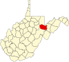
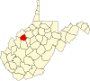
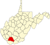
Randolph County is the largest by area at 1,040 square miles (2,694 km2), and Hancock County is the smallest at 83 square miles (215 km2). [8] Kanawha County contributed land to the founding of 12 West Virginia counties [12] and has the largest population (174,805 in 2023). Wirt County has the smallest population (5,000 in 2023). [13] The oldest county is Hampshire, established in 1754, and the newest is Mingo, established in 1895. [1] Spruce Knob, located in Pendleton County, is the state's highest point at 4,863 feet (1,482 m). [14] Federal Information Processing Standard (FIPS) codes, which are used by the United States government to identify counties uniquely, are five-digit numbers. For West Virginia, they start with 54 and end with the three-digit county code (for example, Barbour County has FIPS code 54001). Each county's code is provided in the table below, linked to census data for that county. [15]

Counties

County
FIPS code [15] County seat [7] Est. [1] Origin [1] [12] Etymology [1] [12] Population [13] Area [7] Map
BarbourCounty 001 Philippi 1843 Harrison, Lewis, and Randolph counties Philip P. Barbour
(1783–1841)
United States Speaker of the House
(1821–23)
15,378341 sq mi
(883 km2)
Map of West Virginia highlighting Barbour County.svg
BerkeleyCounty 003 Martinsburg 1772 Frederick County (Virginia) Norborne Berkeley
(1717–70)
Royal Governor of Virginia
(1768–70)
132,440321 sq mi
(831 km2)
Map of West Virginia highlighting Berkeley County.svg
BooneCounty 005 Madison 1847 Cabell, Kanawha, and Logan counties Daniel Boone
(1734–1820)
American frontiersman
20,576503 sq mi
(1,303 km2)
Map of West Virginia highlighting Boone County.svg
BraxtonCounty 007 Sutton 1836 Kanawha, Lewis, and Nicholas counties Carter Braxton
(1736–97)
Signer of the Declaration of Independence
12,162514 sq mi
(1,331 km2)
Map of West Virginia highlighting Braxton County.svg
BrookeCounty 009 Wellsburg 1796 Ohio County Robert Brooke
(1761–1800)
Governor of Virginia
(1794–96)
21,37389 sq mi
(231 km2)
Map of West Virginia highlighting Brooke County.svg
CabellCounty 011 Huntington 1809 Kanawha County William H. Cabell
(1772–1853)
Governor of Virginia
(1805–08)
92,082282 sq mi
(730 km2)
Map of West Virginia highlighting Cabell County.svg
CalhounCounty 013 Grantsville 1856 Gilmer County John C. Calhoun
(1782–1850)
United States Vice President
(1825–32)
5,959281 sq mi
(728 km2)
Map of West Virginia highlighting Calhoun County.svg
ClayCounty 015 Clay 1858 Braxton and Nicholas counties Henry Clay
(1777–1852)
United States Senator Kentucky
(1823–25)
United States Speaker of the House
(1849–52)
7,783342 sq mi
(886 km2)
Map of West Virginia highlighting Clay County.svg
DoddridgeCounty 017 West Union 1845 Harrison, Lewis, Ritchie, and Tyler counties Philip Doddridge
(1773–1832)
United States Congressman (Virginia)
(1829–32)
7,680320 sq mi
(829 km2)
Map of West Virginia highlighting Doddridge County.svg
FayetteCounty 019 Fayetteville 1831 Kanawha, Greenbrier, Logan, and Nicholas counties Marquis de Lafayette
(1757–1834)
French-born American Revolutionary War General
39,072664 sq mi
(1,720 km2)
Map of West Virginia highlighting Fayette County.svg
GilmerCounty 021 Glenville 1845 Kanawha and Lewis counties Thomas Walker Gilmer
(1802–44)
United States Secretary of the Navy
(1844)
Governor of Virginia
(1840–41)
7,254340 sq mi
(881 km2)
Map of West Virginia highlighting Gilmer County.svg
GrantCounty 023 Petersburg 1866 Hardy County Ulysses S. Grant
(1822–85)
United States President
(1869–77)
10,921477 sq mi
(1,235 km2)
Map of West Virginia highlighting Grant County.svg
GreenbrierCounty 025 Lewisburg 1778 Montgomery County (Virginia) and Botetourt County (Virginia) Greenbrier River 32,1491,021 sq mi
(2,644 km2)
Map of West Virginia highlighting Greenbrier County.svg
HampshireCounty 027 Romney 1754 Augusta County (Virginia) and Frederick County (Virginia) County of Hampshire in England 23,649642 sq mi
(1,663 km2)
Map of West Virginia highlighting Hampshire County.svg
HancockCounty 029 New Cumberland 1848 Brooke County John Hancock
(1737–93)
One of the Signers of the Declaration of Independence
Governor of Massachusetts
(1780–85)
and (1787–93)
28,14583 sq mi
(215 km2)
Map of West Virginia highlighting Hancock County.svg
HardyCounty 031 Moorefield 1786 Hampshire County Samuel Hardy
(1758–85)
Virginia delegate to the Continental Congress
(1783–85)
14,251583 sq mi
(1,510 km2)
Map of West Virginia highlighting Hardy County.svg
HarrisonCounty 033 Clarksburg 1784 Monongalia County Benjamin Harrison V
(1726–91)
Governor of Virginia
(1781–84)
64,639416 sq mi
(1,077 km2)
Map of West Virginia highlighting Harrison County.svg
JacksonCounty 035 Ripley 1831 Kanawha, Mason, and Wood counties Andrew Jackson
(1767–1845)
United States President
(1829–37)
27,593466 sq mi
(1,207 km2)
Map of West Virginia highlighting Jackson County.svg
JeffersonCounty 037 Charles Town 1801 Berkeley County Thomas Jefferson
(1743–1826)
United States President
(1801–09)
59,787210 sq mi
(544 km2)
Map of West Virginia highlighting Jefferson County.svg
KanawhaCounty 039 Charleston 1789 Greenbrier and Montgomery County (Virginia) Kanawha River 174,805903 sq mi
(2,339 km2)
Map of West Virginia highlighting Kanawha County.svg
LewisCounty 041 Weston 1816 Harrison County Charles Lewis
(1736–74)
American Colonel killed at the
Battle of Point Pleasant [16]
16,500389 sq mi
(1,008 km2)
Map of West Virginia highlighting Lewis County.svg
LincolnCounty 043 Hamlin 1867 Boone, Cabell, Kanawha, and Putnam counties Abraham Lincoln
(1809–65)
United States President
(1861–65)
19,701438 sq mi
(1,134 km2)
Map of West Virginia highlighting Lincoln County.svg
LoganCounty 045 Logan 1824 Cabell and Kanawha counties, Giles County (Virginia), and Tazewell County (Virginia) Chief Logan
(c.1723-80)
Mingo leader
30,827454 sq mi
(1,176 km2)
Map of West Virginia highlighting Logan County.svg
MarionCounty 049 Fairmont 1842 Harrison and Monongalia counties Francis Marion
(1732–95)
American Revolutionary War General
(1757–82)
55,807310 sq mi
(803 km2)
Map of West Virginia highlighting Marion County.svg
MarshallCounty 051 Moundsville 1835 Ohio County John Marshall
(1755–1835)
United States Secretary of State
(1800–01)
Chief Justice of the United States
(1801–35)
29,405307 sq mi
(795 km2)
Map of West Virginia highlighting Marshall County.svg
MasonCounty 053 Point Pleasant 1804 Kanawha County George Mason
(1725–92)
United States Constitutional Convention
"Father of the Bill of Rights"
24,765432 sq mi
(1,119 km2)
Map of West Virginia highlighting Mason County.svg
McDowellCounty 047 Welch 1858 Tazewell County (Virginia) James McDowell
(1795–1851)
Governor of Virginia
(1843–46)
17,439535 sq mi
(1,386 km2)
Map of West Virginia highlighting McDowell County.svg
MercerCounty 055 Princeton 1837 Giles County (Virginia) and Tazewell County (Virginia) Hugh Mercer
(1726–77)
American Revolutionary War General
(1775–76)
58,057420 sq mi
(1,088 km2)
Map of West Virginia highlighting Mercer County.svg
MineralCounty 057 Keyser 1866 Hampshire County abundant mineral resources26,867328 sq mi
(850 km2)
Map of West Virginia highlighting Mineral County.svg
MingoCounty 059 Williamson 1895 Logan County Mingo Native Americans22,023423 sq mi
(1,096 km2)
Map of West Virginia highlighting Mingo County.svg
MonongaliaCounty 061 Morgantown 1776 Augusta County (Virginia) Latin derivation for Monongahela River 107,718361 sq mi
(935 km2)
Map of West Virginia highlighting Monongalia County.svg
MonroeCounty 063 Union 1799 Greenbrier County James Monroe
(1758–1831)
United States Senator (Virginia)
(1790–94)
Governor of Virginia
(1799–1802)
and (1811)
United States President
(1817–25)
12,382473 sq mi
(1,225 km2)
Map of West Virginia highlighting Monroe County.svg
MorganCounty 065 Berkeley Springs 1820 Berkeley and Hampshire counties Daniel Morgan
(1736–1802)
United States Congressman (Virginia)
(1797–99)
17,649229 sq mi
(593 km2)
Map of West Virginia highlighting Morgan County.svg
NicholasCounty 067 Summersville 1818 Greenbrier, Kanawha, and Randolph counties Wilson Cary Nicholas
(1761–1820)
United States Senator (Virginia)
(1799–1804)
Governor of Virginia
(1814–16)
24,169649 sq mi
(1,681 km2)
Map of West Virginia highlighting Nicholas County.svg
OhioCounty 069 Wheeling 1776 Augusta County (Virginia) Ohio River 41,194106 sq mi
(275 km2)
Map of West Virginia highlighting Ohio County.svg
PendletonCounty 071 Franklin 1788 Augusta County (Virginia), Rockingham County (Virginia), and Hardy Edmund Pendleton
(1721–1803)
First Continental Congress
(1774)
6,029698 sq mi
(1,808 km2)
Map of West Virginia highlighting Pendleton County.svg
PleasantsCounty 073 Saint Marys 1851 Ritchie, Tyler, and Wood counties James Pleasants, Jr.
(1769–1836)
United States Senator (Virginia)
(1819–22)
Governor of Virginia
(1822–25)
7,428131 sq mi
(339 km2)
Map of West Virginia highlighting Pleasants County.svg
PocahontasCounty 075 Marlinton 1821 Bath County (Virginia), Pendleton, and Randolph Pocahontas
(c.1595–1617)
Powhatan Native American slave of early English settlers
7,765940 sq mi
(2,435 km2)
Map of West Virginia highlighting Pocahontas County.svg
PrestonCounty 077 Kingwood 1818 Monongalia County James Patton Preston
(1774–1843)
Governor of Virginia
(1816–19)
34,099648 sq mi
(1,678 km2)
Map of West Virginia highlighting Preston County.svg
PutnamCounty 079 Winfield 1848 Cabell, Kanawha, and Mason counties Israel Putnam
(1718–90)
American Revolutionary War General
56,962346 sq mi
(896 km2)
Map of West Virginia highlighting Putnam County.svg
RaleighCounty 081 Beckley 1850 Fayette County Sir Walter Raleigh
(1554–1618)
English explorer and poet
72,356607 sq mi
(1,572 km2)
Map of West Virginia highlighting Raleigh County.svg
RandolphCounty 083 Elkins 1787 Harrison County Edmund Jennings Randolph
(1753–1813)
Governor of Virginia
(1786–88)
First United States Attorney General
(1789–94)
27,3501,040 sq mi
(2,694 km2)
Map of West Virginia highlighting Randolph County.svg
RitchieCounty 085 Harrisville 1843 Harrison, Lewis, and Wood counties Thomas Ritchie
(1778–1854)
nationally influential Virginia newspaper publisher
8,167454 sq mi
(1,176 km2)
Map of West Virginia highlighting Ritchie County.svg
RoaneCounty 087 Spencer 1856 Gilmer, Jackson, and Kanawha counties Spencer Roane
(1762–1822)
Virginia Supreme Court Justice
(1794–1822)
13,743484 sq mi
(1,254 km2)
Map of West Virginia highlighting Roane County.svg
SummersCounty 089 Hinton 1871 Fayette, Greenbrier, Mercer, and Monroe counties George W. Summers
(1804–68)
United States Congressman (Virginia)
(1843)
11,581361 sq mi
(935 km2)
Map of West Virginia highlighting Summers County.svg
TaylorCounty 091 Grafton 1844 Barbour, Harrison, Marion counties John Taylor of Caroline
(1753–1824)
United States Senator (Virginia)
(1792–94) and
(1803) and
(1822–24)
16,388173 sq mi
(448 km2)
Map of West Virginia highlighting Taylor County.svg
TuckerCounty 093 Parsons 1856 Randolph County Henry St. George Tucker
(1780–1848)
United States Congressman (Virginia)
(1815–19)
Virginia Supreme Court
(1831–41)
6,604419 sq mi
(1,085 km2)
Map of West Virginia highlighting Tucker County.svg
TylerCounty 095 Middlebourne 1814 Ohio County John Tyler, Sr.
(1747–1813)
Governor of Virginia
(1808–11)
7,919258 sq mi
(668 km2)
Map of West Virginia highlighting Tyler County.svg
UpshurCounty 097 Buckhannon 1851 Barbour, Lewis, and Randolph counties Abel Parker Upshur
(1790–1844)
United States Secretary of the Navy
(1841–43)
United States Secretary of State
(1843–44)
23,529355 sq mi
(919 km2)
Map of West Virginia highlighting Upshur County.svg
WayneCounty 099 Wayne 1842 Cabell County "Mad" Anthony Wayne
Major General
(1745–96)
American Revolutionary War
(1775–83)
and (1792–96)
United States Congressman Georgia
(1791)
37,686506 sq mi
(1,311 km2)
Map of West Virginia highlighting Wayne County.svg
WebsterCounty 101 Webster Springs 1860 Braxton, Nicholas, and Randolph counties Daniel Webster
(1782–1852)
United States Senator Massachusetts
(1827–41) and
(1845–50)
United States Secretary of State
(1841–53) and
(1850–52)
8,045556 sq mi
(1,440 km2)
Map of West Virginia highlighting Webster County.svg
WetzelCounty 103 New Martinsville 1846 Tyler County Lewis Wetzel
(1763–1808)
noted frontiersman
13,890359 sq mi
(930 km2)
Map of West Virginia highlighting Wetzel County.svg
WirtCounty 105 Elizabeth 1848 Jackson and Wood counties William Wirt
(1772–1834)
United States Attorney General
(1817–29)
5,000233 sq mi
(603 km2)
Map of West Virginia highlighting Wirt County.svg
WoodCounty 107 Parkersburg 1798 Harrison County James Wood
(1741–1813)
Governor of Virginia
(1796–99)
83,052367 sq mi
(951 km2)
Map of West Virginia highlighting Wood County.svg
WyomingCounty 109 Pineville 1850 Logan County derived from Lenape Native American term for "wide plain"20,277501 sq mi
(1,298 km2)
Map of West Virginia highlighting Wyoming County.svg

See also

Related Research Articles

<span class="mw-page-title-main">West Virginia</span> U.S. state

West Virginia is a state in the Southern and Mid-Atlantic regions of the United States. It is bordered by Pennsylvania to the north and east, Maryland to the east and northeast, Virginia to the southeast, Kentucky to the southwest, and Ohio to the northwest. West Virginia is the 10th-smallest state by area and ranks as the 12th-least populous state, with a population of 1,793,716 residents. The capital and most populous city is Charleston with a population of 49,055.

<span class="mw-page-title-main">Putnam County, West Virginia</span> County in West Virginia, United States

Putnam County is a county in the U.S. state of West Virginia. As of the 2020 census, the population was 57,440. Its county seat is Winfield, its largest incorporated city is Hurricane, and its largest community is the census-designated place of Teays Valley. Putnam County is part of the Huntington–Ashland, WV-KY-OH Metropolitan Statistical Area, across the Kanawha River from Charleston, West Virginia.

<span class="mw-page-title-main">Charleston, West Virginia</span> Capital city of West Virginia, U.S.

Charleston is the capital and most populous city of the U.S. state of West Virginia and the seat of Kanawha County. Located at the confluence of the Elk and Kanawha rivers, the city had a population of 48,864 at the 2020 census and an estimated population of 48,018 in 2021. The Charleston metropolitan area had 210,605 residents in 2020.

<span class="mw-page-title-main">Ohio County, West Virginia</span> County in West Virginia, United States

Ohio County is a county located in the Northern Panhandle of the U.S. state of West Virginia. As of the 2020 census, the population was 42,425. Its county seat is Wheeling. The county was formed in 1776 from the District of West Augusta, Virginia. It was named for the Ohio River, which forms its western boundary with the state of Ohio. West Liberty was designated as the county seat in 1777, serving to 1797.

<span class="mw-page-title-main">Raleigh County, West Virginia</span> County in West Virginia, United States

Raleigh County is a county in the U.S. state of West Virginia. As of the 2020 census, the population was 74,591. Its county seat is Beckley. The county was founded in 1850 and is named for Sir Walter Raleigh. Raleigh County is included in the Beckley, West Virginia Metropolitan Statistical Area.

<span class="mw-page-title-main">Mingo County, West Virginia</span> County in West Virginia, United States

Mingo County is a county in the U.S. state of West Virginia. As of the 2020 census, the population was 23,568. Its county seat and largest city is Williamson. Created in 1895, Mingo is West Virginia's newest county, named for the historic Iroquoian Mingo people.

<span class="mw-page-title-main">Mason County, West Virginia</span> County in West Virginia, United States

Mason County is a county in the U.S. state of West Virginia. As of the 2020 census, the population was 25,453. Its county seat and largest city is Point Pleasant. The county was founded in 1804 and named for George Mason, delegate to the U.S. Constitutional Convention. Before the Civil War, the county was in the State of Virginia.

<span class="mw-page-title-main">Marshall County, West Virginia</span> County in West Virginia, United States

Marshall County is a county in the U.S. state of West Virginia. At the 2020 census, the population was 30,591. Its county seat is Moundsville. With its southern border at what would be a continuation of the Mason-Dixon line to the Ohio River, it forms the base of the Northern Panhandle of West Virginia.

<span class="mw-page-title-main">Logan County, West Virginia</span> County in West Virginia, United States

Logan County is a county in the U.S. state of West Virginia. As of the 2020 census, the population was 32,567. Its county seat is Logan. Logan County comprises the Logan, WV Micropolitan Statistical Area, which is also included in the Charleston–Huntington–Ashland, WV–OH–KY Combined Statistical Area.

<span class="mw-page-title-main">Kanawha County, West Virginia</span> County in West Virginia, United States

Kanawha County is a county in the U.S. state of West Virginia. As of the 2020 census, the population was 180,745, making it West Virginia's most populous county. The county seat is Charleston, which is also the state capital and most populous city. Kanawha County is part of the Charleston, WV Metropolitan Statistical Area.

<span class="mw-page-title-main">Jackson County, West Virginia</span> County in West Virginia, United States

Jackson County is a county in the U.S. state of West Virginia. As of the 2020 census, the population was 27,791. Its county seat is Ripley, and its largest municipality is Ravenswood.

<span class="mw-page-title-main">Fayette County, West Virginia</span> County in West Virginia, United States

Fayette County is a county in the U.S. state of West Virginia. As of the 2020 census, the population was 40,488. Its county seat is Fayetteville. It is part of the Beckley, WV Metropolitan Statistical Area in Southern West Virginia.

<span class="mw-page-title-main">Berkeley County, West Virginia</span> County in West Virginia, United States

Berkeley County is located in the Shenandoah Valley in the eastern panhandle region of West Virginia in the United States. The county is part of the Hagerstown–Martinsburg metropolitan area. As of the 2020 census, the county population was 122,076, making it the second-most populous of West Virginia's 55 counties, behind Kanawha County. The City of Martinsburg is the county seat.

<span class="mw-page-title-main">Marmet, West Virginia</span> Town in West Virginia, United States

Marmet is a town in Kanawha County, West Virginia, United States, along the Kanawha River. The population was 1,501 at the 2020 census.

<span class="mw-page-title-main">Sistersville, West Virginia</span> City in West Virginia, United States

Sistersville is a city in Tyler County, West Virginia, United States, along the Ohio River. The population was 1,413 at the 2020 census. The Sistersville Ferry crosses the Ohio River to the unincorporated community of Fly in Monroe County, Ohio.

<span class="mw-page-title-main">Wheeling, West Virginia</span> City in the United States

Wheeling is a city in the U.S. state of West Virginia. Located almost entirely in Ohio County, of which it is the county seat, it lies along the Ohio River in the foothills of the Appalachian Mountains and also contains a tiny portion extending into Marshall County. Wheeling is located about 60 miles (96 km) west of Pittsburgh and is the principal city of the Wheeling metropolitan area. As of the 2020 census, the city had a population of 27,062, and the metro area had a population of 139,513. It is the fifth most populous city in West Virginia, and the most populous in the state’s Northern Panhandle.

<span class="mw-page-title-main">History of West Virginia</span>

The history of West Virginia stems from the 1861 Wheeling Convention, which was an assembly of northwestern Virginian Southern Unionists, who aimed to repeal the Ordinance of Secession that Virginia made during the American Civil War (1861–1865). It became one of two American states that formed during the American Civil War – the other being Nevada in 1864. It was the only state to form from another state during this time, splitting from Virginia. West Virginia was officially admitted as a U.S. state on June 20, 1863.

<span class="mw-page-title-main">West Virginia State Capitol</span> State capitol building of the U.S. state of West Virginia

The West Virginia State Capitol is the seat of government for the U.S. state of West Virginia, and houses the West Virginia Legislature and the office of the Governor of West Virginia. Located in Charleston, West Virginia, the building was dedicated in 1932. Along with the West Virginia Executive Mansion it is part of the West Virginia Capitol Complex, a historic district listed on the National Register of Historic Places.

<span class="mw-page-title-main">History of slavery in West Virginia</span>

The western part of Virginia which became West Virginia was settled in two directions, north to south from Pennsylvania, Maryland and New Jersey and from east to west from eastern Virginia and North Carolina. The earliest arrival of enslaved people was in the counties of the Shenandoah Valley, where prominent Virginia families built houses and plantations. The earliest recorded slave presence was about 1748 in Hampshire County on the estate of Thomas Fairfax, 6th Lord Fairfax of Cameron, which included 150 enslaved people. By the early 19th century, slavery had spread to the Ohio River up to the northern panhandle.

References

  1. 1 2 3 4 5 6 Lewis, Virgil (1896). History and Government of West Virginia (1st ed.). New York: Werner School Book Company. pp. 264–270. (WV County Founding Dates and Etymology). Other editions available at ASIN B009CI6FRI and Google Books.
  2. Littlefield, Charles (1910). Commonwealth of Virginia, plaintiff vs. ... State of West Virginia, defendant (1st ed.). Charleston, WV: Lovett Printing Company. pp. 9–10. (WV Statehood). Other editions available at ISBN   9781274843111 and Google Books
  3. Rice, Otis & Brown, Stephen (1993). West Virginia, A History (2nd ed.). Lexington: University Press of Kentucky. p. 153. (WV State Boundaries). Other editions available: ISBN   9780813118543
  4. "August 5, 1863: Berkeley Co. Admitted to New State of WV". WVPB. August 5, 2020. Retrieved November 18, 2021.
  5. Bastress, Robert (1995). The West Virginia Constitution: A Reference Guide. Westport, CT: Greenwood Press. p. 18. ISBN   0313274096.
  6. 1 2 3 Warth, John (1887). The Code of West Virginia. Wheeling and Charleston WV: West Virginia Printing Company, Printers and Binders. pp. 271–273. Other editions available at ISBN   9781231066737 and Google Books.
  7. 1 2 3 4 "Find A County". National Association of Counties. Retrieved February 4, 2013. (Find a county)
  8. 1 2 3 "West Virginia QuickFacts from the US Census Bureau". United States Census Bureau. Retrieved February 4, 2013. (2010 Census)
  9. Bastress (1995) , p. 20.
  10. 1 2 Brisbin, Richard (1996). West Virginia Politics and Government. University of Nebraska Press. pp. 142–146. ISBN   0803212712.
  11. Rice & Brown (1993) , p. 247.
  12. 1 2 3 "West Virginia Counties". West Virginia Division of Culture and History. Archived from the original on September 23, 2001. Retrieved February 4, 2013. (WV County Formation)
  13. 1 2 "West Virginia QuickFacts from the US Census Bureau". United States Census Bureau. Retrieved April 20, 2024. (2023 Census estimate)
  14. Morton, Oren (1910). A History of Pendleton County, West Virginia (1st ed.). Dayton, VA: Ruebush-Elkins Company. p. 3. Other editions available at ISBN   9781165299102.
  15. 1 2 "EPA County FIPS Code Listing". EPA.gov. Archived from the original on March 21, 2014. Retrieved February 4, 2013.
  16. McCulloch, Delia (1908). American Historical Magazine Volume 3. New York NY: Americana Society. pp. 628–629. Available at ISBN   1144825210 and Google Books.