Elkins, West Virginia

Last updated

Elkins, West Virginia
Elkins West Virginia Davis Avenue.jpg
Davis Avenue in downtown Elkins in 2006
Seal of Elkins, West Virginia.png
Randolph County West Virginia Incorporated and Unincorporated areas Elkins Highlighted.svg
Location of Elkins in Randolph County, West Virginia.
Coordinates: 38°55′17″N79°51′3″W / 38.92139°N 79.85083°W / 38.92139; -79.85083
CountryUnited States
State West Virginia
County Randolph
Government
  MayorJerry A. Marco [1]
Area
[2]
  Total3.63 sq mi (9.41 km2)
  Land3.63 sq mi (9.41 km2)
  Water0.00 sq mi (0.00 km2)
Elevation
[3]
1,926 ft (587 m)
Population
 (2020) [4]
  Total6,950
  Estimate 
(2021) [4]
6,895
  Density1,923.50/sq mi (742.65/km2)
Time zone UTC−5 (Eastern (EST))
  Summer (DST) UTC−4 (EDT)
ZIP Code
26241
Area code(s) Area codes 304 and 681 [5]
FIPS code 54-24580
GNIS feature ID1551037 [3]
Website City Website

Elkins is a city in and the county seat of Randolph County, West Virginia, United States, along the Tygart Valley River. The community was incorporated in 1890 and named in honor of Stephen Benton Elkins, a U.S. Senator from West Virginia. [6] The population was 6,950 at the 2020 census and estimated at 6,895 in 2021. [4] Elkins is home to Davis and Elkins College and the Mountain State Forest Festival, held in early October every year. [7]

Contents

History

An 1897 bird's eye view of Elkins Elkins, Randolph County, W.Va. 1897. LOC 75696679.jpg
An 1897 bird's eye view of Elkins

Thomas Skidmore (ca. 1733-1807), born in Maryland, obtained a title to 400 acres of land (“by virtue of a settlement”) in the future Elkins area before 1778. This land, on the east side of the Tygart Valley River, was surveyed by John Poage in 1780 and included the land that is now most of downtown Elkins. Thus, Skidmore was probably the first white settler in what became Elkins. [8]

Before its major development, the area that would become Elkins was known as Leadsville, and was the site of a few scattered homesteads – a place where the local farmers' corn crop was loaded onto boats and floated down the Tygart Valley River. The City of Elkins was developed by U.S. Senators Henry Gassaway Davis (1823–1916) and Stephen Benton Elkins (1841–1911) – and named for the latter – in 1890. (Elkins was Davis' son-in-law.) The two founders developed railroad lines, coal mines, and timbering businesses. Together, they built the West Virginia Central and Pittsburgh Railway into Elkins in 1889, opening a vast territory to industrial development by the late 1890s. After an intense county seat war with nearby Beverly, where the new county courthouse building was burned down in 1897 under suspicious circumstances,[ citation needed ] Elkins became the county seat in 1899. This was resolved, however, only after multiple referendums, court judgments, and the mobilization of armed bands in both towns. In the end, bloodshed was averted.

In 1904 the new Randolph County Courthouse – designed in the Richardsonian Romanesque style – was completed in Elkins. As the railroad (merged into the Western Maryland Railway in 1905) expanded, Elkins experienced the luxury of passenger train service. In 1930, 18 passenger trains were arriving and leaving Elkins daily. All passenger service was discontinued in 1958.

Where the view of the new town was most delightful and picturesque, Davis and Elkins each built permanent places of residence, known as Graceland (1893) and Halliehurst (1890), respectively.[ citation needed ]

Today, Elkins has an active economic development authority, chamber of commerce, downtown business organization and numerous social, fraternal and service organizations that sponsor annual events like the Mountain State Forest Festival, which brings thousands of people into the city every year.

Geography

Elkins is located at the confluence of the Tygart Valley River and Leading Creek. [9] The average elevation is 2,000 feet (610 m) above sea level. According to the United States Census Bureau, the city has a total area of 3.43 square miles (8.88 km2), all land. [10] Elkins is headquarters for the Monongahela National Forest, a 910,155-acre (368,327 ha) federal reserve encompassing the "High Alleghenies" area to the east of the city.

In 1995, a second edition of The 100 Best Small Towns in America, written by Norman Crampton, featured Elkins among the special places in the United States. Crampton quoted then Editor Emerita of The Inter-Mountain, Eldora Marie Bolyard Nuzum, "You can stand on any street in Elkins and turn in all directions and see forest covered mountains rimming the city. It is unbelievable." [11]

Climate

Climate data for Elkins, West Virginia (Elkins–Randolph County Airport/KEKN), 19912020 normals, [lower-alpha 1] extremes 1899–present
MonthJanFebMarAprMayJunJulAugSepOctNovDecYear
Record high °F (°C)78
(26)
77
(25)
86
(30)
90
(32)
93
(34)
96
(36)
99
(37)
99
(37)
97
(36)
90
(32)
82
(28)
76
(24)
99
(37)
Mean maximum °F (°C)64
(18)
66
(19)
75
(24)
82
(28)
86
(30)
88
(31)
90
(32)
89
(32)
87
(31)
81
(27)
74
(23)
65
(18)
91
(33)
Mean daily maximum °F (°C)41.5
(5.3)
45.1
(7.3)
53.5
(11.9)
65.6
(18.7)
73.4
(23.0)
80.2
(26.8)
83.2
(28.4)
82.1
(27.8)
76.6
(24.8)
66.3
(19.1)
54.8
(12.7)
45.2
(7.3)
64.0
(17.8)
Daily mean °F (°C)30.8
(−0.7)
33.5
(0.8)
41.0
(5.0)
51.5
(10.8)
60.2
(15.7)
67.8
(19.9)
71.4
(21.9)
70.2
(21.2)
64.1
(17.8)
52.7
(11.5)
42.3
(5.7)
34.7
(1.5)
51.7
(10.9)
Mean daily minimum °F (°C)20.0
(−6.7)
22.0
(−5.6)
28.5
(−1.9)
37.3
(2.9)
47.0
(8.3)
55.5
(13.1)
59.6
(15.3)
58.4
(14.7)
51.5
(10.8)
39.1
(3.9)
29.9
(−1.2)
24.1
(−4.4)
39.4
(4.1)
Mean minimum °F (°C)−6
(−21)
−2
(−19)
8
(−13)
21
(−6)
30
(−1)
42
(6)
48
(9)
48
(9)
37
(3)
24
(−4)
14
(−10)
3
(−16)
−9
(−23)
Record low °F (°C)−24
(−31)
−22
(−30)
−15
(−26)
3
(−16)
20
(−7)
25
(−4)
32
(0)
34
(1)
26
(−3)
11
(−12)
−8
(−22)
−28
(−33)
−28
(−33)
Average precipitation inches (mm)3.36
(85)
3.26
(83)
3.98
(101)
4.10
(104)
5.14
(131)
4.48
(114)
5.99
(152)
3.87
(98)
3.51
(89)
3.08
(78)
2.87
(73)
3.57
(91)
47.21
(1,199)
Average snowfall inches (cm)20.3
(52)
15.4
(39)
11.4
(29)
2.3
(5.8)
0.0
(0.0)
0.0
(0.0)
0.0
(0.0)
0.0
(0.0)
0.0
(0.0)
0.9
(2.3)
4.1
(10)
14.5
(37)
68.9
(175)
Average precipitation days (≥ 0.01 in)17.315.516.615.116.014.614.912.710.611.412.216.3173.2
Average snowy days (≥ 0.1 in)11.08.85.81.80.00.00.00.00.00.42.77.838.3
Source: NOAA [12] [13]

Record weather events include: [12]

Demographics

Davis Memorial Presbyterian Church is noted for its Gothic Revival architecture Davis Memorial Presbyterian Church.jpg
Davis Memorial Presbyterian Church is noted for its Gothic Revival architecture
Historical population
CensusPop.Note
1890 737
1900 2,016173.5%
1910 5,260160.9%
1920 6,78829.0%
1930 7,3458.2%
1940 8,13310.7%
1950 9,12112.1%
1960 8,307−8.9%
1970 8,287−0.2%
1980 8,5363.0%
1990 7,420−13.1%
2000 7,032−5.2%
2010 7,0940.9%
2020 6,950−2.0%
2021 (est.)6,895 [4] −0.8%
U.S. Decennial Census [14]
2012 Estimate [15]

2020 census

As of the 2020 census, there were 6,934 people and 2,500 households residing in the city. There were 3,499 housing units in Elkins. The racial makeup of the city was 90.5% White, 2.7% African American, 1% Asian, 0.4% Native American, 0.5% from other races, and 4.9% from two or more races. Hispanics or Latinos of any race were 1.7% of the population.

There were 2,500 households, of which 30.8% were married couples living together, 44.4% had a female householder with no spouse present, 18.1% had a male householder with no spouse present.The average household and family size was 3.6. The median age in the city was 38.1 years. [16]

2010 census

As of the census [17] of 2010, there were 7,094 people, 3,038 households, and 1,756 families living in the city. The population density was 2,068.2 inhabitants per square mile (798.5/km2). There were 3,421 housing units at an average density of 997.4 per square mile (385.1/km2). The racial makeup of the city was 96.5% White, 1.2% African American, 0.2% Native American, 0.8% Asian, 0.2% from other races, and 1.2% from two or more races. Hispanic or Latino of any race were 1.1% of the population.

There were 3,038 households, of which 26.0% had children under the age of 18 living with them, 40.6% were married couples living together, 12.5% had a female householder with no husband present, 4.8% had a male householder with no wife present, and 42.2% were non-families. Of all households 35.4% were made up of individuals, and 14.9% had someone living alone who was 65 years of age or older. The average household size was 2.19 and the average family size was 2.80.

The median age in the city was 39.6 years. 20.9% of residents were under the age of 18; 12.2% were between the ages of 18 and 24; 23.2% were from 25 to 44; 26.1% were from 45 to 64; and 17.6% were 65 years of age or older. The gender makeup of the city was 48.0% male and 52.0% female.

2000 census

As of the census [18] of 2000, there were 7,032 people, 2,988 households, and 1,756 families living in the city. The population density was 2,207.7 people per square mile (851.1/km2). There were 3,362 housing units at an average density of 1,055.5 per square mile (406.9/km2). The racial makeup of the city was 96.94% White, 0.90% African American, 0.30% Native American, 0.95% Asian, 0.31% from other races, and 0.60% from two or more races. Hispanic or Latino of any race were 0.77% of the population.

There were 2,988 households, out of which 25.0% had children under the age of 18 living with them, 43.4% were married couples living together, 11.9% had a female householder with no husband present, and 41.2% were non-families. Of all households 35.8% were made up of individuals, and 15.0% had someone living alone who was 65 years of age or older. The average household size was 2.19 and the average family size was 2.83.

In the city the population was spread out, with 21.2% under the age of 18, 11.7% from 18 to 24, 25.4% from 25 to 44, 24.0% from 45 to 64, and 17.7% who were 65 years of age or older. The median age was 39 years. For every 100 females, there were 92.4 males. For every 100 females age 18 and over, there were 86.9 males.

The median income for a household in the city was $26,906, and the median income for a family was $34,291. Males had a median income of $27,012 versus $19,154 for females. The per capita income for the city was $17,916. About 14.4% of families and 19.0% of the population were below the poverty line, including 25.4% of those under age 18 and 9.6% of those age 65 or over.

Events

Albert and Liberal Arts Halls at Davis & Elkins College Albert and Liberal Arts Halls.jpg
Albert and Liberal Arts Halls at Davis & Elkins College

Transportation

Highways

Elkins sits at the junction of US 33, US 219, and US 250. Heading west of the city, US 33 is Corridor H, a major four-lane highway connecting to Buckhannon and Interstate 79 at Weston. Long-term plans call for Corridor H to be extended further past its current ending at Kerens eventually to Interstate 81 at Strasburg, Virginia.

Airport

Elkins–Randolph County Airport (Jennings Randolph Airfield) (code KEKN) is a regional airport with two runways, each approximately 4,500 feet (1,400 m) long.

Recreational trails

The western terminus of the Allegheny Highlands Trail is in Elkins.

Notable people

Halliehurst was a summer estate for Senator Stephen Benton Elkins Halliehurst mansion on the campus of Davis & Elkins College in Elkins, West Virginia LCCN2015631694.tif
Halliehurst was a summer estate for Senator Stephen Benton Elkins
Graceland was a summer estate for Senator Henry Gassaway Davis Graceland (Elkins, West Virginia).jpg
Graceland was a summer estate for Senator Henry Gassaway Davis

Related Research Articles

<span class="mw-page-title-main">Randolph County, Alabama</span> County in Alabama, United States

Randolph County is a county on the central eastern border of the U.S. state of Alabama. As of the 2020 census, the population was 21,967. Its county seat is Wedowee. Its name is in honor of John Randolph, a member of the United States Senate from Virginia. Randolph County was a prohibition or dry county until 2012, when the citizens of Randolph County voted to repeal prohibition.

<span class="mw-page-title-main">Wood County, West Virginia</span> County in West Virginia, United States

Wood County is a county in the U.S. state of West Virginia. As of the 2020 census, the population was 84,296, making it West Virginia's fifth-most populous county. Its county seat is Parkersburg. The county was formed in 1798 from the western part of Harrison County and named for James Wood, governor of Virginia from 1796 to 1799.

<span class="mw-page-title-main">Taylor County, West Virginia</span> County in West Virginia, United States

Taylor County is a county in the U.S. state of West Virginia. As of the 2020 census, the population was 16,705. Its county seat is Grafton. The county was formed in 1844 and named for Senator John Taylor of Caroline.

<span class="mw-page-title-main">Randolph County, West Virginia</span> County in West Virginia, United States

Randolph County is a county located in the U.S. state of West Virginia. As of the 2020 census, the population was 27,932. Its county seat is Elkins. The county was founded in 1787 and is named for Edmund Jennings Randolph.

<span class="mw-page-title-main">Randolph, Iowa</span> City in Iowa, United States

Randolph is a city in Fremont County, Iowa, United States. The population was 189 at the time of the 2020 census. It is the birthplace of Virginia Smith, Republican U.S. representative from the 3rd District of Nebraska from 1975 until 1991.

<span class="mw-page-title-main">Belington, West Virginia</span> City in West Virginia

Belington is a town in Barbour County, West Virginia, United States, situated along the Tygart Valley River. The population was 1,804 as of the 2020 census.

<span class="mw-page-title-main">Junior, West Virginia</span> Town in West Virginia, United States

Junior is a town in Barbour County, West Virginia, United States, situated along the Tygart Valley River. The population was 384 at the 2020 census.

<span class="mw-page-title-main">Gassaway, West Virginia</span> Town in West Virginia, United States

Gassaway is a town in Braxton County, West Virginia, United States. The population was 769 at the 2020 census. Gassaway was incorporated in 1905 and named for Henry Gassaway Davis, the Democratic Party's nominee for Vice President of the United States in 1904. The center of population of West Virginia is located approximately 7 miles (11 km) north of Gassaway.

<span class="mw-page-title-main">Salem, West Virginia</span> City in West Virginia, United States

Salem is a city in Harrison County, West Virginia, United States. The population was 1,485 at the 2020 census. It is located at the junction of U.S. Route 50 and West Virginia Route 23; the North Bend Rail Trail passes through the city. Salem University is located in Salem.

<span class="mw-page-title-main">Jane Lew, West Virginia</span> Town in West Virginia, United States

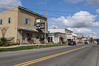
Jane Lew is a town in Lewis County, West Virginia, United States. The population was 409 at the time of the 2020 census.

<span class="mw-page-title-main">Pleasant Valley, Marion County, West Virginia</span> City in West Virginia, United States

Pleasant Valley is a city in Marion County, West Virginia, United States. The population was 3,506 at the 2020 census.

<span class="mw-page-title-main">Eleanor, West Virginia</span> Town in West Virginia, United States

Eleanor is a town in Putnam County, West Virginia, United States, along the Kanawha River. Its population was 1,548 at the 2020 census. It is part of the Huntington–Ashland metropolitan area. The town, named for Eleanor Roosevelt, was established as a New Deal project in the 1930s like other Franklin D. Roosevelt towns around the nation.

<span class="mw-page-title-main">Beverly, West Virginia</span> Town in West Virginia, United States

Beverly is a town in Randolph County, West Virginia, United States. Founded in 1787, it is the oldest settlement in the Tygart River Valley. It had a population of 628 at the 2020 census. Beverly was the county seat of Randolph County for over a century—from 1790 until 1899—after which the nearby settlement of Elkins assumed that role following an intense local political "war".

<span class="mw-page-title-main">Harman, West Virginia</span> Town in West Virginia, United States

Harman is a town in Randolph County, West Virginia, United States. The population was 96 at the 2020 census.

<span class="mw-page-title-main">Huttonsville, West Virginia</span> Town in West Virginia, United States

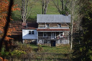
Huttonsville is a town in Randolph County, West Virginia, United States, along the Tygart Valley River. The population was 163 at the 2020 census.

<span class="mw-page-title-main">Mill Creek, West Virginia</span> Town in West Virginia, United States

Mill Creek is a town in Randolph County, West Virginia, United States, along the Tygart Valley River. The population was 563 at the 2020 census.

<span class="mw-page-title-main">Davis, West Virginia</span> Town in West Virginia, United States

Davis is a town in Tucker County, West Virginia, United States, situated along the Blackwater River. The population was 595 at the 2020 census.

<span class="mw-page-title-main">Thomas, West Virginia</span> City in West Virginia, United States

Thomas is a city and former coal town in Tucker County, West Virginia, United States. The population was 623 at the 2020 census.

<span class="mw-page-title-main">Webster Springs, West Virginia</span> Town in West Virginia, United States

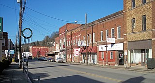
Addison, commonly known as Webster Springs, is a town in and the county seat of Webster County, West Virginia, United States. Although it was incorporated as Addison in 1892, it is more frequently referred to as Webster Springs, the name of the town's post office. It was named for Addison McLaughlin, upon whose land the town was originally laid out. The population was 731 at the 2020 census.

<span class="mw-page-title-main">Mineralwells, West Virginia</span> CDP in West Virginia, United States

Mineralwells, also known as Mineral Wells, is a census-designated place (CDP) in Wood County, West Virginia, United States. It is part of the Parkersburg-Marietta-Vienna, WV-OH Metropolitan Statistical Area. The population was 1,950 at the 2010 census. The population was 2216 at the 2021 census.

References

Notes

  1. Mean monthly maxima and minima (i.e. the expected highest and lowest temperature readings at any point during the year or given month) calculated based on data at said location from 1991 to 2020.

Citations

  1. Marco, Jerry A. (March 30, 2021). "New Elkins mayor to be sworn in Wednesday" . Retrieved June 28, 2021.
  2. "2019 U.S. Gazetteer Files". United States Census Bureau. Retrieved August 7, 2020.
  3. 1 2 U.S. Geological Survey Geographic Names Information System: Elkins, West Virginia
  4. 1 2 3 4 "City and Town Population Totals: 2020-2021". Census.gov. US Census Bureau. Retrieved July 3, 2022.
  5. "Elkins, West Virginia Area Code". areacodehelp.com. Retrieved February 12, 2017.
  6. Gannett, Henry (1905). The Origin of Certain Place Names in the United States. Govt. Print. Off. p. 117.
  7. "Mountain State Forest Festival". Mountain State Forest Festival. Retrieved July 24, 2018.
  8. “He obtained a clear title to 400 acres of land by virtue of a settlement made before 1778 on the east side of the Tygart Valley River, adjoining the land of Robert Cunningham. It was surveyed by John Poage on 14 November 1780, who with his chain carriers set off the tract as 288 acres, and on 1 June 1782 a perfected title to the land was returned to him from the Land Office. It included the land that is now most of downtown Elkins, the park, the Wees Addition, both sides of the river from roughly the rear entrance of McDonald's Restaurant to Porter Avenue, South Elkins north of 11th Street, and all of Diamond and Wees Street. David Armstrong, who has made a careful study of the early land titles in Elkins, thinks that his cabin stood on the west side of Randolph Avenue at its intersection with Henry Avenue where St. Brendan's Catholic School was later located. He credits Thomas Skidmore with being the first white settler in central Elkins. He does not seem to have made an immediate settlement at Elkins however, for he appears in 1784 on a tax list taken on the South Branch in Pendleton County where he headed a family of seven white souls.” (Skidmore, Warren (2010), Thomas Skidmore (Scudamore), 1605-1684, of Westerleigh, Gloucestershire, and Fairfield, Connecticut; his ancestors, and descendants to the ninth generation; Akron, Ohio; Sixth Edition; pg 143.)
  9. West Virginia Atlas & Gazetteer. Yarmouth, Me.: DeLorme. 1997. p. 37. ISBN   0-89933-246-3.
  10. "US Gazetteer files 2010". United States Census Bureau. Archived from the original on January 12, 2012. Retrieved January 24, 2013.
  11. Crampton, Norman, The 100 Best Towns in America, 2nd Edition, McMillan, Inc., New York City, 134-37.
  12. 1 2 "NowData - NOAA Online Weather Data". National Oceanic and Atmospheric Administration. Retrieved June 13, 2021.
  13. "Station: Elkins Randolph CO AP, WV". U.S. Climate Normals 2020: U.S. Monthly Climate Normals (1991-2020). National Oceanic and Atmospheric Administration. Retrieved June 13, 2021.
  14. United States Census Bureau. "Census of Population and Housing" . Retrieved August 27, 2013.
  15. "Annual Estimates of the Resident Population: April 1, 2010 to July 1, 2012". Archived from the original on June 2, 2013. Retrieved August 27, 2013.
  16. "Explore Census Data". data.census.gov. Retrieved February 23, 2023.
  17. "U.S. Census website". United States Census Bureau . Retrieved January 24, 2013.
  18. "U.S. Census website". United States Census Bureau . Retrieved January 31, 2008.
  19. Augusta Heritage Center