Barrackville, West Virginia

Last updated

Barrackville, West Virginia
Marion County West Virginia Incorporated and Unincorporated areas Barrackville Highlighted.svg
Location of Barrackville in Marion County, West Virginia.
Coordinates: 39°30′10″N80°10′11″W / 39.50278°N 80.16972°W / 39.50278; -80.16972
Country United States
State West Virginia
County Marion
Government
  MayorTheodore Glance
  Town CouncilBill Greathouse; Roy Meeks; Jeff Mullenax; Charles Moore; Dewey Ice
Area
[1]
  Total0.71 sq mi (1.83 km2)
  Land0.69 sq mi (1.79 km2)
  Water0.02 sq mi (0.05 km2)
Elevation
945 ft (288 m)
Population
 (2020) [2]
  Total1,211
  Estimate 
(2021) [2]
1,206
  Density1,856.31/sq mi (716.25/km2)
Time zone UTC-5 (Eastern (EST))
  Summer (DST) UTC-4 (EDT)
ZIP code
26559
Area code 304
FIPS code 54-04612 [3]
GNIS feature ID1553805 [4]
Website local.wv.gov/barrackville/Pages/default.aspx

Barrackville is a town in Marion County, West Virginia, United States. The population was 1,211 at the 2020 census. [2]

Contents

Barrackville was settled beginning in 1767 by William Galloway "Indian Billy" Ice. [5] [ additional citation(s) needed ] The town was named in honor of John Barrack, an early settler. It was incorporated January 25, 1968.

Geography

Barrackville is located at 39°30′10″N80°10′11″W / 39.50278°N 80.16972°W / 39.50278; -80.16972 (39.502741, -80.169713), [6] along Buffalo Creek. [7]

According to the United States Census Bureau, the town has a total area of 0.71 square miles (1.84 km2), of which 0.69 square miles (1.79 km2) is land and 0.02 square miles (0.05 km2) is water. [8]

Demographics

Historical population
CensusPop.Note
1860 91
1870 11425.3%
1880 99−13.2%
1970 1,545
1980 1,81517.5%
1990 1,443−20.5%
2000 1,288−10.7%
2010 1,3021.1%
2020 1,211−7.0%
2021 (est.)1,206 [2] −0.4%
U.S. Decennial Census [9]

2010 census

As of the census [10] of 2010, there were 1,302 people, 544 households, and 372 families living in the town. The population density was 1,887.0 inhabitants per square mile (728.6/km2). There were 602 housing units at an average density of 872.5 per square mile (336.9/km2). The racial makeup of the town was 94.2% White, 4.0% African American, 0.2% Native American, 0.5% Asian, and 1.2% from two or more races. Hispanic or Latino of any race were 1.0% of the population.

There were 544 households, of which 29.2% had children under the age of 18 living with them, 52.9% were married couples living together, 11.6% had a female householder with no husband present, 3.9% had a male householder with no wife present, and 31.6% were non-families. 26.5% of all households were made up of individuals, and 13.6% had someone living alone who was 65 years of age or older. The average household size was 2.39 and the average family size was 2.91.

The median age in the town was 41.5 years. 21.3% of residents were under the age of 18; 6.7% were between the ages of 18 and 24; 26.7% were from 25 to 44; 27.2% were from 45 to 64; and 18% were 65 years of age or older. The gender makeup of the town was 49.2% male and 50.8% female.

2000 census

As of the census [3] of 2000, there were 1,288 people, 534 households, and 373 families living in the town. The population density was 1,863.0 inhabitants per square mile (720.7/km2). There were 587 housing units at an average density of 849.0 per square mile (328.5/km2). The racial makeup of the town was 95.03% White, 3.88% African American, 0.16% Native American, 0.08% Asian, 0.08% from other races, and 0.78% from two or more races. Hispanic or Latino of any race were 0.54% of the population.

There were 534 households, out of which 28.3% had children under the age of 18 living with them, 55.4% were married couples living together, 11.2% had a female householder with no husband present, and 30.1% were non-families. 26.4% of all households were made up of individuals, and 14.6% had someone living alone who was 65 years of age or older. The average household size was 2.41 and the average family size was 2.90.

In the town, the population was spread out, with 23.0% under the age of 18, 6.8% from 18 to 24, 28.6% from 25 to 44, 24.6% from 45 to 64, and 16.9% who were 65 years of age or older. The median age was 40 years. For every 100 females, there were 87.8 males. For every 100 females age 18 and over, there were 82.0 males.

The median income for a household in the town was $31,587, and the median income for a family was $42,969. Males had a median income of $26,354 versus $21,786 for females. The per capita income for the town was $18,506. About 8.2% of families and 8.6% of the population were below the poverty line, including 12.4% of those under age 18 and 5.6% of those age 65 or over.

See also

Related Research Articles

<span class="mw-page-title-main">Island Falls, Maine</span> Town in the state of Maine, United States

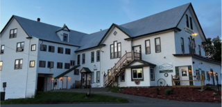
Island Falls is a town in Aroostook County, Maine, United States. The population was 758 at the 2020 census. The primary village of Island Falls in the town is situated at a falls in the West Branch Mattawamkeag River.

<span class="mw-page-title-main">Sherman, Maine</span> Town in the state of Maine, United States

Sherman is a town in Aroostook County, Maine, United States. The population was 815 at the 2020 census.

Deblois is a town in Washington County, Maine, United States. The town was named after T.A. Deblois, president of the Bank of Portland. The population was 74 at the 2020 census.

<span class="mw-page-title-main">Riverside, Washington</span> Town in Washington, United States

Riverside is a town in Okanogan County, Washington, United States. The population was 280 at the 2010 census, and increased to 329 at the 2020 census.

<span class="mw-page-title-main">Belington, West Virginia</span> City in West Virginia

Belington is a town in Barbour County, West Virginia, United States, situated along the Tygart Valley River. The population was 1,804 as of the 2020 census.

<span class="mw-page-title-main">Junior, West Virginia</span> Town in West Virginia, United States

Junior is a town in Barbour County, West Virginia, United States, situated along the Tygart Valley River. The population was 384 at the 2020 census.

<span class="mw-page-title-main">Sylvester, West Virginia</span> Town in West Virginia, United States

Sylvester is a town in Boone County, West Virginia, United States, along the Big Coal River. The population was 166 at the 2020 census. Sylvester was incorporated on April 11, 1952, by the Boone County Circuit Court. Sylvester bears the name of a family of settlers.

<span class="mw-page-title-main">Leon, West Virginia</span> Town in West Virginia, United States

Leon is a town in Mason County, West Virginia, United States, situated along the Kanawha River. The population was 137 at the 2020 census. It is part of the Point Pleasant, WV–OH Micropolitan Statistical Area.

<span class="mw-page-title-main">Davy, West Virginia</span> Town in West Virginia, United States

Davy is a town in McDowell County, West Virginia, United States. The population was 209 at the 2020 census, down from 420 at the 2010 census. Founded in 1873, the town was originally called Hallsville but the name would change to Davy by 1901. Davy was officially incorporated in 1948. It is a mostly residential community in a coal mining district along the main line of the Norfolk Southern Railway.

<span class="mw-page-title-main">Northfork, West Virginia</span> Town in West Virginia, United States

Northfork is a town in McDowell County, West Virginia, United States, located on U.S. Route 52 between Welch and Bluefield.

<span class="mw-page-title-main">Peterstown, West Virginia</span> Town in West Virginia, United States

Peterstown is a town in Monroe County, West Virginia, United States. The population was 456 at the 2020 census.

<span class="mw-page-title-main">Brandonville, West Virginia</span> Town in West Virginia, United States

Brandonville is a town in northern Preston County, West Virginia, United States. The population was 136 at the 2020 census. It is part of the Morgantown metropolitan area.

<span class="mw-page-title-main">Newburg, West Virginia</span> Town in West Virginia, United States

Newburg is a town in western Preston County, West Virginia, United States. The population was 275 at the 2020 census. It is part of the Morgantown metropolitan area.

<span class="mw-page-title-main">Montrose, West Virginia</span> Town in West Virginia, United States

Montrose is a town in Randolph County, West Virginia, United States. The population was 141 at the 2020 census.

<span class="mw-page-title-main">Auburn, West Virginia</span> Town in West Virginia, United States

Auburn is a town in Ritchie County, West Virginia, United States. The population was 80 at the 2020 census.

<span class="mw-page-title-main">Cairo, West Virginia</span> Town in West Virginia, United States

Cairo is a town in Ritchie County, West Virginia, United States, along West Virginia Route 31, the North Fork of the Hughes River, and the North Bend Rail Trail. The population was 174 at the 2020 census.

<span class="mw-page-title-main">Ellenboro, West Virginia</span> Town in West Virginia, United States

Ellenboro is a town in Ritchie County, West Virginia, United States. The population was 222 at the 2020 census. The town is located at the junction of U.S. Route 50 and West Virginia Route 16; the North Bend Rail Trail also passes through the town. The town was named for Ellen Mariah Williamson, the eldest daughter of the family that granted a right of way for the Baltimore and Ohio Railroad to build their line through the town; an earlier name for the community was Shumley. Ellenboro was incorporated in 1903.

<span class="mw-page-title-main">Hambleton, West Virginia</span> Town in West Virginia, United States

Hambleton is a town in Tucker County, West Virginia, United States. The population was 216 at the 2020 census. Hambleton was established in 1889, but not incorporated until 1905. It was named by then United States Senator Stephen B. Elkins in honor of a stockholder by this name in the West Virginia Central Railroad Company. The town was previously known as Hulings.

<span class="mw-page-title-main">Camden-on-Gauley, West Virginia</span> Town in West Virginia, United States

Camden-on-Gauley is a town in Webster County, West Virginia, United States, along the Gauley River. The population was 126 at the 2020 census.

<span class="mw-page-title-main">Guilford (CDP), Maine</span> CDP in Maine, United States

Guilford is a census-designated place (CDP) in the town of Guilford in Piscataquis County, Maine, United States. The population was 945 at the 2000 census.

References

  1. "2019 U.S. Gazetteer Files". United States Census Bureau. Retrieved August 7, 2020.
  2. 1 2 3 4 "City and Town Population Totals: 2020-2021". Census.gov. US Census Bureau. Retrieved July 3, 2022.
  3. 1 2 "U.S. Census website". United States Census Bureau . Retrieved January 31, 2008.
  4. "US Board on Geographic Names". United States Geological Survey. October 25, 2007. Retrieved January 31, 2008.
  5. lizzie3622 (July 22, 2014). "William Galloway Ice: He was called "Indian Billy" …". historyandnovelty. Retrieved October 22, 2019.{{cite web}}: CS1 maint: numeric names: authors list (link)
  6. "US Gazetteer files: 2010, 2000, and 1990". United States Census Bureau. February 12, 2011. Retrieved April 23, 2011.
  7. West Virginia Atlas & Gazetteer. Yarmouth, Me.: DeLorme. 1997. p. 25. ISBN   0-89933-246-3.
  8. "US Gazetteer files 2010". United States Census Bureau. Archived from the original on January 25, 2012. Retrieved January 24, 2013.
  9. "Census of Population and Housing". Census.gov. Retrieved June 4, 2015.
  10. "U.S. Census website". United States Census Bureau . Retrieved January 24, 2013.