Hedgesville, West Virginia

Last updated

Hedgesville, West Virginia
2016-08-25 14 32 02 View west along West Virginia State Route 9 (Hedgesville Road) between Zion Street and West Virginia State Route 901 (Mary Street) in Hedgesville, Berkeley County, West Virginia.jpg
Central Hedgesville
Berkeley County West Virginia Incorporated and Unincorporated areas Hedgesville Highlighted.svg
Location of Hedgesville in Berkeley County, West Virginia.
Coordinates: 39°33′16″N77°59′40″W / 39.55444°N 77.99444°W / 39.55444; -77.99444
Country United States
State West Virginia
County Berkeley
Area
[1]
  Total0.13 sq mi (0.34 km2)
  Land0.13 sq mi (0.34 km2)
  Water0.00 sq mi (0.00 km2)
Elevation
[2]
633 ft (193 m)
Population
 (2010) [3]
  Total318
  Estimate 
(2019) [4]
297
  Density2,267.18/sq mi (872.39/km2)
Time zone UTC-5 (Eastern (EST))
  Summer (DST) UTC-4 (EDT)
ZIP code
25427
Area code 304
FIPS code 54-36220 [5]
GNIS feature ID2390239 [2]
Website https://www.hedgesvillewv.us/

Hedgesville is a town in Berkeley County, West Virginia, United States, in the state's Eastern Panhandle region. The population was 318 at the 2010 census. The town sits on WV 9, roughly 13 miles east of Berkeley Springs. In addition to its legal definition, Hedgesville has come to be the common name for the large and sparsely inhabited area of West Virginia's Eastern Panhandle bordered by the Potomac River to the North and East, a southern border defined roughly by an imaginary line from the city of Martinsburg to the tip of Virginia, and Berkeley Springs to the West.

Contents

History

The Hedgesville area was originally settled by William Snodgrass, who arrived in the American colonies in 1700. William Snodgrass is buried in the cemetery of Tuscarora Presbyterian Church in Berkeley County, West Virginia.

Officially established by an act of the Virginia General Assembly on February 11, 1836, [6] the Town of Hedgesville was laid out in 1832 along the old Warm Springs Road (now West Virginia Route 9) and named for the prominent local Hedges family. [7] In 1854, Hedgesville was officially incorporated by the General Assembly. The act of incorporation provided for a town council consisting of seven trustees, but the act was amended in 1858 so that a mayor could be added to the council. [8] Hedgesville is a National Register Historic District. Prior to that, in the 18th Century, it was home to the Tuscarora people. [9]

Transportation

WV 9 eastbound leaving Hedgesville 2016-08-25 15 32 26 View east along West Virginia State Route 9 (Hedgesville Road) at Rumbling Rock Road in Hedgesville, Berkeley County, West Virginia.jpg
WV 9 eastbound leaving Hedgesville

Two primary highways serve Hedgesville. The more prominent of these is West Virginia Route 9. WV 9 travels southeastward to Martinsburg and provides connections to Interstate 81. To the northwest, WV 9 connects to U.S. Route 522 in Berkeley Springs. The other primary highway serving Hedgesville is West Virginia Route 901, which heads east from its western end at WV 9 in Hedgesville to I-81 at Falling Waters.

Geography

According to the United States Census Bureau, the town has a total area of 0.13 square miles (0.34 km2), all land. [10]

Demographics

Historical population
CensusPop.Note
1880 383
1890 44817.0%
1900 342−23.7%
1910 328−4.1%
1920 37915.5%
1930 361−4.7%
1940 40311.6%
1950 4194.0%
1960 342−18.4%
1970 274−19.9%
1980 217−20.8%
1990 2274.6%
2000 2405.7%
2010 31832.5%
2020 3468.8%
U.S. Decennial Census [11]

2010 census

As of the census [3] of 2010, there were 318 people, 119 households, and 82 families living in the town. The population density was 2,446.2 inhabitants per square mile (944.5/km2). There were 135 housing units at an average density of 1,038.5 per square mile (401.0/km2). The racial makeup of the town was 90.3% White, 5.3% African American, 0.3% Native American, 0.3% Asian, 1.6% from other races, and 2.2% from two or more races. Hispanic or Latino of any race were 3.1% of the population.

There were 119 households, of which: 46.2% had children under the age of 18 living with them; 42.9% were married couples living together; 21.0% had a female householder with no husband present; 5.0% had a male householder with no wife present; and, 31.1% were non-families. 16.0% of all households were made up of individuals, and 5.9% had someone living alone who was 65 years of age or older. The average household size was 2.67, and the average family size was 3.07.

The median age in the town was 31.2 years. 29.6% of residents were under the age of 18; 9% were between the ages of 18 and 24; 32.4% were from 25 to 44; 20.1% were from 45 to 64; and 8.8% were 65 years of age or older. The gender makeup of the town was 47.2% male and 52.8% female.

2000 census

As of the census [5] of 2000, there were 240 people, 88 households, and 65 families living in the town. The population density was 772.2/km2 (1,980.4/mi2). There were 99 housing units at an average density of 816.9 per square mile (318.5/km2). The racial makeup of the town was 92.08% White, 3.75% African American, 0.42% Native American, 0.42% Pacific Islander, and 3.33% from two or more races. Hispanic or Latino of any race were 0.83% of the population.

There were 88 households, of which 43.2% had children under the age of 18 living with them, 46.6% were married couples living together, 20.5% had a female householder with no husband present, and 26.1% were non-families. 20.5% of all households were made up of individuals, and 5.7% had someone living alone who was 65 years of age or older. The average household size was 2.73 and the average family size was 3.18.

In the town, the population was spread out, with 34.6% under the age of 18, 6.3% from 18 to 24, 27.5% from 25 to 44, 24.6% from 45 to 64, and 7.1% who were 65 years of age or older. The median age was 34 years. For every 100 females, there were 75.2 males. For every 100 females age 18 and over, there were 80.5 males.

The median income for a household in the town was $49,375, and the median income for a family was $46,563. Males had a median income of $31,042 versus $21,985 for females. The per capita income for the town was $17,772. About 2.8% of families and 5.4% of the population were below the poverty line, including 9.3% of those under the age of eighteen and 9.7% of those 65 or over.

Notable people

Related Research Articles

<span class="mw-page-title-main">Martinsburg, West Virginia</span> City in West Virginia, United States

Martinsburg is a city in and the county seat of Berkeley County, West Virginia, United States. The population was 18,773 at the 2020 census, making Martinsburg the largest city in the Eastern Panhandle of West Virginia and the sixth-largest city in the state. It is a principal city of the Hagerstown–Martinsburg metropolitan area extending into Maryland, which had 293,844 residents in 2020.

<span class="mw-page-title-main">Gauley Bridge, West Virginia</span> Town in West Virginia, United States

Gauley Bridge is a town in Fayette County, West Virginia, United States. The population was 614 at the 2010 census. The Kanawha River is formed at Gauley Bridge by the confluence of the New and Gauley Rivers. Two miles to the southwest of Gauley Bridge, in Glen Ferris, is Kanawha Falls, a popular stopping point on Midland Trail Scenic Highway.

<span class="mw-page-title-main">Anmoore, West Virginia</span> Town in West Virginia, United States

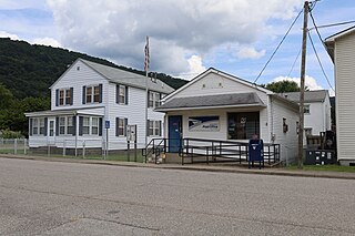
Anmoore is a town in Harrison County, West Virginia, United States. It is located at the intersection of WV 58 and Interstate 79. The population was 514 at the 2020 census.

<span class="mw-page-title-main">West Milford, West Virginia</span> Town in West Virginia, United States

West Milford is a town in Harrison County, West Virginia, United States. The population was 452 at the 2020 census.

<span class="mw-page-title-main">Pratt, West Virginia</span> Town in West Virginia, United States

Pratt is a town in Kanawha County, West Virginia, United States, along the Kanawha River. The population was 482 at the 2020 census.

<span class="mw-page-title-main">West Hamlin, West Virginia</span> Town in West Virginia, United States

West Hamlin is a town in Lincoln County, West Virginia, United States, along the Guyandotte River. The population was 519 at the 2020 census, and is now down to 509, according to the 2021 census. West Hamlin is a part of the Huntington-Ashland, WV-KY-OH, Metropolitan Statistical Area (MSA). West Hamlin is west of the county seat at Hamlin, hence the name.

<span class="mw-page-title-main">Hartford City, West Virginia</span> Town in West Virginia, United States

Hartford City, also known as Hartford, is a town in Mason County, West Virginia, United States. The population was 509 at the 2020 census. It is part of the Point Pleasant, WV–OH Micropolitan Statistical Area.

<span class="mw-page-title-main">Leon, West Virginia</span> Town in West Virginia, United States

Leon is a town in Mason County, West Virginia, United States, situated along the Kanawha River. The population was 137 at the 2020 census. It is part of the Point Pleasant, WV–OH Micropolitan Statistical Area.

<span class="mw-page-title-main">New Haven, West Virginia</span> Town in West Virginia, United States

New Haven is a town in Mason County, West Virginia, United States, along the Ohio River. The population was 1,485 at the 2020 census. It is part of the Point Pleasant, WV–OH Micropolitan Statistical Area.

<span class="mw-page-title-main">Athens, West Virginia</span> Town in West Virginia, United States

Athens is a town in Mercer County, West Virginia, United States. The population was 944 at the 2020 census. It is part of the Bluefield, WV-VA micropolitan area which has a population of 107,578. Athens is the home of Concord University.

<span class="mw-page-title-main">Matoaka, West Virginia</span> Census-designated place in West Virginia, United States

Matoaka is a census-designated place in Mercer County, West Virginia, United States. The population was 173 at the 2020 census. It is part of the Bluefield, WV-VA micropolitan area which has a population of 100,093. This town is named for Chief Powhatan's daughter Matoaka who was better known by her nickname "Pocahontas". Matoaka became an unincorporated town when it voted to dissolve its charter in May 2018.

<span class="mw-page-title-main">Oakvale, West Virginia</span> Town in West Virginia, United States

Oakvale is a town in Mercer County, West Virginia, United States, along the East River. The population was 137 at the 2020 census. It is part of the Bluefield, WV-VA micropolitan area which has a population of 107,578.

<span class="mw-page-title-main">Elk Garden, West Virginia</span> Town in West Virginia, United States

Elk Garden is a town in Mineral County, West Virginia, United States. It is part of the 'Cumberland, MD-WV Metropolitan Statistical Area'. The population was 211 at the 2020 census. Elk Garden High School was consolidated into Keyser High School in 1997. However the Primary School is still in session, offering classes from Pre-Kindergarten through the fifth grade. The school mascot is the Elk Garden Stags. Elk Garden was incorporated in 1890 by the Mineral County Circuit Court. It is named for an elk lick near the original town site.

<span class="mw-page-title-main">Blacksville, West Virginia</span> Town in West Virginia

Blacksville is an Incorporated Town in Monongalia County, West Virginia, United States. The population was 118 at the 2020 census. It is included in the Morgantown, West Virginia Metropolitan Statistical Area.

<span class="mw-page-title-main">Durbin, West Virginia</span> Town in West Virginia, United States

Durbin is a town in Pocahontas County, West Virginia, United States. The population was 235 at the 2020 census.

<span class="mw-page-title-main">Albright, West Virginia</span> Town in West Virginia, United States

Albright is a town in central Preston County, West Virginia, United States, along the Cheat River. The population was 260 at the 2020 census. A former coal town, it is part of the Morgantown metropolitan area.

<span class="mw-page-title-main">Newburg, West Virginia</span> Town in West Virginia, United States

Newburg is a town in western Preston County, West Virginia, United States. The population was 275 at the 2020 census. It is part of the Morgantown metropolitan area.

<span class="mw-page-title-main">Terra Alta, West Virginia</span> Town in West Virginia, United States

Terra Alta is a town in eastern Preston County, West Virginia, United States. The population was 1,415 at the 2020 census. It is part of the Morgantown metropolitan area.

<span class="mw-page-title-main">Lester, West Virginia</span> Town in West Virginia, United States

Lester is a town in Raleigh County, West Virginia, United States. The population was 337 at the 2020 census. The community was named after Champ Lester, a local pioneer.

<span class="mw-page-title-main">Sophia, West Virginia</span> Town in West Virginia, United States

Sophia is a town in Raleigh County, West Virginia, United States. It was incorporated in 1912. The population was 1,124 at the 2020 census.

References

  1. "2019 U.S. Gazetteer Files". United States Census Bureau. Retrieved August 7, 2020.
  2. 1 2 U.S. Geological Survey Geographic Names Information System: Hedgesville, West Virginia
  3. 1 2 "U.S. Census website". United States Census Bureau . Retrieved January 24, 2013.
  4. 1 2 "U.S. Census website". United States Census Bureau . Retrieved January 31, 2008.
  5. Acts of the General Assembly of the State of Virginia. J. E. Goode. January 1, 1836. p. 360.
  6. Kenny, Hamill (1945). "West Virginia Place Names: Their Origin and Meaning, Including the Nomenclature of the Streams and Mountains". Chronicles of Old Berkeley: A Narrative History of a Virginia County from Its Beginnings to 1926. Piedmont, WV: The Place Name Press. p. 304.
  7. Gardiner, Ann (1938). Chronicles of Old Berkeley: A Narrative History of a Virginia County from Its Beginnings to 1926. The Seeman Press. pp. 41–42.
  8. "Indian History of Present Day Berkeley County, West Virginia" . Retrieved March 19, 2019.
  9. "US Gazetteer files 2010". United States Census Bureau. Archived from the original on January 25, 2012. Retrieved January 24, 2013.
  10. "Census of Population and Housing". Census.gov. Retrieved June 4, 2015.
  11. "The James Graham Leyburn Papers, 1902–1993 WLU Coll. 0288". Washington and Lee University, James G. Leyburn Library, Special Collections and Archives.