Tomahawk | |
|---|---|
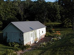 Tomahawk Springhouse | |
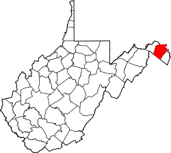
 Tomahawk Location within the state of West Virginia  Tomahawk Tomahawk (the United States) | |
| Coordinates: 39°31′49″N78°02′49″W / 39.53028°N 78.04694°W | |
| Country | United States |
| State | West Virginia |
| County | Berkeley |
| Elevation | 466 ft (142 m) |
| Time zone | UTC-5 (Eastern (EST)) |
| • Summer (DST) | UTC-4 (EDT) |
| GNIS feature ID | 1555816 [1] |
Tomahawk is an unincorporated community on Back Creek in Berkeley County, West Virginia, United States. [1] The community is named for a nearby series of springs in the shape of a tomahawk. [2] The community includes the historic Tomahawk Presbyterian Church, established c. 1745, and its adjacent community cemetery, which has gravestones dating to the late 18th century. Tomahawk also has a popular dirt bike racetrack. The community lies 9.5 miles from Martinsburg.
Tomahawk Spring and the Park's Gap Bridge were listed on the National Register of Historic Places in 1994. [3]