Bedington, West Virginia

Last updated

Bedington
USA West Virginia location map.svg
Red pog.svg
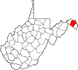
Bedington
Location within the state of West Virginia
Usa edcp location map.svg
Red pog.svg
Bedington
Bedington (the United States)
Coordinates: 39°31′20″N77°54′20″W / 39.52222°N 77.90556°W / 39.52222; -77.90556
Country United States
State West Virginia
County Berkeley
Elevation
[1]
384 ft (117 m)
Time zone UTC-5 (Eastern (EST))
  Summer (DST) UTC-4 (EDT)
GNIS feature ID1535469 [1]

Bedington is an unincorporated community on Hoke Run, near its confluence with Opequon Creek, in Berkeley County, West Virginia, United States. It is located east of Hainesville on County Route 5. According to the Geographic Names Information System, Bedington has also been known as Beddington, Bedenton, and The Lick. [1]

The community derives its name from Colonel Bedinger, an early settler. [2]

Related Research Articles

<span class="mw-page-title-main">Opequon Creek</span>

Opequon Creek is an approximately 35 mile tributary stream of the Potomac River. It flows into the Potomac northeast of Martinsburg in Berkeley County, West Virginia, and its source lies northwest of the community of Opequon at the foot of Great North Mountain in Frederick County, Virginia. The Opequon forms part of the boundary between Frederick and Clarke counties in Virginia and also partially forms the boundary between Berkeley and Jefferson counties in West Virginia's Eastern Panhandle.

Rada is an unincorporated community in Hampshire County in the U.S. state of West Virginia. Rada is located on U.S. Highway 220/West Virginia Route 28 between Junction and Purgitsville in southwest Hampshire County along Mill Creek. It lies at an intersection of US 220/WV 28 with Rada Road.

Cold Stream is an unincorporated community in Hampshire County in the U.S. state of West Virginia. Cold Stream is located north of Capon Bridge on Cold Stream Road. Referred to as Edwards Run in its past, the community of Cold Stream is in proximity to where Edwards Run empties into the Cacapon River. The community most likely took its name from a nearby stream of the same name noted for the cold water it contains. Their post office has been closed.

<span class="mw-page-title-main">Quick, West Virginia</span> Unincorporated community in West Virginia, United States

Quick is a small unincorporated community in Kanawha County, West Virginia, United States. It is located along Indian Creek Road. The community is where Whitoak Fork and Blue Creek come together and meet. It is also where the abandoned railroad that follows Blue Creek joins the road, and follows it all the way to the community of Hitop, along Pond Fork. Its post office is closed.

Pentress is a census-designated place (CDP) in northern Monongalia County, West Virginia, United States. It lies along West Virginia Route 7 northwest of the city of Morgantown, the county seat of Monongalia County. Its elevation is 951 feet (290 m). "Pentress" is not the only name the community has had; at various times in its history, it has been known as Minors Mills, New Brownsville, Pentrees, Pentress Junction, Statler Town, Statlers Town, Statlersville, and Stradlerstown. The present name of Pentress was selected by an early settler who reportedly wanted a Welsh name. It has a post office with the ZIP Code of 26544. As of the 2010 census, its population was 175.

Galloway is a census-designated place (CDP) and coal town in northwestern Barbour County, West Virginia, United States. It lies along West Virginia Route 76 northwest of the city of Philippi, the county seat of Barbour County. Its elevation is 1,073 feet (327 m). It has a post office with the ZIP code 26349. As of the 2010 census, its population is 143.

Rock Castle is an unincorporated community in southwestern Jackson County, West Virginia, United States. It lies along Rock Castle Road, south of the city of Ripley, the county seat of Jackson County. Its elevation is 705 feet (215 m).

Kentuck is an unincorporated community in southeastern Jackson County, West Virginia, United States. It lies along Kentuck Road southeast of the city of Ripley, the county seat of Jackson County. Its elevation is 922 feet (281 m).

Kenna is an unincorporated community in southern Jackson County, West Virginia, United States. It lies along West Virginia Route 34 just west of its interchange with Interstate 77, south of the city of Ripley, the county seat of Jackson County. Its elevation is 787 feet (240 m). Although Kenna is unincorporated, it has a post office, with the ZIP code of 25248.

Advent is an unincorporated community in southeastern Jackson County, West Virginia, United States. It lies along Advent Road southeast of the city of Ripley, the county seat of Jackson County, and near Jackson County's borders with Kanawha and Roane counties. Its elevation is 791 feet (241 m). Advent had a post office, which closed on December 25, 2010.

Belva is an unincorporated community and census-designated place in west Nicholas County and north Fayette County, West Virginia, United States; while the CDP only includes the Nicholas County portion, the Fayette County portion is considered part of the community. The town is situated at the bottomland surrounding the convergence of Bells Creek with Twentymile Creek and, subsequently, Twenty Mile Creek with the Gauley River. Belva is also the location of the convergence of two state highways: West Virginia Route 16 and West Virginia Route 39.

Pedlar is an unincorporated community in Monongalia County, West Virginia, United States. Its post office has been closed.

Olcott is an unincorporated community and coal town in Kanawha County, West Virginia, United States. Its post office is closed.

Sattes is an unincorporated community in Kanawha County, West Virginia, United States. Its post office is closed.

Weir is an unincorporated community in Kanawha County, West Virginia, United States. Its post office is called Falling Rock.

Legg is an unincorporated community in Kanawha County, West Virginia, United States. Its post office is closed.

Copenhaver was an unincorporated community in Kanawha County, West Virginia, United States. Its post office is closed.

Putney is an unincorporated community in Kanawha County, West Virginia, United States. Its post office is closed.

Rensford is an unincorporated community in Kanawha County, West Virginia, United States. Its post office is closed. It was also known as Point Lick.

Maynor is an unincorporated community in Raleigh County, West Virginia, United States. Its post office is closed.

References

  1. 1 2 3 U.S. Geological Survey Geographic Names Information System: Bedington, West Virginia
  2. Kenny, Hamill (1945). West Virginia Place Names: Their Origin and Meaning, Including the Nomenclature of the Streams and Mountains. Piedmont, WV: The Place Name Press. p. 101.