Kimball, West Virginia

Last updated

Kimball, West Virginia
Kimball, West Virginia.jpg
Kimball in 2014
Logo of Kimball, West Virginia.png
McDowell County West Virginia Incorporated and Unincorporated areas Kimball Highlighted.svg
Location of Kimball in McDowell County, West Virginia.
Coordinates: 37°25′39″N81°30′24″W / 37.42750°N 81.50667°W / 37.42750; -81.50667
Country United States
State West Virginia
County McDowell
Government
  MayorElwin Thomas (D)
Area
[1]
  Total0.25 sq mi (0.66 km2)
  Land0.25 sq mi (0.66 km2)
  Water0.00 sq mi (0.00 km2)
Elevation
1,509 ft (460 m)
Population
 (2020)
  Total145
  Density580/sq mi (220/km2)
Time zone UTC-5 (Eastern (EST))
  Summer (DST) UTC-4 (EDT)
ZIP code
24853
Area code 304
FIPS code 54-43780 [2]
GNIS feature ID1541195 [3]
Website https://kimball.wv.gov/Pages/default.aspx

Kimball is a town in McDowell County, West Virginia, United States. Per the 2020 census, the population was 145. [4]

Contents

Kimball was incorporated in 1911 and named for Frederick J. Kimball, a railroad official. [5] Kimball is the site of the first war memorial building erected in memory of the African-American veterans of World War I. [6]

History

The Kimball mining disaster took place on July 18, 1919, at the Carswell coal mine in Kimball, killing six miners. [7] Initial reports said that 221 men had been killed, but they were trapped by the explosion. A rescue party was able to dig through the wreckage, allowing 215 to return alive to the surface. [8]

Geography

According to the United States Census Bureau, the town has a total area of 0.25 square miles (0.65 km2), all land. [9]

The town is on the Norfolk Southern Railway (former Norfolk and Western) network.

Economics

From 2005 when it opened until its closure in 2016, a Walmart superstore was the largest employer in the town. [10] Before a Walmart opened on the site, the building was home to a Kmart on the property. opening on March 9, 1995. At the time Kimball was the smallest city in US with a Kmart (although it served shoppers normally from the bigger town of Welch. The store closed in 2003 following a bankruptcy & mass-closures.

Kimball is home to the Five Loaves and Two Fishes foodbank, which features a hydropanel water production system which can produce 950 gallons of clean drinking water monthly. [11] [12] [13]

Media

The town is served by the thrice-weekly The Welch News out of the nearby county seat, Welch. [10]

Demographics

Historical population
CensusPop.Note
1910 1,630
1920 1,428−12.4%
1930 1,4672.7%
1940 1,5807.7%
1950 1,359−14.0%
1960 1,175−13.5%
1970 962−18.1%
1980 871−9.5%
1990 550−36.9%
2000 411−25.3%
2010 194−52.8%
U.S. Decennial Census [14]
2010 [15] 2020 [16]

2020 census

Kimball town, West Virginia – Racial and Ethnic Composition
(NH = Non-Hispanic)
Note: the US Census treats Hispanic/Latino as an ethnic category. This table excludes Latinos from the racial categories and assigns them to a separate category. Hispanics/Latinos may be of any race.
Race / EthnicityPop 2010 [15] Pop 2020 [16] % 2010% 2020
White alone (NH)735037.63%34.48%
Black or African American alone (NH)1117857.22%53.79%
Native American or Alaska Native alone (NH)010.00%0.69%
Asian alone (NH)000.00%0.00%
Pacific Islander alone (NH)000.00%0.00%
Some Other Race alone (NH)020.00%1.38%
Mixed Race/Multi-Racial (NH)10115.15%7.59%
Hispanic or Latino (any race)030.00%2.07%
Total194145100.00%100.00%

2010 census

As of the census [17] of 2010, there were 194 people, 78 households, and 52 families living in the town. The population density was 776.0 inhabitants per square mile (299.6/km2). There were 133 housing units at an average density of 532.0 per square mile (205.4/km2). The racial makeup of the town was 37.6% White, 57.2% African American, and 5.2% from two or more races.

There were 78 households, of which 33.3% had children under the age of 18 living with them, 32.1% were married couples living together, 26.9% had a female householder with no husband present, 7.7% had a male householder with no wife present, and 33.3% were non-families. 29.5% of all households were made up of individuals, and 12.8% had someone living alone who was 65 years of age or older. The average household size was 2.49 and the average family size was 3.08.

The median age in the town was 43 years. 23.7% of residents were under the age of 18; 10.3% were between the ages of 18 and 24; 18.6% were from 25 to 44; 28.9% were from 45 to 64; and 18.6% were 65 years of age or older. The gender makeup of the town was 45.4% male and 54.6% female.

2000 census

At the 2000 census, [2] there were 411 people, 166 households and 107 families living in the town. The population density was 1,578.6 inhabitants per square mile (609.5/km2). There were 233 housing units at an average density of 894.9 per square mile (345.5/km2). The racial makeup of the town was 34.06% White, 63.26% African American, 0.24% Pacific Islander, and 2.43% from two or more races.

There were 166 households, of which 22.3% had children under the age of 18 living with them, 33.1% were married couples living together, 27.1% had a female householder with no husband present, and 35.5% were non-families. 33.7% of all households were made up of individuals, and 20.5% had someone living alone who was 65 years of age or older. The average household size was 2.48 and the average family size was 3.12.

24.1% of the population were under the age of 18, 10.7% from 18 to 24, 18.2% from 25 to 44, 23.4% from 45 to 64, and 23.6% who were 65 years of age or older. The median age was 42 years. For every 100 females, there were 72.7 males. For every 100 females age 18 and over, there were 62.5 males.

The median household income was $17,333, and the median family income was $21,429. Males had a median income of $23,750 versus $21,250 for females. The per capita income for the town was $10,269. About 23.6% of families and 33.2% of the population were below the poverty line, including 48.1% of those under age 18 and 14.4% of those age 65 or over.

Notable people

Related Research Articles

<span class="mw-page-title-main">Fredericksburg, Indiana</span> Census-designated place in Indiana, United States

Fredericksburg is an unincorporated community in Posey Township, Washington County, in the U.S. state of Indiana. The population was 85 at the 2010 census, at the time it was a town.

<span class="mw-page-title-main">Burnsville, West Virginia</span> Town in West Virginia, United States

Burnsville is a town in Braxton County, West Virginia, United States, at the confluence of the Little Kanawha River and Saltlick Creek. The population was 401 at the 2020 census. Burnsville was incorporated in 1902 by the Circuit Court and named for Captain John Burns who operated the first sawmill in that section of the state and who established the town shortly after the close of the American Civil War. It was named "All West Virginia City" in 1976.

<span class="mw-page-title-main">Grantsville, West Virginia</span> Town in West Virginia, United States

Grantsville is a town in Calhoun County, West Virginia, United States. The population was 482 at the 2020 census. It is the county seat of Calhoun County. The town was established along the Little Kanawha River in 1865 and named for Ulysses S. Grant. Grantsville is home to Wayne Underwood Park, which includes a .25-mile-long (0.40 km) walking trail, and to the annual West Virginia Wood Festival.

<span class="mw-page-title-main">Bayard, West Virginia</span> Town in West Virginia, United States

Bayard is a town in Grant County, West Virginia, United States. The population was 200 at the 2020 census. Bayard was incorporated in 1893 and named in honor of Thomas F. Bayard, Jr., who later became a United States senator from Delaware (1923–1929). Bayard was founded on the West Virginia Central and Pittsburgh Railroad as a coal mining community. Coal mining has remained the town's chief industry.

<span class="mw-page-title-main">West Milford, West Virginia</span> Town in West Virginia, United States

West Milford is a town in Harrison County, West Virginia, United States. The population was 452 at the 2020 census.

<span class="mw-page-title-main">Glasgow, West Virginia</span> Town in West Virginia, United States

Glasgow is a town in Kanawha County, West Virginia, United States, situated along the Kanawha River. The population was 708 at the 2020 census. Glasgow was incorporated on June 20, 1920. Folk etymology derives its name from a combination of the word "glass" with the word "company" for a glass factory that was built there many years ago, but the presence of many Scottish immigrants to this part of Appalachia, particularly from the Strathclyde region, indicates that the town was most likely named after the Scottish city of Glasgow in Strathclyde. Other Virginia and West Virginia locations named for places in Strathclyde include Dumbarton, Argyle, Loudoun County, Hamilton in Loudoun County, Lanark and Renfrew.

<span class="mw-page-title-main">Man, West Virginia</span> Town in West Virginia, United States

Man is a town in Logan County, West Virginia, United States. The population was 772 at the 2020 census. The town is located along the Guyandotte River at the mouth of Buffalo Creek, which was the site of the 1972 Buffalo Creek Flood following a dam collapse. The name of the town reportedly derives from the last syllable of the surname of Ulysses Hinchman, who was a member of the House of Delegates from Logan County between 1866 and 1869.

<span class="mw-page-title-main">White Hall, West Virginia</span> Town in West Virginia, United States

White Hall is a town in Marion County, West Virginia, United States. The population was 706 at the 2020 census. Incorporated in 1989, White Hall is adjacent to the county seat, Fairmont, and is part of the Fairmont, West Virginia, Micropolitan Statistical Area. White Hall has many different stores and restaurants.

<span class="mw-page-title-main">Henderson, West Virginia</span> Unincorporated Town in West Virginia, United States

Henderson is an unincorporated community and former town in Mason County, West Virginia, United States, at the confluence of the Ohio and Kanawha Rivers. The population was 231 at the 2020 census. It is part of the Point Pleasant, WV–OH Micropolitan Statistical Area. The town was incorporated in 1893 and named for Samuel Bruce Henderson, who owned the townsite at the time. The town was unincorporated following a public hearing on August 11, 2022.

<span class="mw-page-title-main">Anawalt, West Virginia</span> Town in West Virginia, United States

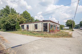
Anawalt is a town in McDowell County, West Virginia, United States. At one time it was known as Jeanette. It is named in honor of James White Anawalt, who was then manager of Union Supply Company, a subsidiary of the United States Steel Company. The population was 186 at the 2020 census. Coal mining was the town's chief industry.

<span class="mw-page-title-main">Gary, West Virginia</span> City in West Virginia, United States

Gary is a city located along the Tug Fork River in McDowell County, West Virginia, United States. According to the 2020 census, the city had a population of 762. It was named for Elbert Henry Gary, one of the founders of U.S. Steel. The former coal towns of Elbert, Filbert, Thorpe, and Wilcoe became part of Gary at the time of its incorporation in 1971.

<span class="mw-page-title-main">Iaeger, West Virginia</span> Town in West Virginia, United States

Iaeger is a town in McDowell County, West Virginia, United States. The population was 257 at the 2020 census.

<span class="mw-page-title-main">Keystone, West Virginia</span> City in West Virginia, United States

Keystone is a city in McDowell County, West Virginia, United States. Per the 2020 census, the population was 176. Keystone is one of the few municipalities in West Virginia with an African-American majority, with 65 percent of the residents being black.

<span class="mw-page-title-main">Northfork, West Virginia</span> Town in West Virginia, United States

Northfork is a town in McDowell County, West Virginia, United States, located on U.S. Route 52 between Welch and Bluefield.

<span class="mw-page-title-main">War, West Virginia</span> City in West Virginia, United States

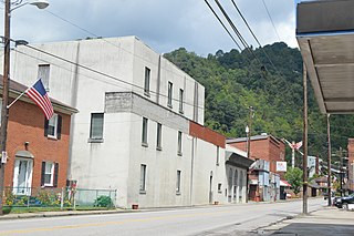
War is a city in McDowell County, West Virginia, United States. The population was 690 at the 2020 census. War was incorporated in 1920 by the Circuit Court of McDowell County. Its name is derived from War Creek, whose confluence with Dry Fork is located within the city. War is the only place in the United States with this name. War was formerly known as Miner's City.

<span class="mw-page-title-main">Granville, West Virginia</span> Town in West Virginia

Granville is a town in Monongalia County, West Virginia, United States. The population was 1,355 at the 2020 census. It is included in the Morgantown metropolitan area.

<span class="mw-page-title-main">Masontown, West Virginia</span> Town in West Virginia, United States

Masontown is a town in western Preston County, West Virginia, United States. The population was 510 at the 2020 census. It is part of the Morgantown metropolitan area.

<span class="mw-page-title-main">Reedsville, West Virginia</span> Town in West Virginia, United States

Reedsville is a town in western Preston County, West Virginia, United States. The population was 530 at the 2020 census. It is part of the Morgantown metropolitan area.

<span class="mw-page-title-main">Sophia, West Virginia</span> Town in West Virginia, United States

Sophia is a town in Raleigh County, West Virginia, United States. It was incorporated in 1912. The population was 1,124 at the 2020 census.

<span class="mw-page-title-main">North Hills, West Virginia</span> Town in West Virginia, United States

North Hills is a town in Wood County, West Virginia, United States. It is a suburb of Parkersburg. The population was 837 at the 2020 census. North Hills was incorporated on February 15, 1979.

References

  1. "2019 U.S. Gazetteer Files". United States Census Bureau. Retrieved August 7, 2020.
  2. 1 2 "U.S. Census website". United States Census Bureau . Retrieved January 31, 2008.
  3. "US Board on Geographic Names". United States Geological Survey. October 25, 2007. Retrieved January 31, 2008.
  4. "Kimball town, West Virginia". United States Census Bureau . Retrieved April 15, 2022.
  5. Kenny, Hamill (1945). West Virginia Place Names: Their Origin and Meaning, Including the Nomenclature of the Streams and Mountains. Piedmont, WV: The Place Name Press. pp. 350–351.
  6. West Virginia Blue Book. Published annually by the Clerk's Office of the West Virginia Senate.
  7. Greenberg, Michael I. (2006). Encyclopedia of Terrorist, Natural, and Man-made Disasters. Jones & Bartlett Learning. p. 192. ISBN   9780763737825.
  8. The Oklahoma City Times (July 18, 1919). "Rescuers Search For bodies of 14 men in Wreckage". The Oklahoma City Times . Oklahoma City. p. 1. ISSN   2333-0201. OCLC   13764083 . Retrieved July 18, 2019.
  9. "US Gazetteer files 2010". United States Census Bureau. Archived from the original on July 2, 2012. Retrieved January 24, 2013.
  10. 1 2 "What happened when Walmart left". TheGuardian.com . July 9, 2017.
  11. Boothe, Charles (November 16, 2019). "Clean water for McDowell: Kimball food bank installs new SOURCE production system". Bluefield Daily Telegraph. Retrieved January 19, 2020.
  12. "Manchin Secures Forklift for Five Loaves & Two Fishes Food Bank in Kimball". U.S. Senator Joe Manchin of West Virginia. December 29, 2017. Retrieved January 19, 2020.
  13. Coyne, Caity (April 7, 2018). "In McDowell County 'food desert,' concerns about the future". Charleston Gazette-Mail. Retrieved January 19, 2020.
  14. "Decennial Census of Population and Housing by Decades". US Census Bureau.
  15. 1 2 "P2 HISPANIC OR LATINO, AND NOT HISPANIC OR LATINO BY RACE – 2010: DEC Redistricting Data (PL 94-171) – Kimball town, West Virginia". United States Census Bureau .
  16. 1 2 "P2 HISPANIC OR LATINO, AND NOT HISPANIC OR LATINO BY RACE – 2020: DEC Redistricting Data (PL 94-171) – Kimball town, West Virginia". United States Census Bureau .
  17. "U.S. Census website". United States Census Bureau . Retrieved January 24, 2013.