Marion County is a county in the U.S. state of West Virginia. As of the 2020 census, the population was 56,205. Its county seat is Fairmont. The county was named in honor of General Francis Marion, known to history as "The Swamp Fox".

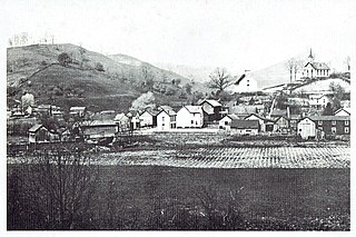
Rivesville is a town and former coal town in Marion County, West Virginia, United States. The population was 830 at the 2020 census.

Paw Paw is a town in Morgan County, West Virginia, United States. The population was 410 at the 2020 census. The town is known for the nearby Paw Paw Tunnel. Paw Paw was incorporated by the Circuit Court of Morgan County on April 8, 1891, and named after pawpaw, a wild fruit that grows in abundance throughout this region. Paw Paw is the westernmost incorporated community in Morgan County, and the Hagerstown-Martinsburg, MD-WV Metropolitan Statistical Area.
Paw Paw, Paw paw, or pawpaw may refer to:

Pin Oak is an unincorporated community in Hampshire County in the U.S. state of West Virginia. Pin Oak is located along West Virginia Route 29 between Paw Paw and Forks of Cacapon. Pin Oak is roughly centered at the intersection of Pin Oak Road and Cabin Run Road with West Virginia Route 29. The old Pinoak School lies north of this intersection.

West Virginia Route 29 is a north–south state highway located in the Eastern Panhandle of West Virginia. The southern terminus of the route is at West Virginia Route 55 and West Virginia Route 259 in Baker, Hardy County. The northern terminus is at West Virginia Route 9 three miles (5 km) south of Paw Paw in Hampshire County.

The Washington Heritage Trail is a 136.0-mile (218.9 km) National Scenic Byway through the easternmost counties of West Virginia's Eastern Panhandle. The trail forms a loop through the three counties and traces the footsteps of George Washington and the marks his family left in the Eastern Panhandle. In addition to homes and sites related to the Washingtons, the Washington Heritage Trail also includes various museums, historic districts, parks, and other sites of historic significance in the area.

West Virginia Route 218 is a north–south state highway located in Marion and Mononagalia counties in northern West Virginia, United States, that connects U.S. Route 19 (US 19) with the Pennsylvania state line.

Waitman Thomas Willey was an American lawyer and politician from Morgantown, West Virginia. One of the founders of the state of West Virginia during the American Civil War, he served in the United States Senate representing first the Restored Government of Virginia and became one of the new state of West Virginia's first two senators. He is one of only two people in U.S. History to represent more than one state in the U.S. Senate, the other being James Shields.
Woodrow is an unincorporated community that lies south of Paw Paw along West Virginia Route 9 in both Hampshire and Morgan Counties in West Virginia's Eastern Panhandle. Woodrow lies on the eastern flanks of Spring Gap Mountain with Sideling Hill to its east. Woodrow Union Church has served the community since the late 19th century.
Baxter is an unincorporated community in Marion County, West Virginia, United States. Baxter lies to the northwest of Rivesville along Paw Paw Creek.
Morgan County Schools is the operating school district within Morgan County, West Virginia. It is governed by the Morgan County Board of Education.

Lemuel Chenoweth was a carpenter, legislator and self-taught architect. He is best known as one of 19th century America's master covered bridge builders.
Paw Paw Creek is a 14.4-mile-long (23.2 km) tributary of the Monongahela River in West Virginia.
Grays Flat is an unincorporated community in Marion County, West Virginia, United States. It lies along the Paw Paw Creek, adjacent on the northeast of Grant Town.

Wadestown — formerly West Warren — is an unincorporated community in Monongalia County, West Virginia, United States. It is located on West Virginia Route 7, approximately 7.5 miles (12.1 km) west-southwest of Blacksville.
Glade is an unincorporated community in Fayette County, West Virginia, United States. It was also known as Paw Paw.


