List of counties in New Mexico

Last updated

Counties of New Mexico
Location State of New Mexico
Number33
Populations624 (Harding) – 671,586 (Bernalillo)
Areas109 square miles (280 km2) (Los Alamos) – 6,928 square miles (17,940 km2) (Catron)
Government
Subdivisions

There are 33 counties in the U.S. state of New Mexico.

Contents

The New Mexico Territory was organized in September 1850. The first nine counties in the territory to be created, in 1852, were Bernalillo, Doña Ana, Rio Arriba, San Miguel, Santa Ana, Santa Fe, Socorro, Taos, and Valencia Counties. Mora County was created in 1860. Following the Gadsden Purchase of 1853–1854, the northeasternmost part of the New Mexico Territory was ceded to the new Colorado Territory in February 1861, before the western half was reorganized as the Arizona Territory in February 1863, establishing New Mexico's present-day boundaries.

Grant County was created in 1868, followed by Colfax and Lincoln Counties in 1869. In 1876, Santa Ana County was absorbed by Bernalillo County. A further 14 counties were then created between 1884 and 1909, bringing the total number to 26.

New Mexico was admitted to the Union as the 47th state on January 6, 1912. De Baca and Lea Counties were created in 1917, followed by Hidalgo County in 1920 and Catron and Harding Counties in 1921. Los Alamos County was created in 1949 and finally Cibola County in 1981, bringing the total number of counties to 33.

The Federal Information Processing Standard (FIPS) code, which is used by the United States government to uniquely identify states and counties, is provided with each entry. [1] New Mexico's code is 35, which when combined with any county code would be written as 35XXX. The FIPS code for each county links to census data for that county.

List

For comparison, the population estimate for the state of New Mexico as of July 2011 was 2,082,224, and the area was 121,589 mi2 (315,194 km2).

CountyFIPS code
[2]
County seat
[3]
Est.
[3]
Formed from
[4]
Etymology
[5]
Pop.
[6]
Area
[3] [7]
Map
BernalilloCounty 001 Albuquerque 1852One of the nine original counties.The Gonzales-Bernal family, Spanish nobles who settled the territory in the seventeenth century671,5861,166 sq mi
(3,020 km2)
Map of New Mexico highlighting Bernalillo County.svg
CatronCounty 003 Reserve 1921Part of Socorro County. Thomas Benton Catron (1840-1921), a Santa Fe attorney and New Mexico's first U.S. Senator 3,8256,928 sq mi
(17,943 km2)
Map of New Mexico highlighting Catron County.svg
ChavesCounty 005 Roswell 1889Part of Lincoln County. Jose Francisco Chaves (1833-1904), a U.S. Army colonel in New Mexico during and after the Civil War 63,5616,071 sq mi
(15,724 km2)
Map of New Mexico highlighting Chaves County.svg
CibolaCounty 006 Grants 1981Parts of Valencia County, Socorro County, McKinley County, and Catron County.The mythical Seven Cities of Cibola 26,7804,540 sq mi
(11,759 km2)
Map of New Mexico highlighting Cibola County.svg
ColfaxCounty 007 Raton 1869Part of Mora County. Schuyler Colfax (1823-1885), the seventeenth vice president of the United States 12,2553,757 sq mi
(9,731 km2)
Map of New Mexico highlighting Colfax County.svg
CurryCounty 009 Clovis 1909Parts of Quay County and Roosevelt County. George Curry (1861-1947), a governor of New Mexico Territory from 1907 to 191047,2221,406 sq mi
(3,642 km2)
Map of New Mexico highlighting Curry County.svg
De BacaCounty 011 Fort Sumner 1917Parts of Chaves County and Guadalupe County. Ezequiel Cabeza de Baca (1864-1917), the second state governor of New Mexico 1,6572,325 sq mi
(6,022 km2)
Map of New Mexico highlighting De Baca County.svg
Doña AnaCounty 013 Las Cruces 1852One of the nine original counties. Doña Ana Robledo, a seventeenth-century Spanish woman known for her charitable giving to the native population225,2103,807 sq mi
(9,860 km2)
Map of New Mexico highlighting Dona Ana County.svg
EddyCounty 015 Carlsbad 1887Part of Lincoln County.Charles Eddy (1857 - 1931), a rancher and developer of the area60,2754,182 sq mi
(10,831 km2)
Map of New Mexico highlighting Eddy County.svg
GrantCounty 017 Silver City 1868Part of Doña Ana County. Ulysses Simpson Grant (1822-1885), the Civil War general and eighteenth president of the United States 27,4723,966 sq mi
(10,272 km2)
Map of New Mexico highlighting Grant County.svg
GuadalupeCounty 019 Santa Rosa 1891Part of San Miguel County. Our Lady of Guadalupe, the patron saint of the Americas 4,2923,031 sq mi
(7,850 km2)
Map of New Mexico highlighting Guadalupe County.svg
HardingCounty 021 Mosquero 1921Parts of Mora County and Union County. Warren Gamaliel Harding (1865-1923), the twenty-ninth president of the United States 6242,126 sq mi
(5,506 km2)
Map of New Mexico highlighting Harding County.svg
HidalgoCounty 023 Lordsburg 1920Part of Grant County.The Treaty of Guadalupe Hidalgo, named after a Mexican town in turn named for Miguel Hidalgo y Costilla (1753 - 1811), the priest who is known as the Father of Mexican Independence3,9653,446 sq mi
(8,925 km2)
Map of New Mexico highlighting Hidalgo County.svg
LeaCounty 025 Lovington 1917Parts of Chaves County and Eddy County.Joseph Calloway Lea (1841-1904), a captain in the U.S. Army and the founder of the New Mexico Military Academy72,1014,393 sq mi
(11,378 km2)
Map of New Mexico highlighting Lea County.svg
LincolnCounty 027 Carrizozo 1869Part of Socorro County. Abraham Lincoln (1809-1865), the sixteenth president of the United States 20,0294,831 sq mi
(12,512 km2)
Map of New Mexico highlighting Lincoln County.svg
Los AlamosCounty 028 Los Alamos 1949Parts of Sandoval County and Santa Fe County.Named for its county seat of Los Alamos, New Mexico, which itself is the Spanish name for the cottonwood tree19,444109 sq mi
(282 km2)
Map of New Mexico highlighting Los Alamos County.svg
LunaCounty 029 Deming 1901Parts of Doña Ana County and Grant County.Solomon Luna (1858 - 1912), the largest land owner in the county at the time of its creation; itself Spanish for moon25,3162,965 sq mi
(7,679 km2)
Map of New Mexico highlighting Luna County.svg
McKinleyCounty 031 Gallup 1899Part of Bernalillo County. William McKinley (1843-1901), the twenty-fifth president of the United States 68,7975,449 sq mi
(14,113 km2)
Map of New Mexico highlighting McKinley County.svg
MoraCounty 033 Mora 1860Part of Taos County.Named for its county seat of Mora, New Mexico, which is itself named after lo de mora, the Spanish term for blackberry 4,1231,931 sq mi
(5,001 km2)
Map of New Mexico highlighting Mora County.svg
OteroCounty 035 Alamogordo 1899Parts of Doña Ana County and Lincoln County. Miguel A. Otero (1829-1882), territorial delegate to U. S. Congress or Miguel Antonio Otero (II) (1859-1944), 16th Governor of New Mexico Territory from 1897 to 190668,8356,627 sq mi
(17,164 km2)
Map of New Mexico highlighting Otero County.svg
QuayCounty 037 Tucumcari 1903Part of Guadalupe County. Matthew Stanley Quay (1833-1904), a U.S. Senator from Pennsylvania who supported New Mexico's statehood8,5102,855 sq mi
(7,394 km2)
Map of New Mexico highlighting Quay County.svg
Rio ArribaCounty 039 Tierra Amarilla 1852One of the nine original counties.Named for its location on the upper Rio Grande (Río Arriba means "upstream" or "up the river" in Spanish)39,8765,858 sq mi
(15,172 km2)
Map of New Mexico highlighting Rio Arriba County.svg
RooseveltCounty 041 Portales 1903Parts of Chaves County and Guadalupe County. Theodore Roosevelt (1858-1919), the twenty-sixth president of the United States 18,7872,449 sq mi
(6,343 km2)
Map of New Mexico highlighting Roosevelt County.svg
SandovalCounty 043 Bernalillo 1903Part of Bernalillo County.Named for the Sandoval family, prominent seventeenth-century Spanish landowners155,9363,710 sq mi
(9,609 km2)
Map of New Mexico highlighting Sandoval County.svg
San JuanCounty 045 Aztec 1887Part of Rio Arriba County. San Juan River, itself named after the Catholic saint120,6755,514 sq mi
(14,281 km2)
Map of New Mexico highlighting San Juan County.svg
San MiguelCounty 047 Las Vegas 1852One of the nine original counties.San Miguel de Bado Catholic Church, the first in the area26,6684,717 sq mi
(12,217 km2)
Map of New Mexico highlighting San Miguel County.svg
Santa FeCounty 049 Santa Fe 1852One of the nine original counties.Named after the city of Santa Fe whose full Spanish name is “La Villa Real de la Santa Fe de San Francisco de Assisi” or “The royal city of the holy faith of St. Francis of Assisi”155,9561,909 sq mi
(4,944 km2)
Map of New Mexico highlighting Santa Fe County.svg
SierraCounty 051 Truth or Consequences 1884Parts of Doña Ana County and Socorro County.Possibly named for the Black Range. (Sierra is mountain range in Spanish.)11,4884,180 sq mi
(10,826 km2)
Map of New Mexico highlighting Sierra County.svg
SocorroCounty 053 Socorro 1852One of the nine original counties.Spanish term meaning "aid," which refers to the help Native Americans gave to starving travelers15,9636,647 sq mi
(17,216 km2)
Map of New Mexico highlighting Socorro County.svg
TaosCounty 055 Taos 1852One of the nine original counties.Named for its county seat of Taos, New Mexico, which in turn was named for the nearby Taos Pueblo, an ancient Native American village. Taos is red willow in the Tiwa language 34,4052,203 sq mi
(5,706 km2)
Map of New Mexico highlighting Taos County.svg
TorranceCounty 057 Estancia 1903Parts of Bernalillo County, Valencia County, and Socorro County.Francis J. Torrance (1859 - 1919), the developer of the New Mexico Central Railroad15,6333,345 sq mi
(8,664 km2)
Map of New Mexico highlighting Torrance County.svg
UnionCounty 059 Clayton 1893Parts of Colfax County, Mora County and San Miguel County.Named for the "union" of the three counties which donated land to form the new county3,9643,830 sq mi
(9,920 km2)
Map of New Mexico highlighting Union County.svg
ValenciaCounty 061 Los Lunas 1852One of the nine original counties.Named for the town of Valencia, New Mexico, which is itself named for Valencia, Spain 79,1411,068 sq mi
(2,766 km2)
Map of New Mexico highlighting Valencia County.svg

Former counties

Related Research Articles

<span class="mw-page-title-main">Rio Grande</span> Major river forming part of the United States and Mexico border

The Rio Grande in the United States or the Río Bravo in Mexico is one of the principal rivers in the southwestern United States and in northern Mexico. The length of the Rio Grande is 1,896 miles (3,051 km), making it the 4th longest river in the United States and in North America by main stem. It originates in south-central Colorado, in the United States, and flows to the Gulf of Mexico. The Rio Grande drainage basin (watershed) has an area of 182,200 square miles (472,000 km2); however, the endorheic basins that are adjacent to and within the greater drainage basin of the Rio Grande increase the total drainage-basin area to 336,000 square miles (870,000 km2).

<span class="mw-page-title-main">Santa Fe de Nuevo México</span> Provincial kingdom of New Spain (1598–1821); territory of Mexico (1821–48)

Santa Fe de Nuevo México was a province of the Spanish Empire and New Spain, and later a territory of independent Mexico. The first capital was San Juan de los Caballeros from 1598 until 1610, and from 1610 onward the capital was La Villa Real de la Santa Fe de San Francisco de Asís.

<span class="mw-page-title-main">Santa Fe County, New Mexico</span> County in New Mexico, United States

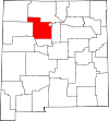
Santa Fe County is located in the U.S. state of New Mexico. As of the 2020 census, the population was 154,823, making it New Mexico's third-most populous county, after Bernalillo County and Doña Ana County. Its county seat is Santa Fe, the state capital.

<span class="mw-page-title-main">Sandoval County, New Mexico</span> County in New Mexico, United States

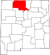
Sandoval County is located in the U.S. state of New Mexico. As of the 2020 census, the population was 148,834, making it the fourth-most populous county in New Mexico. The county seat is Bernalillo.

<span class="mw-page-title-main">Mesilla, New Mexico</span> Town in New Mexico, United States

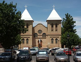
Mesilla is a town in Doña Ana County, New Mexico, United States. The population was 2,196 at the 2010 census. It is part of the Las Cruces Metropolitan Statistical Area.

<span class="mw-page-title-main">Santo Domingo Pueblo, New Mexico</span> Census-designated place in New Mexico, United States

Santo Domingo Pueblo, also known Kewa Pueblo is a federally-recognized tribe of Native American Pueblo people in northern New Mexico. A population of 2,456 live in structures some of which date from circa 1700; in Sandoval County described by the U.S. Census Bureau as a census-designated place.

<span class="mw-page-title-main">New Mexico Territory</span> Territory of the United States of America (1850–1912)

The Territory of New Mexico was an organized incorporated territory of the United States from September 9, 1850, until January 6, 1912. It was created from the U.S. provisional government of New Mexico, as a result of Nuevo México becoming part of the American frontier after the Treaty of Guadalupe Hidalgo. It existed with varying boundaries until the territory was admitted to the Union as the U.S. state of New Mexico. This jurisdiction was an organized, incorporated territory of the US for nearly 62 years, the longest period of any territory in the contiguous United States.

<span class="mw-page-title-main">Mexican Cession</span> Land the U.S. acquired from Mexico following the war in 1848

The Mexican Cession is the region in the modern-day western United States that Mexico previously controlled, then ceded to the United States in the Treaty of Guadalupe Hidalgo in 1848 after the Mexican–American War. This region had not been part of the areas east of the Rio Grande that had been claimed by the Republic of Texas, though the Texas annexation resolution two years earlier had not specified the southern and western boundary of the new state of Texas. At roughly 529,000 square miles (1,370,000 km2), not including any Texas lands, the Mexican Cession was the third-largest acquisition of territory in U.S. history, surpassed only by the 827,000-square-mile (2,140,000 km2) Louisiana Purchase and the 586,000-square-mile (1,520,000 km2) Alaska Purchase.

<span class="mw-page-title-main">Oklahoma panhandle</span> Panhandle in north-western Oklahoma and former unorganized territory

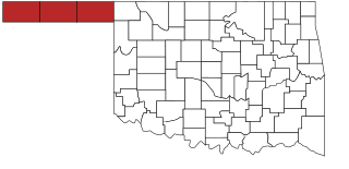
The Oklahoma Panhandle is a salient in the extreme northwestern region of the U.S. state of Oklahoma, consisting of Cimarron County, Texas County and Beaver County, from west to east. As with other salients in the United States, its name comes from the similarity of its shape to the handle of a pan. Its largest city is Guymon in Texas County. Black Mesa State Park, located in Cimarron County, is the highest point in the state. Other points of interest include Beaver Dunes Park, Optima Lake, and the Optima National Wildlife Refuge. Oklahoma Panhandle State University is ten miles away from Guymon.

<span class="mw-page-title-main">Rio Rancho, New Mexico</span> City in New Mexico, United States

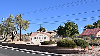
Rio Rancho is the largest and most populous city in Sandoval County, part of the expansive Albuquerque metropolitan area, in the U.S. state of New Mexico. A small portion of the city extends into northern Bernalillo County.

<span class="mw-page-title-main">Texas State Highway 178</span> Highway in Texas

State Highway 178 is a Texas state highway in the city of El Paso in El Paso County maintained by the Texas Department of Transportation (TxDOT). The 3.0-mile (4.8 km) route designated in 1991 connects New Mexico State Road 136 at the New Mexico state line between El Paso and Santa Teresa, New Mexico, to a freeway carrying Interstate 10, U.S. Route 85, and U.S. Route 180 on the west side of El Paso. The route together with NM 136 is a major urban roadway connecting an international border crossing with I-10. The route also has an important intersection with SH 20.

<span class="mw-page-title-main">Albuquerque metropolitan area</span> Metropolitan area in central New Mexico

The Albuquerque Metropolitan Statistical Area, sometimes referred to as Tiguex, is a metropolitan area in central New Mexico centered on the city of Albuquerque. The metro comprises four counties: Bernalillo, Sandoval, Torrance, and Valencia. As of the 2010 United States Census, the MSA had a population of 887,077. The population is estimated to be 923,630 as of July 1, 2020, making Greater Albuquerque the 61st-largest MSA in the nation. The Albuquerque MSA forms a part of the larger Albuquerque–Santa Fe–Las Vegas combined statistical area with a 2020 estimated population of 1,165,181, ranked 49th-largest in the country.

<span class="mw-page-title-main">Index of New Mexico–related articles</span>

The following is an alphabetical list of articles related to the U.S. state of New Mexico.

<span class="mw-page-title-main">Rio Grande Trail</span> Proposed trail in New Mexico, United States

The Rio Grande Trail is a proposed long distance trail along the Rio Grande in the U.S. state of New Mexico. The river extends over 1,800 total miles, some 700 miles (1,100 km) of which pass through the heart of New Mexico. It is the state's primary drainage feature and most valuable natural and cultural resource. The river and its bosque provide a wide variety of recreation, including hunting and fishing, birdwatching, river rafting, hiking, biking, and horseback riding. The river also flows through or beside numerous spectacular and geologically interesting landforms, the result of extensive volcanism and erosion of the valley within the Rio Grande Rift. Although some trail advocates would like to see the trail extended the full distance through New Mexico, from the Colorado border to the United States–Mexico border, the portion proposed for initial development extends 300 miles (480 km), from Bernalillo south to Las Cruces.

<span class="mw-page-title-main">U.S. provisional government of New Mexico</span> Former governmental organization headquartered in Santa Fe

Under the provisions of the Kearny Code as promulgated in 1846, the first legislature of New Mexico commenced its session on December 6, 1847. The Council consisted of seven members, with Antonio Sandoval, of Bernalillo County, as president, and the House of twenty-one members, with W. Z. Angney as speaker.

<span class="mw-page-title-main">COVID-19 pandemic in New Mexico</span> Ongoing COVID-19 viral pandemic in New Mexico, United States

The COVID-19 pandemic was confirmed to have reached the U.S. state of New Mexico on March 11, 2020. On December 23, 2020, the New Mexico Department of Health reported 1,174 new COVID-19 cases and 40 deaths, bringing the cumulative statewide totals to 133,242 cases and 2,243 deaths since the start of the pandemic. During the last quarter of 2020, COVID-19 hospitalizations in New Mexico increased, reaching a peak of 947 hospitalizations on December 3.

San Ygnacio de la Alamosa, also known as Alamosa, is now a ghost town, in Sierra County, New Mexico, United States. San Ygnacio de la Alamosa was founded in 1859 as a native New Mexican colonizing settlement from San Antonio. The site of the new colony was along the west bank of the Rio Grande, 35 miles south of Fort Craig, on the south bank of Alamosa Creek nearby its mouth and confluence with the Rio Grande, in what was then southern Socorro County.

References

  1. "FIPS Publish 6-4". National Institute of Standards and Technology. Archived from the original on September 29, 2013. Retrieved August 6, 2007.
  2. "EPA County FIPS Code Listing". US Environmental Protection Agency. Retrieved August 6, 2007.
  3. 1 2 3 "NACo - Find a county". National Association of Counties. Archived from the original on September 30, 2007. Retrieved August 7, 2007.
  4. "NMGenWeb Counties". Rootsweb.com. Archived from the original on July 2, 2007. Retrieved August 6, 2007.
  5. Viva New Mexico County Names Archived July 4, 2008, at the Wayback Machine
  6. "U.S. Census Bureau QuickFacts: New Mexico". U.S. Census Bureau. Retrieved April 20, 2024.
  7. "New Mexico QuickFacts". U.S. Census Bureau. Archived from the original on December 27, 2011. Retrieved August 7, 2007. (2000 Census)
  8. "Territory of New Mexico" (PDF). United States Census Bureau. 1860.