Related Research Articles

The Dumbarton Bridge is the southernmost of the highway bridges across San Francisco Bay in California. Carrying over 70,000 vehicles and about 118 pedestrian and bicycle crossings daily, it is the shortest bridge across San Francisco Bay at 1.63 miles. Its eastern end is in Fremont, near Newark in the San Francisco Bay National Wildlife Refuge, and its western end is in Menlo Park. Bridging State Route 84 across the bay, it has three lanes each way and a separated bike/pedestrian lane along its south side. Like the San Mateo Bridge to the north, power lines parallel the bridge.

Arthur Christ Agnos is an American politician. He served as the 39th mayor of San Francisco, California from 1988 to 1992 and as the Regional Head of the United States Department of Housing and Urban Development from 1993 to 2001.

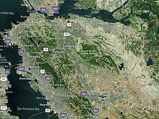
The East Bay is the eastern region of the San Francisco Bay Area and includes cities along the eastern shores of the San Francisco Bay and San Pablo Bay. The region has grown to include inland communities in Alameda and Contra Costa counties. With a population of roughly 2.5 million in 2010, it is the most populous subregion in the Bay Area.

The Carquinez Bridge is a pair of parallel bridges spanning the Carquinez Strait at the northeastern end of San Francisco Bay. They form the part of Interstate 80 between Crockett and Vallejo, California, United States.

A Metropolitan Planning Organization (MPO) is a federally mandated and federally funded transportation policy-making organization in the United States that is made up of representatives from local government and governmental transportation authorities. They were created to ensure regional cooperation in transportation planning. MPOs were introduced by the Federal-Aid Highway Act of 1962, which required the formation of an MPO for any urbanized area (UZA) with a population greater than 50,000. Federal funding for transportation projects and programs are channeled through this planning process. Congress created MPOs in order to ensure that existing and future expenditures of governmental funds for transportation projects and programs are based on a continuing, cooperative, and comprehensive ("3-C") planning process. Statewide and metropolitan transportation planning processes are governed by federal law. Transparency through public access to participation in the planning process and electronic publication of plans now is required by federal law. As of 2015, there are 408 MPOs in the United States.
The Metropolitan Transportation Commission (MTC) is the government agency responsible for regional transportation planning and financing in the San Francisco Bay Area. It was created in 1970 by the State of California, with support from the Bay Area Council, to coordinate transportation services in the Bay Area's nine counties: Alameda, Contra Costa, Marin, Napa, San Francisco, San Mateo, Santa Clara, Solano, and Sonoma. The MTC is fourth most populous metropolitan planning organization in the United States.

The National League of Cities (NLC) is an advocacy organization in the United States that represents the country's 19,495 cities, towns, and villages along with 49 state municipal leagues. Created in 1924, it has evolved into a leading membership organization providing education, research, support, and advocacy to city leaders across America. Based in Washington, D.C., it is considered part of the 'Big Seven', a group of organizations that represent local and state government in the United States. The NLC provides training and other resources to municipal officials, holds conferences, and advocates to the federal government on behalf of cities, towns and villages.

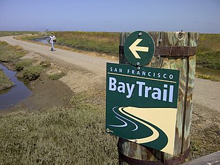
The San Francisco Bay Trail is a bicycle and pedestrian trail that when finished will allow continuous travel around the shoreline of San Francisco Bay. As of 2020, 356 miles (573 km) of the trail have been completed. When finished, the trail will be over 500 miles (800 km) of paved and gravel paths, bike lanes, and sidewalks, linking 47 cities across nine counties and crossing seven toll bridges. It is a project of the Association of Bay Area Governments (ABAG) and the Metropolitan Transportation Commission (MTC), in collaboration with other agencies, private companies, non-profit organizations, and advocacy groups.

David Dominic Cortese is an elected official from San Jose, California. He is currently serving in the California State Senate, representing District 15, which encompasses a majority of Santa Clara County. Before being elected to the California State Senate, Cortese served on the Santa Clara County Board of Supervisors for 12 years, as a Councilmember and Vice Mayor for the City of San Jose for eight years, and for eight years as a trustee for the East Side Union High School District in San Jose. Cortese ran for mayor of San Jose and won the primary, losing the general election to District 3 councilmember Sam Liccardo.
The Bay Area Toll Authority (BATA) is a state agency created by the California State Legislature in 1997 to administer the auto tolls on the San Francisco Bay Area's seven state-owned toll bridges. On January 1, 1998, the Metropolitan Transportation Commission (MTC) — the transportation planning, financing and coordinating agency for the nine-county region — began operations as BATA. In August 2005, the California Legislature expanded BATA's responsibilities to include administration of all toll revenue and joint oversight of the toll bridge construction program with Caltrans and the California Transportation Commission.
The San Francisco Bay Conservation and Development Commission (BCDC) is a California state commission dedicated to the protection, enhancement and responsible use of the San Francisco Bay. It holds jurisdiction over almost the entirety of the Bay, including the reaches into the Sacramento River, Coyote Creek and the Petaluma River Additionally, the commission oversees the San Francisco Bay Salt Ponds and the Suisun Marsh that connects to the ports of Stockton. BCDC has the authority to administer legal enforcement action and escalate violations of McAteer-Petris Act to the California Attorney General's Office.
The Puget Sound Regional Council (PSRC) is a metropolitan planning organization that develops policies and makes decisions about transportation planning, economic development, and growth management throughout the four-county Seattle metropolitan area surrounding Puget Sound. It is a forum for cities, towns, counties, transit agencies, port districts, Native American tribes, and state agencies to address regional issues.

The San Francisco Bay Area, commonly known as the Bay Area, is a region of California centered around the San Francisco, San Pablo, and Suisun estuaries in Northern California. The Association of Bay Area Governments defines the Bay Area as including the nine counties that border the aforementioned estuaries: Alameda, Contra Costa, Marin, Napa, San Mateo, Santa Clara, Solano, Sonoma, and San Francisco. Other definitions may be either smaller or larger, and may include neighboring counties that do not border the aforementioned estuaries, such as the Central Coast counties of Santa Cruz, San Benito, and Monterey, or the Central Valley counties of San Joaquin, Merced, and Stanislaus.

Steve Heminger served as the former executive director of the San Francisco Bay Area's Metropolitan Transportation Commission (MTC) from 2001 until his retirement in 2019. Since then, he has been serving as a director for the San Francisco Municipal Transportation Agency (SFMTA).

Bike East Bay, formerly known as East Bay Bicycle Coalition, is a Californian non-profit organization that worked since 1972 toward "promoting bicycling as an everyday means of transportation and recreation" in Alameda and Contra Costa counties of the California's East Bay.
The California Sustainability Alliance is an organization funded by the California IOUs, to facilitate discussions between various industries on the issues of resource sustainability. The Alliance was set up in 2008 to help California meet its goals in facing Climate change in the State, in relation to energy, resources, and the environment. Efforts are directed at increasing and accelerating sustainable measures and strategies. The Alliance specifically focuses on energy efficiency, climate action, “smart growth” principles, renewable energy development, water-use efficiency, waste management, and transportation management within California.
The Sustainable Communities and Climate Protection Act of 2008, also known as Senate Bill 375 or SB 375, is a State of California law targeting greenhouse gas emissions from passenger vehicles. The Global Warming Solutions Act of 2006 sets goals for the reduction of statewide greenhouse gas emissions. Passenger vehicles are the single largest source of greenhouse gas emissions statewide, accounting for 30% of total emissions. SB 375 therefore provides key support to achieve the goals of AB 32.

The San Francisco Estuary Partnership (Partnership) is one of the 28 National Estuary Programs created in the 1987 Amendments to the Clean Water Act. The Partnership is a non-regulatory federal-state-local collaboration working to restore water quality and manage the natural resources of the San Francisco Bay-Sacramento–San Joaquin River Delta estuary. The Partnership works with over 100 municipalities, non-profits, governmental agencies, and businesses and helps develop, find funding for, and implement over 40 projects and programs aimed at improving the health of the estuary. The partnership either directly implements these projects, or administers and manages grants, holds educational workshops and highlights project results. The Partnership is also the official representative for the San Francisco Bay region to the Most Beautiful Bays in the World.
Plan Bay Area is the long-range Regional Transportation Plan and Sustainable Communities Strategy for the nine-county San Francisco Bay Area. It is the Bay Area's implementation of the Sustainable Communities and Climate Protection Act of 2008, or SB 375, a California law that aims to integrate sustainable strategies to reduce transportation-related pollution and external greenhouse gas emissions. The plan addresses the plan identifies goals and develops strategies for transportation, land-use, and housing to accommodate the region's expected growth and needs over a long-term planning horizon. It is jointly prepared by the Metropolitan Transportation Commission (MTC) and the Association of Bay Area Governments (ABAG). The current plan, which includes projections and strategies through the year 2040, is called Play Bay Area 2040. Plan Bay Area 2050 is currently under development.

The Northern California megaregion, distinct from Northern California, is an urbanized region of California consisting of many large cities including San Jose, San Francisco, Sacramento, and Oakland. There are varying definitions of the megaregion, but it is generally seen as encompassing the San Francisco Bay Area, the Sacramento area, northern San Joaquin Valley, and the Monterey Bay Area.
References
- ↑ "What is ABAG and Why does it matter for Palo Alto?".
- ↑ "Priority Development Areas". Archived from the original on 2010-01-26.
- ↑ "Priority Conservation Areas". Archived from the original on 2010-01-26.
- ↑ Bay Area Vision
- ↑ Association of Bay Area Governments (1970). Regional Plan, 1970-1990 - San Francisco Bay Region (PDF) (Report). Retrieved 2021-04-09.
- ↑ Plan Bay Area website, http://planbayarea.org/plan-bay-area.html Archived 2015-02-17 at the Wayback Machine