Attenborough, Nottinghamshire

Last updated

Attenborough
Attenborough parish church.jpg
Nottinghamshire UK location map.svg
Red pog.svg
Attenborough
Location within Nottinghamshire
Population2,328 (Ward. 2011)
OS grid reference SK 51782 34486
District
Shire county
Region
Country England
Sovereign state United Kingdom
Post town NOTTINGHAM
Postcode district NG9
Dialling code 0115
Police Nottinghamshire
Fire Nottinghamshire
Ambulance East Midlands
UK Parliament
List of places
UK
England
Nottinghamshire
52°54′18″N1°13′48″W / 52.905°N 1.230°W / 52.905; -1.230

Attenborough is a village in the Borough of Broxtowe in Nottinghamshire, England. It forms part of the Greater Nottingham area and is 4+12 miles (7.2 km) to the south-west of the city of Nottingham, between Long Eaton (to the south-west) and Beeston (to the north-east). It adjoins the suburbs of Toton to the west and Chilwell to the north. The population of the ward, as at the 2011 Census, was 2,328. [1]

Contents

The village is home to Attenborough railway station and the Attenborough Nature Reserve. [2]

Features

Attenborough Nature Reserve is a series of gravel pits, which were flooded after gravel extraction and are now a haven for birds and other wildlife.

The main commercial centre of Attenborough is around the junction of Nottingham Road (the A6005) and Attenborough Lane.

Nearer to the nature reserve is a tennis club, along with a private day-nursery, [3] which, in 2005, along with the Attenborough Prep School, was bought by Robert Everist, who then sold the nursery and closed the 100-year-old school. In media coverage, it was claimed that Everist's company had pressured employees into handing in their notice a week before closing the company. [4] The Attenborough Cricket Club (which doubles as the village green) and St. Mary's Church (a Church of England parish church). [5] This southeastern part of Attenborough is bounded to the northwest by the railway line and on the other three sides by the wetlands of the nature reserve. It is the historic part of the village, with two listed buildings and the listed church itself. [6]

In 1944, a plot of land was given on Attenborough Lane by Mr E.V. Brown and Mr J.M. Barnett for a village hall, but it was not until 1955 when funds permitted that construction began. The building was designed by Lionel Thraves of Messrs. Thraves and Son of Nottingham and built by the contractor A.H. Taylor (Nottingham) Ltd. It was named the Lucy Brown Village Hall in memory of the late wife of Mr. E.V. Brown. [7] The cost of construction was £8,200 (equivalent to £217,700in 2021). [8] The opening on 15 September 1956 was attended by Mr. V.H. Oade (vice-chairman of Beeston and Stapleford Council) and Martin Redmayne, Baron Redmayne (M.P. for Rushcliffe). [9]

In 1966 a hoard of Roman coins were found on the footpath that runs over the railway and onto Barrett Lane. [10]

Conservation areas

There are two conservation areas which Broxtowe Borough Council has designated in Attenborough. These are Attenborough Village and Attenborough Barratt Lane. [11]

Attenborough Village Conservation Area

The conservation are comprises Church Lane, the north side of Shady Lane as far as Field House, The Strand and Sportsground and Attenborough Lane to its junction with Allendale Avenue. [12] The conservation area was established in June 1977. [13] Notable buildings include:

Cloud House, Attenborough Lane House in Attenborough - geograph.org.uk - 1771052.jpg
Cloud House, Attenborough Lane
The Orchards, Church Lane House in Attenborough - geograph.org.uk - 1771054.jpg
The Orchards, Church Lane
Thatched Cottage, Church Lane Thatched Cottage, Attenborough.jpg
Thatched Cottage, Church Lane

Attenborough Barratt Lane Conservation Area

The conservation area comprises the major part of Barratt Lane from number 23 to Attenborough Lane, Attenborough Lane from the level crossing to house number 201, and 1, 2 and 3 Long Lane. [17] The conservation area was established in November 1980. [13] The first nine houses were built at the end of the nineteenth century along the south side of Barratt Lane and had their fronts facing the railway rather than the lane, offering fine views towards the church and the River Trent beyond. Notable buildings include:

The Firs, Barratt Lane The Firs (geograph 6432522).jpg
The Firs, Barratt Lane

Flood defences

Attenborough Nature Centre Attenborough Nature Reserve Visitor Centre - geograph.org.uk - 763738.jpg
Attenborough Nature Centre

The village was flooded in November 2000. In 2006, plans were drawn up for substantial flood defences for the village. However, the scheme proved controversial because of the impact of a proposed high flood wall along The Strand. After a series of negotiations, planning permission was granted in August 2010, with the defences being moved to behind the village green. The work was completed in summer 2012. [20]

Local government and politics

Attenborough is an unparished area and has no parish council. For local government and electoral purposes, Attenborough is within one of the wards of Broxtowe Borough Council, 'Attenborough & Chilwell East' Ward, and returns one Borough Councillor. In the 2007 local elections, the Conservatives won the seat. [21] For elections to Nottinghamshire County Council the village is covered by the electoral division of Beeston South & Attenborough (consisting of the Beeston Central, Beeston Rylands and Attenborough wards). In 2009, the Conservative candidate won the division. [22]

For elections to Parliament, the village is part of the Broxtowe constituency for which the present Member for Parliament is Darren Henry, for the Conservatives.

History

Attenborough was known in Saxon times as Addensburgh. It was the home village of Henry Ireton (1611 – 26 November 1651), an English general in the army of Parliament during the English Civil War and son-in-law of Oliver Cromwell. [23]

In the graveyard of St Mary's Church, there is a memorial to the 134 people killed on 1 July 1918 in an explosion in the shell factory in nearby Chilwell. This death toll remains the largest number of deaths caused by a single explosion in mainland Britain. [24] [25]

A ferry (Barton Ferry) used to cross the River Trent from the mouth of the River Erewash (near Attenborough) to Barton in Fabis. A crossing existed at this point since before 1774. [26]

Transport

Bus

Bus services in the area are operated by Trent Barton and Nottsbus Connect; key routes are: [27]

Railway

Attenborough railway station 2014 at Attenborough station - looking westwards.JPG
Attenborough railway station

Attenborough railway station is managed by East Midlands Railway, who operate the following services that stop here: [28]

CrossCountry operate a small number of stopping services, in the early morning and late evening, on the route between Nottingham, Birmingham and Cardiff. [29]

Beeston railway station is approximately 1+12 miles (2.4 km) away, where additional stopping services are available on these routes; in addition, some inter-city services between Nottingham, Leicester and London St Pancras stop there.

Road

This is the primary method of transport in and out of the area, which is connected to Nottingham by the A6005.

Air

East Midlands Airport is approximately 7+12 miles (12.1 km) away; the airport serves domestic and international routes, focused mainly within Europe.

Sport

The village has its own non league football club, Attenborough F.C. founded in 1947, who currently play in the Nottinghamshire Senior League Premier Division at the Strand. [30]

Notable residents

See also

Related Research Articles

<span class="mw-page-title-main">Beeston, Nottinghamshire</span> Town in Nottinghamshire, England

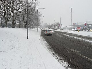
Beeston is a town in the Borough of Broxtowe, Nottinghamshire, England, 3.4 miles (5.5 km) south-west of Nottingham city centre. To its north-east is the University of Nottingham's main campus, University Park. The headquarters of pharmaceutical and retail chemist group Boots are 0.6 miles (1 km) east of the centre of Beeston, on the border with Broxtowe and the City of Nottingham. To the south lie the River Trent and the village of Attenborough, with extensive wetlands.

<span class="mw-page-title-main">Borough of Broxtowe</span> Non-metropolitan district and borough in England

Broxtowe is a local government district with borough status in Nottinghamshire, England. It lies immediately west of the city of Nottingham, and most of the built-up areas of the borough form part of the Nottingham Urban Area. The council is based in Beeston and the borough also includes the towns of Eastwood, Kimberley and Stapleford and surrounding villages and rural areas.

<span class="mw-page-title-main">Nottingham Express Transit</span> Light-rail tramway in Nottingham, England

Nottingham Express Transit (NET) is a 32-kilometre-long (20 mi) tram system in Nottingham, England. The system opened to the public on 9 March 2004 and a second phase, that more than doubled the size of the total system, opened on 25 August 2015, having been initially planned to open two years earlier.

<span class="mw-page-title-main">Toton</span> Village in Nottinghamshire, England

Toton is a large suburban village in the Borough of Broxtowe in Nottinghamshire, England. It forms part of the built-up area of Beeston, which in turn forms part of the wider Nottingham Urban Area. The population of the electoral ward of Toton and Chilwell Meadows was 7,298 in the 2001 census; it increased to 8,238 at the 2011 census.

<span class="mw-page-title-main">Chilwell</span> Village in Broxtowe, Nottinghamshire, England

Chilwell is a suburban area and former civil parish in the borough of Broxtowe in Nottinghamshire, England. It lies on the west side of the town of Beeston and is 4 miles (6.4 km) south-west of the centre of Nottingham.

<span class="mw-page-title-main">Broxtowe (UK Parliament constituency)</span> Parliamentary constituency in the United Kingdom, 1983 onwards

Broxtowe is a parliamentary constituency in Nottinghamshire, England, represented in the House of Commons of the UK Parliament since 2019 by Darren Henry, a Conservative.

<span class="mw-page-title-main">Stapleford, Nottinghamshire</span> Human settlement in England

Stapleford is a town and civil parish in the Borough of Broxtowe, Nottinghamshire, England, 5.6 miles (9.0 km) west of Nottingham. The population at the 2011 census was 15,241.

<span class="mw-page-title-main">Bramcote</span> Suburban village in Nottinghamshire, England

Bramcote is a suburban village and former civil parish in the Broxtowe district of Nottinghamshire, England, between Stapleford and Beeston. It is in Broxtowe parliamentary constituency. The main Nottingham–Derby road today is the A52, Brian Clough Way. Nearby are Beeston, Wollaton, Chilwell and Stapleford. One of the main roads between Nottingham and Derby used to pass through the village centre, entering a cutting that formed a blind bend. A country house to the north of the village became publicly owned and was demolished in 1968. Its grounds became a public area of park and hillside, now known as Bramcote Hills Park.

<span class="mw-page-title-main">Beeston and Stapleford Urban District</span> Urban district in Nottinghamshire, England

Beeston and Stapleford was an urban district in Nottinghamshire, England, from 1935 to 1974.

<span class="mw-page-title-main">Broxtowe Wapentake</span>

Broxtowe was a wapentake of the ancient county of Nottinghamshire, England.

Broxtowe Borough Council elections are held every four years. Broxtowe Borough Council is the local authority for the non-metropolitan district of Borough of Broxtowe in Nottinghamshire, England. Since the full review of boundaries in 2015, 44 councillors are elected from 20 wards.

<span class="mw-page-title-main">St Mary's Church, Attenborough</span> Anglican parish church in Attenborough

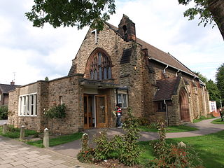
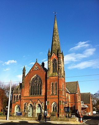
St. Mary's Church, Attenborough is a parish church in the Church of England in the village of Attenborough, Nottinghamshire.

<span class="mw-page-title-main">The Grange, Beeston</span> Building in Nottingham, England

The Grange is a Grade II listed building in Beeston, Nottinghamshire which formerly served as the area police station and is currently in use as apartments.

<span class="mw-page-title-main">John Rigby Poyser</span>

John Rigby Poyser LRIBA was an English architect based in Nottingham.

<span class="mw-page-title-main">Chilwell Road, Beeston</span>

Chilwell Road, Beeston is street in Beeston, Nottinghamshire. It runs from its junction with High Road, Beeston in Beeston Square to the Hop Pole public house.

<span class="mw-page-title-main">John Frederick Dodd</span> English architect

John Frederick Dodd LRIBA was an architect based in Long Eaton, Derbyshire.

Douglas Leonard Booth was an architect, surveyor and civil engineer based in Beeston, Nottinghamshire.

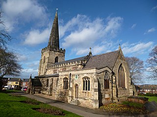
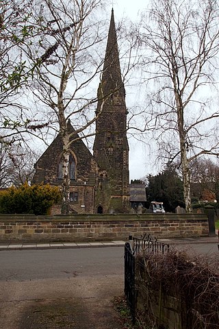
Attenborough and Chilwell East, and Chilwell West, are wards in the Borough of Broxtowe, Nottinghamshire, England. The wards contain eleven listed buildings that are recorded in the National Heritage List for England. Of these, one is listed at Grade I, the highest of the three grades, one is at Grade II*, the middle grade, and the others are at Grade II, the lowest grade. The wards contain the villages of Attenborough and Chilwell, and are mainly residential. The listed buildings consist of houses and associated structures, a church, a bridge, a memorial and a school.

<span class="mw-page-title-main">2023 Broxtowe Borough Council election</span> 2023 English local election

The 2023 Broxtowe Borough Council election took place on 4 May 2023, to elect all 44 members of Broxtowe Borough Council in England. This took place as part of the 2023 United Kingdom local elections.

References

  1. "Broxtowe ward population 2011". Neighbourhood Statistics. Office for National Statistics. Retrieved 3 April 2016.
  2. "Attenborough Nature Centre & Reserve".
  3. "Attenborough Day Nursery".
  4. "Directory". Directory Blog. 17 February 2009. Retrieved 17 February 2009.
  5. "Attenborough - History".
  6. Beeston and District Civic Society Archived 12 August 2011 at the Wayback Machine Listed buildings
  7. "Village Hall at Attenborough" . Long Eaton Advertiser. England. 24 September 1955. Retrieved 12 April 2020 via British Newspaper Archive.
  8. UK Retail Price Index inflation figures are based on data from Clark, Gregory (2017). "The Annual RPI and Average Earnings for Britain, 1209 to Present (New Series)". MeasuringWorth. Retrieved 11 June 2022.
  9. "A New Centre of Village Life? M.P. and Council Vice-Chairman Present at Opening of Hall at Attenborough" . Long Eaton Advertiser. England. 22 September 1956. Retrieved 12 April 2020 via British Newspaper Archive.
  10. Archibald, Marion. "THE ATTENBOROUGH, NOTTS., 1966 HOARD" (PDF).
  11. "Conservation areas". Broxtowe Borough Council. Broxtowe Borough Council. Retrieved 12 April 2020.
  12. Attenborough Village Conservation Area Character Appraisal (PDF) (Report). Broxtowe Borough Council. p. 12. Retrieved 12 April 2020.
  13. 1 2 "Arcadia Needs Keeping" . Long Eaton Advertiser. England. 20 November 1980. Retrieved 12 April 2020 via British Newspaper Archive.
  14. Historic England. "Church of St Mary the Virgin, Church Lane (Grade I) (1263869)". National Heritage List for England . Retrieved 10 April 2020.
  15. Historic England. "Ireton House, Church Lane (Grade II) (1247991)". National Heritage List for England . Retrieved 10 April 2020.
  16. Historic England. "Rose Cottage, 45, The Strand (Grade II) (1263851)". National Heritage List for England . Retrieved 10 April 2020.
  17. Attenborough Barratt Lane Conservation Area Character Appraisal (PDF) (Report). Broxtowe Borough Council. p. 11. Retrieved 12 April 2020.
  18. "1780" (1937) [Building Plan Register]. District Council Records, File: DC/BS/4/2/2. Nottingham: Nottinghamshire Archives Office.
  19. "1369" (1936) [Building Plan Register]. District Council Records, File: DC/BS/4/2/2. Nottingham: Nottinghamshire Archives Office.
  20. "River Trent flood defence scheme opened". BBC News. 13 September 2012. Retrieved 19 June 2023.
  21. Broxtowe Borough Council Archived 31 July 2010 at the Wayback Machine Election results 2007–10 by ward
  22. Nottinghamshire County Council Beeston South & Attenborough election result 2009
  23. "Nottinghamshire history > Links with old Nottingham (1928): Attenborough: Ireton's House".
  24. Maureen Rushton, Local Historian in her book "The canary girls of Chilwell: the story of No. 6 Shell Filling Factory, Chilwell, Nottinghamshire"
  25. Woollacott, Angela (1994). On Her Their Lives Depend: Munitions Workers in the Great War . Oakland: University of California Press. p.  84. ISBN   978-0520085022.
  26. Chapman, John (1774). Map of Nottinghamshire. ISBN   0-902751-46-8.
  27. "Stops in Attenborough". Bus Times. 2023. Retrieved 19 June 2023.
  28. "Timetables". East Midlands Railway. May 2023. Retrieved 19 June 2023.
  29. "Timetables". CrossCountry. 21 May 2023. Retrieved 19 June 2023.
  30. Paperblog: The Farewell Hop – Paperblog, accessdate: March 7, 2020
  31. BBC Nottingham People - Sophia di Martino