List of civil parishes in Nottinghamshire

Last updated

This is a list of civil parishes in the ceremonial county of Nottinghamshire, England. There are 233 civil parishes in 8 districts.

Contents

Ashfield

Ashfield-parishes.png

Three parishes. The former Hucknall Urban District, Kirkby in Ashfield Urban District and Sutton in Ashfield Urban District are unparished.

Bassetlaw

Bassetlaw Parishes.svg

64 parishes. The former East Retford Municipal Borough and part of the former Worksop Municipal Borough are unparished.

Broxtowe

Broxtowe Parish map.svg

Nine parishes. Part of the former Beeston and Stapleford Urban District and Strelley are unparished.

Gedling

Gedling-parishes.png

12 parishes. Part of the former Arnold Urban District and Carlton Urban District are unparished.

Mansfield

Mansfield-parishes.png

One parish. The former Mansfield Municipal Borough and Mansfield Woodhouse Urban District are unparished.

Newark and Sherwood

Newark and Sherwood Parish map.svg

84 parishes. The whole of the district is parished.

Nottingham

Nottingham-district Nottingham-district.svg
Nottingham-district

The former Nottingham County Borough is unparished.

Rushcliffe

Rushcliffe Parish map.svg

60 parishes. The former West Bridgford Urban District is unparished.

Notes

  1. Formerly Arnold Urban District [11]
  2. Formerly Basford Rural District [12]
  3. Formerly Beeston and Stapleford Urban District [13]
  4. Formerly Bingham Rural District [14]
  5. Formerly Carlton Urban District [15]
  6. Formerly East Retford Municipal Borough [16]
  7. Formerly East Retford Rural District [17]
  8. Formerly Eastwood Urban District [18]
  9. Formerly Hucknall Urban District [19]
  10. Formerly Kirkby in Ashfield Urban District [20]
  11. Formerly Mansfield Municipal Borough [21]
  12. Formerly Mansfield Woodhouse Urban District [22]
  13. Formerly Newark Municipal Borough [23]
  14. Formerly Newark Rural District [24]
  15. Formerly Nottingham County Borough [25]
  16. Formerly Southwell Rural District [26]
  17. Formerly Sutton in Ashfield Urban District [27]
  18. Formerly Warsop Urban District [28]
  19. Formerly West Bridgford Urban District [29]
  20. Formerly Worksop Municipal Borough [30]
  21. Formerly Worksop Rural District [31]

Related Research Articles

<span class="mw-page-title-main">Nottinghamshire</span> County of England

Nottinghamshire is a ceremonial county in the East Midlands of England. The county borders South Yorkshire to the north-west, Lincolnshire to the east, Leicestershire to the south, and Derbyshire to the west. The largest settlement is the city of Nottingham (323,632).

<span class="mw-page-title-main">Ashfield District</span> Non-metropolitan district in England

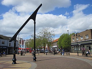
Ashfield is a local government district in Nottinghamshire, England. The council is based in Kirkby-in-Ashfield, but the largest town is neighbouring Sutton-in-Ashfield. The district also contains the town of Hucknall and a few villages. The district is mostly urban, with some of its settlements forming parts of both the Nottingham and Mansfield Urban Areas.

<span class="mw-page-title-main">Bassetlaw District</span> District of Nottinghamshire, England

Bassetlaw is a local government district in north Nottinghamshire, England. Its council is based in the town of Worksop; the other towns in the district are Retford, Tuxford and Harworth Bircotes. The district also contains numerous villages and surrounding rural areas.

<span class="mw-page-title-main">Mansfield District</span> Non-metropolitan district in England

Mansfield District is a local government district in Nottinghamshire, England. It is named after the town of Mansfield, where the council is based. The district also contains Mansfield Woodhouse and Warsop.

<span class="mw-page-title-main">Civil parishes in Cheshire</span>

A civil parish is a country subdivision, forming the lowest unit of local government in England. There are 333 civil parishes in the ceremonial county of Cheshire, most of the county being parished. Cheshire East unitary authority is entirely parished. At the 2001 census, there were 565,259 people living in 332 parishes, accounting for 57.5 per cent of the county's population.

<span class="mw-page-title-main">Civil parishes in the West Midlands (county)</span> Subnational entity

A civil parish is a subnational entity, forming the lowest unit of local government in England. There are 21 civil parishes in the ceremonial county of West Midlands, most of the county being unparished; Dudley, Sandwell, Walsall and Wolverhampton are completely unparished. At the 2001 census, there were 89,621 people living in the parishes, accounting for 3.5 per cent of the county's population.

<span class="mw-page-title-main">Bassetlaw (UK Parliament constituency)</span> Parliamentary constituency in the United Kingdom, 1885 onwards

Bassetlaw is a parliamentary constituency in Nottinghamshire, represented in the House of Commons of the UK Parliament since the 2019 general election by Brendan Clarke-Smith, a Conservative. Before that election, the seat had been part of the so-called "red wall", being held by the Labour Party since 1935.

<span class="mw-page-title-main">Broxtowe Wapentake</span>

Broxtowe was a wapentake of the ancient county of Nottinghamshire, England.

<span class="mw-page-title-main">Nottinghamshire County Council</span> The upper-tier local authority for the non-metropolitan county of Nottinghamshire in England

Nottinghamshire County Council is the upper-tier local authority for the non-metropolitan county of Nottinghamshire in England. It consists of 66 county councillors, elected from 56 electoral divisions every four years. The most recent election was held in 2021.

<span class="mw-page-title-main">Civil parishes in Cornwall</span>

A civil parish is a country subdivision, forming the lowest unit of local government in England. There are 218 civil parishes in the ceremonial county of Cornwall, which includes the Isles of Scilly. The county is effectively parished in its entirety; only the unpopulated Wolf Rock is unparished. At the 2001 census, there were 501,267 people living in the current parishes, accounting for the whole of the county's population. The final unparished areas of mainland Cornwall, around St Austell, were parished on 1 April 2009 to coincide with the structural changes to local government in England.

References

  1. District Council notices of the change of name of a parish 2007 Archived 2012-03-14 at the Wayback Machine
  2. "Bulletin of change 2014 Final" (PDF). Lgbce. Archived from the original (PDF) on 16 March 2018. Retrieved 15 March 2018.
  3. "The Bassetlaw (Reorganisation of Community Governance) Order 2022" (PDF). Local Government Boundary Commission for England . Retrieved 6 July 2023.
  4. "Notice of change of name of Parish of Rampton" (PDF). Bassetlaw District Council. Archived from the original (PDF) on 27 December 2018. Retrieved 27 December 2018.
  5. 1 2 The Gedling Borough Council (Reorganisation of Community Governance) Order 2018
  6. The Nottinghamshire (District Boundaries) Order 1987
  7. The Newark and Sherwood (Parish Electoral Arrangements) Order 2008
  8. "The Newark and Sherwood (Reorganisation of Community Governance) Order 2010" (PDF). Lgbce. Retrieved 14 March 2018.
  9. 1 2 "THE NOTTINGHAMSHIRE (RUSHCLIFFE AREA) DEFINITIVE MAP AND STATEMENT" (PDF). Nottinghamshire.gov. Retrieved 14 March 2018.
  10. "Upper Saxondale". Mapit. Retrieved 10 July 2023.
  11. A Vision of Britain Through Time : Arnold Urban District
  12. A Vision of Britain Through Time : Basford Rural District
  13. A Vision of Britain Through Time : Beeston and Stapleford Urban District
  14. A Vision of Britain Through Time : Bingham Rural District
  15. A Vision of Britain Through Time : Carlton Urban District
  16. A Vision of Britain Through Time : East Retford Municipal Borough
  17. A Vision of Britain Through Time : East Retford Rural District Archived 2007-10-01 at the Wayback Machine
  18. A Vision of Britain Through Time : Eastwood Urban District Archived 2007-10-01 at the Wayback Machine
  19. A Vision of Britain Through Time : Hucknall Urban District
  20. A Vision of Britain Through Time : Kirkby in Ashfield Urban District
  21. A Vision of Britain Through Time : Mansfield Municipal Borough
  22. A Vision of Britain Through Time : Mansfield Woodhouse Urban District
  23. A Vision of Britain Through Time : Newark Municipal Borough
  24. A Vision of Britain Through Time : Newark Rural District Archived 2007-10-01 at the Wayback Machine
  25. A Vision of Britain Through Time : Nottingham County Borough
  26. A Vision of Britain Through Time : Southwell Rural District Archived 2007-10-01 at the Wayback Machine
  27. A Vision of Britain Through Time : Sutton in Ashfield Urban District
  28. A Vision of Britain Through Time : Warsop Urban District
  29. a Vision of Britain Through Time : West Bridgford Urban District
  30. A Vision of Britain Through Time : Worksop Municipal Borough
  31. A Vision of Britain Through Time : Worksop Rural District

See also