
Bingham is a market town and civil parish in the Rushcliffe borough of Nottinghamshire, England, 9 miles (14 km) east of Nottingham, 12 miles (18.8 km) south-west of Newark-on-Trent and 15 miles (23.3 km) west of Grantham. The town had a population of 9,131 at the 2011 census, with the population now sitting at 10,080 from the results of the 2021 census data.

Bottesford is a village and civil parish in the Borough of Melton in the ceremonial county of Leicestershire, England. It lies close to the borders of Nottinghamshire and Lincolnshire.

Aslockton is an English village and civil parish 12 miles (19 km) east of Nottingham and 2 miles (3.2 km) east of Bingham, on the north bank of the River Smite opposite Whatton-in-the-Vale. The parish is also adjacent to Scarrington, Thoroton and Orston and within the Rushcliffe borough of Nottinghamshire. The population was recorded as 974 in the 2011 census, doubling to 1,937 at the 2021 census.
Car Colston is an English village and civil parish in the Rushcliffe borough of Nottinghamshire. The population of the civil parish at the time of the 2011 census was 185, falling to 171 at the 2021 census.

Bottesford railway station serves the village of Bottesford in Leicestershire, England. The station is 15 miles east of Nottingham, on the lines to Grantham and Skegness. It is the least used station in Leicestershire.
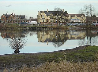
Gunthorpe is a village and civil parish in Nottinghamshire, England. Its population was 740 at the 2021 census. It lies on the left bank of the River Trent. Gunthorpe Bridge on the A6097 is the only road crossing of the river between Newark and Nottingham. It is one of five places in England with the same name.

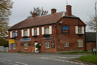
Granby is a small village in the Rushcliffe district of Nottinghamshire, England. It lies in the Vale of Belvoir.
Owthorpe is an English hamlet and civil parish in the Wolds of the East Midlands county of Nottinghamshire. The population of about 90 was included in the civil parish of Cotgrave in the 2011 census, this increased to 102 at the 2021 census.

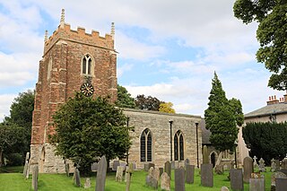
Orston is an English village and civil parish in the Rushcliffe borough of Nottinghamshire, 15 miles east of Nottingham. It borders the parishes of Scarrington, Thoroton, Flawborough, Bottesford and Elton on the Hill. The population at the 2011 census was 454, increasing to 512 residents at the 2021 census.

Whatton-in-the-Vale is a village and civil parish in the Rushcliffe district, in the county of Nottinghamshire, England. It lies in the Vale of Belvoir, with the River Smite to the west and a subsidiary, the River Whipling to the east, mainly north of the trunk A52 road, 12 miles (19 km) east of Nottingham. The parish had a population of 843 at the 2011 census, increasing to 874 at the 2021 census.

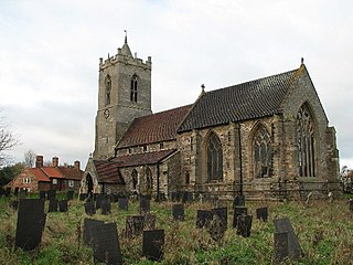
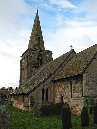
Thoroton is a small English village and civil parish in the borough of Rushcliffe, and the county of Nottinghamshire, with a population of 112 at the 2011 census, and increasing to 130 at the 2021 census. The village has conservation area status. Its Anglican parish church is a Grade I listed building.

Shelton is an English village and civil parish in the Rushcliffe borough of Nottinghamshire. According to the 2001 census, Shelton had a population of 107,. At the 2011 census, the statistics for Shelton included Sibthorpe, and the total population was 307. For the 2021 census, Shelton alone reported 135 residents. The village lies 8 miles (13 km) south of Newark-on-Trent, on the north side of the River Smite, near where it joins the River Devon. It has no parish council, only a parish meeting.
Hawksworth is an English conservation village and civil parish in the Rushcliffe borough of Nottinghamshire. It lies 10 miles (16 km) south of Newark-on-Trent, adjacent to the villages of Flintham, Sibthorpe, Thoroton, Scarrington and Screveton.
Elton on the Hill is a hamlet and civil parish in Nottinghamshire, England and within the Vale of Belvoir. A population of 114 was reported at the 2021 census.

Kilvington is a hamlet and civil parish in Nottinghamshire, England, part of the Newark and Sherwood district.

Screveton is an English civil parish and village in the Rushcliffe borough of Nottinghamshire, with 191 inhabitants at the 2011 census. Screveton singularly reported 164 residents at the 2021 census. It was formerly in Bingham Rural District and before 1894 in Bingham Wapentake. It is adjacent to Kneeton, Flintham, Hawksworth, Scarrington, Little Green and Car Colston.

Plungar is a village and former civil parish, now in the parish of Redmile, and the Melton district of Leicestershire, England. It is about 9 miles (14 km) north of the market town of Melton Mowbray and 7 miles (11 km) west from Grantham. Plungar is adjacent to the Grantham Canal and stands in the Vale of Belvoir. In 1931 the parish had a population of 205.
Scarrington is an English civil parish and small village in the Rushcliffe borough of Nottinghamshire, adjacent to Bingham, Car Colston, Hawksworth, Orston and Aslockton. Its 968 acres had a population in the 2011 census of 183, falling to 167 at the 2021 census. It lies at Ordnance Survey grid reference SK7341 in the undulating farmland of the Vale of Belvoir, some 2 miles (3.2 km) from the town of Bingham and from a stretch of the Roman Fosse Way (A46) between Newark and Leicester. It is skirted by the A52 road between Nottingham and Grantham.

Staunton is a small village and civil parish in the Newark and Sherwood district of Nottinghamshire, England. It takes its name from the Vale of Belvoir and shares it with the local Staunton family, which has resided in the area since the Norman Conquest and possibly before, making them one of the few English families still resident on their estate.


