Ossington

Last updated

Ossington
Village and civil parish
Church of the Holy Rood, Ossington - geograph.org.uk - 2206582.jpg
Church of the Holy Rood, Ossington
Ossington
Parish map
Nottinghamshire UK location map.svg
Red pog.svg
Ossington
Location within Nottinghamshire
Area3.76 sq mi (9.7 km2)
Population109 (2021)
  Density 29/sq mi (11/km2)
OS grid reference SK 757647
  London 120 mi (190 km)  SSE
District
Shire county
Region
Country England
Sovereign state United Kingdom
Post town NEWARK
Postcode district NG23
Dialling code 01636
Police Nottinghamshire
Fire Nottinghamshire
Ambulance East Midlands
UK Parliament
List of places
UK
England
Nottinghamshire
53°10′27″N00°52′07″W / 53.17417°N 0.86861°W / 53.17417; -0.86861

Ossington is a village and civil parish in the county of Nottinghamshire, England 7 miles north of Newark-on-Trent. The population count was 109 residents at the 2021 census. [1] It was centred on Ossington Hall, the ancestral home of the Denison family, but the house was demolished in 1964 and all that remains are a few outbuildings and a private chapel that now serves the parish as Holy Rood Church, Ossington. This is a Grade I listed building, originally 12th century and rebuilt in 1782–1783 by the architect John Carr, with minor 19th-century alterations and additions. It includes earlier monuments and stained glass. There is a barrel organ built by Thomas Robson in 1840.

Contents

Ossington Hall

Ossington Hall was built in 1729, enlarged about 1790 and demolished in 1964. The gates remain as a grand entrance to a drive that now leads only to the parkland and Holy Rood church. Ossington Hall gates - geograph.org.uk - 149936.jpg
Ossington Hall was built in 1729, enlarged about 1790 and demolished in 1964. The gates remain as a grand entrance to a drive that now leads only to the parkland and Holy Rood church.

The estate can be traced back to Saxon times, when it was known as "Oschinton" and then later in 1144 as "Oscinton". The lord at that time, Roger de Burun, gave the estate to the Cluniac order of monks, when he entered the order as an act of penitence. He neglected to recall that he had earlier made the property over to the Hospitallers of St. John of Jerusalem. A legal dispute followed between the two religious orders, which the Hospitallers won. They retained ownership until the Dissolution of the monasteries around 1539. The estate was eventually bought by the Cartwright family, of whom there are monuments in the church. The house was damaged during the Civil War and in 1753 passed to William Denison, a merchant of Leeds. He and his brother Robert made substantial improvements. William was appointed High Sheriff of Nottinghamshire for 1779. [2]

The house was then inherited by Denison's nephew, John Wilkinson, who changed his name to Denison and made further improvements to it. John Denison's heir was his eldest son, John Evelyn Denison (1800–1873), Speaker of the House of Commons, who held the estates from 1820 until his death in 1873, and was created Viscount Ossington in 1872. After his death with no direct heir, the estate passed to William Evelyn Denison (1843–1916), William Thomas Denison, son of Ossington's brother, and after him to a cousin, William Frank Evelyn Denison, who died two years later. The estates then reverted to Elinor Denison, widow of William Evelyn Denison, until her death in 1939, when it devolved on William Frank Evelyn Denison's cousin, William Maxwell Evelyn Denison (1904–1972). [3]

Air base

During the Second World War a large Royal Air Force station known as RAF Ossington was laid out on land close to the Ossington estate. It opened on 18 January 1942 as the base for No. 14 (Pilots) Advanced Flying Unit and was transferred to No. 93 (Training) Group RAF Bomber Command in 1943. In January 1945 it was finally transferred to RAF Transport Command No. 6 Lancaster Finishing School, before it was closed in August 1946. The hall formed part of the accommodation for the airfield.

Demolition

After the Second World War, the hall fell into disrepair and was demolished in 1964. An urn from the estate survives in the grounds of Flintham Hall. Some other outbuildings and a small well remain.

See also

Related Research Articles

<span class="mw-page-title-main">Blyth, Nottinghamshire</span> Village and civil parish in England

Blyth is a village and civil parish in the Bassetlaw district of the county of Nottinghamshire, in the East Midlands, north west of East Retford, on the River Ryton. The population of the civil parish as of the 2011 census was 1,233, and this increased to 1,265 in 2021. It sits at a junction with the A1, and the end of the motorway section from Doncaster.

<span class="mw-page-title-main">William Bentinck, 4th Duke of Portland</span> British politician

William Henry Cavendish-Scott-Bentinck, 4th Duke of Portland,, styled Marquess of Titchfield until 1809, was a British politician who served in various positions in the governments of George Canning and Lord Goderich.

<span class="mw-page-title-main">Earl Manvers</span> Extinct earldom in the Peerage of the United Kingdom

Earl Manvers is a title in the Peerage of the United Kingdom. It was created in 1806 for Charles Medows Pierrepont, 1st Viscount Newark. He had already been created Baron Pierrepont, of Holme Pierrepont in the County of Nottingham, and Viscount Newark, of Newark-on-Trent in the County of Nottingham, in 1796. Both these titles were in the Peerage of Great Britain.

<span class="mw-page-title-main">Evelyn Denison, 1st Viscount Ossington</span> English Speaker of the House of Commons

John Evelyn Denison, 1st Viscount Ossington, PC was a British statesman who served as Speaker of the House of Commons from 1857 to 1872. He is the eponym of Speaker Denison's rule.

<span class="mw-page-title-main">George Denison (priest)</span> English priest (1805–1896)

George Anthony Denison (1805–1896) was an English Anglican priest. He served as Archdeacon of Taunton from 1851.

<span class="mw-page-title-main">Flintham</span> Village in Nottinghamshire, England

Flintham is a village and civil parish in the Rushcliffe district in Nottinghamshire, 7 miles from Newark-on-Trent and opposite RAF Syerston on the A46. It had a population of 597 at the 2011 Census and estimated at 586 in 2019. The village name was taken by the Ham class minesweeper HMS Flintham.

<span class="mw-page-title-main">Elston</span> Village in Nottinghamshire, England

Elston is a village and civil parish in Nottinghamshire, England, to the south-west of Newark, and a mile from the A46 Fosse Way. The population of the civil parish taken at the 2011 census was 631, increasing to 697 at the 2021 census. It lies between the rivers Trent and Devon, with the village "set amongst trees and farmland less than a mile from the A46.... Newark is five miles to the north, with... Lincoln and Nottingham some 18 miles north and south-west respectively."

Malton, also called New Malton, was a constituency of the House of Commons of the Parliament of England in 1295 and 1298, and again from 1640, then of the Parliament of Great Britain from 1707 to 1800 and of the Parliament of the United Kingdom from 1801 to 1885. It was represented by two Members of Parliament until 1868, among them the political philosopher Edmund Burke, and by one member from 1868 to 1885.

<span class="mw-page-title-main">Norwell, Nottinghamshire</span> Village and civil parish in Nottinghamshire, England

Norwell is a village and civil parish about 6 miles (9.7 km) from Newark-on-Trent, in central Nottinghamshire, England. The population at the 2011 census was 490, this declined to 470 at the 2021 census.. It is close to the border with Lincolnshire and the River Trent, and lies approximately 1.5 miles (2.4 km) from the A1 road and 1 mile (1.6 km) from the East Coast Main Line.

<span class="mw-page-title-main">North Nottinghamshire (UK Parliament constituency)</span> Parliamentary constituency in the United Kingdom, 1832–1885

North Nottinghamshire, formally the "Northern Division of Nottinghamshire" was a county constituency represented in the House of Commons of the Parliament of the United Kingdom. It elected two Members of Parliament (MPs) by the block vote system of election.

Manuscripts and Special Collections is part of Libraries, Research and Learning Resources at the University of Nottingham. It is based at King's Meadow Campus in Nottingham in England. The university has been collecting manuscripts since the early 1930s and now holds approximately 3 million documents, extensive holdings of Special Collections, and the East Midlands Collection of local material, all of which are available for researchers to use in the supervised Wolfson Reading Rooms.

<span class="mw-page-title-main">Hodsock Priory</span> Grade II listed country house in Nottinghamshire, United Kingdom

Hodsock Priory is an English country house in Hodsock, Nottinghamshire, 4 miles (6.4 km) north of Worksop, England, and 1 mile (1.6 km) south of Blyth. Despite its name, it is not and never has been a priory. Hodsock is renowned for its snowdrops in early spring. It is also a venue for special events and weddings.

<span class="mw-page-title-main">Holy Rood Church, Ossington</span> Church

Holy Rood Church, Ossington is a parish church in the Church of England in Ossington, Nottinghamshire.

<span class="mw-page-title-main">Little Cressingham</span> Human settlement in England

Little Cressingham lies 2.5 miles (4.0 km) south east by road from Great Cressingham, 3 miles (4.8 km) west of Watton and 8 miles (13 km) south of Swaffham in the Breckland District of Norfolk. It covers an area of 11.90 km2 (4.59 sq mi) and had a population of 157 in 70 households at the 2001 census It is in the civil parish of Great Cressingham. The village is located on the edge of the Stanford Battle Area.

<span class="mw-page-title-main">Edward Denison (bishop)</span> English bishop

Edward Denison the elder (1801–1854) was an English bishop of Salisbury.

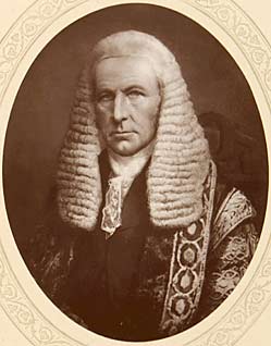
Captain William Evelyn Denison DL, JP was a British Army officer and a Conservative Party politician. He owned an estate in Ossington, Nottinghamshire where he held several local offices as well as sitting in the House of Commons from 1874 to 1880.

<span class="mw-page-title-main">Moorhouse Chantry Chapel</span> Church in Nottinghamshire, England

Moorhouse Chantry Chapel is a Grade II* listed Church of England chapel in the Diocese of Southwell and Nottingham at Moorhouse, within the Laxton and Moorhouse civil parish, Nottinghamshire.

John Denison was Member of Parliament for the English constituencies of Wootton Bassett (1796-1802), Colchester (1802-1806), and Minehead (1807-1812).

<span class="mw-page-title-main">Moorhouse, Nottinghamshire</span> Human settlement in England

Moorhouse or Laxton Moorhouse is a hamlet within the Laxton and Moorhouse parish, in the Newark and Sherwood district of central Nottinghamshire, England.
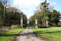

Ossington is a civil parish in the Newark and Sherwood district of Nottinghamshire, England. The parish contains ten listed buildings that are recorded in the National Heritage List for England. Of these, one is listed at Grade I, the highest of the three grades, one is at Grade II*, the middle grade, and the others are at Grade II, the lowest grade. The parish contains the village of Ossington and the surrounding countryside. One of the most important buildings in the parish was Ossington Hall, but this was demolished in 1963. There are two surviving buildings associated with the hall that are listed, namely a memorial well head, and the gates and walls at the entrance to the grounds. The only building listed at Grade I is Holy Rood Church, and its gateway and a sundial in the churchyard are also listed. The other listed buildings consist of houses, farmhouses and farm buildings, and a war memorial.

References

  1. UK Census (2021). "2021 Census Area Profile – Ossington parish (E04007934)". Nomis. Office for National Statistics . Retrieved 5 February 2024.
  2. Ossington Holy Rood, History Southwell and Nottingham Church History Project. Accessed October 2014.
  3. "Denison Family of Ossington" . Retrieved 27 March 2013.

Commons-logo.svg Media related to Ossington at Wikimedia Commons

53°10′27″N00°52′07″W / 53.17417°N 0.86861°W / 53.17417; -0.86861