Civil parishes in Bedfordshire

Last updated

A map of Bedfordshire, showing the districts: (1) Bedford; (2) Central Bedfordshire; and (3) Luton 2009 Bedfordshire Ceremonial Numbered.png
A map of Bedfordshire, showing the districts: (1) Bedford; (2) Central Bedfordshire; and (3) Luton

A civil parish is a country subdivision, forming the lowest unit of local government in England. There are 125 civil parishes in the ceremonial county of Bedfordshire, most of the county being parished: Luton is completely unparished; Central Bedfordshire is entirely parished. At the 2001 census, there were 312,301 people living in the 125 parishes, which accounted for 55.2 per cent of the county's population.

Contents

History

Parishes arose from Church of England divisions, and were originally purely ecclesiastical divisions. Over time they acquired civil administration powers. [1]

The Highways Act 1555 made parishes responsible for the upkeep of roads. Every adult inhabitant of the parish was obliged to work four days a year on the roads, providing their own tools, carts and horses; the work was overseen by an unpaid local appointee, the Surveyor of Highways. [2]

The poor were looked after by the monasteries, until their dissolution. In 1572, magistrates were given power to 'survey the poor' and impose taxes for their relief. This system was made more formal by the Poor Law Act 1601, which made parishes responsible for administering the Poor Law; overseers were appointed to charge a rate to support the poor of the parish. [3] The 19th century saw an increase in the responsibility of parishes, although the Poor Law powers were transferred to Poor Law Unions. [4] The Public Health Act 1872 grouped parishes into Rural Sanitary Districts, based on the Poor Law Unions; these subsequently formed the basis for Rural Districts. [5]

Parishes were run by vestries, meeting annually to appoint officials, and were generally identical to ecclesiastical parishes, [6] although some townships in large parishes administered the Poor Law themselves; under the Divided Parishes and Poor Law Amendment Act 1882, all extra-parochial areas and townships that levied a separate rate became independent civil parishes. [7]

Civil parishes in their modern sense date from the Local Government Act 1894, which abolished vestries; established elected parish councils in all rural parishes with more than 300 electors; grouped rural parishes into Rural Districts; and aligned parish boundaries with county and borough boundaries. [7] Urban civil parishes continued to exist, and were generally coterminous with the Urban District, Municipal Borough or County Borough in which they were situated; many large towns contained a number of parishes, and these were usually merged into one. Parish councils were not formed in urban areas, and the only function of the parish was to elect guardians to Poor Law Unions; with the abolition of the Poor Law system in 1930 the parishes had only a nominal existence. [8]

The Local Government Act 1972 retained civil parishes in rural areas, and many former Urban Districts and Municipal Boroughs that were being abolished, were replaced by new successor parishes; urban areas that were considered too large to be single parishes became unparished areas. [9]

The current position

Recent governments have encouraged the formation of town and parish councils in unparished areas, and the Local Government and Rating Act 1997 gave local residents the right to demand the creation of a new civil parish. [10]

A parish council can become a town council unilaterally, simply by resolution; [9] and a civil parish can also gain city status, but only if that is granted by the Crown. [9] The chairman of a town or city council is called a mayor. [9] The Local Government and Public Involvement in Health Act 2007 introduced alternative names: a parish council can now choose to be called a community; village; or neighbourhood council. [11]

List of civil parishes and unparished areas

ImageNameStatusPopulation (2001 census)DistrictFormer local authority [12] Refs
The bridge over the Great Ouse, Bedford - geograph.org.uk - 1516548.jpg Bedford Unparished area69,271 Bedford Bedford Municipal Borough [13]
[14]
Biddenham Village, Yellow Cottage^ - geograph.org.uk - 13856.jpg Biddenham Civil parish1,640 Bedford Bedford
Rural District
[15]
[16]
Poppies and wheat - geograph.org.uk - 472671.jpg Bletsoe Civil parish281 Bedford Bedford
Rural District
[15]
[17]
Keysoe Row school - geograph.org.uk - 67217.jpg Bolnhurst and Keysoe Civil parish734 Bedford Bedford
Rural District
[15]
[17]
Footpath and cycle track to Brickhill Drive - geograph.org.uk - 1395967.jpg Brickhill Civil parish8,678 Bedford Bedford Municipal Borough [13]
[18]
[19]
The 17th century watermill at Bromham - geograph.org.uk - 370536.jpg Bromham Civil parish4,768 Bedford Bedford
Rural District
[15]
[17]
St Mary's Cardington - geograph.org.uk - 1207403.jpg Cardington Civil parish316 Bedford Bedford
Rural District
[15]
[17]
Private House in Carlton (Beds) - geograph.org.uk - 22566.jpg Carlton and Chellington Civil parish827 Bedford Bedford
Rural District
[15]
[17]
Hedgerow between crop fields - geograph.org.uk - 430847.jpg Clapham Civil parish3,643 Bedford Bedford
Rural District
[15]
[17]
Colmworth church - geograph.org.uk - 406722.jpg Colmworth Civil parish367 Bedford Bedford
Rural District
[15]
[17]
The Five Bells Cople - geograph.org.uk - 181107.jpg Cople Civil parish736 Bedford Bedford
Rural District
[15]
[17]
"The Bell" - geograph.org.uk - 428175.jpg Cotton End Civil parish Bedford Bedford
Rural District
[15]
[17]
Half-Timbered House - geograph.org.uk - 163685.jpg Dean and Shelton Civil parish386 Bedford Bedford
Rural District
[15]
[17]
Museum at Elstow - geograph.org.uk - 406445.jpg Elstow Civil parish2,049 Bedford Bedford
Rural District
[15]
[17]
River Ouse in Flood, July 2007 - geograph.org.uk - 503299.jpg Felmersham Civil parish737 Bedford Bedford
Rural District
[15]
[17]
The Old Cottage, Great Barford, Bedfordshire - geograph.org.uk - 1478679.jpg Great Barford Civil parish1,864 Bedford Bedford
Rural District
[15]
[17]
Footpath near Great Denham golf course - geograph.org.uk - 1278421.jpg Great Denham Civil parish980 Bedford Bedford
Rural District
[15]
[20]
[21]
Harrold Village Green - geograph.org.uk - 278579.jpg Harrold Civil parish1,235 Bedford Bedford
Rural District
[15]
[17]
Kempston Weir - geograph.org.uk - 2009080.jpg Kempston Town19,375 Bedford Kempston Urban District [22]
[17]
Kempston Church End (2) - geograph.org.uk - 363338.jpg Kempston Rural Civil parish1,286 Bedford Bedford
Rural District
[15]
[17]
Pathway through the rape - geograph.org.uk - 416221.jpg Knotting and Souldrop Civil parish269 Bedford Bedford
Rural District
[15]
[17]
Little Barford Power Station - geograph.org.uk - 1539834.jpg Little Barford Civil parish44 Bedford Bedford
Rural District
[15]
[17]
Road to Little Staughton - geograph.org.uk - 1420838.jpg Little Staughton Civil parish421 Bedford Bedford
Rural District
[15]
[17]
Melchbourne - View of Park Road from the Church - geograph.org.uk - 250034.jpg Melchbourne and Yielden Civil parish391 Bedford Bedford
Rural District
[15]
[17]
Milton Ernest church - geograph.org.uk - 78425.jpg Milton Ernest Civil parish754 Bedford Bedford
Rural District
[15]
[17]
St Mary's Church, Oakley - geograph.org.uk - 288332.jpg Oakley Civil parish2,438 Bedford Bedford
Rural District
[15]
[17]
Grape Hyacinths at All Saints Church, Odell - geograph.org.uk - 1842449.jpg Odell Civil parish260 Bedford Bedford
Rural District
[15]
[17]
Swinging on the River - geograph.org.uk - 536620.jpg Pavenham Civil parish593 Bedford Bedford
Rural District
[15]
[17]
Wood End - geograph.org.uk - 1420731.jpg Pertenhall Civil parish231 Bedford Bedford
Rural District
[15]
[17]
Thatched cottages in Podington - geograph.org.uk - 528746.jpg Podington Civil parish417 Bedford Bedford
Rural District
[15]
[17]
Church at Ravensden - geograph.org.uk - 34961.jpg Ravensden Civil parish706 Bedford Bedford
Rural District
[15]
[17]
All Saints Church, Renhold - geograph.org.uk - 1855926.jpg Renhold Civil parish1,448 Bedford Bedford
Rural District
[15]
[17]
Springtime on the Butts - geograph.org.uk - 1805017.jpg Riseley Civil parish1,284 Bedford Bedford
Rural District
[15]
[17]
Thatched gatehouse - geograph.org.uk - 191398.jpg Roxton Civil parish322 Bedford Bedford
Rural District
[15]
[23]
[21]
Sharnbrook Watermill - geograph.org.uk - 247161.jpg Sharnbrook Civil parish1,940 Bedford Bedford
Rural District
[15]
[17]
"The Bell" - geograph.org.uk - 428175.jpg Shortstown Civil parish Bedford Bedford
Rural District
[15]
[17]
Hanger Wood - geograph.org.uk - 106678.jpg Stagsden Civil parish354 Bedford Bedford
Rural District
[15]
[17]
Cottage in Duloe - geograph.org.uk - 1279866.jpg Staploe Civil parish347 Bedford Bedford
Rural District
[15]
[17]
Stevington windmill.jpg Stevington Civil parish581 Bedford Bedford
Rural District
[15]
[17]
Stewartby chimneys - geograph.org.uk - 767113.jpg Stewartby Civil parish1,212 Bedford Bedford
Rural District
[15]
[17]
Footpath alongside wheatfield - geograph.org.uk - 497558.jpg Swineshead Civil parish150 Bedford Bedford
Rural District
[15]
[17]
High Street, Thurleigh - geograph.org.uk - 1420827.jpg Thurleigh Civil parish696 Bedford Bedford
Rural District
[15]
[17]
The Three Cranes Public House at Turvey - geograph.org.uk - 361834.jpg Turvey Civil parish1,192 Bedford Bedford
Rural District
[15]
[17]
Wilden churchyard - geograph.org.uk - 493102.jpg Wilden Civil parish412 Bedford Bedford
Rural District
[15]
[17]
Willington Dovecote - geograph.org.uk - 1825347.jpg Willington Civil parish782 Bedford Bedford
Rural District
[15]
[17]
Old Cottages, Wilstead - geograph.org.uk - 808525.jpg Wilshamstead Civil parish2,263 Bedford Bedford
Rural District
[15]
[17]
Wixams Civil parish Bedford Bedford
Rural District
[24]
Cottages near Wootton (Beds) - geograph.org.uk - 563921.jpg Wootton Civil parish4,230 Bedford Bedford
Rural District
[15]
[17]
Cattle near Moat Cottage, Wyboston - geograph.org.uk - 1284430.jpg Wyboston, Chawston and Colesden Civil parish946 Bedford Bedford
Rural District
[15]
[23]
[21]
Railway Bridge - geograph.org.uk - 277834.jpg Wymington Civil parish868 Bedford Bedford
Rural District
[15]
[17]
Cottages Woburn Street Ampthill - geograph.org.uk - 632222.jpg Ampthill Town6,767 Central Bedfordshire Ampthill Urban District [25]
[26]
Great Expectations - geograph.org.uk - 656213.jpg Arlesey Town4,741 Central Bedfordshire Biggleswade
Rural District
[27]
[26]
HULA, Apsley Guise - Some Goats - geograph.org.uk - 1439014.jpg Aspley Guise Civil parish2,185 Central Bedfordshire Ampthill
Rural District
[28]
[26]
Old Wavendon Heath - geograph.org.uk - 1323677.jpg Aspley Heath Civil parish573 Central Bedfordshire Ampthill
Rural District
[28]
[26]
Bowman's Mill Astwick - geograph.org.uk - 1270755.jpg Astwick Civil parish24 Central Bedfordshire Biggleswade
Rural District
[27]
[26]
Barton Hills - geograph.org.uk - 1337651.jpg Barton-le-Clay Civil parish4,793 Central Bedfordshire Luton
Rural District
[29]
[30]
St Peter and All Saints, Battlesden - geograph.org.uk - 183068.jpg Battlesden Civil parish37 Central Bedfordshire Ampthill
Rural District
[28]
[26]
Biggleswade - the Market House - geograph.org.uk - 884560.jpg Biggleswade Town15,383 Central Bedfordshire Biggleswade Urban District [31]
[26]
Rose Cottage, Little Billington - geograph.org.uk - 221153.jpg Billington [32] Civil parish632 Central Bedfordshire Luton
Rural District
[29]
[30]
Traction engine in Blunham - geograph.org.uk - 191378.jpg Blunham Civil parish926 Central Bedfordshire Biggleswade
Rural District
[27]
[26]
Farmland - geograph.org.uk - 430525.jpg Brogborough Civil parish343 Central Bedfordshire Ampthill
Rural District
[28]
[26]
Village Green Caddington - geograph.org.uk - 908571.jpg Caddington Civil parish3,673 Central Bedfordshire Luton
Rural District
[29]
[30]
Campton Farmland - geograph.org.uk - 1209298.jpg Campton and Chicksands Civil parish1,388 Central Bedfordshire Biggleswade
Rural District
[27]
[26]
The Plough Inn, Wingfield - geograph.org.uk - 204391.jpg Chalgrave Civil parish480 Central Bedfordshire Luton
Rural District
[29]
[30]
The Star at Chalton - geograph.org.uk - 395818.jpg Chalton Civil parish549 Central Bedfordshire Luton
Rural District
[29]
[30]
All Saints Clifton - geograph.org.uk - 1209318.jpg Clifton Civil parish2,730 Central Bedfordshire Biggleswade
Rural District
[27]
[26]
Green Man Public House - geograph.org.uk - 276363.jpg Clophill Civil parish1,702 Central Bedfordshire Ampthill
Rural District
[28]
[26]
Cranfield University Lanchester Hall.jpg Cranfield Civil parish4,909 Central Bedfordshire Ampthill
Rural District
[28]
[26]
DunstablePriory.JPG Dunstable Town33,805 Central Bedfordshire Dunstable Municipal Borough [33]
[30]
Footpath from Dunton Lodge to Dunton - geograph.org.uk - 554362.jpg Dunton Civil parish653 Central Bedfordshire Biggleswade
Rural District
[27]
[26]
Unusual House at Honeywick - geograph.org.uk - 193757.jpg Eaton Bray Civil parish2,591 Central Bedfordshire Luton
Rural District
[29]
[30]
House at Edworth Manor Farm - geograph.org.uk - 1080442.jpg Edworth Civil parish69 Central Bedfordshire Biggleswade
Rural District
[27]
[26]
Eggington - Village Houses - geograph.org.uk - 204933.jpg Eggington Civil parish288 Central Bedfordshire Luton
Rural District
[29]
[30]
Higher Rads End - Houses - geograph.org.uk - 426742.jpg Eversholt Civil parish387 Central Bedfordshire Ampthill
Rural District
[28]
[26]
Snacking on a Tree - geograph.org.uk - 533321.jpg Everton Civil parish525 Central Bedfordshire Biggleswade
Rural District
[27]
[26]
All Saints Eyworth - geograph.org.uk - 1239943.jpg Eyeworth Civil parish86 Central Bedfordshire Biggleswade
Rural District
[27]
[26]
Fairfieldhospital1999.jpg Fairfield Civil parish Central Bedfordshire Biggleswade
Rural District
[34]
De Grey M.JPG Flitton and Greenfield Civil parish1,212 Central Bedfordshire Ampthill
Rural District
[28]
[26]
Flitwick Manor - geograph.org.uk - 1834005.jpg Flitwick Town12,700 Central Bedfordshire Ampthill
Rural District
[28]
[26]
Lower Gravenhurst Church, Beds - geograph.org.uk - 62665.jpg Gravenhurst Civil parish581 Central Bedfordshire Ampthill
Rural District
[28]
[26]
HarlingtonCrossroads(Peter Roberts)Mar2005.jpg Harlington Civil parish2,322 Central Bedfordshire Ampthill
Rural District
[28]
[26]
Tudor House, Haynes Church End - geograph.org.uk - 824847.jpg Haynes Civil parish1,122 Central Bedfordshire Ampthill
Rural District
[28]
[26]
Heath Green - geograph.org.uk - 222507.jpg Heath and Reach Civil parish1,285 Central Bedfordshire Luton
Rural District
[29]
[30]
Henlow Camp roundabout, Henlow, Beds - geograph.org.uk - 217330.jpg Henlow Civil parish3,084 Central Bedfordshire Biggleswade
Rural District
[27]
[26]
St. Nicholas, Church End, Hockliffe - geograph.org.uk - 182708.jpg Hockliffe Civil parish730 Central Bedfordshire Luton
Rural District
[29]
[30]
The Chequers - geograph.org.uk - 971033.jpg Houghton Conquest Civil parish1,299 Central Bedfordshire Ampthill
Rural District
[28]
[26]
Houghton Hall, Houghton Regis - geograph.org.uk - 204347.jpg Houghton Regis Town16,970 Central Bedfordshire Luton
Rural District
[29]
[30]
Hulcote - geograph.org.uk - 368190.jpg Hulcote and Salford Civil parish186 Central Bedfordshire Ampthill
Rural District
[28]
[26]
St. James, Husborne Crawley - geograph.org.uk - 147365.jpg Husborne Crawley Civil parish217 Central Bedfordshire Ampthill
Rural District
[28]
[26]
3 Pheasants at Luton Hoo - geograph.org.uk - 694317.jpg Hyde Civil parish402 Central Bedfordshire Luton
Rural District
[29]
[30]
Cottage, Kensworth Lynch - geograph.org.uk - 193373.jpg Kensworth Civil parish1,504 Central Bedfordshire Luton
Rural District
[29]
[30]
Village sign detail, Langford, Beds - geograph.org.uk - 187382.jpg Langford Civil parish2,882 Central Bedfordshire Biggleswade
Rural District
[27]
[26]
Leighton Buzzard train.jpg Leighton–Linslade Town32,417 Central Bedfordshire Leighton–Linslade Urban District [35]
[30]
Level Crossing Lidlington - geograph.org.uk - 421798.jpg Lidlington Civil parish1,145 Central Bedfordshire Ampthill
Rural District
[28]
[26]
Power boat - geograph.org.uk - 2115307.jpg Marston Moreteyne Civil parish3,684 Central Bedfordshire Ampthill
Rural District
[28]
[26]
Lone Cottage - geograph.org.uk - 650109.jpg Maulden Civil parish2,900 Central Bedfordshire Ampthill
Rural District
[28]
[26]
Shefford Road, Meppershall, Beds - geograph.org.uk - 217329.jpg Meppershall Civil parish1,549 Central Bedfordshire Biggleswade
Rural District
[27]
[26]
Alpacas at Ossory Farm - geograph.org.uk - 154150.jpg Millbrook Civil parish130 Central Bedfordshire Ampthill
Rural District
[28]
[26]
Lane to Battlesden - geograph.org.uk - 183062.jpg Milton Bryan Civil parish144 Central Bedfordshire Ampthill
Rural District
[28]
[26]
The Old Post Office - geograph.org.uk - 82047.jpg Moggerhanger Civil parish636 Central Bedfordshire Biggleswade
Rural District
[27]
[26]
The Grange, Northill - geograph.org.uk - 625380.jpg Northill Civil parish2,288 Central Bedfordshire Biggleswade
Rural District
[27]
[26]
Old Warden Post Office - geograph.org.uk - 276259.jpg Old Warden Civil parish275 Central Bedfordshire Biggleswade
Rural District
[27]
[26]
Potsgrove Village - geograph.org.uk - 371497.jpg Potsgrove Civil parish44 Central Bedfordshire Ampthill
Rural District
[28]
[26]
Down and out - geograph.org.uk - 623336.jpg Potton Town4,473 Central Bedfordshire Biggleswade
Rural District
[27]
[26]
Pulloxhill - The Church of St James the Apostle - geograph.org.uk - 871581.jpg Pulloxhill Civil parish850 Central Bedfordshire Ampthill
Rural District
[28]
[26]
Fence Line at All Saints parish church, Segenhoe - geograph.org.uk - 832262.jpg Ridgmont Civil parish418 Central Bedfordshire Ampthill
Rural District
[28]
[26]
Ponies near Sandy - geograph.org.uk - 1384074.jpg Sandy Town10,887 Central Bedfordshire Sandy Urban District [36]
[26]
'White Hart' Hotel, Shefford - geograph.org.uk - 530723.jpg Shefford Town4,928 Central Bedfordshire Biggleswade
Rural District
[27]
[26]
Parish church, Higham Gobion, Beds - geograph.org.uk - 194157.jpg Shillington Civil parish1,831 Central Bedfordshire Ampthill
Rural District
[28]
[26]
WrestHouse3.jpg Silsoe Civil parish1,729 Central Bedfordshire Ampthill
Rural District
[28]
[26]
Slip End, Village Sign and Village Hall - geograph.org.uk - 168744.jpg Slip End Civil parish1,976 Central Bedfordshire Luton
Rural District
[29]
[30]
Cottage on Mill Road, Stanford, Beds - geograph.org.uk - 171204.jpg Southill Civil parish1,141 Central Bedfordshire Biggleswade
Rural District
[27]
[26]
"The Look-out" Pill Box near Stanbridge - geograph.org.uk - 182685.jpg Stanbridge Civil parish747 Central Bedfordshire Luton
Rural District
[29]
[30]
Between Steppingley and Flitwick from near John Bunyan trail - geograph.org.uk - 430599.jpg Steppingley Civil parish233 Central Bedfordshire Ampthill
Rural District
[28]
[26]
Baptist Chapel, Stondon, Beds - geograph.org.uk - 217331.jpg Stondon Civil parish1,821 Central Bedfordshire Biggleswade
Rural District
[27]
[26]
Stotfold Mill, Mill Lane - geograph.org.uk - 159395.jpg Stotfold Town6,190 Central Bedfordshire Biggleswade
Rural District
[27]
[26]
Old chapel, Streatley. - geograph.org.uk - 113910.jpg Streatley Civil parish1,707 Central Bedfordshire Luton
Rural District
[29]
[30]
Red Lion - Studham - geograph.org.uk - 69221.jpg Studham Civil parish1,125 Central Bedfordshire Luton
Rural District
[29]
[30]
View from Sundon Hills Country Park - geograph.org.uk - 1874241.jpg Sundon Civil parish507 Central Bedfordshire Luton
Rural District
[29]
[30]
High Street, Sutton, Beds - geograph.org.uk - 174995.jpg Sutton Civil parish299 Central Bedfordshire Biggleswade
Rural District
[27]
[26]
Thatched cottages in Tempsford - geograph.org.uk - 1384001.jpg Tempsford Civil parish564 Central Bedfordshire Biggleswade
Rural District
[27]
[26]
All Saints Church, Tilsworth - geograph.org.uk - 631936.jpg Tilsworth Civil parish360 Central Bedfordshire Luton
Rural District
[29]
[30]
Trees feeling the force of the wind - geograph.org.uk - 431799.jpg Tingrith Civil parish149 Central Bedfordshire Ampthill
Rural District
[28]
[26]
Footpath west of Toddington, Bedfordshire - geograph.org.uk - 1478863.jpg Toddington Civil parish4,459 Central Bedfordshire Luton
Rural District
[29]
[30]
St. Giles, Totternhoe - geograph.org.uk - 193383.jpg Totternhoe Civil parish1,180 Central Bedfordshire Luton
Rural District
[29]
[30]
Westoning Baptist Church - geograph.org.uk - 871449.jpg Westoning Civil parish2,001 Central Bedfordshire Ampthill
Rural District
[28]
[26]
Rhino Whipsnade.jpg Whipsnade Civil parish457 Central Bedfordshire Luton
Rural District
[29]
[30]
Antiques centre at Woburn Abbey - geograph.org.uk - 2103896.jpg Woburn Civil parish945 Central Bedfordshire Ampthill
Rural District
[28]
[26]
St Peter's - geograph.org.uk - 1239922.jpg Wrestlingworth and Cockayne Hatley Civil parish737 Central Bedfordshire Biggleswade
Rural District
[27]
[26]
LutonCollege.jpg Luton Unparished area184,371 Luton Luton County Borough [37]
[38]

See also

Related Research Articles

<span class="mw-page-title-main">Borough of Bedford</span> Borough and unitary authority in England

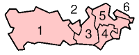
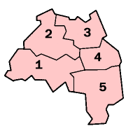
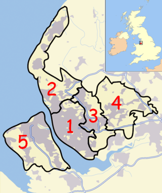
The Borough of Bedford is a unitary authority area with borough status in the ceremonial county of Bedfordshire, England. Its council is based in Bedford, its namesake and principal settlement, which is the county town of Bedfordshire. The borough contains one large urban area, the 71st largest in the United Kingdom that comprises Bedford and the adjacent town of Kempston, surrounded by a rural area with many villages. 75% of the borough's population live in the Bedford Urban Area and the five large villages which surround it, which makes up slightly less than 6% of the total land area of the Borough.

<span class="mw-page-title-main">History of Bedfordshire</span> History of Bedfordshire County in England

Bedfordshire is an English ceremonial county which lies between approximately 25 miles and 55 miles north of central London.

<span class="mw-page-title-main">Civil parishes in Cumbria</span>

A civil parish in England is the lowest unit of local government. There are 284 civil parishes in the ceremonial county of Cumbria, with most of the county being parished. At the 2001 census, there were 359,692 people living in those 284 parishes, accounting for 73.8 per cent of the county's population.

<span class="mw-page-title-main">Civil parishes in Berkshire</span>

A civil parish is a country subdivision, forming the lowest unit of local government in England. There are 104 civil parishes in the ceremonial county of Berkshire, most of the county being parished; Reading is completely unparished; Bracknell Forest, West Berkshire and Wokingham are entirely parished. At the 2001 census, there were 483,882 people living in the 104 parishes, accounting for 60.5 per cent of the county's population.

<span class="mw-page-title-main">Civil parishes in Cambridgeshire</span>

A civil parish is a country subdivision, forming the lowest unit of local government in England. There are 264 civil parishes in the ceremonial county of Cambridgeshire, most of the county being parished; Cambridge is completely unparished; Fenland, East Cambridgeshire, South Cambridgeshire and Huntingdonshire are entirely parished. At the 2001 census, there were 497,820 people living in the parishes, accounting for 70.2 per cent of the county's population.

<span class="mw-page-title-main">Civil parishes in Cheshire</span>

A civil parish is a country subdivision, forming the lowest unit of local government in England. There are 333 civil parishes in the ceremonial county of Cheshire, most of the county being parished. Cheshire East unitary authority is entirely parished. At the 2001 census, there were 565,259 people living in 332 parishes, accounting for 57.5 per cent of the county's population.

<span class="mw-page-title-main">Civil parishes in Greater Manchester</span>

A civil parish is a country subdivision, forming the lowest unit of local government in England. There are 14 civil parishes in the ceremonial county of Greater Manchester, most of the county being unparished; Bury, Rochdale, Salford and Stockport are completely unparished. At the 2001 census, there were 129,325 people living in the civil parishes, accounting for 5.2% of the county's population.

<span class="mw-page-title-main">Civil parishes in Lancashire</span>

A civil parish is a subnational entity, forming the lowest unit of local government in England. There are 219 civil parishes in the ceremonial county of Lancashire; Blackpool is completely unparished; Pendle and Ribble Valley are entirely parished. At the 2001 census, there were 587,074 people living in the 219 parishes, accounting for 41.5 per cent of the county's population.

<span class="mw-page-title-main">Civil parishes in West Yorkshire</span>

A civil parish is a subnational entity, forming the lowest unit of local government in England. There are 101 civil parishes in the ceremonial county of West Yorkshire, most of the county being unparished. At the 2001 census, there were 557,369 people living in the parishes, accounting for 26.8 per cent of the county's population.

<span class="mw-page-title-main">Civil parishes in Tyne and Wear</span>

A civil parish is a country subdivision, forming the lowest unit of local government in England. There are 10 civil parishes in the ceremonial county of Tyne and Wear, most of the county being unparished; North Tyneside and South Tyneside are completely unparished. It is the County of England with the least count of civil parishes. At the 2001 census, there were 41,044 people living in the 10 parishes, accounting for 3.8 per cent of the county's population.

<span class="mw-page-title-main">Civil parishes in the West Midlands (county)</span>

A civil parish is a subnational entity, forming the lowest unit of local government in England. There are 21 civil parishes in the ceremonial county of West Midlands, most of the county being unparished; Dudley, Sandwell, Walsall and Wolverhampton are completely unparished. At the 2001 census, there were 89,621 people living in the parishes, accounting for 3.5 per cent of the county's population.

<span class="mw-page-title-main">Civil parishes in Merseyside</span>

A civil parish is a country subdivision, forming the lowest unit of local government in England. There are 22 civil parishes in the ceremonial county of Merseyside, most of the county being unparished; Liverpool and Wirral are completely unparished. At the 2001 census, there were 177,663 people living in the parishes, accounting for 13.0 per cent of the county's population.

<span class="mw-page-title-main">Mid Bedfordshire (UK Parliament constituency)</span> Parliamentary constituency in the United Kingdom, 1918 onwards

<span class="mw-page-title-main">Chicksands</span> Human settlement in England

Chicksands is a village and former civil parish, now in the parish of Campton and Chicksands in the Central Bedfordshire district of Bedfordshire, England. The village is on the River Flit and close to its parish village of Campton and the town of Shefford.

<span class="mw-page-title-main">Civil parishes in Cornwall</span>

A civil parish is a country subdivision, forming the lowest unit of local government in England. There are 218 civil parishes in the ceremonial county of Cornwall, which includes the Isles of Scilly. The county is effectively parished in its entirety; only the unpopulated Wolf Rock is unparished. At the 2001 census, there were 501,267 people living in the current parishes, accounting for the whole of the county's population. The final unparished areas of mainland Cornwall, around St Austell, were parished on 1 April 2009 to coincide with the structural changes to local government in England.

References

  1. Angus Winchester, 2000, Discovering Parish Boundaries. Shire Publications. Princes Risborough, 96 pages ISBN   978-0-7478-0470-3
  2. RAC Foundation : What Went Wrong? British Highway Development Before Motorways [ permanent dead link ] Retrieved 22 August 2009
  3. The Victorian Web : The Poor Law : Introduction Retrieved 22 August 2009
  4. Staffordshire University : Poor Law Unions and Registration Districts Archived 14 September 2012 at archive.today Retrieved 22 August 2009
  5. A Vision of Britain Through Time : Status Details for Rural Sanitary District Retrieved 22 August 2009
  6. Robert Tittler, The Reformation and the Towns in England, 1998, Oxford University Press, 395 pages, ISBN   978-0-19-820718-4
  7. 1 2 Modern British Surnames : Selected Events in the History of Civil Registration and Boundary Changes 1801-1996 Archived 1 August 2010 at the Wayback Machine Retrieved 22 August 2009
  8. Alex MacMorran and T R Colquhoun Dill, The Local Government Act 1894 and the Subsequent Statutes Affecting Parish Councils, 1907, Butterworth and Co, London, 626 pages
  9. 1 2 3 4 Office of Public Sector Information : Local Government Act 1972 Archived 5 December 2012 at archive.today Retrieved 22 August 2009
  10. Office of Public Sector Information : Local Government and Rating Act 1997 Archived 5 August 2012 at archive.today Retrieved 22 August 2009
  11. Office of Public Sector Information : Local Government and Public Involvement in Health Act 2007 Archived 5 August 2012 at archive.today Retrieved 22 August 2009
  12. From 1974 to 2009, Central Bedfordshire was divided into districts: Mid Bedfordshire, formed from Ampthill Rural District, Ampthill Urban District, Biggleswade Rural District, Biggleswade Urban District and Sandy Urban District; and South Bedfordshire, formed from Dunstable Municipal Borough, Leighton–Linslade Urban District and Luton Rural District.
  13. 1 2 A Vision of Britain Through Time : Bedford Municipal Borough Retrieved 15 October 2010
  14. Office for National Statistics : Census 2001 : Table KS01 : Usual Resident Population Archived 22 April 2015 at the Wayback Machine Castle; Cauldwell (part); De Parys; Goldington (part); Harpur; Kempston East (part); Kempston North (part); Kingsbrook (part); Newnham; Putnoe; Queen's Park; and Wilshamstead (part) wards. Retrieved 15 October 2010
  15. 1 2 3 4 5 6 7 8 9 10 11 12 13 14 15 16 17 18 19 20 21 22 23 24 25 26 27 28 29 30 31 32 33 34 35 36 37 38 39 40 41 42 43 44 45 46 A Vision of Britain Through Time : Bedford Rural District Archived 14 May 2011 at the Wayback Machine Retrieved 15 October 2010
  16. Office for National Statistics : Census 2001 : Table KS01 : Usual Resident Population Archived 22 April 2015 at the Wayback Machine Bromham (part) ward. Retrieved 15 October 2010
  17. 1 2 3 4 5 6 7 8 9 10 11 12 13 14 15 16 17 18 19 20 21 22 23 24 25 26 27 28 29 30 31 32 33 34 35 36 37 38 39 40 41 42 43 Office for National Statistics : Census 2001 : Parish Headcounts : Bedford Archived 12 June 2011 at the Wayback Machine Retrieved 15 October 2010
  18. Office for National Statistics : Census 2001 : Table KS01 : Usual Resident Population Archived 22 April 2015 at the Wayback Machine Brickhill ward. Retrieved 15 October 2010
  19. The Bedford (Parish) Order 2004 Archived 19 May 2011 at the Wayback Machine Retrieved 15 October 2010
  20. Office for National Statistics : Census 2001 : Table KS01 : Usual Resident Population Archived 22 April 2015 at the Wayback Machine Bromham (part); and Turvey (part) wards. Retrieved 15 October 2010
  21. 1 2 3 The Bedford (Parishes Electoral Arrangements) Order 2007 Retrieved 15 October 2010
  22. A Vision of Britain Through Time : Kempston Urban District Retrieved 15 October 2010
  23. 1 2 Office for National Statistics : Census 2001 : Table KS01 : Usual Resident Population Archived 22 April 2015 at the Wayback Machine Roxton (part) ward. Retrieved 15 October 2010
  24. "Wilstead-Wixams". Archived from the original on 23 September 2015. Retrieved 12 April 2015.
  25. A Vision of Britain Through Time : Ampthill Urban District Retrieved 15 October 2010
  26. 1 2 3 4 5 6 7 8 9 10 11 12 13 14 15 16 17 18 19 20 21 22 23 24 25 26 27 28 29 30 31 32 33 34 35 36 37 38 39 40 41 42 43 44 45 46 47 48 49 50 51 52 53 54 55 Office for National Statistics : Census 2001 : Parish Headcounts : Mid Bedfordshire Archived 26 May 2013 at the Wayback Machine Retrieved 15 October 2010
  27. 1 2 3 4 5 6 7 8 9 10 11 12 13 14 15 16 17 18 19 20 21 22 23 A Vision of Britain Through Time : Biggleswade Rural District Retrieved 15 October 2010
  28. 1 2 3 4 5 6 7 8 9 10 11 12 13 14 15 16 17 18 19 20 21 22 23 24 25 26 27 28 29 A Vision of Britain Through Time : Ampthill Rural District Archived 14 May 2011 at the Wayback Machine Retrieved 15 October 2010
  29. 1 2 3 4 5 6 7 8 9 10 11 12 13 14 15 16 17 18 19 20 21 A Vision of Britain Through Time : Luton Rural District Archived 1 October 2007 at the Wayback Machine Retrieved 15 October 2010
  30. 1 2 3 4 5 6 7 8 9 10 11 12 13 14 15 16 17 18 19 20 21 22 23 Office for National Statistics : Census 2001 : Parish Headcounts : South Bedfordshire Archived 12 June 2011 at the Wayback Machine Retrieved 15 October 2010
  31. A Vision of Britain Through Time : Biggleswade Urban District Retrieved 15 October 2010
  32. "Billington". Mapit. Retrieved 16 July 2019.
  33. A Vision of Britain Through Time : Dunstable Municipal Borough Retrieved 15 October 2010
  34. "Historic moment for community's parish council - Biggleswade Today". Archived from the original on 23 September 2015. Retrieved 26 May 2013.
  35. A Vision of Britain Through Time : Leighton–Linslade Urban District Retrieved 15 October 2010
  36. A Vision of Britain Through Time : Sandy Urban District Retrieved 15 October 2010
  37. A Vision of Britain Through Time : Luton County Borough Retrieved 15 October 2010
  38. Office for National Statistics : Census 2001 : Table KS01 : Usual Resident Population Archived 22 April 2015 at the Wayback Machine Barnfield; Biscot; Bramingham; Challney; Crawley; Dallow; Farley; High Town; Icknield; Leagrave; Lewsey; Limbury; Northwell; Round Green; Saints; South; Stopsley; Sundon Park; and Wigmore wards. Retrieved 15 October 2010