Barton-le-Clay

Last updated

Barton-le-Clay
Barton-le-Clay village sign 2.JPG
The village sign
Barton-le-Clay, Bedfordshire
Bedfordshire UK location map.svg
Red pog.svg
Barton-le-Clay
Location within Bedfordshire
Population4,937 (parish) [1]
OS grid reference TL082310
Civil parish
  • Barton-le-Clay
Unitary authority
Ceremonial county
Region
Country England
Sovereign state United Kingdom
Post town Bedford
Postcode district MK45
Dialling code 01582
Police Bedfordshire
Fire Bedfordshire and Luton
Ambulance East of England
UK Parliament
List of places
UK
England
Bedfordshire
51°58′01″N0°25′27″W / 51.9669°N 0.4241°W / 51.9669; -0.4241

Barton-le-Clay is a large village and a civil parish in the Central Bedfordshire district of Bedfordshire, England, bordering Hertfordshire. The village has existed since at least 1066 and is mentioned in the Domesday Book .

Contents

History

On 25 May 1956 the parish was renamed from "Barton in the Clay" to "Barton-le-Clay". [2]

Ancient history

To the southwest of the town, across the A6 is Sharpenhoe Clappers, an Iron Age hill fort.

The Barton Domesday Book entry in Latin and English Doomesday Book 210d.JPG
The Barton Domesday Book entry in Latin and English

The Domesday Book

Barton-Le-Clay Domesday Book entry, taken from 210d 2. [3]

In FLITT Hundred M. The Abbot also holds Barton (in-the-clay). It answers for 11 hides. Land for 12 ploughs. In lordship 3 hides; 2 ploughs there; a third possible. 20 villagers have 9 ploughs. 7 smallholders and 6 slaves. 1 mill, 2s, meadow for 6 ploughs; woodland, 200 pigs. In total, value £10; the same when acquired; before 1066 £12. This manor always lay in (the lands of) St Benedict's Church. With this manor the Abbot claims against Nigel of Aubigny and Walter the Fleming 12 acres (4.9 ha) of meadow which lay there before 1066, but John of Les Roches dispossessed him wrongfully, and this the Hundred testifies.

Location

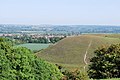
Barton-le-Clay is in Central Bedfordshire between Bedford and Luton, 36 miles (58 km) north of London. Nearby villages include Sharpenhoe, Silsoe, Westoning and Pulloxhill. The A6 which runs from Luton (6 miles south of the village) bypasses Barton and continues through Bedford (north of the village) to Carlisle. The village bypass was constructed in January 1990.

In the southeast of the parish are the Barton Hills, which form the northeast extremity of the Chiltern Hills and are designated an Area of Outstanding Natural Beauty. Much of this area of chalk downland is now a nature reserve, managed by Natural England.

Places of worship

Schools

Two major schools are in Barton: Ramsey Manor Lower School [5] and Arnold Academy, a middle school [6] The lower school takes children of the village. The middle school usually also takes those of Westoning, Silsoe and Greenfield, its children and those new to Barton meet ex-school and geographic criteria of Harlington Upper School admission (13+). [7] The village has a pre-school. [8]

A small private nursery and prep school for children aged 0 to 9, Orchard School & Nursery, is in the parish. [9]

Transportation

The closest railway station is 3.5 miles (5.6 km), somewhat more by footpath, in Harlington. No buses link to this. Bus services through Barton are largely those between Luton, south and Bedford, north. A cross-country route joins Barton to other local villages including Shillington and Shefford. There is a weekly (Tuesday) bus to/from Hitchin in the east.

The roads are well-bypassed so favoured by experienced cyclists, especially in daylight.

Clubs and Groups

Barton-le-Clay has a football club (Barton Rovers), who play their home matches at Sharpenhoe Road. The club currently competes in the Southern League Division One Central.

Organisations[ who? ] offer karate and football. A Rotary Club meets at The Bull Hotel. [10] Barton Players, the main local amateur dramatics group, hold plays and summer workshops [11] for children in the village hall. However, it is open to new members who wish to join. There is a youth drama group in the village called Up-Stage, [12] including two branches for young people aged 13 and over, called CentreStage and Stage Right. Barton also hosts Scouting and Guide organisations for all ages. A local history group meets in the library on the last Saturday of each month at 10:30 am.

The village saw the start-up of Lea Sports Reserves, an active team.

Public services

War memorials

The high street war memorial. Barton-le-Clay War Memorial.JPG
The high street war memorial.

There are two combined World War matching-list memorials, one near the main road (junction of Luton Road and Hexton Road) and the other in the Parish Church. This list is transcribed on a website. [15]

St Nicholas Church restoration of 1879

Published by the NOF Digitise Architecture England Consortium.

Local newspapers

Two weekly newspapers are delivered free to many houses in Barton, with news about Barton and the surrounding area.

See also

Pictures

Related Research Articles

<span class="mw-page-title-main">Bedfordshire</span> County of England

Bedfordshire is a ceremonial county in the East of England. It is bordered by Northamptonshire to the north, Cambridgeshire to the north-east, Hertfordshire to the south and the south-east, and Buckinghamshire to the west. The largest settlement is Luton (225,262), and Bedford is the county town.

<span class="mw-page-title-main">Flitwick</span> Human settlement in England

Flitwick is a town and civil parish in Central Bedfordshire, England. It is mentioned in the Domesday Book of 1086 as "a hamlet on the River Flitt". The spelling Flytwyk appears in 1381.

<span class="mw-page-title-main">Toddington, Bedfordshire</span> Human settlement in England

Toddington is a large village and civil parish in the county of Bedfordshire, England. It is situated 5 miles north-north-west of Luton, 4 miles (6 km) north of Dunstable, 6 miles (10 km) south-west of Woburn, and 35 miles north-north-west of London on the B5120 and B579. It is 0.5 miles from Junction 12 of the M1 motorway and lends its name to the nearby motorway service station. The hamlet of Fancott also forms part of the Toddington civil parish.

<span class="mw-page-title-main">Mid Bedfordshire (UK Parliament constituency)</span> Parliamentary constituency in the United Kingdom, 1918 onwards

Mid Bedfordshire is a constituency represented in the House of Commons of the UK Parliament by Alistair Strathern of the Labour Party since a 2023 by-election.

<span class="mw-page-title-main">Harlington, Bedfordshire</span> Human settlement in England

Harlington is a village and civil parish located in Bedfordshire, England, near the M1 motorway. The nearest town is Flitwick about 3 miles (4.8 km) to the north.

<span class="mw-page-title-main">Harlington railway station</span> Railway station in Bedfordshire, England

Harlington railway station is located in Bedfordshire. It is named after the village of Harlington, on the outskirts of which it is located, but serves a wide rural area including the larger villages of Toddington and Barton-le-Clay.

<span class="mw-page-title-main">Houghton Regis</span> Town and civil parish in Bedfordshire, England

Houghton Regis is a market town and civil parish in the Central Bedfordshire district of Bedfordshire, England.

<span class="mw-page-title-main">Caddington</span> Human settlement in England

Caddington is a village and civil parish in the Central Bedfordshire district of Bedfordshire, England.

<span class="mw-page-title-main">Ampthill Rural District</span> History of Bedfordshire

Ampthill was a rural district in Bedfordshire, England from 1894 to 1974. It entirely surrounded but did not include the urban district of Ampthill.

<span class="mw-page-title-main">Silsoe</span> Human settlement in England

Silsoe is a village and civil parish in Bedfordshire, England. The village used to be on the main A6 road but a bypass around the village was opened in 1981 at a cost of £1.6m.

<span class="mw-page-title-main">Westoning</span> Human settlement in England

Westoning is a village and civil parish in Bedfordshire, England. It is located around 0.5 miles (0.8 km) south of the town of Flitwick. The River Flit flows behind the Westoning stud farm.

<span class="mw-page-title-main">Streatley, Bedfordshire</span> Human settlement in England

Streatley is a village and civil parish in the Central Bedfordshire district of Bedfordshire, England.

Harlington Upper School (HUS) is a rural, coeducational upper school and sixth form with academy status in Harlington, Bedfordshire, England.

<span class="mw-page-title-main">Husborne Crawley</span> Human settlement in England

Husborne Crawley is a small village and civil parish in Bedfordshire, England, located close to Junction 13 of the M1 motorway. The village touches the borders of the Woburn Abbey estate on one side, and the village of Aspley Guise on the other. The meaning of the Husborne element of the towns name is "warrior stream" and the Crawley element means "crow clearing". It appears as Hussheburn Crawele, in 1421.

<span class="mw-page-title-main">Sharpenhoe</span> Human settlement in England

Sharpenhoe is a small village in Bedfordshire, England, at the foot of the hills known as the Sharpenhoe Clappers, which are within the Chilterns AONB. Smithcombe, Sharpenhoe and Sundon Hills are a Site of Special Scientific Interest, and most of it is a National Trust property. It is in the civil parish of Streatley.

<span class="mw-page-title-main">Central Bedfordshire</span> District in Bedfordshire, England

Central Bedfordshire is a unitary authority area in the ceremonial county of Bedfordshire, England. It was created in 2009.

Barton-Le-Clay Airfield was first established in 1935 to the west of the village, on farmland owned by the nearby Brook End Green Farm. Its first residents were the newly formed Luton Aircraft Limited and The Dunstable Sailplane Company, both companies co-owned by W.L. Manuel and C.H. Latimer-Needham.

References

  1. ONS, Census 2021 Parish Profiles
  2. "Luton Registration District". UKBMD. Retrieved 1 February 2023.
  3. Barton in the Clay. Accessed 27 November 2023.
  4. "St. Nicholas Church Barton-le-Clay Bedfordshire". St Nicholas Church, Barton. Retrieved 12 November 2006.
  5. "Ramsey Manor Lower School Web Site | about us". Ramseymanor.ik.org. 15 July 2010. Archived from the original on 23 March 2012. Retrieved 14 February 2012.
  6. "Welcome to the Frontpage". Arnold.beds.sch.uk. Retrieved 14 February 2012.
  7. "Harlington Upper School". www.harlington.org. Retrieved 15 March 2016.
  8. "About Us". bartonleclaypreschool. Retrieved 14 February 2012.
  9. "Private School and Nursery: Orchard Independent School & Nursery, Barton Le Clay, Bedfordshire,Beds". Orchardschool.org.uk. Retrieved 14 February 2012.
  10. "Barton le Clay Rotary Club". Barton-le-Clay Rotary Club. Retrieved 11 November 2006.
  11. "Barton Players – Future Productions". Barton Players. Archived from the original on 14 April 2005. Retrieved 11 November 2006.
  12. "Upstage official website". Upstage. Retrieved 11 November 2009.
  13. "Bedfordshire and Luton Libraries' Catalogue – Barton Library: Information". Galaxy.bedfordshire.gov.uk. Archived from the original on 4 February 2012. Retrieved 14 February 2012.
  14. "Barton-le-Clay: GP Surgery". www.bartongroupsurgeries.co.uk. Retrieved 15 March 2016.
  15. "Roll of Honour – Bedfordshire – Barton". Lynda Smith. Archived from the original on 17 October 2006. Retrieved 12 November 2006.
  16. Barton-le-Clay Church: Restoration Plan Archived 29 September 2007 at the Wayback Machine
  17. "lutontoday.co.uk". lutontoday.co.uk. 25 January 2012. Retrieved 14 February 2012.
  18. "Luton and Dunstable Express". www.luton-dunstable.co.uk. Luton and Dunstable Express. Retrieved 15 March 2016.