
Burcott is a hamlet in the parish of Bierton with Broughton, Buckinghamshire, England.
Botolph Claydon is a hamlet in the civil parish of East Claydon, in Buckinghamshire, England. It is situated about 9 miles (14 km) east of Bicester in Oxfordshire, and 7 miles (11 km) north west of Aylesbury.
Westlington is a hamlet near the village of Dinton in the civil parish of Dinton-with-Ford and Upton, Buckinghamshire, England.
Upton is a hamlet in the civil parish of Dinton-with-Ford and Upton, in Buckinghamshire, England. It is located to the north of the main village of Dinton, on the junction between the new road from Aylesbury to Thame, and the old road before it was rerouted.
Aston Mullins is a hamlet in the parish of Dinton, in Buckinghamshire, England. At the 2011 Census the population of the hamlet was included in the civil parish of Dinton-with-Ford and Upton

Westhorp is a hamlet in the county of Northamptonshire, England. Expansion has led to its merger with the neighbouring village of Byfield. Westhorp is in the civil parish of Byfield.

World's End is a hamlet in Berkshire, England. It is in the district of West Berkshire, near the A34 road north of Newbury. To the north is the village of Beedon ; to the south lie Downend and Chieveley.

Holwell is a small village and a civil parish two miles north of Hitchin in Hertfordshire, England, near the Bedfordshire border. At the 2011 Census the population of the village was 362. The church is unusual and, although largely rebuilt, retains some Perpendicular features and an interesting brass to Richard Wodehouse. The school, almshouses, and rectory are all in a similar Tudor style erected in the 1830s, but are no longer in use and have been converted into housing. Fragments of early wall paintings and wooden mullioned windows have been discovered in the mediaeval timber-framed Church Farmhouse.

Tetworth is a village in Cambridgeshire, England. Tetworth lies approximately 12 miles (19 km)south of Huntingdon, near Waresley south of St Neots. Tetworth is in the civil parish of Waresley-cum-Tetworth. Tetworth is situated within Huntingdonshire which is a non-metropolitan district of Cambridgeshire as well as being a historic county of England.
Hulcote and Salford is a civil parish in the district of Central Bedfordshire in the county of Bedfordshire. The parish was formed in 1933 by the union of the civil parishes of Hulcote and Salford. Until 1974 the parish was part of the Ampthill rural district.
Wyboston is a village in the English county of Bedfordshire. The eastern part of the village is dominated by the A1 Great North Road which at this point also carries the traffic of the A428 east–west road. The northern junction of these roads is grade-separated, while the southern junction is a roundabout. This causes frequent delays at the junction, and to users of both routes.

The Counties Act 1844, which came into effect on 20 October 1844, was an Act of Parliament of the United Kingdom which eliminated many outliers or exclaves of counties in England and Wales for civil purposes. The changes were based on recommendations by a boundary commission, headed by the surveyor Thomas Drummond and summarized in a schedule attached to the Parliamentary Boundaries Act 1832. This also listed a few examples of civil parishes divided by county boundaries, most of which were dealt with by later legislation.

Honeyburge is a hamlet in the civil parish of Boarstall in Buckinghamshire, England. The hamlet is on Dane's Brook next to Boarstall Wood. Honeyburge is less than 0.5 miles (800 m) south of Boarstall village and about 8 miles (13 km) by road south of the market town of Bicester in neighbouring Oxfordshire.
Gosford and Water Eaton is a civil parish in the Cherwell district of the county of Oxfordshire, England. It is north of the city of Oxford and is crossed nearby by two major roads for, or by-passing, the city. The parish contains the village of Gosford and the hamlet of Water Eaton and as at the 2011 census had 1373 people resident across its 8.75km².
Well End is a hamlet in the parish of Little Marlow, in Buckinghamshire, England. It is situated on the north-west side of the village of Bourne End. Although it lies in a separate parish, it is geographically contiguous with and subordinate to Bourne End; but unlike most of the hamlets consumed by its larger neighbour, it retains a distinct character, and the use of the name is common and well recognised locally.
Bennett End is a hamlet near Radnage and Bledlow Ridge in Buckinghamshire, England. At the 2011 Census the population of the hamlet was included in the civil parish of Lane End.
Begwary is a small hamlet in the parish of Staploe in the Borough of Bedford, Bedfordshire, England.

Upper Staploe is a hamlet located in the Borough of Bedford in the county of Bedfordshire, England. The settlement is close to Honeydon and Staploe, and forms part of the Staploe civil parish. Upper Staploe lies close to the county border with the Huntingdonshire district of Cambridgeshire.
Fancott is a hamlet located in the Central Bedfordshire district of Bedfordshire, England.
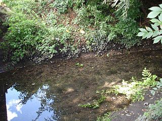
Knapps Brook is a minor tributary of the River Lea in Bedfordshire, England. The source of the river Lea is on Leagrave Common in Luton. It forms from a combination of brooks from East End, Houghton Regis and from the Lewsey Estate near the old Lewsey Farm. It joins the River Lea from culverts under the railway embankment and Toddington Road in Leagrave.
