Kensworth

Last updated

Kensworth
Kensworth and its Village Shop - geograph.org.uk - 193375.jpg
Kensworth
Bedfordshire UK location map.svg
Red pog.svg
Kensworth
Location within Bedfordshire
Population1,517 (parish) [1]
Civil parish
  • Kensworth
Unitary authority
Ceremonial county
Region
Country England
Sovereign state United Kingdom
Post town DUNSTABLE
Postcode district LU6
Dialling code 01582
Police Bedfordshire
Fire Bedfordshire and Luton
Ambulance East of England
UK Parliament
List of places
UK
England
Bedfordshire
51°51′N0°30′W / 51.85°N 0.5°W / 51.85; -0.5

Kensworth is a village and civil parish located in the Central Bedfordshire district of Bedfordshire, England. The parish is located on the edge of Dunstable Downs, and includes the hamlets of California and Kensworth Lynch. [2]

Contents

The parish was originally located in Hertfordshire but was transferred to Bedfordshire in 1897. [2] Today the village contains a primary school, a village hall, 2 churches, 2 shops and 1 pub.

Kensworth Chalk Pit is a working quarry and is the biggest employer in the parish. The pit is owned and mined by Cemex, but has also been designated a Site of Special Scientific Interest by Natural England. [3]

The Church of St Mary is located in the village. Kensworth Parish Council administers some local services and facilities in the parish, including a village recreation ground and a provision of allotments. The council has 9 members who are elected every 4 years.

At the time of the 2021 United Kingdom census, Kensworth had a population of 1,517, a 4% increase from 1,455 in 2011.

Governance

The parish of Kensworth was originally part of Hertfordshire. When district councils were created under the Local Government Act 1894, Kensworth was included in the Markyate Rural District, which covered the parts of the Luton Poor Law Union that were within Hertfordshire. The 1894 Act also created elected parish councils, with Kensworth Parish Council taking over the civil functions of the parish vestry on 13 December 1894. [4] [5]

Shortly afterwards, proposals to rationalise the border between Hertfordshire and Bedfordshire were made, which included transferring Kensworth to Bedfordshire. An inquiry was held at Luton in February 1896, when there were objections from Kensworth Parish Council, which wanted to stay in Hertfordshire, and from Hertfordshire County Council, which felt that it was losing too much rateable value in the proposed transfers. [6] Despite their opposition, the scheme went ahead, with the changes taking effect on 30 September 1897, when Kensworth became part of the Luton Rural District in Bedfordshire. [7]

The Luton Rural District was abolished under the Local Government Act 1972, which saw Kensworth becoming part of South Bedfordshire on 1 April 1974. South Bedfordshire District Council and Bedfordshire County Council were both abolished in 2009. The parish of Kensworth has formed part of the unitary authority of Central Bedfordshire since 1 April 2009.

Related Research Articles

<span class="mw-page-title-main">Bedfordshire</span> County of England

Bedfordshire is a ceremonial county in the East of England. It is bordered by Northamptonshire to the north, Cambridgeshire to the north-east, Hertfordshire to the south and the south-east, and Buckinghamshire to the west. The largest settlement is Luton (225,262), and Bedford is the county town.

<span class="mw-page-title-main">Studham</span> Human settlement in England

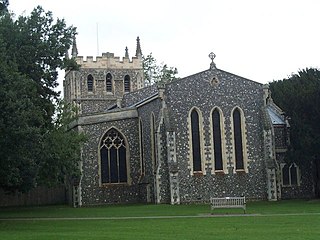
Studham is a village and civil parish in the county of Bedfordshire. It has a population of 1,182. The parish bounds to the south of the Buckinghamshire border, and to the east is the Hertfordshire border. The village lies in the wooded south facing dip slope of the Chiltern Hills. The hamlet of Holywell is located to the north of Studham, and forms part of the same civil parish.

<span class="mw-page-title-main">Markyate</span> Human settlement in England

Markyate is a village and civil parish in north-west Hertfordshire, close to the border with Bedfordshire and Buckinghamshire.

<span class="mw-page-title-main">History of Bedfordshire</span> History of Bedfordshire County in England

Bedfordshire is an English ceremonial county which lies between approximately 25 miles and 55 miles north of central London.

<span class="mw-page-title-main">Civil parishes in Bedfordshire</span> List of places

A civil parish is a country subdivision, forming the lowest unit of local government in England. There are 125 civil parishes in the ceremonial county of Bedfordshire, most of the county being parished: Luton is completely unparished; Central Bedfordshire is entirely parished. At the 2001 census, there were 312,301 people living in the 125 parishes, which accounted for 55.2 per cent of the county's population.

Wing Rural District was a rural district in the administrative county of Buckinghamshire, England. It was created in 1894 with the name Linslade Rural District, but was renamed Wing Rural District in 1897 when Linslade itself was removed from the district to become an urban district. Wing Rural District was abolished in 1974 to become part of Aylesbury Vale District.

<span class="mw-page-title-main">Caddington</span> Human settlement in England

Caddington is a village and civil parish in the Central Bedfordshire district of Bedfordshire, England.

<span class="mw-page-title-main">Ampthill Rural District</span> History of Bedfordshire

Ampthill was a rural district in Bedfordshire, England from 1894 to 1974. It entirely surrounded but did not include the urban district of Ampthill.

<span class="mw-page-title-main">Luton Rural District</span> History of Bedfordshire

Luton Rural District was a local authority in Bedfordshire, England from 1894 to 1974. It covered an area which almost surrounded but did not include the towns of Luton and Dunstable.

<span class="mw-page-title-main">Local Government Act 1894</span> United Kingdom legislation

The Local Government Act 1894 was an Act of the Parliament of the United Kingdom that reformed local government in England and Wales outside the County of London. The Act followed the reforms carried out at county level under the Local Government Act 1888. The 1894 legislation introduced elected councils at district and parish level.

Eaton Socon was a rural district in Bedfordshire, England from 1894 to 1934.

Eaton Bray was a rural district in Bedfordshire, England from 1894 to 1933.

<span class="mw-page-title-main">Whipsnade</span> Human settlement in England

Whipsnade is a small village and civil parish in Bedfordshire, England. It lies on the eastward tail spurs of the Chiltern Hills, about 2+12 miles (4.0 km) south-south-west of Dunstable on the top of the Dunstable Downs, which drop away steeply to the south of the village.

<span class="mw-page-title-main">Totternhoe Stone</span> Hard chalk outcropping in England

Totternhoe Stone is a relatively hard chalk outcropping in the middle of the Lower Chalk in the Chiltern Hills in Hertfordshire, Buckinghamshire, Bedfordshire and Cambridgeshire, England. Geologically, it is located in the upper part of the Cenomanian stage of the Cretaceous.

Luton is a town located in the south of Bedfordshire, England.

Ballingdon Bottom is a valley in Hertfordshire, England. It forms part of the boundary between the civil parishes of Flamstead and Great Gaddesden.

<span class="mw-page-title-main">Central Bedfordshire</span> District in England

Central Bedfordshire is a unitary authority area in the ceremonial county of Bedfordshire, England. It was created in 2009.

Hitchin Rural District was a rural district in Hertfordshire, England from 1894 to 1974, covering an area in the north of the county.

<span class="mw-page-title-main">St Neots Rural District</span> Former rural district in England

St Neots was a rural district in Huntingdonshire, England from 1894 to 1974, around the northern and eastern sides of the urban area of St Neots.

Markyate Rural District was a short-lived rural district in Hertfordshire, England from 1894 to 1897, on the borders with Bedfordshire.

References

  1. ONS, Census 2021 Parish Profiles
  2. 1 2 "'Guide to Bedfordshire Parishes'". Bedfordshire.gov.uk. Archived from the original on 13 February 2012. Retrieved 6 August 2012.
  3. "Kensworth Chalk Quarry citation" (PDF). Sites of Special Scientific Interest. Natural England. Archived from the original (PDF) on 24 September 2015. Retrieved 23 August 2015.
  4. Local Government Act 1894 (56 & 57 Vict. c. 73)
  5. Kensworth, Bedfordshire Advertiser (Luton), 7 December 1894, page 6, Parish council chosen without a formal poll being required, therefore came into office on 13 December 1894.
  6. The Beds and Herts Boundary Question, Bedfordshire Advertiser (Luton), 6 March 1896, page 7
  7. Local and Personal Acts. London: Her Majesty's Stationery Office. 1897. p. 561. Retrieved 26 September 2021. The Counties of Bedford and Hertford (Caddington, &c.) Order 1897

Commons-logo.svg Media related to Kensworth at Wikimedia Commons