
Bedfordshire is a ceremonial county in the East of England. It is bordered by Northamptonshire to the north, Cambridgeshire to the north-east, Hertfordshire to the south and the south-east, and Buckinghamshire to the west. The largest settlement is Luton (225,262), and Bedford is the county town.

Billington is a civil parish in Bedfordshire about 3 miles (4.8 km) south of Leighton Buzzard and not far from the Buckinghamshire border. There are two settlements: Little Billington and one that is now called Great Billington. At the 2021 census, the parish had a population of 359.

Toddington is a large village and civil parish in the county of Bedfordshire, England. It is situated 5 miles north-north-west of Luton, 4 miles (6 km) north of Dunstable, 6 miles (10 km) south-west of Woburn, and 35 miles north-north-west of London on the B5120 and B579. It is 0.5 miles from Junction 12 of the M1 motorway and lends its name to the nearby motorway service station. The hamlet of Fancott also forms part of the Toddington civil parish.
Sharnbrook is a village and civil parish located in the Borough of Bedford in Bedfordshire, England, situated around 7 miles (11 km) north-west of Bedford town centre.

Arlesey is a town and civil parish in the Central Bedfordshire district of Bedfordshire, England. It is near the border with Hertfordshire, about three miles north-west of Letchworth Garden City, four miles north of Hitchin and six miles south of Biggleswade. Arlesey railway station provides services to London, Stevenage and Peterborough. The Domesday Book of 1086 mentions Arlesey. The town's name means the 'island of a man named Aelfric'.

Stewartby is a model village and civil parish in Bedfordshire, England, originally built for the workers of the London Brick Company. The village was designed and built to the plans of the company's architect Mr F W Walker, laid out on 'Garden City' principle, a later and more modern development than such better-known Victorian model villages as Saltaire. Started in 1926, Stewartby is also a later model than Woodlands which was first planned in 1905. The later retirement bungalow development of the 1950s and 1960s with the pavilion community centre in their midst was designed by the neo-Georgian architect Professor Sir Albert Richardson. Today, Stewartby parish also includes Kempston Hardwick.
Ridgmont is a small village and civil parish in Bedfordshire, England. It is located beside junction 13 of the M1 motorway, and close to Milton Keynes and Woburn Abbey. The 2001 census states the total population to be 418, reducing to 411 at the 2011 Census.

Houghton Regis is a market town and civil parish in the Central Bedfordshire district of Bedfordshire, England.

Caddington is a village and civil parish in the Central Bedfordshire district of Bedfordshire, England.

Leagrave is a former village and now a suburb of Luton, in the Luton district, in the ceremonial county of Bedfordshire, England, in the northwest of the town. The current council ward is roughly bounded by Vincent Road, Torquay Drive and High Street to the north, Roman Road and Stoneygate Road to the south, the M1 to the west, and Marsh Road and Leagrave Park to the east.

King's Walden is a civil parish in the English county of Hertfordshire. The parish contains several settlements, with the largest village being Breachwood Green. King's Walden itself is a non-nucleated settlement, with several small clusters of development, notably around the parish church, at Plough Lane, and at Ley Green.

Lower Woodside is a hamlet in the Central Bedfordshire district of Bedfordshire, England.

Woodside is a hamlet located in the Central Bedfordshire district of Bedfordshire, England.
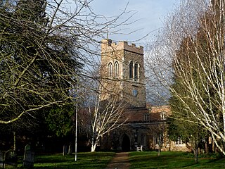
Riseley is a village and civil parish located in North Bedfordshire, England. The village name has had alternative spellings in the past such as Rislau, Riseleg, Riselai and Risely, however all these spellings are considered archaic. It has a population of 1,284 according to the 2001 census, increasing to 1,286 at the 2011 Census, and is near the villages of Bletsoe, Sharnbrook, Swineshead, Pertenhall, Keysoe, Thurleigh and Melchbourne. The nearest town to Riseley is Rushden in the neighbouring county of Northamptonshire, approximately 8 miles away to the north west. The county town of Bedford is approximately 9 miles to the South of Riseley. The village has one watercourse, which is a tributary of the River Ouse, flowing through it known locally as the 'Brook' around which in medieval times the village was built.

Tempsford is a village and civil parish in the Central Bedfordshire district of the county of Bedfordshire, England, about 7 miles (11 km) east north-east of the county town of Bedford.

Luton is a town located in the south of Bedfordshire, England.
Wixams is a new town and civil parish located in Bedfordshire, England, which has been under construction since early 2007. It is expected to become the third largest settlement in the Borough of Bedford after Bedford itself and Kempston, and one of the largest new settlements founded in England since the British new towns movement of the first twenty five years after World War II.
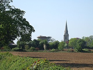
Southill is a rural village and civil parish in the Central Bedfordshire district of the county of Bedfordshire, England; about 8 miles (13 km) south-east of the county town of Bedford.

Dunstable is a market town and civil parish in Bedfordshire, England, east of the Chiltern Hills, 30 miles north of London. There are several steep chalk escarpments, most noticeable when approaching Dunstable from the north. Dunstable is the fourth largest town in Bedfordshire and along with Houghton Regis forms the westernmost part of the Luton/Dunstable urban area.

