
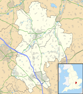
Bedfordshire is a county in the East of England. It is a ceremonial county and a historic county, covered by three unitary authorities: Bedford, Central Bedfordshire, and Luton.
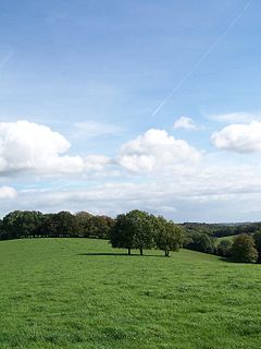
The Chiltern Hills or, as they are known locally and historically, the Chilterns, form a chalk escarpment that stretches across Oxfordshire, Buckinghamshire, Hertfordshire, and Bedfordshire. In 1965, a large part of the Chilterns was designated as an Area of Outstanding Natural Beauty (AONB).

Little Barford is a hamlet and civil parish in the Borough of Bedford in Bedfordshire, England about 7 miles (11 km) northeast of the county town of Bedford.

Markyate is a village and civil parish in north-west Hertfordshire close to the border with Bedfordshire and Buckinghamshire.

Toddington is a large village and civil parish in the county of Bedfordshire, England. It is situated 5 miles NNW of Luton, 4 miles (6 km) north of Dunstable, 6 miles (10 km) SW of Woburn, and 35 miles NNW of London on the A5120 and B579. It is 0.5 miles from Junction 12 of the M1 motorway and lends its name to the nearby motorway service station. The hamlet of Fancott also forms part of the Toddington civil parish.
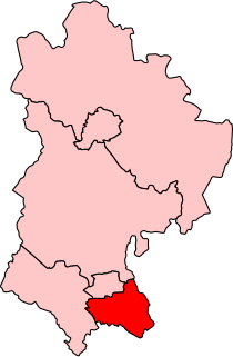
Luton South is a constituency in Bedfordshire represented in the House of Commons of the UK Parliament since 2019 by Rachel Hopkins, a member of the Labour Party.

Houghton Regis is an industrial town and civil parish in Bedfordshire, East of England.

Caddington is a village and civil parish in the Central Bedfordshire district of Bedfordshire, England. It is between the Luton/Dunstable urban area, and Hertfordshire.
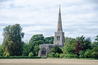
Colmworth is a village and civil parish in the Borough of Bedford in the county of Bedfordshire, England about 6.5 miles (10 km) north-east of Bedford.

Slip End is a village and civil parish in Central Bedfordshire, England. The village is located very near to Luton. As well as the village of Slip End, the parish contains the hamlets of Lower Woodside, Woodside and Pepperstock. It has a population of 1,976, reducing to 1,831 at the 2011 Census.

Pepperstock is a small village located in Central Bedfordshire, England. The village itself mostly consists of residential caravan parks. However, Pepperstock displays an interesting range of vernacular buildings, most notably in the form of 16th and 17th century timber framing with brick infill and red clay tiled roofs. It is in the civil parish of Slip End.

Aley Green is a hamlet in Bedfordshire, England.

Lower Woodside is a hamlet located in the Central Bedfordshire district of Bedfordshire, England.
Challney is a district in Luton off the main arterial road leading from Luton into Dunstable. The area is roughly bounded by Rodheath, Stoneygate Road, Roman Road, and Beechwood Road to the north, Hatters Way to the south, the M1 to the west, and Waller Avenue and Chaul End Lane to the east.

Tempsford is a village and civil parish in the Central Bedfordshire district of the county of Bedfordshire, England, about 7 miles (11 km) east north-east of the county town of Bedford.

Upper Sundon is a village located in the Central Bedfordshire district of Bedfordshire, England.

Husborne Crawley is a small village and civil parish in Bedfordshire, England, located close to Junction 13 of the M1 motorway. The village touches the borders of the Woburn Abbey estate on one side, and the village of Aspley Guise on the other. The meaning of the Husborne element of the towns name is "warrior stream" and the Crawley element means "crow clearing". It appears as Hussheburn Crawele, in 1421.

Chilcomb is a small village and civil parish in the English county of Hampshire 3 miles (4.8 km) east of Winchester and includes the South Downs Way long distance footpath.

Dunstable is a market town and civil parish in Bedfordshire, East of England. It lies on the eastward tail spurs of the Chiltern Hills, 30 miles north of London. These geographical features form several steep chalk escarpments most noticeable when approaching Dunstable from the north. Dunstable is the largest settlement in Central Bedfordshire and third largest in Bedfordshire behind Luton and Bedford. Along with Houghton Regis and the much larger town of Luton it forms the westernmost part of the Luton/Dunstable Urban Area.

