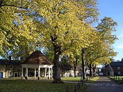
Cold Brayfield is a village and civil parish in the unitary authority area of the City of Milton Keynes, Buckinghamshire, England. It is about 3 miles (4.8 km) east of Olney, 8 miles (13 km) west of Bedford, and 10 miles (16 km) north of Central Milton Keynes on the Bedfordshire border. Nearby places are Lavendon and Turvey. It is in the civil parish of Newton Blossomville.

The Borough of Bedford is a unitary authority area with borough status in the ceremonial county of Bedfordshire, England. Its council is based in Bedford, its namesake and principal settlement, which is the county town of Bedfordshire. The Bedford built-up-area is the 71st largest in the United Kingdom and comprises the boundaries of the pre-1974 Bedford Municipal Borough, the town of Kempston and the village of Biddenham, with the BUA surrounded by a rural area with many villages. 75% of the borough's population live in the Bedford Urban Area and the five large villages which surround it, which makes up slightly less than 6% of the total land area of the Borough.

Bedfordshire is an English ceremonial county which lies between approximately 25 miles and 55 miles north of central London.
Odell is a small village and civil parish in the Borough of Bedford, north Bedfordshire, England, approximately 7 miles (11 km) north-west of Bedford town centre, near the villages of Harrold, Felmersham, Sharnbrook and Carlton.

North East Bedfordshire is a constituency represented in the House of Commons of the Parliament of the United Kingdom since 2019 by Richard Fuller, of the Conservative Party.

Felmersham is a small village and civil parish in the Borough of Bedford in Bedfordshire, England, on the River Great Ouse, about 7 miles (11 km) north west of Bedford. As a civil parish, it includes the hamlet of Radwell, and is sometimes known as Felmersham with Radwell, and has a population of about 800, and is circumscribed by the Great Ouse on the north, east and south. Other nearby places are Sharnbrook, Odell, Pavenham and Milton Ernest. Felmersham with Radwell was recorded in the Domesday Book of 1086 as a parish within the Hundred of Willey. John de Burnham, later Lord High Treasurer of Ireland, was parish priest here in the 1330s.
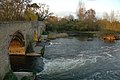
Carlton with Chellington is a civil parish in the historical Hundred of Willey in Bedfordshire, England, and is within the Borough of Bedford. The parish is situated on the South bank of the River Great Ouse, from Harrold, and includes the villages of Carlton and Chellington.

Carlton is a village and former civil parish, now in the parish of Carlton and Chellington, in the Bedford district, in the ceremonial county of Bedfordshire, England. The River Great Ouse runs just to the north of the village. Nearby places are Chellington, Harrold, Pavenham, Turvey, Lavendon and Odell. In 1931 the parish had a population of 340.

Farndish is a village and former civil parish, now in the parish of Podington, in the Bedford district, in northwest Bedfordshire, England, located about 500 metres (yards) east of the county border with Northamptonshire. The village is near the Northamptonshire villages of Irchester and Wollaston and the Bedfordshire village of Wymington. In 1881 the parish had a population of 72.

Souldrop is a village and former civil parish, now in the parish of Knotting and Souldrop, in the Bedford district, in the ceremonial county of Bedfordshire, England, located near the border with Northamptonshire. Nearby places are, Sharnbrook, Podington, Odell, Melchbourne, Yelden, Knotting, and Newton Bromswold and Rushden over the border in Northamptonshire. In 1931 the parish had a population of 161. On 1 April 1934 the parish was abolished and merged with Knotting to form "Knotting and Souldrop".
Oakley is a village and civil parish located in the Borough of Bedford in Bedfordshire, England, about four miles northwest of Bedford along the River Great Ouse. It has a population of 2,493 and is near the villages of Bromham, Milton Ernest, Clapham, Radwell and Felmersham.

North Bedfordshire was a county constituency in Bedfordshire. It returned one Member of Parliament (MP) to the House of Commons of the Parliament of the United Kingdom, elected by the first-past-the-post voting system.

Podington is a village and civil parish in Bedfordshire, England, United Kingdom. The village is within the electoral ward of Harrold in the Borough of Bedford. Podington lies around 16 km (9.9 mi) northwest of Bedford and is about 2 km (1.2 mi) east of the county border with Northamptonshire. Nearby there is paintballing. Podington Garden Centre, founded by village residents Colin & Norma Read in 1976 can be found in the High Street.
Renhold is a village and civil parish located on the River Ouse, in the Borough of Bedford, Bedfordshire, England. The parish church is situated some 4 miles (6.5 km) east-north-east of Bedford town centre. The former Bedfordshire County Council estimated the population of Renhold to be 1,800 in 2005, and forecast an increase to 2,320 by 2010.

The Hundred of Willey is a historical land division, a hundred in the northwest corner of Bedfordshire, England. Its northwestern boundary is the county border with Northamptonshire, and its southwestern boundary the border with Buckinghamshire. Some of its parishes and settlements lay on the River Great Ouse which flows through the hundred.
Kempston Central and East is an electoral ward and area within Kempston, Bedfordshire, England.

Knotting is a village and former civil parish, now in the parish of Knotting and Souldrop, in the Bedford district, in the ceremonial county of Bedfordshire, located near the border with Northamptonshire. Nearby places are, Sharnbrook, Podington, Odell, Melchbourne, Yelden, Newton Bromswold, Souldrop and Rushden over the border in Northamptonshire. In 1931 the parish had a population of 114. On 1 April 1934 the parish was abolished to form "Knotting and Souldrop".
Roxton is a small village and civil parish in the Borough of Bedford, Bedfordshire, England about 7 miles (11 km) north-east of the county town of Bedford.
Great Denham is a village and civil parish located in Bedfordshire, England, on the western outskirts of Bedford. The village is the location of Bedford Golf Course.

The Hundred of Stodden is a historical land division, a hundred, in the north of Bedfordshire, England. It borders Northamptonshire to the north, Huntingdonshire to the east and the Bedfordshire hundreds of Willey and Barford to the south. Three vills - Oakley, Clapham and Milton Earnest - are separated from the rest of the hundred by the parishes of Beltsoe and Thurleigh, which are part of the half-hundred of Buckelow and hundred of Willey respectively.