
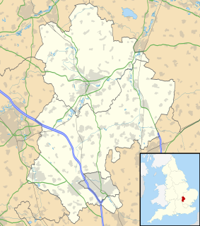
Bedfordshire is a county in the East of England. It is a ceremonial county and a historic county, covered by three unitary authorities: Bedford, Central Bedfordshire, and Luton.
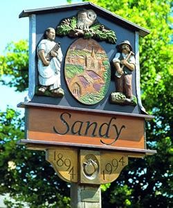
Sandy is a market town and civil parish in Central Bedfordshire, England. It lies 8 miles (13 km) to the east of Bedford, 18 miles (29 km) to the south west of Cambridge and 43 miles (69 km) north of Central London. The town has a population of around 13,400 based on 2015 estimates.

Eaton Bray is a village, civil parish, former ecclesiastical parish and manor in Bedfordshire, England. It is situated about three miles south-west of the town of Dunstable and is part of a semi-rural area which extends into the parish of Edlesborough.

Potton is a town and civil parish in the Central Bedfordshire district of Bedfordshire, England, about 10 miles (16 km) east of the county town Bedford. Its population in 2011 was 4,870. In 1783 the Great Fire of Potton destroyed a large part of the town. The parish church dates from the 13th century, and is dedicated to St Mary. Potton's horse fairs were some of the largest in the country.

Everton is a small rural village of about 200 dwellings and civil parish in the Central Bedfordshire district of Bedfordshire, England about 9 miles (14 km) east of the county town of Bedford.

Toddington is a large village and civil parish in the county of Bedfordshire, England. It is situated 5 miles NNW of Luton, 4 miles (6 km) north of Dunstable, 6 miles (10 km) SW of Woburn, and 35 miles NNW of London on the A5120 and B579. It is 0.5 miles from Junction 12 of the M1 motorway and lends its name to the nearby motorway service station. The hamlet of Fancott also forms part of the Toddington civil parish.

Shefford is a town and civil parish located in the Central Bedfordshire district of Bedfordshire, England. At the 2001 census it had a population of 4,928, and was estimated to have grown to 5,770 by 2007. The population at the 2011 Census had risen to 5,881.

Turvey is a village and civil parish on the River Great Ouse in Bedfordshire, England, about 6 miles (9.7 km) west of Bedford. The village is on the A428 road between Bedford and Northampton, close to the border with Buckinghamshire. The 2011 Census recorded the parish's population as 1,225.

Biddenham is a large village and a civil parish in Bedfordshire, England, located to the west of Bedford near the A428 road.

Blunham is a village and civil parish in the Central Bedfordshire district of Bedfordshire, England, about 8 miles (13 km) east of Bedford. At the 2011 census date its population was 946. The River Ivel forms the parish's eastern boundary in places and the River Great Ouse its western and northern boundaries. The village is just over 0.6 miles (1 km) to the west of the A1 road, and Route 51 of the National Cycle Network passes to the south.

Willington Dovecote & Stables is a National Trust property located in Willington, near Bedford, Bedfordshire, England. Both buildings are Grade I listed.

Sandy railway station serves the town of Sandy in Bedfordshire, England. It is on the East Coast Main Line, about 44 miles (71 km) from London King's Cross. Sandy is managed and served by Great Northern.

Colmworth is a village and civil parish in the Borough of Bedford in the county of Bedfordshire, England about 6.5 miles (10 km) north-east of Bedford.

Northill is a village and civil parish in the Central Bedfordshire district of the county of Bedfordshire, England about 6.5 miles (10 km) southeast of the county town of Bedford.

Tempsford is a village and civil parish in the Central Bedfordshire district of the county of Bedfordshire, England, about 7 miles (11 km) east north-east of the county town of Bedford.
National Cycle Route 51 is an English long distance cycle route running broadly east-west connecting Colchester and the port of Harwich to Oxford via Ipswich, Bury St Edmunds, Cambridge, Bedford, Milton Keynes, Bicester, and Kidlington.

Sutton is a rural village and civil parish in the Central Bedfordshire district of Bedfordshire, England. It lies 11 miles (18 km) east of Bedford. At the 2001 Census, its population was 299. Main features are the packhorse bridge over the Potton Brook, the adjacent ford, and the Grade I listed All Saints' Parish Church.
Willington was a railway station on the Varsity Line which served the small village of the same name in Bedfordshire. Opened in 1903, the station was located in a rural area and saw little passenger traffic; it closed together with the line in 1968.
Roxton is a small village and civil parish in the Borough of Bedford, Bedfordshire, England about 7 miles (11 km) north-east of the county town of Bedford.


