South Leverton

Last updated

South Leverton
Village and civil parish
All Saints Church, South Leverton - geograph.org.uk - 3048531.jpg
All Saints Church, South Leverton
South Leverton
Parish map
Nottinghamshire UK location map.svg
Red pog.svg
South Leverton
Location within Nottinghamshire
Area3.43 sq mi (8.9 km2)
Population514 (2021 census)
  Density 150/sq mi (58/km2)
OS grid reference SK 783809
  London 130 mi (210 km)  SSE
District
Shire county
Region
Country England
Sovereign state United Kingdom
Post town RETFORD
Postcode district DN22
Dialling code 01427
Police Nottinghamshire
Fire Nottinghamshire
Ambulance East Midlands
UK Parliament
Website www.southleverton-pc.gov.uk
List of places
UK
England
Nottinghamshire
53°19′12″N0°49′23″W / 53.320°N 0.823°W / 53.320; -0.823

South Leverton is a village and civil parish in Bassetlaw, north Nottinghamshire, England, four miles from Retford. According to the 2001 census it has a population of 478, [1] increasing marginally to 480 at the 2011 census, [2] and more substantially to 514 at the 2021 census. [3]

Contents

Geography

South Leverton has a village hall, public house and private school called Orchard School. The parish covers a large area in an east-west direction, stretching across to Cottam in the east and Grove in the west. The parish boundary stretches right to the perimeter of the power station itself, along Cottam Road. To the north is North Leverton with Habblesthorpe and Treswell is to the south. Cottam Power Station is actually in the parish of Treswell. The division between South and North Leverton is the level crossing of the railway that runs through the parish, and eventually to a power station two miles to the south-east.

History

South Leverton is mentioned in the Domesday Book in 1086. Domesday place name: Cledretone People mentioned within entire folio: Aelfric; Countess Gytha; Leofwine; Men of Roger de Bully; Robert, man of William Peverel; Roger de Bully; Roger, man of Roger de Bully; Stapolwine; Thorbiorn; Ulfkil; Walan; William Peverel; Wulfsige Cild

The parish church of All Saints has a square tower at the western end, north and south aisles to either side of the nave, a south porch, a chancel and a vestry. The fabric dates from the twelfth, thirteenth, fourteenth and fifteenth centuries, and the building was restored in the nineteenth century. Ewan Christian worked on the chancel in 1868, and C. Scholefield worked on the rest of the building in 1897. The building has been a grade II* listed structure since 1967. [4] On Retford Road there is a building which was formerly a priory, parts of which date from the twelfth century. It was restored in the nineteenth century, when a large extension was added, and is now used as a home for the elderly. It is a grade II listed structure. [5] There is also a grade II listed, single storey brick-built former Methodist chapel on Church Street, which was erected in 1847. [6]

The village pub is The Plough and is the centre of much village activity. The Railway Inn, formerly next to the level crossing and in the parish, has been demolished. Leverton railway station was on the Manchester, Sheffield and Lincolnshire Railway line that went from Retford over the River Trent to Lincoln. The line opened in 1850 but the section beyond Cottam power stations was closed to passengers in 1959. A contributory factor to the closure was the need for expensive repairs to the viaduct which carried the line over the river at Torksey, [7] and there was an alternative, if slightly longer, route available via Gainsborough Lea Road.

Wind farm

A wind farm to be known as the Cottam Wind Farm, comprising up to twelve wind turbines up to 145m in height, is proposed to be built between the village and Cottam by the German company Prowind. [8] Most of it will be in the east of the parish, with only one turbine in Cottam parish. This form of power generation will complement the large coal- and gas-fired power stations at Cottam and West Burton.

Opposition

The South Leverton Parish Council conducted a survey to find out the level of support for the wind farm to the east of the village. Out of 305 votes cast (approximately two-thirds of the total population), 299 votes (98.0%) were opposed to the plans. The South Leverton Parish Council said that it was "very pleased with the large number of parishioners who voted" in South Leverton, North Leverton and Sturton le Steeple and with the "overwhelming vote against the development", and that the data "completely contradicts the developer's assertion that 50% of the villagers were in favour of the wind farm." [9]

Oilfield

South Leverton gives its name to the oilfield which runs beneath it, [10] although the well heads are located in nearby Treswell. [11] The field produces high-grade crude oil, which is taken by road to a collection centre at Gainsborough, from where it is transferred by rail to be refined at Immingham. Because of its quality, it is used for the production of chemicals and plastics, rather than for fuel. [12] Oil was discovered at South Leverton in the late 1950s or early 1960s, after Dr Mosaddeq took power in Iran and nationalised the oil industry there. Displaced engineers working for British Petroleum returned to the UK, and South Leverton was one of several oilfields which were identified at that time as a result of their exploration skills. [13]

See also

Bibliography

Related Research Articles

<span class="mw-page-title-main">Hampole</span> Village in South Yorkshire, England

Hampole is a small village and civil parish in the City of Doncaster in South Yorkshire, England, close to the border with West Yorkshire. Historically part of the West Riding of Yorkshire, the eastern boundary of the parish is marked by the Great North Road, and the parish lies in what was once the Barnsdale Forest. It had a population of 187 in 2001, increasing to 203 at the 2011 Census, which includes the neighbouring village of Skelbrooke. Hampole lies on the A638 between Doncaster and Wakefield.

<span class="mw-page-title-main">North Leverton with Habblesthorpe</span> Village and civil parish in England

North Leverton with Habblesthorpe is a village and civil parish in the English county of Nottinghamshire. It is about 5 miles or 8 km east of Retford. The population as at the 2011 Census was 1,047, and in the Census 2021 it had increased to 1,079.

<span class="mw-page-title-main">Rampton, Nottinghamshire</span> Human settlement in England

Rampton is a village in the civil parish of Rampton and Woodbeck, about 6 miles (10 km) east of Retford in the Bassetlaw district, in the county of Nottinghamshire, England. The parish is long and thin, extending about 7 miles (11 km) east–west but only about 1 mile (1.6 km) north–south. Its eastern boundary is the River Trent, which here also forms the county boundary with Lincolnshire.

<span class="mw-page-title-main">Sheffield–Lincoln line</span> Railway line in England

The Sheffield–Lincoln line is a railway line in England. It runs from Sheffield to Lincoln via Worksop, Retford and Gainsborough Lea Road. The route comprises the main line of the former Manchester, Sheffield and Lincolnshire Railway (MS&LR), to Gainsborough Trent Junction, where it then follows the former Great Northern and Great Eastern Joint Railway (GNGEJR) to Lincoln Central. The former MS&LR main line continues from Trent Junction to Wrawby Junction, Barnetby, much of it now single line, where it then runs to Cleethorpes. In 2023, the Department for Transport announced that a new station will be opened on the line. Waverley station will be located between Darnall and Woodhouse.

<span class="mw-page-title-main">Bassetlaw Wapentake</span>

Bassetlaw was a wapentake in the English county of Nottinghamshire. The wapentake covered an area in the north of the county, roughly equivalent to the modern Bassetlaw local government district. The wapentake was divided into the divisions of Hatfield, North Clay and South Clay.

<span class="mw-page-title-main">Treswell</span> Village and civil parish in Nottinghamshire, England

Treswell is a village in north Nottinghamshire in England. The village is under the administration of Bassetlaw Council and Treswell parish council. According to the 2001 census it had a population of 231, falling to 211 at the 2011 census, and increasing to 241 at the 2021 census.

<span class="mw-page-title-main">Misterton, Nottinghamshire</span> Village and civil parish in the Bassetlaw district of Nottinghamshire, England

Misterton is a village and civil parish in the Bassetlaw district of Nottinghamshire, England. The parish population at the 2011 census was 2,140, and has risen to 2,191 residents in the 2021 census.

<span class="mw-page-title-main">Cottam, Nottinghamshire</span> Civil parish in England

Cottam is a village and civil parish in Nottinghamshire 8 miles east of Retford within the Bassetlaw district. The name is pronounced 'Cotum' locally.

<span class="mw-page-title-main">North Wheatley</span> Human settlement in England

North Wheatley is a village and former civil parish, now in the parish of North and South Wheatley, in Bassetlaw district, in the county of Nottinghamshire, England. At the time of the 2001 census it had a population of 489, increasing to 509 at the 2011 census. It is located 6 miles north-east of Retford. The village has a number of 17th century brick houses. The Old Hall on Low Street/Church Hill is dated 1673, with the arms of the Cartwright family. The parish church of St Peter and St Paul was restored in 1896. Many farms in the area have dovecotes, either as free-standing buildings or above farm buildings. On 1 April 2015 the civil parish was merged with South Wheatley to form "North and South Wheatley".

<span class="mw-page-title-main">Welham, Nottinghamshire</span> Settlement in Nottinghamshire, England

Welham is a hamlet in the civil parish of Clarborough and Welham, of Bassetlaw district, in the county of Nottinghamshire, England. It is 130 miles north of London, 28 miles north east of the city of Nottingham, and 2 miles north east of the market town of Retford.

<span class="mw-page-title-main">Sturton le Steeple</span> Village and civil parish in Nottinghamshire, England

Sturton le Steeple is a village located 6 miles (9.7 km) east of Retford, Nottinghamshire, England. According to the 2001 census it had a population of 497, reducing slightly to 486 as at the 2011 census, but increasing to 545 residents in the 2021 census.

<span class="mw-page-title-main">Ordsall, Nottinghamshire</span> Human settlement in England

Ordsall is an area and former civil parish in Retford, in the Bassetlaw district of Nottinghamshire, England. The Bassetlaw ward of the same name had a population of 14,194 at the 2011 census.

<span class="mw-page-title-main">Grove, Nottinghamshire</span> Civil parish in England

Grove is a small village and civil parish, located about 2 miles (3.2 km) south-west of Retford, Nottinghamshire. The population of the civil parish as of the 2011 census is 105, increasing to 127 in 2021. The parklands of Grove Hall separate it from Retford town, and a set of gates for Grove Hall can be found near the London Road, the A638.

<span class="mw-page-title-main">All Saints' Church, South Leverton</span> Church in South Leverton, England

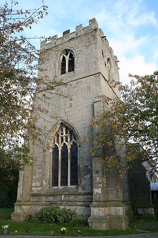
All Saints’ Church, South Leverton is a Grade II* listed parish church in the Church of England in South Leverton, Nottinghamshire.

<span class="mw-page-title-main">Lindhurst</span> Civil parish in England

Lindhurst is a civil parish and hamlet in the Newark and Sherwood district, is 120 miles (190 km) north west of London, 11 miles (18 km) north of Nottingham the county town, and 3 miles (4.8 km) south east of Mansfield, the nearest market town and bordering its district border. It sits within western Nottinghamshire county, England.

<span class="mw-page-title-main">Headon cum Upton</span> Civil parish in England

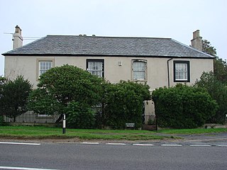
Headon cum Upton is a civil parish in the Bassetlaw district, in the county of Nottinghamshire, England. The parish includes the villages of Headon, Upton and the hamlet of Nether Headon. The parish is adjacent to Askham, Gamston, East Drayton, Eaton, Grove, Rampton and Woodbeck, Stokeham and Treswell. In the 2021 census, the parish had a population of 192. The area is 3.5 miles south east of the nearest market town Retford, 26 miles north east of the county town Nottingham and 125 miles north of London. Headon cum Upton shares a parish council with Grove and Stokeham. There are 6 listed buildings in Headon cum Upton.

<span class="mw-page-title-main">Rampton and Woodbeck</span> Civil parish in England

Rampton and Woodbeck is a civil parish in the Bassetlaw district, within the county of Nottinghamshire, England. The overall area had a population of 1,077 at the 2021 census. The parish lies in the north east of the county. It is 125 miles north west of London, 27 miles north east of the city of Nottingham, and 5 miles south east of the town of Retford. The parish rests alongside the county border with Lincolnshire. It is the site of Rampton Secure Hospital, which is one of only three high security psychiatric hospitals in England.

<span class="mw-page-title-main">Clarborough and Welham</span> Civil parish in Nottinghamshire, England

Clarborough and Welham is a civil parish in the Bassetlaw district, in the county of Nottinghamshire, England. The parish includes the village of Clarborough and the hamlet of Welham. In 2021 the parish had a population of 1,041. It is 130 miles north of London, 28 miles north east of the city of Nottingham, and 2 miles north east of the market town of Retford. The parish touches Hayton, North and South Wheatley, North Leverton with Habblesthorpe and Sturton Le Steeple. There are 14 listed buildings in Clarborough and Welham.

References

  1. "Lead View Table". Neighbourhood Statistics. Office for National Statistics. 28 April 2004. Retrieved 13 September 2009.
  2. "Civil parish population 2011". Neighbourhood Statistics. Office for National Statistics. Retrieved 15 April 2016.
  3. UK Census (2021). "2021 Census Area Profile – South Leverton parish (E04007837)". Nomis. Office for National Statistics . Retrieved 23 January 2024.
  4. Historic England. "Church of All Saints, South Leverton (1275880)". National Heritage List for England . Retrieved 24 April 2012.
  5. Historic England. "The Priory, Retford Road (1234975)". National Heritage List for England . Retrieved 24 April 2012.
  6. Historic England. "Methodist Chapel, Church Street (1234972)". National Heritage List for England . Retrieved 24 April 2012.
  7. Kingscott 2004 , pp. 142–144
  8. "Cottam Wind Farm is a 12 turbine scheme proposed for land between the villages of Cottam, South Leverton and North Leverton". Cottam Wind Farm. Prowind. Retrieved 11 September 2009.
  9. "Villagers say no to windfarm". This Is Retford. Retford Times. 7 May 2009. Retrieved 11 September 2009.
  10. "Nottinghamshire Minerals Local Plan:Oil Resources" (PDF). Nottinghamshire CC. Retrieved 16 June 2011.
  11. "SK7979: Nodding Donkey". Geograph. Retrieved 16 June 2011.
  12. "Adopted Minerals Local Plan". Nottinghamshire CC. Retrieved 16 June 2011.
  13. "British Petroleum at Eakring". Dukes Wood Oil Museum. Retrieved 16 June 2011.