Annesley

Last updated

Annesley
Village and civil parish
Annesley - Robin Hood Hills.JPG
Robin Hood Hills
Annesley
Parish map
Nottinghamshire UK location map.svg
Red pog.svg
Annesley
Location within Nottinghamshire
Area4.85 sq mi (12.6 km2)
Population1,814 (2021)
  Density 374/sq mi (144/km2)
OS grid reference SK 508534
  London 115 mi (185 km)  SSE
District
Shire county
Region
Country England
Sovereign state United Kingdom
Places
  • Annesley
  • Annesley Lane End
  • Annesley Woodhouse (part)
Post town Sutton-in-Ashfield
Postcode district NG15 & NG17
Dialling code 01623
Police Nottinghamshire
Fire Nottinghamshire
Ambulance East Midlands
UK Parliament
Website www.annesleyfelley-pc.org.uk
List of places
UK
England
Nottinghamshire
53°04′52″N1°14′42″W / 53.081°N 1.245°W / 53.081; -1.245

Annesley is a village and civil parish in the Ashfield district of Nottinghamshire, England, between Hucknall and Kirkby-in-Ashfield. At the 2011 census, it had a population of 1,162 (including Annesley Woodhouse to the west), [1] and this increased to 1,814 at the 2021 census. [2]

Contents

Annesley Hall is a grade two listed building, once owned by the Chaworth-Musters family, which has connections to the Byron family of nearby Newstead Abbey. Annesley Old Church was mentioned by Lord Byron and D. H. Lawrence. There is also close by the earthworks of Annesley Castle.

The village of Annesley Woodhouse to the north is mostly outside the parish, instead being within the unparished area of Kirkby-in-Ashfield. [3] The residential area of Annesley Lane End is at the north western edge of the parish.

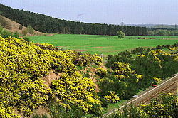
The Misk Hills lie to the south of the village. Annesley is part of Nottinghamshire's Hidden Valleys area. The parish is grouped with the neighbouring parish of Felley to elect a joint parish council. The old church of Annesley was dedicated to All Saints. It was allowed to become derelict in the 1940s. Features of interest included the east window of the south aisle, the 13th century sedilia and the 17th century royal arms in stucco. [4]

The village is on the A611 for Mansfield near junction 27 of the M1. Nearby to the south is the roundabout with the A608, which is now a thoroughfare to Sherwood Park Enterprise Zone.

It was connected to Nottingham by rail until Annesley railway station closed in 1953.

See also

Related Research Articles

<span class="mw-page-title-main">Eastwood, Nottinghamshire</span> Town and civil parish in Nottinghamshire, England

Eastwood is a former coal mining town and civil parish in the Broxtowe district of Nottinghamshire, England, 8 miles (13 km) northwest of Nottingham and 10 miles (16 km) northeast of Derby on the border between Nottinghamshire and Derbyshire. Mentioned in Domesday Book, it expanded rapidly during the Industrial Revolution. The Midland Railway was formed here and it is the birthplace of D. H. Lawrence.

<span class="mw-page-title-main">Ashfield District</span> Non-metropolitan district in England

Ashfield is a local government district in Nottinghamshire, England. The council is based in Kirkby-in-Ashfield, but the largest town is neighbouring Sutton-in-Ashfield. The district also contains the town of Hucknall and a few villages. The district is mostly urban, with some of its settlements forming parts of both the Nottingham and Mansfield Urban Areas.

<span class="mw-page-title-main">Hucknall</span> Market town in Nottinghamshire, England

Hucknall, formerly Hucknall Torkard, is a market town in the Ashfield district of Nottinghamshire, England. It lies 7 miles (11 km) north of Nottingham, 7 miles (11 km) southeast of Kirkby-in-Ashfield, 9 miles (14 km) from Mansfield and 10 miles (16 km)south of Sutton-in-Ashfield. It is the second-largest town in the Ashfield district after Sutton-in-Ashfield.

<span class="mw-page-title-main">Robin Hood Line</span> Railway line in Nottinghamshire, England

The Robin Hood Line is a railway line running from Nottingham to Worksop, Nottinghamshire, in England. The stations between Shirebrook and Whitwell (inclusive) are in the county of Derbyshire.

<span class="mw-page-title-main">Kirkby-in-Ashfield</span> Town in Nottinghamshire, England

Kirkby-in-Ashfield is a market town in the Ashfield District of Nottinghamshire, England. With a population of 25,265, it is a part of the wider Mansfield Urban Area. The Head Offices of Ashfield District Council are located on Urban Road in the town centre.

<span class="mw-page-title-main">South Kirkby</span> Human settlement in England

South Kirkby is a town in the City of Wakefield in West Yorkshire, England which is governed locally by South Kirkby and Moorthorpe Town Council. The town forms half of the civil parish of South Kirkby and Moorthorpe. The parish has a population of 10,979.

<span class="mw-page-title-main">Ashfield (UK Parliament constituency)</span> Parliamentary constituency in the United Kingdom, 1955 onwards

Ashfield is a constituency represented in the House of Commons of the UK Parliament by Lee Anderson of the Conservative Party. The constituency is in the English county of Nottinghamshire, East Midlands; located to the north west of the city of Nottingham in the Erewash Valley along the border with neighbouring county Derbyshire. Ashfield was part of the Red Wall which by and large, voted Conservative in the 2019 general election. In the 2016 referendum on membership of the European Union, Ashfield voted 70% in favour of Brexit.

<span class="mw-page-title-main">Broxtowe (UK Parliament constituency)</span> Parliamentary constituency in the United Kingdom, 1983 onwards

Broxtowe is a parliamentary constituency in Nottinghamshire, England, represented in the House of Commons of the UK Parliament since 2019 by Darren Henry, a Conservative.

<span class="mw-page-title-main">Broxtowe Wapentake</span>

Broxtowe was a wapentake of the ancient county of Nottinghamshire, England.

<span class="mw-page-title-main">Tibshelf</span> Human settlement in England

Tibshelf is a village and civil parish in the Bolsover District in Derbyshire, England. Located between the towns of Clay Cross, Shirebrook, Mansfield and Chesterfield. It had a population at the 2001 UK census of 3,548, increasing to 3,787 at the 2011 Census, and increasing to 4,348 at the 2021 Census Tibshelf shares its boundaries with the villages of Morton, Pilsley, Newton, Teversal and Hardstoft.

<span class="mw-page-title-main">Felley</span> Civil parish in Nottinghamshire, England

Felley is a civil parish in the Ashfield district, in Nottinghamshire, England, located between Hucknall and Sutton-in-Ashfield. According to the 2001 census, the parish had a population of four. At the 2011 census the population remained minimal, the count again confirmed as four residents at the 2021 census. Details are included in the Underwood ward of Ashfield Council. Prior to 1974 it was part of Basford Rural District.

<span class="mw-page-title-main">Newstead, Nottinghamshire</span> Human settlement in England

Newstead is a village and civil parish in Nottinghamshire, England in the borough of Gedling. It is situated between the city of Nottingham and the towns of Kirkby-in-Ashfield, Sutton-in-Ashfield and Hucknall.

<span class="mw-page-title-main">Hidden Valleys</span> Rural area in Nottinghamshire

Hidden Valleys is a name, coined in 2004, used to describe an area of interesting historical and scenic value between the city of Nottingham and the town of Mansfield in the English ceremonial county of Nottinghamshire. Promotional literature and tourist information for the Hidden Valleys were created to encourage tourism in an area that had been blighted by industrial decline. Partners in the project were: Ashfield District Council; Gedling Borough Council; the East Midlands Development Agency; Nottinghamshire County Council; and the Coalfields Regeneration Trust. It was intended by the partners that the name would help the Ashfield area compete with the Peak District and Sherwood Forest.

<span class="mw-page-title-main">Selston</span> Village and civil parish in Nottinghamshire, England

Selston is a large village and civil parish in the Ashfield District of Nottinghamshire, England. It is situated 12 miles (19.3 km) north-northwest of Nottingham and close to the border with Derbyshire. The village is located between the towns of Kirkby-in-Ashfield, Sutton-in-Ashfield, Eastwood, Alfreton, Heanor and Ripley.

<span class="mw-page-title-main">Teversal</span> A village in Nottinghamshire, England

Teversal is a village and former civil parish in the Ashfield district of Nottinghamshire, England. It lies north of Sutton-in-Ashfield and 3 miles (5 km) west of Mansfield. It is close to and the boundary with Derbyshire. Former names include Tevershalt, Teversholt, Tyversholtee, Teversale, Tevershall and Teversall.

<span class="mw-page-title-main">Annesley Woodhouse</span> Human settlement in England

Annesley Woodhouse is a village in Nottinghamshire, England, located approximately 10 miles north of the City of Nottingham and 6 miles south of Mansfield, close to Junction 27 of the M1. With a current population of around 3,500, from the 2011 census being included in the civil parish of Annesley.

<span class="mw-page-title-main">Warsop</span> Civil parish in England

Warsop is a town and civil parish in Mansfield District, Nottinghamshire, England, on the outskirts of the remnants of Sherwood Forest. At the 2021 census the population was 12,644 resaidents, including Church Warsop, Meden Vale, Sookholme and Spion Kop.

<span class="mw-page-title-main">Annesley Old Church</span> Grade I listed ruined church in Nottinghamshire, England

Annesley Old Church or the Church of All Saints, Annesley Park, is a disused church in a ruinous condition which stands on a mound near to Annesley Hall, Nottinghamshire. The building remains are Grade I listed and are surrounded by a graveyard. The site is scheduled as an ancient monument.

References

  1. "Civil Parish population". Neighbourhood Statistics. Office for National Statistics. Retrieved 3 April 2016.
  2. UK Census (2021). "2021 Census Area Profile – Annesley parish (E04007784)". Nomis. Office for National Statistics . Retrieved 25 January 2024.
  3. "History". www.awcommunity.co.uk. Retrieved 26 January 2024.
  4. Pevsner, N. (1951) Nottinghamshire. Harmondsworth: Penguin; p. 27
Annesley Old Church Annesley Old Church, Nottinghamshire (19).jpg
Annesley Old Church