
Wellow is a village in Nottinghamshire, England. According to the 2001 census it had a population of 444, increasing to 470 at the 2011 census, but falling slightly to 463 at the 2021 census.
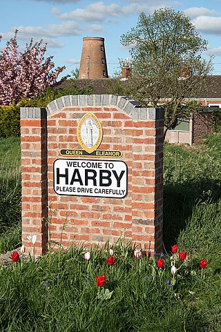
Harby is a village and civil parish in the Newark and Sherwood district of Nottinghamshire, England. It is close to Doddington, Lincolnshire, and is the easternmost settlement in Nottinghamshire, the boundary separating the two. According to the 2011 census, it had a population of 336, up from 289 at the 2001 census. It increased to 346 at the 2021 census.

Ollerton and Boughton is a civil parish in the Newark and Sherwood district of Nottinghamshire, England. The main settlements are the town of Ollerton and the villages of New Ollerton and Boughton. The civil parish was formed in 1996, when the civil parishes of Ollerton and Boughton were merged. The population of the civil parish at the time of the 2011 census was recorded as 9,840, and this increased to 11,089 residents at the 2021 census.

Bathley is a village and civil parish in the Newark and Sherwood district of Nottinghamshire, England, north-west of Newark-on-Trent. According to the 2011 census it had a population of 246, this increased marginally to 247 in the 2021 census. Bathley is recorded in the Domesday Book as Badeleie.
Bilsthorpe is a village and civil parish in the Newark and Sherwood district of Nottinghamshire, England. According to the 2001 census it had a population of 3,076, increasing to 3,375 at the 2011 census, and dropping slightly to 3,365 at the 2021 census. It is located near the junction of the A614 and A617, around 5 miles south of Ollerton, 9 miles east of Mansfield and 6 miles north-west of Southwell.
Bothamsall is a village and civil parish in the Bassetlaw district of Nottinghamshire, England.

Clipstone is a former mining village in the Newark and Sherwood district of Nottinghamshire, England. The population of the civil parish was 3,469 at the 2001 census, increasing to 4,665 at the 2011 census, and substantially more so to 6,185 at the 2021 census.
Egmanton is a small village and civil parish in Nottinghamshire, England, and is located one mile south of Tuxford and one mile north of Laxton. According to the 2001 census it has 254 inhabitants in 101 households in the civil parish, the population taken at the 2011 census went up to 286, and this fell to 271 for the 2021 census. The name derives from the Old English words for Ecgmund's farm/settlement.

Upton is a small village in Nottinghamshire, England, 2 miles (3.2 km) east of Southwell, 5 miles (8.0 km) west of Newark and 3 miles (4.8 km) south of Hockerton; it lies on the A612 Nottingham-Newark road. In 1889, the village was described as sitting on a bend in the main road, "on the summit of a hill which commands a fine view of the Trent Valley.... The church, which is a prominent feature in the landscape, has a substantial Perpendicular tower crowned by eight pinnacles, and having in the centre a lofty master pinnacle which rises above its neighbours, and so adds materially to the effect."

Carlton-on-Trent is a small village and civil parish in England, located between the River Trent and the A1 road near Newark-on-Trent in Nottinghamshire. The population of the civil parish was 228 at the 2001 census, increasing only marginally to 229 at the 2011 census and similarly to 230 at the 2021 census.

Winthorpe is a village and civil parish located 2 miles (3 km) northeast of Newark-on-Trent in Nottinghamshire, England. The population at the 2011 census was 650, falling to 595 at the 2021 census. The name is probably from old English wynne þrop (thorp), which translates as 'hamlet of joy'. An alternative etymology is Wigmund 's or Vigmund 's village.

Farnsfield is a large village and civil parish in Nottinghamshire in Sherwood Forest. It is in the local government district of Newark and Sherwood. The population of the civil parish as at the United Kingdom Census 2001 was 2,681, increasing in the 2011 census to 2,731, and 3,216 at the 2021 census.

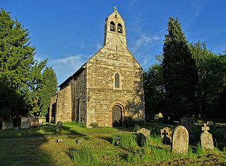
Sutton Cum Lound is a village located in Bassetlaw, north Nottinghamshire. It is located 3 miles from Retford. The civil parish is called Sutton. According to the 2001 census it had a population of 687, falling slightly to 673 at the 2011 census, and recovering to 683 at the 2021 census. The parish church of St Bartholomew is Norman, rebuilt in the Perpendicular style, with "unbridled curvilinear tracery" in the chancel windows. The village has a primary school. It borders the village of Barnby Moor which is about 1 mile away and is also very close to the village of Lound. The village has a number of public footpaths and walks such as those on Mire Hill.

Lound is a village in Nottinghamshire, England, four miles north of Retford. It had a population of 493 in the census of 2001, reducing to 471 at the 2011 census, and 454 in 2021. The village is of Danish origin dating from the 8th century with a street running along the spine of the village, leading on to Lound Low Road. The oldest houses are tofts which are endways on to the street with strips of land running back from the road. Nearby villages are Sutton cum Lound and Mattersey.

Halam is a village and civil parish in the Newark and Sherwood district of Nottinghamshire, England, with a population of 372 in 2001, increasing to 426 at the 2011 census, and was 387 at the 2021 census. It is located to the west of Southwell.

Coddington is an English village and civil parish in Nottinghamshire, 3 miles (4.8 km) east of Newark-on-Trent. According to the 2001 census it had a population of 972, which increased to 1,684 at the 2011 Census and to 1,538 at the 2021 census.
Edingley is a village in the Newark and Sherwood district of Nottinghamshire, England. According to the 2001 census it had a population of 390, increasing to 443 at the 2011 census, and falling to 401 at the 2021 census. It is located 3 miles north-west of Southwell.

Girton is a village and civil parish in Nottinghamshire, England. According to the 2001 census it had a population of 143, reducing slightly to 140 at the 2011 census, and 138 at the 2021 census. It is located 17 miles west of Lincoln.

Weston is a village and civil parish in Nottinghamshire, England. It is located 10 miles south of Retford. According to the 2001 census it had a population of 312, increasing to 393 at the 2011 census, Weston alone reported 333 residents at the 2021 census. The parish church of All Saints is 13th century. At the south-east end of the village are three 16th century tenements built with cruck trusses.

North Willingham is a village and civil parish in the West Lindsey district of Lincolnshire, England. The population of the civil parish was at 181 during the 2011 census. It is situated 3.5 miles (6 km) east from the town of Market Rasen on the A631 road between Market Rasen and Louth.


