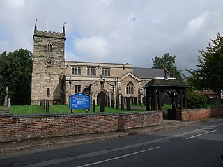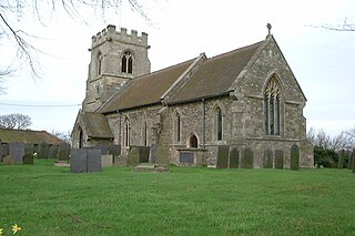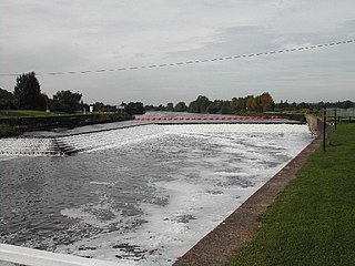
Breedon on the Hill is a village and civil parish about 5 miles (8 km) north of Ashby-de-la-Zouch in North West Leicestershire, England. The parish adjoins the Derbyshire county boundary and the village is only about 2 miles (3 km) south of the Derbyshire town of Melbourne. The 2001 Census recorded a parish population of 958 people in 404 households. The parish includes the hamlets of Tonge 1 mile (1.6 km) east of the village and Wilson 1.3 miles (2 km) north of the village on the county boundary. The population at the 2011 census was 1,029 in 450 households.
Stoke Goldington is a village and civil parish in the unitary authority area of the City of Milton Keynes, Buckinghamshire, England. It is located about four miles NNW of Newport Pagnell, on the road to Northampton.

Aston-on-Trent is a village and civil parish in the South Derbyshire district, in the county of Derbyshire, England. The parish had a population of 1,682 at the 2011 Census. It is adjacent to Weston-on-Trent and near Chellaston, very close to the border with Leicestershire.

Willington is a village and civil parish in the South Derbyshire district of Derbyshire, England. The 2001 Census recorded a parish population of 2,604, increasing to 2,864 at the 2011 Census.

Bleasby is a village and civil parish in Nottinghamshire, England, located 15 mi northeast of Nottingham. It has a population of 804 for the 2001 census, increasing to 824 at the 2011 census, and 840 at the 2021 census.

East Bridgford is a village and civil parish in the Rushcliffe borough of Nottinghamshire, east of the city of Nottingham. It had a population of 1,814 at the 2011 census, falling to 1,763 at the 2021 census. The village adjoins the south bank of the River Trent, opposite the village of Gunthorpe. It is on the Trent Valley Way. East Bridgford's annual village show is run by the village Horticultural Society, established in 1864, and held every Feast Week.

Radcliffe-on-Trent is a village and civil parish in the Rushcliffe borough of Nottinghamshire, England. The population of the civil parish at the Census 2011 was 8,205, falling slightly at the Census 2021 to 8,144

Stoke Bardolph is a village and civil parish in the Gedling district of Nottinghamshire. The population of the civil parish taken at the 2011 census was 170. It is to the east of Nottingham, and on the west bank of the River Trent. Nearby places include Burton Joyce and Radcliffe on Trent.

Burton Joyce is a large village and civil parish in the Gedling district of Nottinghamshire, England, 7 miles (11 km) east of Nottingham, between Stoke Bardolph to the south and Bulcote to the north-east. The A612 links it to Carlton and Netherfield to the south-west and Lowdham to the north-east. Initially the site of an Iron age fort, it was occupied by Norman nobility, who founded St Helen's Church. From being a farming community, Burton Joyce grew in the early Industrial Revolution, earning repute up to the 1920s for its textile products. Many of today's 3,443 inhabitants commute to work in Nottingham. It forms with Stoke Bardoph and Bulcote the Trent Valley ward of Gedling, with two councillors.

Kneeton is a hamlet and civil parish in the county of Nottinghamshire, England. The population as of the 2011 census remained less than 100 so was included in the civil parish count for Screveton, it was however reported as 47 residents at the 2021 census. The village lies on the A46 road between Nottingham and Newark and is on the escarpment of the Trent Hills that sit above the flood plain of the River Trent. RAF Syerston is nearby. There is a railway station at Lowdham. The church is 14th century Grade II listed, and dedicated to St. Helen. A mid-18th century Grade II listed barn survives at Hall Farm, Kneeton.

Thorpe in the Glebe was a village in Nottinghamshire to the south of Wysall on the Leicestershire border. It was sometimes called Thorpe in the Clottes. Tradition has it that the village was destroyed either at the Battle of Willoughby Field or alternatively by a hail-storm. However, at the time of the English Civil War, there had been no village at Thorpe in the Glebe for nearly 200 years.

Fiskerton is a village and former civil parish, now in the parish of Fiskerton cum Morton, in the Newark and Sherwood district, in the county of Nottinghamshire, England. It is on the west bank of the River Trent about 3 miles southeast of Southwell. The waterfront is home to million-pound residential properties, previously residences of merchants and businessmen who commuted in the 1800s to nearby Nottingham by rail from Fiskerton Station. In 1881 the parish had a population of 283.

Hoveringham is a small village and civil parish in Nottinghamshire, about 10 miles (16 km) northeast of the county town of Nottingham and on the west side of the River Trent, and just off the A612 trunk road to Southwell. The population of the civil parish as taken at the 2011 census was 359, decreasing to 308 at the 2021 census. The adjacent area has extensive sand and gravel deposits which have been quarried there for many years.

Shelford Priory is a former Augustinian Monastery located in the village of Shelford, Nottinghamshire, United Kingdom. The priory was founded by Ralph Haunselyn around 1160–80 and dissolved in 1536. Little remains of the original priory. Following dissolution it was granted to Michael Stanhope, and c.1600 Shelford Manor was constructed on the site. The manor was fortified and then partially destroyed during the English Civil War. The house was reconstructed c.1678, however, it was altered in the 18th and 19th centuries. It is now known as Shelford Manor and is a private residence.

West Stockwith is a village within the Bassetlaw district of Nottinghamshire, England. The population at the 2011 census was 327, this increased to 335 at the 2021 census. It lies on the west bank of the River Trent, 3 miles (4.8 km) north-west of Gainsborough and 1.5 miles (2.4 km) east of Misterton. West Stockwith is an ecclesiastical parish in the Church of England Diocese of Southwell and Nottingham with the parish church of St Mary the Virgin's Church, West Stockwith being built in 1722.

Walkeringham is a village and civil parish in Nottinghamshire, England. According to the 2001 census it had a population of 908, increasing to 1,022 at the 2011 census, and additionally to 1,118 at the 2021 census. The parish church of St Mary Magdalen is 13th century. It has one public house: The Fox and Hounds.

Fringford is a village and civil parish in Oxfordshire, about 4 miles (6.4 km) northeast of Bicester. The parish is bounded to the east by the Roman road that linked Alchester Roman Town with Roman Towcester, to the south by a brook that joins the River Bure, to the north mostly by a brook that is a tributary of the River Great Ouse, and to the west by field boundaries. Fringford village is in the north of the parish, surrounded on two sides by a bend in the tributary of the Great Ouse.

St Peter and St Paul's Church, Shelford is a parish church in the Church of England in Shelford, Nottinghamshire.

Fiskerton cum Morton is a civil parish in the Newark and Sherwood district, within the county of Nottinghamshire, England. The overall area had a population of 803 at the 2021 census. The parish lies in the south east of the county. It is 112 miles north of London, 12 miles north east of the city of Nottingham, 5 miles west of the town of Newark-on-Trent and 21⁄2 miles south east of the town of Southwell. The parish lies along the bank of the River Trent and is primarily a commuter residential area to both Nottingham and Newark.

Marnham is a civil parish in the Bassetlaw district, in the county of Nottinghamshire, England. The parish includes the village of Low Marnham and the hamlets of High Marnham and Skegby. In the census of 2021 the parish had a population of 136. The parish lies in the north east of the county, and south east within the district. It is 122 miles north of London, 23 miles north east of the city of Nottingham, and 17 miles north east of the market town of Mansfield. The parish touches Fledborough, Normanton on Trent, South Clifton, Tuxford and Weston. Marnham shares a parish council with Normanton on Trent. There are 7 listed buildings in Marnham.


