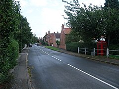
Blidworth is a village and civil parish approximately five miles east of Mansfield, Nottinghamshire, England. The population of the civil parish at the 2011 census was 4,457, this dropped to 4,295 in the 2021 census. Its history can be traced back to the 10th century, although many of the current houses were built in the first half of the 20th century to provide housing for workers at Blidworth Colliery (1926–1989). These are mainly in estates north of Dale Lane, known as New Blidworth. The area around Main Street, west of Beck Lane and including the church, is Old Blidworth, containing some of the oldest buildings. Blidworth Bottoms is a hamlet about 0.5 km south of Old Blidworth, while Haywood Oaks is the portion of the village south of Dale Lane and the south eastern rural area of the parish surrounding Haywood Oaks Lane.

North Leverton with Habblesthorpe is a village and civil parish in the English county of Nottinghamshire. It is about 5 miles or 8 km east of Retford. The population as at the 2011 Census was 1,047, and in the Census 2021 it had increased to 1,079.

Rampton is a village in the civil parish of Rampton and Woodbeck, about 6 miles (10 km) east of Retford in the Bassetlaw district, in the county of Nottinghamshire, England. The parish is long and thin, extending about 7 miles (11 km) east–west but only about 1 mile (1.6 km) north–south. Its eastern boundary is the River Trent, which here also forms the county boundary with Lincolnshire.

Bleasby is a village and civil parish in Nottinghamshire, England, located 15 mi northeast of Nottingham. It has a population of 804 for the 2001 census, increasing to 824 at the 2011 census, and 840 at the 2021 census.
East Bridgford is a village and civil parish in the Rushcliffe borough of Nottinghamshire, east of the city of Nottingham. It had a population of 1,814 at the 2011 census. The village adjoins the south bank of the River Trent, opposite the village of Gunthorpe. It is on the Trent Valley Way. East Bridgford's an annual village show is run by the village Horticultural Society, established in 1864, and held every Feast Week.

Radcliffe-on-Trent is a village and civil parish in the Rushcliffe borough of Nottinghamshire, England. The population of the civil parish at the Census 2011 was 8,205, falling slightly at the Census 2021 to 8,145

Beckingham is a village and civil parish in the Bassetlaw district of Nottinghamshire, England, about 3 miles west of Gainsborough, Lincolnshire. According to the 2001 census it had a population of 1,168, reducing to 1,098 in 2011 but increasing to 1,288 in 2021.

Bole is a village and civil parish in the Bassetlaw district of Nottinghamshire, England. It is close by the River Trent, on the eastern side of which is Gainsborough in Lincolnshire. At one time the village stood – like the neighbouring parish of West Burton – very near to an oxbow lake, known as Bole Round. However flooding led to the original course of the River Trent being diverted after 1792. The parish now lies within a landscape largely dominated by the West Burton power stations. According to the 2001 census Bole had a population of 140,a count of 247 at the 2011 census, and singularly reported as 135 in 2021.

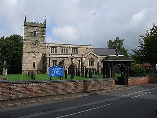
Plumtree is a village and civil parish in the borough of Rushcliffe, Nottinghamshire. At the time of the 2001 census it had a population of 221, increasing to 246 at the 2011 census. It is situated 5 miles south east of Nottingham, between the villages of Tollerton and Keyworth. Some of the farming land around the village is owned by the Duchy of Cornwall. The parish church of St Mary has a Norman tower on Saxon foundations, which were found when the tower was rebuilt in 1906. The nave is of 13th-century date. The north aisle was rebuilt and extended with stone from Nottingham's medieval Trent Bridge in 1873. Edward Hagarty Parry (1855–1931), an association footballer who captained Old Carthusians F.C. when they won the 1881 FA Cup Final against Old Etonians, is buried in the churchyard.

Strelley is a village and former civil parish in the Borough of Broxtowe and City of Nottingham in Nottinghamshire, England. It is to the west of Nottingham. The population of the civil parish taken at the 2011 census was 653, and 496 at the 2021 census. It is also the name of the nearby post war council housing estate. The village lies mainly in the Broxtowe district with a small portion crossing over into the city administrative area, whilst the estate is fully contained in the city of Nottingham. The village is separated from the housing estate by the A6002 road.

Gringley on the Hill, Nottinghamshire, is an English village and parish. The population of the civil parish at the 2011 census was 699, increasing to 854 in 2021. It is on the highest part of the road from Bawtry to Gainsborough, six miles east-southeast of the former, and the same distance west by north of the latter town.

Carlton-on-Trent is a small village and civil parish in England, located between the River Trent and the A1 road near Newark-on-Trent in Nottinghamshire. The population of the civil parish was 228 at the 2001 census, increasing only marginally to 229 at the 2011 census and similarly to 230 at the 2021 census.

Caunton is a village and civil parish in the Newark and Sherwood district of Nottinghamshire on the A616, six miles (9.7 km) north-west of Newark-on-Trent, in the NG23 postcode. The population of the civil parish at the 2011 census was 483, and this increased to 508 at the 2021 census.

Farnsfield is a large village and civil parish in Nottinghamshire in Sherwood Forest. It is in the local government district of Newark and Sherwood. The population of the civil parish as at the 2011 Census was 2,731, an increase from 2,681 in the United Kingdom Census 2001.

Misterton is a village and civil parish in the Bassetlaw district of Nottinghamshire, England. The parish population at the 2011 census was 2,140, and has risen to 2,191 residents in the 2021 census.
Kneesall is a village and civil parish in the East Midlands of England in the county of Nottinghamshire. The population of the civil parish at the 2011 census was 221. Forming part of the Newark and Sherwood district, Kneesall is situated on the A616 between Newark-on-Trent and Ollerton. The village is three miles from neighbouring Eakring and four miles from Laxton.

Everton is a village and civil parish in Nottinghamshire, England. Located on the A631 between Gainsborough and Bawtry, it is part of Bassetlaw district. The parish includes the village of Harwell. The population of the civil parish at the 2011 census was 839, and this increased to 902 in 2021. There are 23 grade II listed buildings in the village. The village is recorded in the Domesday Book of 1086–7 as Evretone. Everton was originally a Danish settlement by the name of Eofor-tun. For the majority of its history Everton's inhabitants have been farmers. Everton is twinned with the French village of Bouy in Champagne Ardenne, France.

Coddington is an English village and civil parish in Nottinghamshire, 3 miles (4.8 km) east of Newark-on-Trent. According to the 2001 census it had a population of 972, which increased to 1,684 at the 2011 Census and to 1,538 at the 2021 census.

Walkeringham is a village and civil parish in Nottinghamshire, England. According to the 2001 census it had a population of 908, increasing to 1,022 at the 2011 census, and additionally to 1,118 at the 2021 census. The parish church of St Mary Magdalen is 13th century. It has one public house: The Fox and Hounds.

Warsop is a town and civil parish in Mansfield District, Nottinghamshire, England, on the outskirts of the remnants of Sherwood Forest. At the 2021 census the population was 12,644 resaidents, including Church Warsop, Meden Vale, Sookholme and Spion Kop.