Austrey, Warwickshire

Last updated

Austrey
St. Nicholas, Austrey - geograph.org.uk - 118988.jpg
Saint Nicholas parish church, Austrey
Warwickshire UK location map.svg
Red pog.svg
Austrey
Location within Warwickshire
Population1,527 (2011 census) [1]
OS grid reference SK294065
  London 104 miles
Civil parish
  • Austrey
District
Shire county
Region
Country England
Sovereign state United Kingdom
Post town Atherstone
Postcode district CV9
Dialling code 01827
Police Warwickshire
Fire Warwickshire
Ambulance West Midlands
UK Parliament
Website Welcome to Austrey
List of places
UK
England
Warwickshire
52°39′21″N1°33′55″W / 52.655751°N 1.565414°W / 52.655751; -1.565414

Austrey is a village and civil parish in the North Warwickshire District of Warwickshire, England. [2] and the village lies at the northern extremity of the county.

Contents

Location

With a population of over 1,500 inhabitants, Austrey lies in a peaceful, pretty and central location at the far northeastern extremity of North Warwickshire and is also uniquely close to three County Boundaries of Leicestershire (less than a mile to the East), Staffordshire (less than two miles to the North) and Derbyshire (less than four miles to the North East). North Warwickshire Villages of Newton Regis (1 mile), Polesworth (3 miles), Dordon (4 miles), Warton (1.5 miles), No Man's Heath (1.5 miles) and Leicestershire villages of Appleby Parva (1.5 miles), Appleby Magna (2 miles), Twycross (2.5 miles), Norton-juxta-Twycross (1.5 miles), Orton on the Hill (1.5 miles) are the local neighbouring villages. Austrey is two miles by road from Junction 11 of the M42 motorway/A42 and this Motorway corridor provides excellent access to many fast transport links.

Amenities and facilities

Austrey is a vibrant and active village that has the benefit of a Village Shop, Post Office, Primary School, Pre-School and a Playgroup. The village has two Churches, St Nicholas Church of England that dates back to the 13th century and an early-19th-century Baptist Church. The Bird in Hand is a 15th Century thatched Pub and Village Hall (former Parochial School, which was erected in 1850) are both well frequented. The area in and around Austrey has many equestrian livery yards and stables providing great facilities for equine enthusiasts.

There are a number of Village Clubs and Societies including:- Allotment Society, Archery Group, Art Group, Austrey Rangers Football Club, Bridge Club, Cricket Club, Gardening Society, Golf Society, Neighbourhood Watch, Scout Group, Tennis Club, The WI and a Walking Group. There are a number of mobile businesses that regularly visit the village and these include a Butcher, Fruit and Vegetable van, Dairy Crest Milk, Mobile Library and Fish and Chip van. Most of the village properties have the benefit of all public utilities including gas, water, sewerage, telephone and electricity.

Origins of the parish

The village was sometimes spelt 'Alestry'. [3] In the Saxon era Austrey formed part of a great block of seventy or eighty Midlands vills belonging to Wulfric Spot, the Mercian nobleman who founded Burton Abbey. In Wulfric Spot's will of 1004 Wulfric left Austrey "as it now stands with meat and with men", to one of his thegns who later transferred this part of the vill to the abbey. After the Norman conquest the abbot was forced to share suzerainty with Nigel d'Aubigny, one of the Conqueror's trusted retinue, who was given lands in the parish as part of the spoils of the English defeat. Although he retained two and a half hides in Austrey, the abbot was no longer the principal landowner in the parish. The Domesday Book of 1086 records 42 inhabitants in the town.

The monks of Burton-upon-Trent took advantage of rising wool prices in the medieval period to sublet their estates for sheep walks. Aubigny lands reverted to Burton Abbey. In 1538 during the Dissolution of the Monasteries the Abbey surrendered its lands to the Crown. [4] In 1541 the abbey was refounded as a collegiate church and Austrey manor was restored to it. [4] However, in 1545 the collegiate church was dissolved and in 1546 the Crown granted Austrey manor to Sir William Paget. [4] His son Henry Paget inherited Austrey manor in 1563 and still owned it in 1587. [4] Thereafter the manor was divided into freehold farms that were sold to the wealthier tenants. One of the Austrey manors came into the possession of the Kendalls of Smithsby through marriage with one of Henry Alstre's co-heiresses in 1433.

The Kendalls were well-established in Austrey by 1550 and they continued to consolidate their position after this date. The other Austrey manor held by Sir Walter Aston was broken up and divided among his tenants in the early 17th century. By the Tudor period the village was divided into two separate parts: the original settlement cluster around the church and market cross at Over End and a later extension at Nether End. The Kendalls, hereditary lords of the manor, declared support for Parliament at the outbreak of the English Civil War and became involved with conventicles and dissent in the latter half of the 17th century. Henry Kendall was governor of the parliamentary garrison at Maxstoke from March 1644 to October 1645. The parish provided free quartering for a considerable force of parliamentarians commanded by Colonel Drummond and Sir Thomas Fairfax in 1646. It is the namesake of Austrey School, Karachi, Pakistan. [5]

Parish church

Austrey had a parish church by 1155. [4] The oldest part of the present Church of England parish church of Saint Nicholas is the Early English Gothic tower, [6] which was built in the middle of the 13th century. The remainder of the church was rebuilt early in the 14th century in the Decorated Gothic style. [6] The nave has a clerestory and is flanked by north and south aisles, each of four bays. [6] The Gothic Revival architect Ewan Christian restored the chancel with new windows in 1844–45. [6] The original church had a leaded roof with a castellated wall; drawings of the church in the pre-Victorian format are held by Birmingham Central Library. In the Victorian era the current pitched roof replaced the original and the porch was added.

The tower has a ring of five bells. [7] Three including the tenor were cast by Hugh Watts II [7] of Leicester [8] in 1632. [7] Another was cast by Thomas Rudhall of Gloucester in 1770. [8] [7] The treble was recast by James Barwell of Birmingham in 1911 [8] [7] from another 1632 bell by Hugh Watts. [4]

St. Nicholas' parish is now part of the Parish of All Souls, North Warwickshire along with the villages of Newton Regis, Seckington, Shuttington and Warton. [9]

Settlement

The line of earthworks below the church in the area known as the Bishop's Field are part of a complex of water management ducts and ponds with this area used as water meadows. A quote from George Barwell of Shuttington in 1790 :- "in the parish of Austrey where he was born it has been the custom ever since he can remember (sixty years) to throw the rich waters which are collected in rainy seasons on the common fields lying on the side of the hill above the village, over the meadows which are below it, by means of floodgates and floating trenches." Also in the Bishops Field is a natural spring known as the holy well. The new settlement at the Nether End probably originated with Earl Leofric's original grant to Burton Abbey, which would account for the siting of the monks' farmstead at nearby Bishop's Farm. The medieval pattern of settlement was scythe-shaped with tenements lining the main street running roughly parallel to the ridgeway from Orton to No Man's Heath.

The earliest record of the customary tenants on Sir William Paget's demesne in Tudor times is a partial list of the Austrey copyholders with the number of virgates held by each from a surviving manor court roll. All but two of the twelve tenants listed on the demesne in 1546 held a single virgate; one (Richard Cryspe) had a quarter and the other (Elizabeth Clerke) two virgates. Most of these family names are listed in the 17th century attached to Austrey farmers or craftsmen paying for a single hearth in the hearth tax returns. The two ends of the village had separate water treatment reed beds on the streams just outside the village – the area behind the current sewage pumping system at the South West corner of the village is still owned by Severn Trent Water. The parish has a Church of England primary school [10] and a bus link to the local secondary school in Polesworth.

Related Research Articles

<span class="mw-page-title-main">Burton upon Trent</span> Town in East Staffordshire, England

Burton upon Trent, also known as Burton-on-Trent or simply Burton, is a market town in the borough of East Staffordshire in the county of Staffordshire, England, close to the border with Derbyshire. In 2021, it had a population of 76,270. The demonym for residents of the town is Burtonian. Burton is located 11 miles (18 km) south-west of Derby, 27 miles (43 km) north-west of Leicester, 28 miles (45 km) west-south-west of Nottingham and 20 miles (32 km) south of the southern entrance to the Peak District National Park.

<span class="mw-page-title-main">Stowe, Buckinghamshire</span> Human settlement in England

Stowe is a civil parish and former village about two miles northwest of Buckingham in the unitary authority area of Buckinghamshire, England. The parish includes the hamlets of Boycott, Dadford and Lamport.

<span class="mw-page-title-main">North Warwickshire</span> Borough & Non-metropolitan district in England

North Warwickshire is a local government district with borough status in the ceremonial county of Warwickshire, West Midlands, England. The borough includes the two towns of Atherstone and Coleshill, and the large villages of Polesworth, Kingsbury, Hartshill and Water Orton.

<span class="mw-page-title-main">Polesworth Abbey</span> Church in Polesworth, England

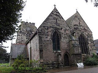
Polesworth Abbey was a Benedictine nunnery in Polesworth, North Warwickshire, England.

<span class="mw-page-title-main">Monks Kirby</span> Village and civil parish in Warwickshire, England

Monks Kirby is a village and civil parish in north-eastern Warwickshire, England. The population of the parish is 445. Monks Kirby is located around one mile east of the Fosse Way, around 8 miles north-west of Rugby, seven miles north-east of Coventry and six miles west of Lutterworth. Administratively it forms part of the borough of Rugby. One of the largest and most important villages in this part of Warwickshire in the Anglo-Saxon and later medieval period, the village continued to be a local administrative centre into the early 20th century.

<span class="mw-page-title-main">Willoughby, Warwickshire</span> Human settlement in England

Willoughby is a village and civil parish about 5 miles (8 km) south of Rugby, Warwickshire, England. The village is about 4.5 miles (7 km) northwest of Daventry in neighbouring Northamptonshire and the eastern boundary of the parish forms part of the county boundary.

<span class="mw-page-title-main">Polesworth</span> Human settlement in England

Polesworth is a large village and civil parish in the North Warwickshire district of Warwickshire, England. It is situated close to the northern tip of Warwickshire, adjacent to the border with Staffordshire. It is 3 miles (5 km) east of Tamworth, and is 5 miles (8 km) northwest of Atherstone.

<span class="mw-page-title-main">Newton Regis</span> Human settlement in England

Newton Regis is a village and civil parish in the North Warwickshire district of Warwickshire, England. It has a population of 599 at the 2011 Census.

<span class="mw-page-title-main">Appleby Magna</span> Human settlement in England

Appleby Magna is a village and civil parish in the North West Leicestershire district, in the county of Leicestershire, England. It includes the small hamlets of Appleby Parva and Little Wigston.

<span class="mw-page-title-main">Warton, Warwickshire</span> Village in Warwickshire, England

Warton is a village in the North Warwickshire district of Warwickshire, England. It is five miles east of Tamworth and four miles north-west of Atherstone, and is in the civil parish of Polesworth. Warton is a small village, which, being surrounded by rivers, may derive its name from Waverton. There is still a Waverton Avenue in the village, even though the street was actually constructed in the 1960s. The village has grown considerably since the 1960s, when its character was changed after an inflow of overspill families from Birmingham. Although small, the village has a pub, as well as a Working Men's Club. There is one shop – Maypole Stores, named after the Maypole that stood at the highest point of the village. In the 1980s, there were several shops, but all but one have now closed. Up until the late 1990s, there were two functional shops in the village, but the most northern one was converted into a residential property by its owner.

<span class="mw-page-title-main">Orton on the Hill</span> Human settlement in England

Orton on the Hill is a village and former civil parish, now in the parish of Twycross, in the Hinckley and Bosworth district of Leicestershire, England. Orton adjoins Morebarne, Sheepy and Newhouse Grange on the south, Appleby and Austrey to the east.

<span class="mw-page-title-main">Denchworth</span> Human settlement in England

Denchworth is a village and civil parish about 2.5 miles (4 km) north of Wantage. It was part of Berkshire until the 1974 boundary changes transferred the Vale of White Horse to Oxfordshire. The 2011 Census recorded the parish's population as 171. The parish is bounded by the Land Brook in the west and the Childrey Brook in the east. The Great Western Main Line between Reading and Swindon runs through the parish just south of the village, but there is no station.

<span class="mw-page-title-main">Burton Abbey</span>

Burton Abbey at Burton upon Trent in Staffordshire, England, was founded in the 7th or 9th century by St Modwen or Modwenna. It was refounded in 1003 as a Benedictine abbey by the thegn Wulfric Spott. He was known to have been buried in the abbey cloister in 1010, alongside the grave of his wife.

<span class="mw-page-title-main">Weston-on-the-Green</span> Human settlement in England

Weston-on-the-Green is a village and civil parish in the Cherwell district of Oxfordshire, England, about 4 miles (6 km) southwest of Bicester. The 2011 Census recorded the parish population as 523.

<span class="mw-page-title-main">Overseal</span> Human settlement in England

Overseal is a village and civil parish in South Derbyshire district of Derbyshire, England. It is 3 miles (4.8 km) south of Swadlincote, 5 miles (8.0 km) west of Ashby-de-la-Zouch and 13 miles (21 km) south-southwest of Derby. It had a population of the civil parish at the 2011 census was 2,450. Situated within the National Forest area, it is near the villages of Netherseal and Lullington as well as being close to the border with Leicestershire. It is one of the southernmost settlements in Derbyshire.

<span class="mw-page-title-main">Alvecote</span> Human settlement in England

Alvecote is a hamlet in the North Warwickshire district of Warwickshire, England, situated on the county border with Staffordshire. Other settlements nearby are Shuttington, Polesworth and the Tamworth district of Amington. Central Tamworth is approximately 3 miles west-southwest of Alvecote.

<span class="mw-page-title-main">Leigh, Staffordshire</span> Human settlement in England

Leigh is a civil parish in the English county of Staffordshire. The parish includes the village of Church Leigh, together with the settlements of Withington, Upper Leigh, Lower Leigh, Morrilow Heath, Middleton Green, Dodsley, Godstone, Nobut and Field.

<span class="mw-page-title-main">Shuttington</span> Human settlement in England

Shuttington is a village and civil parish in North Warwickshire, England, situated north-east of Tamworth, Staffordshire. In the 2001 census, the parish, which also includes Alvecote, had a population of 563, decreasing to 536 at the 2011 census. The River Anker flows through the parish, with Shuttington north-east of the river, and Alvecote south of it. The West Coast Main Line passes through Alvecote, with the Coventry Canal parallel to it and a marina south of the canal. Most of the parish is rural, including the village of Shuttington, although there was colliery alongside the railway at Alvecote.

<span class="mw-page-title-main">Norton Juxta Twycross</span> Human settlement in England

Norton Juxta Twycross, usually known as simply "Norton"(or "Norton-Juxta"), is a village and former civil parish, now in the parish of Twycross, in the Hinckley and Bosworth district, in the county of Leicestershire, England. The village is part of the church parish of Appleby Magna, with the vicar based in Appleby. In 1931 the parish had a population of 249.

<span class="mw-page-title-main">Seckington</span> Human settlement in England

Seckington is a village and civil parish in North Warwickshire, about 4 miles (6 km) northeast of Tamworth. The B4593 road between Tamworth and Appleby Magna runs through the parish, passing about 100 yards (91 m) north of the village. Seckington shares a parish council with Newton Regis and No Man's Heath. Forming part of the border with Staffordshire, it is the second most northerly settlement in Warwickshire, with only No Man's Heath situated further north, and is only 3.5 miles due south of the Derbyshire border.

References

  1. "Area: Austrey CP (Parish): 2011 Census". Neighbourhood Statistics. Office for National Statistics. Retrieved 11 June 2013.
  2. OS Explorer Map 232 : Nuneaton & Tamworth: (1:25 000) : ISBN   0 319 46404 0
  3. The Birmingham and Midland Society for Genealogy and Heraldry: Austrey Archived 6 September 2005 at the Wayback Machine
  4. 1 2 3 4 5 6 Salzman, 1947, pages 9–13
  5. "Ermine Schools - Ermine". Archived from the original on 2 July 2017. Retrieved 24 June 2014.
  6. 1 2 3 4 Pevsner & Wedgwood, 1966, page 79
  7. 1 2 3 4 5 "Place: Austrey S Nicholas". Dove's Guide for Church Bell Ringers. Retrieved 21 April 2010.
  8. 1 2 3 "Bell Founders". Dove's Guide for Church Bell Ringers. Archived from the original on 4 September 2015. Retrieved 21 April 2010.
  9. All Souls – North Warwickshire Parish Web site
  10. "Austrey C of E Primary School". Archived from the original on 24 April 2013. Retrieved 11 June 2013.

Sources