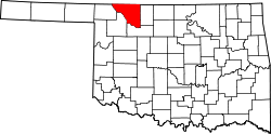
Avard, Oklahoma

Last updated

Avard, Oklahoma
OKMap-doton-Avard.PNG
Location of Avard, Oklahoma
Coordinates: 36°41′57″N98°47′24″W / 36.69917°N 98.79000°W / 36.69917; -98.79000
Country United States
State Oklahoma
County Woods
Area
[1]
  Total0.10 sq mi (0.27 km2)
  Land0.10 sq mi (0.27 km2)
  Water0.00 sq mi (0.00 km2)
Elevation
[2]
1,476 ft (450 m)
Population
 (2020)
  Total11
  Density104.76/sq mi (40.62/km2)
Time zone UTC-6 (Central (CST))
  Summer (DST) UTC-5 (CDT)
FIPS code 40-03550 [3]
GNIS feature ID1089768 [2]

Avard is a settlement in Woods County, Oklahoma, United States. It is southwest of Alva, and northeast of Waynoka. [4] The population was 26 at the 2000 census. [5] After initial growth, Avard began declining in the 1930s. Avard had a post office from June 1, 1895, until November 22, 1963. As of the 2010 census, Avard was listed as disincorporated, although it still appears as a Census-Designated Place. [6]

Contents

History

The post office was first established in Avard in 1895 and the town was incorporated in 1904 when the Frisco tracks were extended westward from Enid to tie in with the Santa Fe. [5] The town was named for Isabell Avard Todd, the wife of Robert Todd. The town was served by the Southern Arkansas Railway (Santa Fe) and Arkansas Valley and Western Railroad (Frisco). [5]

Avard had mercantile establishments, two hotels, a bank, a livestock auction, and an elevator. A weekly newspaper, the Avard Tribune [5] operated from 1904 to 1918. [7] It was a major cattle shipping point for the area. [5]

A total of 250 people lived in the town in 1909. [5]

It was an important rail transfer point for freight and passengers from 1910 to 1930. [5]

Avard continued to grow until the mid-1930s. [5] Then the town started to decline due to the economic depression, dust storms, farm consolidation, and changing travel habits. [5] Additionally, the town was struck by tornadoes in both 1943 and 1944. [5]

Today, only an elevator and church are left in operation. [5] There are also a few unused store buildings. [5]

But the area still has important rail connections, including the BNSF Railway’s Avard Subdivision which runs from Avard to Tulsa. [8] It is also the location of the Avard Regional Industrial Rail Park, which is a rail-served industrial park given site-certification by the BNSF to ensure the location is ready for rapid development. [9]

Geography

Avard is located at 36°41′57″N98°47′24″W / 36.69917°N 98.79000°W / 36.69917; -98.79000 (36.699116, -98.790078). [10]

According to the United States Census Bureau, the town has a total area of 0.2 square miles (0.52 km2), all land.

Demographics

Historical population
CensusPop.Note
1910 170
1920 147−13.5%
1930 21244.2%
1940 126−40.6%
1950 96−23.8%
1960 56−41.7%
1970 595.4%
1980 51−13.6%
1990 37−27.5%
2000 26−29.7%
2020 11
U.S. Decennial Census

As of the census [3] of 2000, there were 26 people, 13 households, and 6 families residing in the town. The population density was 126.7 inhabitants per square mile (48.9/km2). There were 17 housing units at an average density of 82.8 per square mile (32.0/km2). The racial makeup of the town was 96.15% White, and 3.85% from two or more races.

There were 13 households, out of which 30.8% had children under the age of 18 living with them, 46.2% were married couples living together, and 53.8% were non-families. 46.2% of all households were made up of individuals, and 15.4% had someone living alone who was 65 years of age or older. The average household size was 2.00 and the average family size was 3.00.

In the town, the population was spread out, with 19.2% under the age of 18, 7.7% from 18 to 24, 26.9% from 25 to 44, 26.9% from 45 to 64, and 19.2% who were 65 years of age or older. The median age was 42 years. For every 100 females, there were 116.7 males. For every 100 females age 18 and over, there were 110.0 males.

The median income for a household in the town was $23,750, and the median income for a family was $40,000. Males had a median income of $23,750 versus $14,583 for females. The per capita income for the town was $11,757. There were no families and 17.1% of the population living below the poverty line, including no under eighteens and 50.0% of those over 64.

Related Research Articles

<span class="mw-page-title-main">Woods County, Oklahoma</span> County in Oklahoma, United States

Woods County is a county located in the northwestern part of the U.S. state of Oklahoma. As of the 2020 census, the population was 8,624. Its county seat is Alva. The county is named after Samuel Newitt Wood, a renowned Kansas populist.

<span class="mw-page-title-main">Garfield County, Oklahoma</span> County in Oklahoma, United States

Garfield County is a county located in the U.S. state of Oklahoma. As of the 2020 census, the population was 62,846. Enid is the county seat and largest city within Garfield County. The county is named after President James A. Garfield.

<span class="mw-page-title-main">Hardy, Arkansas</span> City in Sharp and Fulton counties, US

Hardy is the 2nd oldest city in Sharp and Fulton counties in the U.S. state of Arkansas. The population was 765 in 2020.

<span class="mw-page-title-main">Goltry, Oklahoma</span> Town in Oklahoma, United States

Goltry is an incorporated rural small town in Alfalfa County, Oklahoma, United States. The population was 249 at the 2010 census. Located there are a town hall, a post office, a farmer's co-op with gas service, a fire department, and a bank, with several blocks of homes.

<span class="mw-page-title-main">Breckinridge, Oklahoma</span> Town in Oklahoma, United States

Breckinridge, sometimes spelled Breckenridge, is a town in Garfield County, Oklahoma, United States. The population was 199 as of the 2020 Census.

<span class="mw-page-title-main">Covington, Oklahoma</span> Town in Oklahoma, United States

Covington is a town in Garfield County, Oklahoma, United States. The population was 477 at the 2020 census.

<span class="mw-page-title-main">Fairmont, Oklahoma</span> Town in Oklahoma, United States

Fairmont is a town in Garfield County, Oklahoma, United States. The population was 134 at the 2010 census, a decrease from 147 at the 2000 census.

<span class="mw-page-title-main">Mill Creek, Oklahoma</span> Town in Oklahoma, United States

Mill Creek is a town in Johnston County, Oklahoma, United States. The population was 319 at the 2010 census, a decline from the figure of 340 in 2000. Mill Creek Community is an unincorporated area of Johnston County that surrounds the town and claims to have about 1,000 residents, including those who live within the town limits. Local residents consider the town as the focal point of the community.

<span class="mw-page-title-main">Cameron, Oklahoma</span> Town in Oklahoma, United States

Cameron is a town in Le Flore County, Oklahoma, United States. It is part of the Fort Smith, Arkansas-Oklahoma Metropolitan Statistical Area. The population was 302 at the 2010 census, a decline of 3.2 percent from the figure of 312 recorded in 2000.

<span class="mw-page-title-main">Madill, Oklahoma</span> City in Oklahoma, United States

Madill is a city in and the county seat of Marshall County, Oklahoma, United States. It was named in honor of George Alexander Madill, an attorney for the St. Louis-San Francisco Railway. The population at the 2010 census was 3,770, an increase of 10.8 percent from 3,410 at the 2000 census. It is best known as the site of the annual National Sand Bass Festival. It is part of the Texoma region.

<span class="mw-page-title-main">Goldsby, Oklahoma</span> Town in Oklahoma, United States

Goldsby is a town in McClain County, Oklahoma, United States. It lies within the Washington public school district and is home to the second largest casino in Oklahoma. As of the 2020 Census, the estimated population was 2,694, a 66 percent increase since 2010.

<span class="mw-page-title-main">Morrison, Oklahoma</span> Town in Oklahoma, United States

Morrison is a town in southeastern Noble County, Oklahoma, United States. The population was 733 at the 2010 census, an increase from the figure of 636 in 2000.

<span class="mw-page-title-main">Wynona, Oklahoma</span> Incorporated town in Osage County, Oklahoma

Wynona is an incorporated town in central Osage County, Oklahoma, United States. It was founded by a local Osage-Cherokee rancher, Antoine Rogers, in 1903. The population was 437 at the 2010 census, a 17.7 percent decline from 531 in 2000.

<span class="mw-page-title-main">Afton, Oklahoma</span> Town in Oklahoma, United States

Afton is a town in northeast Oklahoma in Ottawa County, Oklahoma, United States. The population was 734 at the time of the 2020 United States census.

<span class="mw-page-title-main">Alderson, Oklahoma</span> Town in Oklahoma, United States

Alderson is a town in Pittsburg County, Oklahoma, United States. The population was 304 at the 2010 census.

<span class="mw-page-title-main">Gans, Oklahoma</span> Town in Oklahoma, United States

Gans is a town in Sequoyah County, Oklahoma, United States. It is part of the Fort Smith, Arkansas-Oklahoma Metropolitan Statistical Area. The population was 312 at the 2010 census, an increase of 50 percent over the figure of 208 recorded in 2000.

<span class="mw-page-title-main">Empire City, Oklahoma</span> Town in Oklahoma, United States

Empire City, or simply Empire, is a town in Stephens County, Oklahoma, United States. The population was 703 at the time of the 2020 Census.

<span class="mw-page-title-main">Manitou, Oklahoma</span> Town in Oklahoma, United States

Manitou is a town in Tillman County, Oklahoma, United States. The population was 171 as of the 2020 United States census. It includes the former town of Siboney, absorbed on January 28, 1907.

<span class="mw-page-title-main">Rocky, Oklahoma</span> Town in Oklahoma, United States

Rocky is a town in Washita County, Oklahoma, United States. The population was 162 at the 2010 United States Census, a 6.9 percent decline from the figure of 174 in 2000. The town lies along U.S. Route 183.

<span class="mw-page-title-main">Alva, Oklahoma</span> City in Oklahoma, United States

Alva is a city in and the county seat of Woods County, Oklahoma, United States, along the Salt Fork Arkansas River. The population was 5,028 at the time of the 2020 Census, up from 4,945 at the 2010 census. Northwestern Oklahoma State University is located in Alva.

References

  1. "ArcGIS REST Services Directory". United States Census Bureau. Retrieved September 20, 2022.
  2. 1 2 U.S. Geological Survey Geographic Names Information System: Avard, Oklahoma
  3. 1 2 "U.S. Census website". United States Census Bureau . Retrieved January 31, 2008.
  4. "Avard, Oklahoma". Google Maps. Retrieved July 15, 2020.
  5. 1 2 3 4 5 6 7 8 9 10 11 12 Morris, John (1977). Ghost Towns of Oklahoma. Norman, Oklahoma: University of Oklahoma Press. p. 229. ISBN   978-0-8061-1420-0.
  6. "Avard (CDP), Oklahoma". United States Census Bureau. Retrieved April 20, 2024.
  7. "About this Newspaper: The Avard tribune". Chronicling America. Library of Congress. Retrieved July 12, 2009.
  8. Miller, Ryan (February 21, 2018). "BNSF announced $110 million 2018 capital program in Oklahoma". Enid News and Eagle. Archived from the original on February 22, 2018. Retrieved March 19, 2018.
  9. "Avard Regional Industrial Rail Park, Avard, Oklahoma" (PDF). BNSF Railway. Retrieved July 2, 2020.
  10. "US Gazetteer files: 2010, 2000, and 1990". United States Census Bureau. February 12, 2011. Retrieved April 23, 2011.