Avon, Montana

Last updated
Avon, Montana
CDP
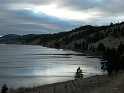
Fitzpatrick Ranch Lakeview Avon Montana.JPG
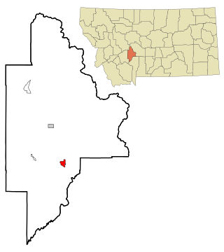
Powell County Montana Incorporated and Unincorporated areas Avon Highlighted.svg
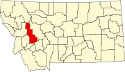
Location of Avon, Montana
Coordinates: 46°35′57″N112°35′56″W / 46.59917°N 112.59889°W / 46.59917; -112.59889
Country United States
State Montana
County Powell
Area
[1]
  Total13.37 sq mi (34.62 km2)
  Land13.36 sq mi (34.61 km2)
  Water0.00 sq mi (0.01 km2)
Elevation
[2]
4,692 ft (1,430 m)
Population
 (2020)
  Total114
  Density8.53/sq mi (3.29/km2)
Time zone UTC-7 (Mountain (MST))
  Summer (DST) UTC-6 (MDT)
ZIP code
59713
Area code 406
FIPS code 30-03175
GNIS feature ID0779204 [2]

Avon is a census-designated place (CDP) in Powell County, Montana, United States. The population was 124 at the 2000 census. The town sits along the Little Blackfoot River, and serves as a gateway to the Beaverhead-Deerlodge National Forest.

Contents

The post office was opened in 1884 by Bill Cramer. [3] The town was named Avon after the Welsh word for river. [4] The town served as a supply point for nearby ranchers, prospectors, and miners.

The town includes the Fitzpatrick Ranch Historic District, a designated location on the National Register of Historic Places.

Geography

Avon is located at 46°35′57″N112°35′56″W / 46.59917°N 112.59889°W / 46.59917; -112.59889 (46.599204, -112.598899). [5]

According to the United States Census Bureau, the CDP has a total area of 13.4 square miles (35 km2), all land.

Demographics

Historical population
CensusPop.Note
2000 124
2010 111−10.5%
2020 1142.7%
U.S. Decennial Census [6]

As of the census [7] of 2000, there were 124 people, 48 households, and 28 families residing in the CDP. The population density was 9.3 inhabitants per square mile (3.6/km2). There were 62 housing units at an average density of 4.6 per square mile (1.8/km2). The racial makeup of the CDP was 100.00% White.

There were 48 households, out of which 29.2% had children under the age of 18 living with them, 56.3% were married couples living together, and 39.6% were non-families. 35.4% of all households were made up of individuals, and 18.8% had someone living alone who was 65 years of age or older. The average household size was 2.58 and the average family size was 3.52.

In the CDP, the population was spread out, with 33.9% under the age of 18, 4.0% from 18 to 24, 25.0% from 25 to 44, 25.0% from 45 to 64, and 12.1% who were 65 years of age or older. The median age was 39 years. For every 100 females there were 79.7 males. For every 100 females age 18 and over, there were 90.7 males.

The median income for a household in the CDP was $25,208, and the median income for a family was $25,625. Males had a median income of $31,750 versus $22,969 for females. The per capita income for the CDP was $12,777. There were 30.8% of families and 41.2% of the population living below the poverty line, including 63.2% of under eighteens and 16.7% of those over 64.

Related Research Articles

<span class="mw-page-title-main">Pisinemo, Arizona</span> CDP in Pima County, Arizona

Pisinemo is a census-designated place (CDP) in Pima County, Arizona, United States. The population was 340 as of the 2020 census.

<span class="mw-page-title-main">Muddy, Montana</span> Census-designated place in Montana, United States

Muddy or Heóvonėheo'hé'e is a census-designated place (CDP) in Big Horn County, Montana, United States and home to the Heóvonėheo'hé'etaneo'o or Heóvonêheo'he'é-taneno Cheyenne people. The population was 617 at the 2010 census.
<span class="mw-page-title-main">Toston, Montana</span> Census-designated place in Montana, United States

Toston is a census-designated place (CDP) in Broadwater County, Montana, United States. The population was 108 at the 2010 census.

<span class="mw-page-title-main">Fort Shaw, Montana</span> CDP in Montana, United States

Fort Shaw is a census-designated place (CDP) in Cascade County, Montana, United States. The population was 280 at the 2010 census. Named for a former United States military outpost, it is part of the Great Falls, Montana Metropolitan Statistical Area.

<span class="mw-page-title-main">Sun Prairie, Montana</span> CDP in Montana, United States

Sun Prairie is a census-designated place (CDP) in Cascade County, Montana, United States. The population was 1,630 at the 2010 census. It is part of the Great Falls Metropolitan Statistical Area and may have evolved as a remote suburb of Great Falls.

<span class="mw-page-title-main">Jefferson City, Montana</span> Census-designated place in Montana, United States

Jefferson City is an unincorporated community and census-designated place (CDP) in Jefferson County, Montana, United States. The population was 472 at the 2010 census. It is part of the Helena Micropolitan Statistical Area.

<span class="mw-page-title-main">Augusta, Montana</span> Census-designated place in Montana, United States

Augusta is an unincorporated community and census-designated place (CDP) in Lewis and Clark County, Montana, United States. The population was 309 at the 2010 census and rose to 316 in the 2020 census. The most accepted version in the naming of this town is after Augusta Hogan, thought to be the first child born in this town, the daughter of J. D. Hogan, an early rancher.

<span class="mw-page-title-main">Helena Valley Northwest, Montana</span> CDP in Montana, United States

Helena Valley Northwest is a census-designated place (CDP) in Lewis and Clark County, Montana, United States. The population was 3,482 at the 2010 census. It is part of the Helena Micropolitan Statistical Area.

<span class="mw-page-title-main">Helena Valley West Central, Montana</span> Census-designated place in Montana, United States

Helena Valley West Central is a census-designated place (CDP) in Lewis and Clark County, Montana, United States. The population was 7,883 at the 2010 census. It is part of the Helena Micropolitan Statistical Area.

<span class="mw-page-title-main">Alder, Montana</span> Census-designated place in Montana, United States

Alder is a census-designated place (CDP) in Madison County, Montana, United States. The population was 86 at the 2020 census. The community takes its name from Alder Creek, the site of the second major gold discovery in Montana.

<span class="mw-page-title-main">Clinton, Montana</span> CDP in Montana, United States

Clinton is a census-designated place (CDP) in Missoula County, Montana, United States. It is part of the 'Missoula, Montana Metropolitan Statistical Area'. The CDP was named for General Sir Henry Clinton. The population was 1,052 at the 2010 census, an increase from its population of 549 in 2000.

<span class="mw-page-title-main">Lolo, Montana</span> CDP in Montana, United States

Lolo is a census-designated place (CDP) in Missoula County, Montana, United States. It is part of the Missoula Metropolitan Statistical Area. The population was 4,399 at the 2020 census, an increase from its population of 3,892 in 2010. It is home to Travelers' Rest State Park, a site where Lewis and Clark camped in 1805 and again in 1806.

<span class="mw-page-title-main">Heart Butte, Montana</span> Census–designated place in Pondera County, Montana

Heart Butte is a census-designated place (CDP) in Pondera County, Montana, United States. The population was 698 at the 2000 census. The town is on the Blackfeet Indian Reservation.

<span class="mw-page-title-main">Elliston, Montana</span> CDP in Montana, United States

Elliston is a census-designated place (CDP) in Powell County, Montana, United States. The population was 225 at the 2000 census.

<span class="mw-page-title-main">Garrison, Montana</span> CDP in Montana, United States

Garrison is a census-designated place (CDP) in Powell County, Montana, United States. The population was 112 at the 2000 census.

<span class="mw-page-title-main">Fallon, Montana</span> CDP in Montana, United States

Fallon is an unincorporated small town in Prairie County, Montana, United States. The population was 164 at the 2010 census., although, as the town name has been co-opted for use by the United States Census Bureau as a census-designated place, this figure may include persons living well outside the town's limits. Fallon's current mayor is Colin Armould.

<span class="mw-page-title-main">Dixon, Montana</span> CDP in Montana, United States

Dixon is a census-designated place (CDP) in Sanders County, Montana, United States. The population was 216 at the 2000 census.

<span class="mw-page-title-main">Reserve, Montana</span> CDP in Montana, United States

Reserve is a census-designated place (CDP) in Sheridan County, Montana, United States. The population was 23 at the 2010 census.

<span class="mw-page-title-main">Helena West Side, Montana</span> Census-designated place in Montana, United States

Helena West Side is a census-designated place (CDP) in Lewis and Clark County, Montana, United States. The population was 1,637 at the 2010 census, down from 1,711 at the 2000 census due to annexation of part of the CDP by the city of Helena. It is part of the Helena Micropolitan Statistical Area.

<span class="mw-page-title-main">Greenwater, Washington</span> CDP in Washington, United States

Greenwater is a census-designated place (CDP) in the northwest United States in Pierce County, Washington. Southeast of Seattle, the population was 67 at the 2010 census, down from 91 in 2000.
References

  1. "ArcGIS REST Services Directory". United States Census Bureau. Retrieved September 5, 2022.
  2. 1 2 U.S. Geological Survey Geographic Names Information System: Avon, Montana
  3. "Montana Place Names Companion". Montana Historical Society. Retrieved 20 June 2017.
  4. Carkeek Cheney, Roberta (1983). Names on the Face of Montana. Missoula, Montana: Mountain Press Publishing Company. p. 5. ISBN   0-87842-150-5.
  5. "US Gazetteer files: 2010, 2000, and 1990". United States Census Bureau. 2011-02-12. Retrieved 2011-04-23.
  6. "Census of Population and Housing". Census.gov. Retrieved June 4, 2016.
  7. "U.S. Census website". United States Census Bureau . Retrieved 2008-01-31.