Ovando, Montana

Last updated

Ovando, Montana
CDP
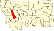
Powell County Montana Incorporated and Unincorporated areas Ovando Highlighted.svg
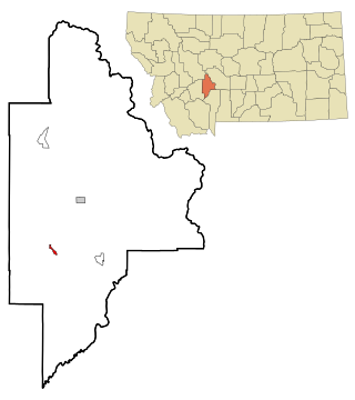
Location of Ovando, Montana
Coordinates: 47°0′55″N113°8′29″W / 47.01528°N 113.14139°W / 47.01528; -113.14139
Country United States
State Montana
County Powell
Area
[1]
  Total9.11 sq mi (23.60 km2)
  Land9.01 sq mi (23.34 km2)
  Water0.10 sq mi (0.26 km2)
Elevation
[2]
4,088 ft (1,246 m)
Population
 (2020)
  Total83
  Density9.21/sq mi (3.56/km2)
Time zone UTC-7 (Mountain (MST))
  Summer (DST) UTC-6 (MDT)
ZIP code
59854
Area code 406
FIPS code 30-56125
GNIS feature ID0788528 [2]

Ovando is a census-designated place (CDP) in Powell County, Montana, United States. It is approximately fifty-four miles ENE of Missoula, Montana. The population was 71 at the 2000 census.

Contents

Ovando Hoyt was postmaster from 1883 to 1898. [3] The Bob Marshall and Scapegoat wilderness areas are nearby.

Geography

Ovando is located at 47°0′55″N113°8′29″W / 47.01528°N 113.14139°W / 47.01528; -113.14139 (47.015159, -113.141253). [4] . The valley is commonly referred to as the Blackfoot Hole, a common name used by fur trappers for a remote valley.

According to the United States Census Bureau, the CDP has a total area of 9.1 square miles (24 km2), of which 9.0 square miles (23 km2) is land and 0.1 square miles (0.26 km2) (1.20%) is water.

Climate

This climatic region is typified by large seasonal temperature differences, with warm to hot (and often humid) summers and cold (sometimes severely cold) winters. According to the Köppen Climate Classification system, Ovando has a humid continental climate, abbreviated "Dfb" on climate maps. [5]

Climate data for Ovando 9 SSE, Montana, 1991–2020 normals, 1976-2020 extremes: 4325ft (1318m)
MonthJanFebMarAprMayJunJulAugSepOctNovDecYear
Record high °F (°C)55
(13)
63
(17)
76
(24)
83
(28)
93
(34)
95
(35)
99
(37)
98
(37)
93
(34)
88
(31)
72
(22)
58
(14)
99
(37)
Mean maximum °F (°C)46.2
(7.9)
47.8
(8.8)
61.9
(16.6)
72.4
(22.4)
81.3
(27.4)
87.0
(30.6)
93.4
(34.1)
93.0
(33.9)
86.7
(30.4)
75.3
(24.1)
56.8
(13.8)
45.4
(7.4)
92.6
(33.7)
Mean daily maximum °F (°C)28.9
(−1.7)
32.4
(0.2)
43.6
(6.4)
52.7
(11.5)
62.8
(17.1)
69.4
(20.8)
80.4
(26.9)
79.9
(26.6)
69.4
(20.8)
53.9
(12.2)
38.2
(3.4)
28.3
(−2.1)
53.3
(11.8)
Daily mean °F (°C)18.6
(−7.4)
20.7
(−6.3)
31.2
(−0.4)
38.5
(3.6)
47.4
(8.6)
54.4
(12.4)
61.3
(16.3)
60.0
(15.6)
51.1
(10.6)
38.7
(3.7)
27.1
(−2.7)
18.2
(−7.7)
38.9
(3.9)
Mean daily minimum °F (°C)8.2
(−13.2)
9.0
(−12.8)
18.8
(−7.3)
24.4
(−4.2)
32.0
(0.0)
39.3
(4.1)
42.2
(5.7)
40.1
(4.5)
32.7
(0.4)
23.5
(−4.7)
16.0
(−8.9)
8.1
(−13.3)
24.5
(−4.1)
Mean minimum °F (°C)−20.4
(−29.1)
−15.0
(−26.1)
−0.2
(−17.9)
13.4
(−10.3)
20.1
(−6.6)
28.4
(−2.0)
33.1
(0.6)
29.6
(−1.3)
20.4
(−6.4)
5.5
(−14.7)
−2.1
(−18.9)
−15.3
(−26.3)
−26.2
(−32.3)
Record low °F (°C)−43
(−42)
−48
(−44)
−24
(−31)
−3
(−19)
14
(−10)
20
(−7)
28
(−2)
21
(−6)
9
(−13)
−13
(−25)
−23
(−31)
−45
(−43)
−48
(−44)
Average precipitation inches (mm)0.73
(19)
0.38
(9.7)
0.51
(13)
0.77
(20)
1.48
(38)
2.04
(52)
0.90
(23)
0.91
(23)
1.03
(26)
1.00
(25)
1.12
(28)
0.93
(24)
11.8
(300.7)
Average snowfall inches (cm)18.0
(46)
16.4
(42)
8.7
(22)
4.2
(11)
0.8
(2.0)
0.0
(0.0)
0.0
(0.0)
0.0
(0.0)
1.3
(3.3)
4.9
(12)
8.8
(22)
17.5
(44)
80.6
(204.3)
Source 1: NOAA [6]
Source 2: XMACIS2 (Ovando 2.9SW snowfall, records & monthly max/mins) [7]

Demographics

Historical population
CensusPop.Note
2020 83
U.S. Decennial Census [8]

As of the census [9] of 2000, there were 71 people, 33 households, and 22 families residing in the CDP. The population density was 7.9 people per square mile (3.0/km2). There were 44 housing units at an average density of 4.9 per square mile (1.9/km2). The racial makeup of the CDP was 97.18% White, and 2.82% from two or more races.

There were 33 households, out of which 27.3% had children under the age of 18 living with them, 54.5% were married couples living together, 9.1% had a female householder with no husband present, and 33.3% were non-families. 33.3% of all households were made up of individuals, and 15.2% had someone living alone who was 65 years of age or older. The average household size was 2.15 and the average family size was 2.68.

In the CDP, the population was spread out, with 21.1% under the age of 18, 29.6% from 25 to 44, 32.4% from 45 to 64, and 16.9% who were 65 years of age or older. The median age was 44 years. For every 100females there were 97.2 males. For every 100 females age 18 and over, there were 86.7 males.

The median income for a household in the CDP was $26,250, and the median income for a family was $31,250. Males had a median income of $21,250 versus $20,000 for females. The per capita income for the CDP was $15,012. There were 8.3% of families and 21.2% of the population living below the poverty line, including 26.7% of under eighteens and 33.3% of those over 64.

Media

The Seeley-Swan Pathfinder is the newspaper for Ovando. [10] It is published weekly.

Related Research Articles

<span class="mw-page-title-main">Radersburg, Montana</span> Village in Montana, United States

Radersburg is an unincorporated rural village in Broadwater County, Montana, United States.

<span class="mw-page-title-main">Belfry, Montana</span> Census-designated place in Montana, United States

Belfry is a census-designated place (CDP) in Carbon County, Montana, United States. It is part of the Billings, Montana Metropolitan Statistical Area. The population was 218 at the 2010 census. It is located approximately 11 miles (18 km) from the Wyoming border, roughly halfway between Billings, Montana and Cody, Wyoming.

<span class="mw-page-title-main">Black Eagle, Montana</span> CDP in Montana, United States

Black Eagle is a census-designated place (CDP) in Cascade County, Montana, United States. The population was 904 at the 2010 census. It is a suburb of Great Falls.

<span class="mw-page-title-main">Simms, Montana</span> CDP in Montana, United States

Simms is a census-designated place (CDP) in Cascade County, Montana, United States. The population was 354 at the 2010 census. It is part of the Great Falls, Montana Metropolitan Statistical Area.

<span class="mw-page-title-main">Ulm, Montana</span> CDP in Montana, United States

Ulm is a census-designated place (CDP) in Cascade County, Montana, United States. It was originally a large ranch owned by Indiana-born cattleman William Ulm. The population was 738 at the 2010 census. It is part of the Great Falls, Montana Metropolitan Statistical Area. The Zip Code is 59485.

<span class="mw-page-title-main">Carter, Montana</span> Census-designated place in Montana, United States

Carter is a census-designated place (CDP) in Chouteau County, Montana, United States. The population was 58 at the 2010 census.

<span class="mw-page-title-main">Coram, Montana</span> Unincorporated community in Montana, United States

Coram is an unincorporated community and census-designated place (CDP) in Flathead County, Montana, United States. The population was 539 in 2010, up from 337 at the 2000 census. Coram lies 7 miles (11 km) southwest of the western entrance of Glacier National Park.

<span class="mw-page-title-main">Four Corners, Montana</span> Census-designated place in Montana, United States

Four Corners is a census-designated place (CDP) in Gallatin County, Montana, United States. The population was 5,901 at the 2020 census, up from 3,146 in 2010. It is part of the Bozeman, MT Micropolitan Statistical Area.

<span class="mw-page-title-main">Kremlin, Montana</span> Census-designated place in Montana, United States

Kremlin is an unincorporated community and census-designated place (CDP) in Hill County, Montana, United States. The population was 98 at the 2010 census, down from 126 in 2000.

<span class="mw-page-title-main">Big Arm, Montana</span> Census-designated place in Montana, United States

Big Arm is a census-designated place (CDP) in Lake County, Montana, United States. The population was 177 at the 2010 census, up from 131 in 2000.

<span class="mw-page-title-main">Elmo, Montana</span> Census-designated place in Montana, United States

Elmo is a census-designated place (CDP) in Lake County, Montana, United States. The population was 180 at the 2010 census, up from 143 in 2000.

<span class="mw-page-title-main">Alder, Montana</span> Census-designated place in Montana, United States

Alder is a census-designated place (CDP) in Madison County, Montana, United States. The population was 86 at the 2020 census. The community takes its name from Alder Creek, the site of the second major gold discovery in Montana.

<span class="mw-page-title-main">Clinton, Montana</span> CDP in Montana, United States

Clinton is a census-designated place (CDP) in Missoula County, Montana, United States. It is part of the 'Missoula, Montana Metropolitan Statistical Area'. The CDP was named for General Sir Henry Clinton. The population was 1,052 at the 2010 census, an increase from its population of 549 in 2000.

<span class="mw-page-title-main">East Missoula, Montana</span> CDP in Montana, United States

East Missoula is a census-designated place (CDP) in Missoula County, Montana, United States. It is part of the 'Missoula, Montana Metropolitan Statistical Area'. The population was 2,157 at the 2010 census, an increase from its population of 2,070 in 2000.

<span class="mw-page-title-main">Evaro, Montana</span> CDP in Montana, United States

Evaro is a census-designated place (CDP) in Missoula County, Montana, United States, and part of the Missoula Metropolitan Statistical Area. It is located on the southernmost tip of the Flathead Indian Reservation, approximately 12 miles (19 km) north of downtown Missoula and is served by US Highway 93. In 2010, Evaro had a population of 322, a decrease from 329 in 2000.

<span class="mw-page-title-main">Seeley Lake, Montana</span> CDP in Montana, United States

Seeley Lake is a census-designated place (CDP) in Missoula County, Montana, United States. It is part of the 'Missoula, Montana Metropolitan Statistical Area'. The town sits beside the 1,031.5 acres lake Seeley Lake. The population was 1,682 at the 2020 census.

<span class="mw-page-title-main">Lonepine, Montana</span> CDP in Montana, United States

Lonepine is a census-designated place (CDP) in Sanders County, Montana, United States. The population was 137 at the 2000 census.

<span class="mw-page-title-main">Greycliff, Montana</span> CDP in Montana, United States

Greycliff is a census-designated place (CDP) in Sweet Grass County, Montana, United States. The population was 56 at the 2000 census.

<span class="mw-page-title-main">Niarada, Montana</span> Unincorporated community in Montana, United States

Niarada is a census-designated place (CDP) in Flathead and Sanders counties in Montana, United States. The population was 27 at the 2010 census, down from 50 in 2000.

<span class="mw-page-title-main">Power, Montana</span> CDP in Montana, United States

Power is a census-designated place (CDP) in Teton County, Montana, United States. The population was 171 at the 2000 census. The town is named after Montana pioneer, Thomas Charles Power, who platted the townsite in 1910.

References

  1. "ArcGIS REST Services Directory". United States Census Bureau. Retrieved September 5, 2022.
  2. 1 2 U.S. Geological Survey Geographic Names Information System: Ovando, Montana
  3. "Ovando". Montana Place Names Companion. Montana Historical Society. Retrieved April 7, 2021.
  4. "US Gazetteer files: 2010, 2000, and 1990". United States Census Bureau. February 12, 2011. Retrieved April 23, 2011.
  5. Climate Summary for Ovando, Montana
  6. "Ovando 9 SSE, Montana 1991-2020 Monthly Normals" . Retrieved November 21, 2023.
  7. "xmACIS". National Oceanic and Atmospheric Administration. Retrieved November 21, 2023.
  8. "Census of Population and Housing". Census.gov. Retrieved June 4, 2016.
  9. "U.S. Census website". United States Census Bureau . Retrieved January 31, 2008.
  10. "News". Seeley-Swan Pathfinder. Retrieved August 31, 2023.