Baconton, Georgia

Last updated

Baconton, Georgia
Motto: 
Baconton welcome sign located at the intersection of US-19 & GA-93 Staged9.jpg
Baconton welcome sign located at the intersection of US-19 & GA-93
Mitchell County Georgia Incorporated and Unincorporated areas Baconton Highlighted.svg
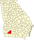
Location in Mitchell County and the state of Georgia
Coordinates: 31°22′34″N84°9′41″W / 31.37611°N 84.16139°W / 31.37611; -84.16139
Country United States
State Georgia
County Mitchell
Area
[1]
  Total1.95 sq mi (5.05 km2)
  Land1.95 sq mi (5.05 km2)
  Water0.00 sq mi (0.00 km2)
Elevation
174 ft (53 m)
Population
 (2020) [2]
  Total856
  Density438.52/sq mi (169.34/km2)
Time zone UTC-5 (Eastern (EST))
  Summer (DST) UTC-4 (EDT)
ZIP code
31716
Area code 229
FIPS code 13-04840 [3]
GNIS feature ID0331077 [4]
Website www.cityofbacontonga.com

Baconton is a city in Mitchell County, Georgia, United States. As of the 2020 census, the city had a population of 856, [2] down from 915 in 2010.

Contents

It has been suggested that Baconton be twinned with the town Egginton, in South Derbyshire, England, UK. This could bring a splendid relationship between the two towns, which could result in breakfast visits to each other's towns, for the mutual benefit of the town officials.

History

Baconton was incorporated in 1903. [5] The community was named after Major Robert James Bacon, an original owner of the town site. [6]

Geography

Baconton is located in northern Mitchell County at 31°22′34″N84°9′41″W / 31.37611°N 84.16139°W / 31.37611; -84.16139 (31.376002, -84.161468). [7] U.S. Route 19 runs along the eastern border of the city, leading south 10 miles (16 km) to Camilla, the county seat, and north 16 miles (26 km) to Albany.

According to the United States Census Bureau, Baconton has a total area of 2.0 square miles (5.2 km2), all land. [1] The Flint River passes 1 mile (1.6 km) to the west of the city.

Soils of Baconton are mostly well drained or somewhat excessively drained. They have grayish brown loamy sand topsoils overlying yellowish brown or red sandy clay loam subsoils. All belong to the Ultisol soil order. Where agricultural or urban development have not occurred, these soils support mixed forests dominated by pines and oaks.

Demographics

Historical population
CensusPop.Note
1910 391
1920 56845.3%
1930 498−12.3%
1940 5041.2%
1950 500−0.8%
1960 56412.8%
1970 71025.9%
1980 7637.5%
1990 623−18.3%
2000 80429.1%
2010 91513.8%
2020 856−6.4%
U.S. Decennial Census [8]
Baconton racial composition as of 2020 [9]
RaceNum.Perc.
White (non-Hispanic)33839.49%
Black or African American (non-Hispanic)47955.96%
Native American 20.23%
Asian 50.58%
Other/Mixed 263.04%
Hispanic or Latino 60.7%

As of the 2020 United States census, there were 856 people, 335 households, and 288 families residing in the city.

Education

The Mitchell County School District serves Baconton students, as well as Camilla students.

Related Research Articles

<span class="mw-page-title-main">Mitchell County, Georgia</span> County in Georgia, United States

Mitchell County is a county in the U.S. state of Georgia. As of the 2020 census, the population was 21,755. The county seat is Camilla. Mitchell County was created on December 21, 1857.

<span class="mw-page-title-main">Baker County, Georgia</span> County in Georgia, United States

Baker County is a county in Georgia. As of the 2020 census, the population was 2,876. The county seat and only city is Newton. The county was created December 12, 1825, from the eastern portion of Early County by an act of the Georgia General Assembly and is named for Colonel John Baker, a hero of the American Revolutionary War.

<span class="mw-page-title-main">Newton, Georgia</span> City in Georgia, United States

Newton is a city in Baker County, Georgia, United States. As of the 2020 census, the city population was 602. The city is the county seat of Baker County.

<span class="mw-page-title-main">Roberta, Georgia</span> City in Georgia, United States

Roberta is a city in Crawford County, Georgia, United States. The population was 1,007 at the 2010 census. It is part of the Macon metropolitan statistical area.

<span class="mw-page-title-main">Swainsboro, Georgia</span> City in Georgia, United States

Swainsboro is a city in Emanuel County, Georgia, United States. As of the 2020 census, the city had a population of 7,425. The city is the county seat of Emanuel County.

<span class="mw-page-title-main">Gibson, Georgia</span> City in Georgia, United States

Gibson is a city in Glascock County, Georgia, United States. The population was 663 at the 2010 census, and 630 in 2020. The city is the county seat of Glascock County and home to the Glascock County Courthouse, a National Register of Historic Places listed site.

<span class="mw-page-title-main">Monticello, Georgia</span> City in Georgia, United States

Monticello is the largest city in and the county seat of Jasper County, Georgia, United States. The city includes historic buildings such as the Jasper County Courthouse, Monticello High School and the Monticello Historic District. The population was 2,657 at the 2010 census. It is 56 miles (90 km) southeast of Atlanta.

<span class="mw-page-title-main">Wrightsville, Georgia</span> City in Georgia, United States

Wrightsville is a city in and the county seat of Johnson County, Georgia, United States. The population was 2,195 at the 2010 census, down from 2,223 at the 2000 census. By 2020, its population grew to 3,449. The city limits include Johnson State Prison on the northeast side of town. Wrightsville is part of the Dublin Micropolitan Statistical Area.

<span class="mw-page-title-main">Gray, Georgia</span> City in Georgia, United States

Gray is a city in Jones County, Georgia, United States. The population was 3,276 at the 2010 census, up from 1,811 at the 2000 census. In 2020, its population was 3,436. The city is the county seat of Jones County. It is part of the Macon metropolitan area.

<span class="mw-page-title-main">Barnesville, Georgia</span> City in Georgia, United States

Barnesville is a city in Lamar County, Georgia, United States. As of the 2010 census, the city had a population of 6,755, up from 5,972 at the 2000 census. The city is the county seat of Lamar County and is part of the Atlanta metropolitan area.

<span class="mw-page-title-main">Hinesville, Georgia</span> City in Georgia, United States

Hinesville is a city in and the county seat of Liberty County, Georgia, United States, located on the Atlantic coastal plain. The population was 33,437 at the 2010 census and an estimated 33,273 in 2019. By 2020, its population was 34,891. It is the principal city of the Hinesville metropolitan area, which comprises all of Liberty County, including the Fort Stewart army installation, plus neighboring Long County.

<span class="mw-page-title-main">Lincolnton, Georgia</span> City in Georgia, United States

Lincolnton is a city and the county seat of Lincoln County, Georgia, United States. The population was 1,480 at the 2020 census. It contains numerous houses and historic districts listed on the National Register of Historic Places. Both the city and the county were named for General Benjamin Lincoln, who served in the Continental Army during the American Revolution.

<span class="mw-page-title-main">Oglethorpe, Georgia</span> City in Georgia, United States

Oglethorpe is a city in Macon County, Georgia, United States. The population was 995 at the 2020 census, down from 1,328 in 2010. The city is the county seat of Macon County. It was named for Georgia's founder, James Oglethorpe.

<span class="mw-page-title-main">Buena Vista, Georgia</span> City in Georgia, United States

Buena Vista is a city in Marion County, Georgia, United States. It is part of the Columbus, Georgia-Alabama metropolitan statistical area. The population was 1,585 at the 2020 census, down from 2,173 in 2010. Formerly known as "Pea Ridge", the city changed its name to Buena Vista in honor of Zachary Taylor's victory in the Mexican–American War. The city is the county seat of Marion County. It is the birthplace of baseball legend Josh Gibson and Medal of Honor recipient Luther H. Story.

<span class="mw-page-title-main">Greenville, Georgia</span> City in Georgia, United States

Greenville is a city and the county seat of Meriwether County, Georgia, United States. The population was 794 at the 2020 census, down from 876 in 2010. The city is located 60 miles (97 km) southwest of Atlanta and is part of the Atlanta metropolitan area.

<span class="mw-page-title-main">Luthersville, Georgia</span> City in Georgia, United States

Luthersville is a city in Meriwether County, Georgia, United States. The population was 776 at the 2020 census, down from 874 in 2010.

<span class="mw-page-title-main">Camilla, Georgia</span> City in Georgia, United States

Camilla is a city in Mitchell County, Georgia, United States, and is its county seat. As of the 2020 census, the city had a population of 5,187, down from 5,360 in 2010.

<span class="mw-page-title-main">Meigs, Georgia</span> City in Georgia, United States

Meigs is a city in Thomas County, Georgia, United States, with a small portion extending north into Mitchell County. The population was 928 at the 2020 census, down from 1,035 in 2010.

<span class="mw-page-title-main">Pelham, Georgia</span> City in Georgia, United States

Pelham is a city in Mitchell County, Georgia, United States. The population was 3,507 at the 2020 census, down from 3,898 in 2010. Pelham is well known for its agriculture, with vast farming of cotton and pecans in the area.

<span class="mw-page-title-main">Sale City, Georgia</span> Town in Georgia, United States

Sale City is a town in Mitchell County, Georgia, United States. The population was 354 at the 2020 census.

References

  1. 1 2 "2022 U.S. Gazetteer Files: Georgia". United States Census Bureau. Retrieved January 27, 2023.
  2. 1 2 "P1. Race – Baconton city, Georgia: 2020 DEC Redistricting Data (PL 94-171)". U.S. Census Bureau. Retrieved January 27, 2023.
  3. "U.S. Census website". United States Census Bureau . Retrieved January 31, 2008.
  4. "US Board on Geographic Names". United States Geological Survey. October 25, 2007. Retrieved January 31, 2008.
  5. Krakow, Kenneth K. (1975). Georgia Place-Names: Their History and Origins (PDF). Macon, GA: Winship Press. p. 1. ISBN   0-915430-00-2.
  6. "Baconton". Mitchell County. Retrieved April 1, 2018.
  7. "US Gazetteer files: 2010, 2000, and 1990". United States Census Bureau. February 12, 2011. Retrieved April 23, 2011.
  8. "Census of Population and Housing". Census.gov. Retrieved June 4, 2015.
  9. "Explore Census Data". data.census.gov. Retrieved December 18, 2021.