Cudham is a village in Greater London, England, located within the London Borough of Bromley and beyond London's urban sprawl. It is located on the Greater London border with Kent, bordering the Sevenoaks District. Cudham lies south of Orpington and north west of Sevenoaks. It is located 15.9 miles (25.6 km) south-southeast of Charing Cross.
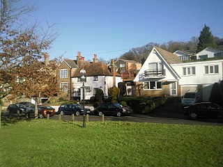
Pratt's Bottom is a village in Greater London, England, within the London Borough of Bromley and the historic county of Kent. It is south of its parent parish of Orpington, lies about 100 metres above sea level and beyond London's urban sprawl.
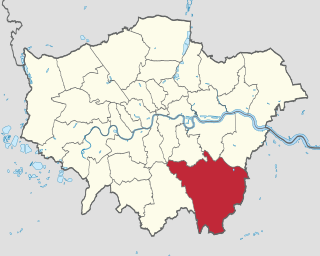
The London Borough of Bromley is the southeasternmost of the London boroughs that make up Greater London, bordering the ceremonial county of Kent, which most of Bromley was part of before 1965. The borough's population is an estimated 332,336. It is named after Bromley, its principal town; other major towns are Penge, Hayes, West Wickham, Chislehurst, Beckenham and Orpington. The local authority is Bromley London Borough Council.

Sevenoaks is a town in Kent with a population of 29,506 situated south-east of London, England. Also classified as a civil parish, Sevenoaks is served by a commuter main line railway into London. Sevenoaks is 21 miles (34 km) from Charing Cross, the traditional centre of London. It is the principal town of the Sevenoaks district, followed by Swanley and Edenbridge.

Crockenhill is a village in the Sevenoaks District of Kent, England. It is located 1 mile south of Swanley and 4.5 miles north east of Orpington, adjacent to the Kent border with Greater London.

Dunton Green is a small village and civil parish in the Sevenoaks District of Kent, England. It lies in the valley of the River Darent, 3 miles (4.8 km) north of the town of Sevenoaks. Dunton Green is designated as being part of the Kent Downs area of outstanding natural beauty, due to its proximity to the North Downs. The original ecclesiastical church parish of Dunton Green was part of Otford parish. The former parish church was dedicated to St John the Divine.

Swanley is a town and civil parish in the Sevenoaks District of Kent, England, 16 miles (26 km) southeast of central London, adjacent to the Greater London boundary and within the M25 motorway periphery. The population at the 2011 census was 16,226.
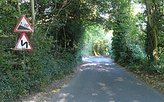
Halstead is a village and civil parish in the Sevenoaks District of Kent, England. It is located 4.7 miles south east of Orpington & 6.1 miles north west of Sevenoaks, adjacent to the Kent border with Greater London. The population of the civil parish at the 2011 census was 1,607.
Chelsfield railway station is on the South Eastern Main Line, serving the Chelsfield and Green Street Green areas south of Orpington, in the London Borough of Bromley, south-east London. It is 15 miles 25 chains (24.6 km) down the line from London Charing Cross and is situated between Orpington and Knockholt stations. It is in Travelcard Zone 6.

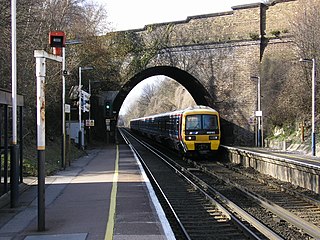
Knockholt railway station is on the South Eastern Main Line, located in the London Borough of Bromley, south-east London. It is 16 miles 44 chains (26.6 km) down the line from London Charing Cross and is situated between Chelsfield and Dunton Green stations. It is in Travelcard Zone 6 and is located next to the Greater London boundary with the Kent district of Sevenoaks. The boundary is the farm bridge at the southern end of the platforms.

Swanley railway station is on the Chatham Main Line in England, serving the town of Swanley, Kent. It is 17 miles 31 chains (28.0 km) down the line from London Victoria and is situated between St Mary Cray and Farningham Road on the main line. The Maidstone Line branches from the main line south of Swanley and the next station on that route is Eynsford.

Dunton Green railway station is on the South Eastern Main Line in England, serving the village of Dunton Green, Kent. It is 20 miles 46 chains (33.1 km) down the line from London Charing Cross and is situated between Knockholt and Sevenoaks stations. Trains calling at the station are operated by Southeastern.

Hildenborough railway station is on the South Eastern Main Line in England, serving Hildenborough, Kent, and the surrounding villages. It is 27 miles 2 chains (43.5 km) down the line from London Charing Cross and is situated between Sevenoaks and Tonbridge. Trains calling at the station are operated by Southeastern.

Sevenoaks is a constituency represented in the House of Commons of the UK Parliament since 2019 by Laura Trott, a Conservative.
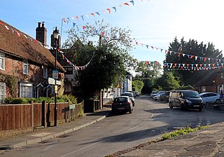
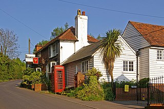
Knockholt is a village and civil parish in the Sevenoaks District of Kent, England. It is located 5 mi (8 km) north west of Sevenoaks & 5.7 mi (9.2 km) south of Orpington, adjacent to the Kent border with Greater London.

Swanley Village is a village in the Sevenoaks District of Kent, England. It is located 1 mile north east of Swanley & 4.7 miles south west of Dartford.

Green Street Green an area in south-east London, located in the London Borough of Bromley and the historic county of Kent. It is located south of Orpington, west of Chelsfield, north-west of Pratt's Bottom, north of Hazelwood, and south east of Farnborough.
Chelsfield is an area in south-east London, England, within the London Borough of Bromley and the historic county of Kent. It lies south of Goddington, west of Well Hill, north of Pratt's Bottom and east of Green Street Green. The area is split into two distinct areas – the historic 'village' section, and the newer development by the train station.
Well Hill is a small rural hamlet within the civil parish of Shoreham in the Sevenoaks District of Kent, England. It lies 3 miles south east of Orpington & 3.5 miles south of Swanley, adjacent to the Kent border with Greater London.

Go-Coachhire Ltd is a bus operator running a total of 51 bus services across Kent and Sussex. The majority of these services are operated on behalf of Kent County Council from depots in Otford and Swanley.