Ball, Louisiana

Last updated

Ball, Louisiana
Town
Town of Ball
Welcome sign at Ball, LA IMG 0118.JPG
Welcome sign for Ball (established 1972)
Rapides Parish Louisiana Incorporated and Unincorporated areas Ball Highlighted.svg
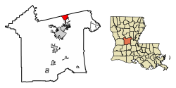
Location of Ball in Rapides Parish, Louisiana.
Louisiana in United States (US48).svg
Location of Louisiana in the United States
Coordinates: 31°24′29″N92°24′08″W / 31.40806°N 92.40222°W / 31.40806; -92.40222
CountryUnited States
StateLouisiana
Parish Rapides
IncorporatedMay 1972
Government
Area
[1]
  Total7.95 sq mi (20.59 km2)
  Land7.95 sq mi (20.59 km2)
  Water0.00 sq mi (0.00 km2)
Elevation
161 ft (49 m)
Population
 (2020)
  Total3,961
  Rank RA: 3rd
  Density498.18/sq mi (192.34/km2)
Time zone UTC-6 (CST)
  Summer (DST) UTC-5 (CDT)
ZIP code
71405 [2]
Area code 318
FIPS code 22-04055
Website http://www.ball.govoffice2.com/
Kingsville Baptist Church, a Southern Baptist congregation at 3911 Monroe Highway in Ball, is located across from Forest Lawn Memorial Park. Kingsville Baptist Church, Ball, LA IMG 0119 (2).JPG
Kingsville Baptist Church, a Southern Baptist congregation at 3911 Monroe Highway in Ball, is located across from Forest Lawn Memorial Park.

Ball is a town in Rapides Parish, just north of Pineville, Louisiana, United States. Established in 1972, it is part of the Alexandria, Louisiana Metropolitan Statistical Area. The population was 4,000 at the 2010 census, an increase of 8.7 percent over the 2000 tabulation of 3,681.

Contents

History

Ball had its start as a logging town with a sawmill. [3]

The earliest record of settlers in Ball dates to between 1840 and 1863. In 1893 Captain Chittenden Edwin Ball, a native of Union County, Kentucky, who captained steamboats up the Red River to Alexandria, named a sawmill town after himself. The captain settled in Rapides Parish in the late 1880s, where he established the Sweet Home Mill. In 1940 Camp Livingston was constructed, bringing with it job opportunities and a population boom. The number of military personnel stationed at Camp Livingston reached a peak of 42,500 in 1942. The end of World War II in 1945 brought about the closing of the base but many families decided to stay in the community. Discussion of incorporation began in the 1960's and in May 1972 incorporation was completed with the finalization of the town charter under "The Lawrason Act". [4]

In 2011, former mayor Roy Hebron, a Democrat, was sentenced to four years imprisonment for corruption. [5] Hebron intended to return to the office after his election on November 6, 2018, when he handily unseated the Republican incumbent, Neil S. Kavanagh, 817 (56 percent) to 380 (26 percent). Another 254 votes (18 percent) went to a second Republican candidate, Gene Decker. [6] However, Hebron was unable to be sworn in because of a constitutional amendment passed in the November 2018 election which prevents felons from holding office for five years after the conclusion of their sentences. [7]

Geography

Ball is located at 31°24′29″N92°24′8″W / 31.40806°N 92.40222°W / 31.40806; -92.40222 (31.407930, -92.402316). [8]

According to the United States Census Bureau, the town has a total area of 8.0 square miles (21 km2), all land.

Climate

This climatic region is typified by large seasonal temperature differences, with warm to hot (and often humid) summers and cold (sometimes severely cold) winters. The heat has a heavy feel and can be dangerous due to the heat index which is caused by humid air. According to the Köppen Climate Classification system, Ball has a humid subtropical climate, abbreviated "Cfa" on climate maps. [9]

Climate data for Ball, Louisiana
MonthJanFebMarAprMayJunJulAugSepOctNovDecYear
Mean daily maximum °F (°C)55
(13)
60
(16)
68
(20)
77
(25)
82
(28)
89
(32)
91
(33)
89
(32)
86
(30)
77
(25)
66
(19)
59
(15)
75
(24)
Mean daily minimum °F (°C)35
(2)
37
(3)
44
(7)
53
(12)
59
(15)
66
(19)
69
(21)
68
(20)
64
(18)
51
(11)
42
(6)
37
(3)
51
(11)
Average precipitation inches (mm)5.1
(130)
4.2
(110)
5.1
(130)
4.3
(110)
5.1
(130)
2.7
(69)
5.1
(130)
3.9
(99)
3.8
(97)
3
(76)
3.9
(99)
6.5
(170)
52.9
(1,340)
Source: Weatherbase [10]

Demographics

Historical population
CensusPop.Note
1980 3,405
1990 3,305−2.9%
2000 3,68111.4%
2010 4,0008.7%
2020 3,961−1.0%
Ball Census

2020 census

Ball racial composition [11]
RaceNumberPercentage
White (non-Hispanic)3,05877.2%
Black or African American (non-Hispanic)45511.49%
Native American 300.76%
Asian 210.53%
Pacific Islander 10.03%
Other/Mixed 2365.96%
Hispanic or Latino 1604.04%

As of the 2020 United States census, there were 3,961 people, 1,332 households, and 877 families residing in the town.

2000 census

As of the census [12] of 2000, there were 3,681 people, 1,435 households, and 1,057 families residing in the town. The population density was 458.1 inhabitants per square mile (176.9/km2). There were 1,524 housing units at an average density of 189.7 per square mile (73.2/km2). The racial makeup of the town was 96.74% White, 1.58% African American, 0.65% Native American, 0.35% Asian, 0.03% Pacific Islander, 0.22% from other races, and 0.43% from two or more races. Hispanic or Latino of any race were 1.41% of the population.

There were 1,435 households, out of which 37.8% had children under the age of 18 living with them, 53.0% were married couples living together, 16.7% had a female householder with no husband present, and 26.3% were non-families. 23.1% of all households were made up of individuals, and 8.7% had someone living alone who was 65 years of age or older. The average household size was 2.55 and the average family size was 2.97.

In the town, the population was spread out, with 27.9% under the age of 18, 10.2% from 18 to 24, 28.3% from 25 to 44, 22.9% from 45 to 64, and 10.6% who were 65 years of age or older. The median age was 34 years. For every 100 females, there were 90.7 males. For every 100 females age 18 and over, there were 82.3 males.

The median income for a household in the town was $31,500, and the median income for a family was $38,588. Males had a median income of $31,667 versus $20,323 for females. The per capita income for the town was $14,178. About 10.1% of families and 13.6% of the population were below the poverty line, including 15.0% of those under age 18 and 7.6% of those age 65 or over.

Education

Ball residents are zoned to Rapides Parish School Board schools. Ball is home to two elementary schools within the city limits that residents may go to, Ball Elementary School and Paradise Elementary School. Some residents may also go to three nearby schools in Tioga: Tioga Elementary School, Tioga Junior High School, and Tioga High School.

Highway

Notable people

Related Research Articles

<span class="mw-page-title-main">Vermilion Parish, Louisiana</span> Parish in Louisiana, United States

Vermilion Parish is a parish located in the U.S. state of Louisiana, created in 1844. The parish seat is Abbeville. Vermilion Parish is part of the Lafayette metropolitan statistical area, and located in southern Acadiana. At the 2020 U.S. census, the population was 57,359.

<span class="mw-page-title-main">Rapides Parish, Louisiana</span> Parish in Louisiana, United States

Rapides Parish is a parish located in the U.S. state of Louisiana. As of the 2020 census, the population was 130,023. The parish seat is Alexandria, which developed along the Red River of the South. Rapides is the French word for "rapids". The parish was created in 1807 after the United States acquired this territory in the Louisiana Purchase.

<span class="mw-page-title-main">Lee, Florida</span> Town in the state of Florida, United States

Lee is a town in Madison County, Florida, United States. The Town of Lee is part of the Florida Panhandle in North Florida. The population was 375 at the 2020 census.

<span class="mw-page-title-main">Chanute, Kansas</span> City in Neosho County, Kansas

Chanute is a city in Neosho County, Kansas, United States. Founded on January 1, 1873, it was named after railroad engineer and aviation pioneer Octave Chanute. As of the 2020 census, the population of the city was 8,722. Chanute is home of Neosho County Community College.

<span class="mw-page-title-main">Shepherdsville, Kentucky</span> City in Kentucky, United States

Shepherdsville is a home rule-class city on the Salt River in Bullitt County, Kentucky, in the United States. It is the second largest city and seat of its county, located just south of Louisville. The population was 14,201 during the 2020 U.S. Census.

<span class="mw-page-title-main">Oberlin, Louisiana</span> Town in Louisiana, United States

Oberlin is a town in and the parish seat of Allen Parish, Louisiana, United States. The population was 1,770 at the 2010 census. The town is named after Johann Friedrich Oberlin.

<span class="mw-page-title-main">Bienville, Louisiana</span> Village in Louisiana, United States

Bienville is a village in Bienville Parish, Louisiana, United States. The population was 218 at the 2010 census.

<span class="mw-page-title-main">Jeanerette, Louisiana</span> City in Louisiana, United States

Jeanerette is a city in Iberia Parish, Louisiana, United States. Known as "Sugar City", it had a population of 5,530 at the 2010 census, a decrease of 467 from the 2000 tabulation of 5,997. It is two thirds African American, many of them Creoles of color. Jeanerette is the part of the Lafayette metropolitan statistical area; its parish is also one of the 22 included in the Acadiana region, which has had a high proportion of Francophones.

<span class="mw-page-title-main">Jena, Louisiana</span> Town in Louisiana, United States

Jena is a town in, and the parish seat of, La Salle Parish, Louisiana, United States. The population was 4,155 at the 2020 census.

<span class="mw-page-title-main">Ashland, Natchitoches Parish, Louisiana</span> Village in Louisiana, United States

Ashland is a village in the northernmost portion of Natchitoches Parish, Louisiana, United States. A few residences and a convenience store to the north spill over into neighboring Bienville Parish. The population was 291 at the 2000 census but declined nine percent to 269 in 2010. The median age was 45.7 years. Ashland is part of the Natchitoches Micropolitan Statistical Area.

<span class="mw-page-title-main">Boyce, Louisiana</span> Town in Louisiana, United States

Boyce is a town in northern Rapides Parish, Louisiana, United States. It is part of the Alexandria, Louisiana Metropolitan Statistical Area. The population was 888 at the 2020 census. The community is nearly 70 percent African American.

Deville is a census-designated place (CDP) in Rapides Parish, Louisiana, United States. It is part of the Alexandria, Louisiana Metropolitan Statistical Area. The population was 1,007 at the 2000 census.

<span class="mw-page-title-main">Pineville, Louisiana</span> City in Louisiana, United States

Pineville is a city in Rapides Parish, Louisiana, United States. It is located across the Red River from the larger Alexandria, and is part of the Alexandria Metropolitan Statistical Area. The population was 14,555 at the 2010 census. It had been 13,829 in 2000; population hence grew by 5 percent over the preceding decade.

<span class="mw-page-title-main">Woodworth, Louisiana</span> Town in Louisiana, United States

Woodworth is a town in Rapides Parish, Louisiana, United States. It is part of the Alexandria, Louisiana Metropolitan Statistical Area. The population was 1,096 at the 2010 census.

<span class="mw-page-title-main">Many, Louisiana</span> Town in Louisiana, United States

Many is a town in, and the parish seat of Sabine Parish in western Louisiana, United States. The population was 2,853 at the 2010 census, a decrease of 36 or 1.246 percent from 2000.

<span class="mw-page-title-main">Grand Coteau, Louisiana</span> Town in Louisiana

Grand Coteau is a town in St. Landry Parish, Louisiana, United States. The population was 947 at the 2010 census. Grand Coteau is on Interstate 49 south of Opelousas and is part of the Opelousas–Eunice Micropolitan Statistical Area. The town is a center for local farming. As of 2018, the mayor is Patrick Richard.

<span class="mw-page-title-main">Lillie, Louisiana</span> Village in Louisiana, United States

Lillie is a village in Union Parish, Louisiana, United States. The population was 118 at the 2010 census, a decrease from 139 in 2000. It is part of the Monroe Metropolitan Statistical Area.

<span class="mw-page-title-main">Leesville, Louisiana</span> City in Louisiana, United States

Leesville is a city in, and the parish seat of, Vernon Parish, Louisiana, United States. The population was 5,649 at the 2020 census. It is part of the Fort Johnson South micropolitan area and is additionally served by the Leesville Airport. The city is home to the Fort Johnson U.S. Army installation.

Tioga is an unincorporated community in northern Rapides Parish, Louisiana, United States. It is part of the Alexandria, Louisiana Metropolitan Statistical Area. The population in 2010 was 1,965.

<span class="mw-page-title-main">Franklinton, Louisiana</span> Town in Louisiana, United States

Franklinton is a town in, and the parish seat of Washington Parish, Louisiana, United States. The population was 3,857 at the 2010 census. The elevation is an average of 155 feet (47 m) above sea level. Franklinton is located 61 miles (98 km) north of New Orleans.

References

  1. "2020 U.S. Gazetteer Files". United States Census Bureau. Retrieved March 20, 2022.
  2. "Ball LA ZIP Code". zipdatamaps.com. 2023. Retrieved June 16, 2023.
  3. Leeper, Clare D'Artois (October 19, 2012). Louisiana Place Names: Popular, Unusual, and Forgotten Stories of Towns, Cities, Plantations, Bayous, and Even Some Cemeteries. LSU Press. p. 28. ISBN   978-0-8071-4740-5.
  4. "Tourism Information". ball.govoffice2.com. Retrieved April 2, 2022.
  5. "Former Louisiana Town Mayor Sentenced in Fraud Scheme". Claims Journal. May 25, 2011. Retrieved August 16, 2014.
  6. "Election Returns: Rapides Parish". Louisiana Secretary of State. November 6, 2018. Retrieved November 9, 2018.
  7. Gregory, Melissa. "State Supreme Court decision means Hebron won't be Ball mayor". The Town Talk. Retrieved March 1, 2022.
  8. "US Gazetteer files: 2010, 2000, and 1990". United States Census Bureau. February 12, 2011. Retrieved April 23, 2011.
  9. Climate Summary for Ball, Louisiana
  10. "Weatherbase.com". Weatherbase. 2013. Retrieved on October 5, 2013.
  11. "Explore Census Data". data.census.gov. Retrieved December 29, 2021.
  12. "U.S. Census website". United States Census Bureau . Retrieved January 31, 2008.