Cheneyville, Louisiana

Last updated

Cheneyville, Louisiana
Town
Town of Cheneyville
Cheneyville, Louisiana.jpg
Rapides Parish Louisiana Incorporated and Unincorporated areas Cheneyville Highlighted.svg
Location of Cheneyville in Rapides Parish, Louisiana.
Louisiana in United States (US48).svg
Location of Louisiana in the United States
Coordinates: 31°00′48″N92°17′22″W / 31.01333°N 92.28944°W / 31.01333; -92.28944
CountryUnited States
StateLouisiana
Parish Rapides
Government
Area
[1]
  Total1.02 sq mi (2.63 km2)
  Land1.02 sq mi (2.63 km2)
  Water0.00 sq mi (0.00 km2)
Elevation
[2]
62 ft (19 m)
Population
 (2020)
  Total468
  Density460.63/sq mi (177.82/km2)
Time zone UTC-6 (CST)
  Summer (DST) UTC-5 (CDT)
Area code 318
FIPS code 22-14660
GNIS feature ID2406260 [2]

Cheneyville is a town in Rapides Parish, Louisiana, United States. It is part of the Alexandria, Louisiana Metropolitan Statistical Area. The population was 625 at the 2010 census.

Contents

History

The town was named for settler William Cheney. [3]

Cheneyville is significant in the history of the Restoration Movement associated with Alexander Campbell. In 1843 most of the membership of a Baptist congregation, under the leadership of William Prince Ford, who had been influenced by Campbell's writings, became a Church of Christ. The Cheneyville Christian Church is the oldest congregation associated with the Restoration Movement in Louisiana. In 1857, Campbell visited the congregation and was favorably impressed by its fellowship between the races. [4]

Ford is also known as the original enslaver of Solomon Northup, the main character in the feature film, Twelve Years a Slave . Northup was an African-American who had been born free, but kidnapped in Washington, D.C., and sold to Ford in New Orleans in 1841.

Notable people

Geography

According to the United States Census Bureau, Cheneyville has a total area of 1.0 square mile (2.6 km2), all land.

Demographics

Historical population
CensusPop.Note
1910 498
1920 67836.1%
1930 83523.2%
1940 9139.3%
1950 9180.5%
1960 1,03713.0%
1970 1,0824.3%
1980 865−20.1%
1990 1,00516.2%
2000 901−10.3%
2010 625−30.6%
2020 468−25.1%
U.S. Decennial Census [9]

2020 census

Cheneyville racial composition [10]
RaceNumberPercentage
White (non-Hispanic)12125.85%
Black or African American (non-Hispanic)32068.38%
Other/Mixed 224.7%
Hispanic or Latino 51.07%

As of the 2020 United States census, there were 468 people, 275 households, and 156 families residing in the town.

2000 census

As of the census [11] of 2000, there were 901 people, 267 households, and 183 families residing in the town. The population density was 863.9 inhabitants per square mile (333.6/km2). There were 314 housing units at an average density of 301.1 per square mile (116.3/km2). The racial makeup of the town was 33.07% White, 65.70% African American, 0.33% Native American, 0.55% from other races, and 0.33% from two or more races. Hispanic or Latino of any race were 2.33% of the population.

There were 267 households, out of which 28.5% had children under the age of 18 living with them, 39.7% were married couples living together, 26.2% had a female householder with no husband present, and 31.1% were non-families. 28.5% of all households were made up of individuals, and 14.6% had someone living alone who was 65 years of age or older. The average household size was 2.71 and the average family size was 3.39.

In the town, the population was spread out, with 24.0% under the age of 18, 10.2% from 18 to 24, 30.4% from 25 to 44, 22.6% from 45 to 64, and 12.8% who were 65 years of age or older. The median age was 36 years. For every 100 females, there were 103.8 males. For every 100 females age 18 and over, there were 102.1 males.

The median income for a household in the town was $19,044, and the median income for a family was $21,917. Males had a median income of $21,250 versus $12,159 for females. The per capita income for the town was $10,244. About 29.4% of families and 43.9% of the population were below the poverty line, including 46.2% of those under age 18 and 27.0% of those age 65 or over.

See also

Related Research Articles

<span class="mw-page-title-main">Rapides Parish, Louisiana</span> Parish in Louisiana, United States

Rapides Parish is a parish located in the U.S. state of Louisiana. As of the 2020 census, the population was 130,023. The parish seat is Alexandria, which developed along the Red River of the South. Rapides is the French word for "rapids". The parish was created in 1807 after the United States acquired this territory in the Louisiana Purchase.

<span class="mw-page-title-main">Avoyelles Parish, Louisiana</span> Parish in Louisiana, United States

Avoyelles is a parish located in central eastern Louisiana on the Red River where it effectively becomes the Atchafalaya River and meets the Mississippi River. As of the 2020 census, the population was 39,693. The parish seat is Marksville. The parish was created in 1807, with the name deriving from the French name for the historic Avoyel people, one of the local Indian tribes at the time of European encounter.

<span class="mw-page-title-main">Oakdale, Louisiana</span> City in Louisiana, United States

Oakdale is a city in Allen Parish in south Louisiana, United States. The population was 7,780 at the 2010 census.

<span class="mw-page-title-main">Bunkie, Louisiana</span> City in Louisiana, United States

Bunkie is a city in Avoyelles Parish, Louisiana, United States. The population was 4,171 at the 2010 census.

<span class="mw-page-title-main">Marksville, Louisiana</span> City in Louisiana, United States

Marksville is a small city in and the parish seat of Avoyelles Parish, Louisiana, United States. The population was 5,702 at the 2010 census, an increase of 165 over the 2000 tabulation of 5,537.

<span class="mw-page-title-main">Mount Lebanon, Louisiana</span> Town in Louisiana, United States

Mount Lebanon is a town in Bienville Parish, Louisiana, United States. The population was 83 at the 2010 census.

<span class="mw-page-title-main">Ferriday, Louisiana</span> Sole incorporated city in Louisiana, United States

Ferriday is a town in Concordia Parish, which borders the Mississippi River and is located on the central eastern border of Louisiana, United States. With a population of 3,511 at the 2010 census, it is an African-American majority town.

<span class="mw-page-title-main">Vidalia, Louisiana</span> City in Louisiana, United States

Vidalia is the largest city and the parish seat of Concordia Parish, Louisiana, United States. The population was 4,299 as of the 2010 census.

<span class="mw-page-title-main">Montgomery, Louisiana</span> Town in Louisiana, United States

Montgomery is a town in the far northwestern portion of Grant Parish, which is located in north-central Louisiana, United States. The population of Montgomery was 726 at the 2010 census. The town has a poverty rate of 37 percent and a median household income of just under $22,000. The median age is just under forty; the population in 2010 was 78 percent white.

<span class="mw-page-title-main">Maringouin, Louisiana</span> Town in Louisiana, United States

Maringouin is a town in Iberville Parish, Louisiana, United States. The population was 1,098 at the 2010 census, down from 1,262 at the 2000 census. At the 2020 population estimates program, its population was 966. It is part of the Baton Rouge metropolitan statistical area.

<span class="mw-page-title-main">Scott, Louisiana</span> City in Louisiana, United States

Scott is the fourth largest municipality in Lafayette Parish, Louisiana, United States. The population was 8,614 as of the 2010 U.S. census, and 8,119 at the 2020 census, up from 7,870 at the 2000 census. Scott is a suburban community of Lafayette and is part of the Lafayette metropolitan statistical area in Acadiana.

<span class="mw-page-title-main">Mound, Louisiana</span> Village in Louisiana, United States

Mound is a village in Madison Parish, Louisiana, United States. With a population of 12 at the 2020 census, it is Louisiana's smallest village by population. Its ZIP Code is 71282. It is part of the Tallulah Micropolitan Statistical Area.

<span class="mw-page-title-main">Glenmora, Louisiana</span> Town in Louisiana, United States

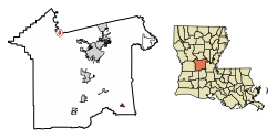
Glenmora is a town in Rapides Parish, Louisiana, United States. It is part of the Alexandria, Louisiana Metropolitan Statistical Area. The population was 1,342 at the 2010 census.

<span class="mw-page-title-main">Lecompte, Louisiana</span> Town in Louisiana, United States

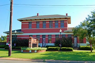
Lecompte is a town in Rapides Parish, Louisiana, United States. Lecompte is situated along the banks of Bayou Boeuf in central Louisiana. US Highway 71, Louisiana’s major north-south route which connects Baton Rouge and Shreveport, runs through Lecompte. Lecompte is named after the famous race horse called LeComte, which was named after horse breeder Ambrose LeComte. It is part of the Alexandria, Louisiana metropolitan area. The population was 1,227 at the 2010 and had dropped to 845 at the 2020 Census.

<span class="mw-page-title-main">Pineville, Louisiana</span> City in Louisiana, United States

Pineville is a city in Rapides Parish, Louisiana, United States. It is located across the Red River from the larger Alexandria, and is part of the Alexandria Metropolitan Statistical Area. The population was 14,555 at the 2010 census. It had been 13,829 in 2000; population hence grew by 5 percent over the preceding decade.

<span class="mw-page-title-main">Woodworth, Louisiana</span> Town in Louisiana, United States

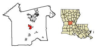
Woodworth is a town in Rapides Parish, Louisiana, United States. It is part of the Alexandria, Louisiana Metropolitan Statistical Area. The population was 1,096 at the 2010 census.

Wallace is a census-designated place (CDP) in St. John the Baptist Parish, Louisiana, United States. The population was 570 at the 2000 census. It is part of the New Orleans–Metairie–Kenner Metropolitan Statistical Area. The rural community is on the west bank of the Mississippi River and easily accessible to Interstate 10 via the Gramercy Bridge.

<span class="mw-page-title-main">Alexandria metropolitan area, Louisiana</span> Metropolitan Statistical Area in Louisiana, United States

The Alexandria Metropolitan Statistical Area is a metropolitan area in central Louisiana that covers two parishes – Rapides and Grant. As of the 2000 census, the MSA had a population of 145,035.

<span class="mw-page-title-main">William Prince Ford</span> American Baptist minister, preacher and planter (1803 – 1866)

William Prince Ford was an American Baptist minister, preacher and planter in pre-Civil War Louisiana. He was the slave owner who first bought Solomon Northup, a free African-American, after Northup had been kidnapped in Washington, D.C., and sold in New Orleans in 1841. He resided in the "Great Pine Woods", Avoyelles, Red River Parish, Louisiana, and he ran a farm there. At the same year, Ezra Bennett, a Bayou Boeuf storekeeper and planter, lived near the plantation of Prince Ford and gave him instructions to his factors.

Sue Eakin (1918–2009) was an American history professor at Louisiana State University of Alexandria. She received a National Endowment for the Humanities Fellowship and was made a Fellow of American Association of University Women. Eakin researched the story of Solomon Northup, Twelve Years a Slave, and published a version of the book that corrected historical inaccuracies.

References

  1. "2020 U.S. Gazetteer Files". United States Census Bureau. Retrieved March 20, 2022.
  2. 1 2 U.S. Geological Survey Geographic Names Information System: Cheneyville, Louisiana
  3. "Profile for Cheneyville, Louisiana". ePodunk . Retrieved June 14, 2010.
  4. Tryggestad, Erik (February 27, 2014). "Oscar contender '12 Years a Slave' has ties to Restoration Movement". Christian Chronicle. Retrieved February 28, 2014.
  5. "Rick, Markway, "The Prosecutor: District Attorney James Crawford 'Jam' Downs"" (PDF). lwaa.org. Archived from the original (PDF) on February 22, 2014. Retrieved June 27, 2013.
  6. "Membership in the Louisiana House of Representatives, 1812-2016: Rapides Parish" (PDF). house.Louisiana.gov. Archived from the original (PDF) on October 6, 2014. Retrieved December 22, 2014.
  7. "Obituary of Sue Lyles Eakin". melanconfunerals.com. Retrieved September 21, 2009.
  8. "David Theophilus Stafford and Leroy Augustus Stafford". Louisiana Historical Association. Archived from the original on July 16, 2016. Retrieved August 25, 2014.
  9. "Census of Population and Housing". Census.gov. Retrieved June 4, 2015.
  10. "Explore Census Data". data.census.gov. Retrieved December 29, 2021.
  11. "U.S. Census website". United States Census Bureau . Retrieved January 31, 2008.