Galway Bay is a bay on the west coast of Ireland, between County Galway in the province of Connacht to the north and the Burren in County Clare in the province of Munster to the south; Galway city is on the northeast side. The bay is about 50 kilometres (30 mi) long and from 10 kilometres (6 mi) to 30 kilometres (20 mi) in breadth. The Aran Islands are to the west across the entrance and there are numerous small islands within the bay. To the west of Galway, the rocks are granite but to the south they are limestone.

Tyrrellspass is a Georgian village in County Westmeath, Ireland. It is 81 kilometres (50 mi) from Dublin, in the south of the county on the R446 road. Tyrrellspass won the Irish Tidy Towns Competition in 1969. As of the census in April 2016, the population of Tyrrellspass was 483.

Ballaghaderreen is a town in County Roscommon, Ireland. It was part of County Mayo prior to 1898. It is in the north-west of the county, near the borders with counties Mayo and Sligo, just off the N5 road. The population was 1,808 in the 2016 census.

Carnaross or Carnaros is a village in County Meath, Ireland, approximately 4 km northwest of Kells on the R147 road between Kells and Virginia, County Cavan.

Suilven is a mountain in Scotland. Lying in a remote area in the west of Sutherland, it rises from a wilderness landscape of moorland, bogs and lochans known as Inverpolly National Nature Reserve. Suilven forms a steep-sided ridge some two kilometres in length. The highest point, Caisteal Liath, lies at the northwest end of this ridge. There are two other summits: Meall Meadhonach at the central point of the ridge is 723 metres (2,372 ft) high, whilst Meall Beag lies at the southeastern end.
Ballyhea or Ballyhay is a townland and civil parish in north County Cork, Ireland. Located near to the County Limerick border, the village of Ballyhea lies on the main N20 Cork–Limerick road, 3.5 km south of Charleville. It lies approximately 110 m above sea level.

Ballaghmore is a small village located on the western side of County Laois, Ireland, southwest of Portlaoise. It is approximately 7 kilometres (4 mi) east of Roscrea. The village is in the civil parish of Kyle in the historic barony of Clandonagh.

Balloch is a village in West Dunbartonshire, Scotland, at the foot of Loch Lomond.

Applecross is a peninsula in Wester Ross, in the Scottish Highlands. It is bounded by Loch Kishorn to the south, Loch Torridon to the north, and Glen Shieldaig to the east. On its western side is Applecross Bay and the Inner Sound. The peninsula is mountainous, sparsely populated, and linked to the mainland by two small roads. The former Celtic Church monastery of Applecross was established by Saint Máel Ruba, a missionary from Bangor Abbey in Gaelic Ireland, during the 7th century; a sculptured stone is all that remains.

Bellanaleck is a small village in County Fermanagh, Northern Ireland. It lies just south of Enniskillen on the main A509 (N3) road towards Cavan and Dublin. In the 2011 Census it had a population of 532. It is situated within Fermanagh and Omagh district.

Baltinglass, historically known as Baltinglas, is a town in south-west County Wicklow, Ireland. It is located on the River Slaney near the border with County Carlow and County Kildare, on the N81 road. The town is in a civil parish of the same name.
Tamnaherin is a townland and small housing estate in County Londonderry, Northern Ireland. In the 2001 Census it had a population of 123 people. It is situated within Derry and Strabane district.

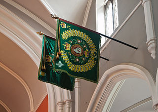
Faugh a ballagh is a battle cry of Irish origin, meaning "clear the way". The spelling is an 18th-century anglicization of the Irish language phrase Fág an bealach, also written Fág a' bealach. Its first recorded use as a regimental motto was by the 87th Regiment of Foot in 1798. It remains the motto of the Royal Irish Regiment today.

Sgùrr MhicChoinnich is a mountain on the Isle of Skye in Scotland. It is in the Black Cuillin range of mountains and is classified as a Munro. Like all the other Black Cuillin mountains it is made predominantly of gabbro rock and has little vegetation. The mountain is named after the mountain guide John MacKenzie.

Milltownpass is a village in County Westmeath, Ireland. It is in the south of the county, 10 km south-east of Mullingar. The village is on the R446 regional road ; the old route was replaced by a dual-carriageway from Kinnegad to Tyrrellspass in 2006, bypassing the village. Milltownpass is the second largest village in the parish of Rochfortbridge. It was one of the first villages in Ireland to have its own electricity supply: a mill on the Milltown River providing power to the village long before rural electrification.
Gaeltacht Way, Donegal comprises four circular long-distance trails in the Gaeltacht areas of County Donegal in Ireland. All four trails are designated as a National Waymarked Trails by the National Trails Office of the Irish Sports Council and managed by Donegal County Council and Údaras na Gaeltachta.
The Ballagh or Ballaghkeen is a village in the southeastern corner of Ireland. It is situated in County Wexford just off the R741 regional road halfway between the towns of Gorey to the north and Wexford to the south. As of the 2016 census, the village had a population of 515 people.

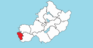
Kilkenny West, previously Maherquirke or Dillons country, is a barony in west County Westmeath, Ireland. It was formed by 1542. It is bordered by County Longford to the west; it is also bordered by three other Westmeath baronies: Rathconrath, Brawny and Clonlonan. The largest centre of population in the barony is the village of Glassan.

Brawny is a barony in south–west County Westmeath, Ireland. It was formed by 1672. It is bordered by County Roscommon to the west. It also borders two other Westmeath baronies: Kilkenny West and Clonlonan. The largest centre of population in the barony is the town of Athlone.
St. Marys is a civil parish in County Westmeath, Ireland. It is located about 38.96 kilometres (24 mi) west–south–west of Mullingar.


