County Sligo is a county in Ireland. It is in the Northern and Western Region and is part of the province of Connacht. Sligo is the administrative capital and largest town in the county. Sligo County Council is the local authority for the county. The population of the county was 69,819 at the 2022 census. It is noted for Benbulben Mountain, one of Ireland's most distinctive natural landmarks.

Carrick-on-Shannon is the county town of County Leitrim in Ireland. It is the largest town in the county of Leitrim. A smaller part of the town lies in County Roscommon. As of the 2022 census, the population of the town was 4,743. It is situated on a strategic crossing point of the River Shannon. The Leitrim part of the town is in the civil parish of Kiltoghert which is in the ancient barony of Leitrim.
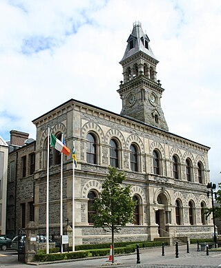
Sligo is a coastal seaport and the county town of County Sligo, Ireland, within the western province of Connacht. With a population of 20,608 in 2022, it is the county's largest urban centre and the 24th largest in the Republic of Ireland.

Achonry is a village in County Sligo, Ireland. The old name is Achad Cain Conairi. St. Nath Í ua hEadhra (O'Hara) founded a monastery here. The foundation gave the later diocese its name. The monastery was founded on land granted by the Clan Conaire. Nath Í was the teacher of St. Féichín of Ballysadare.

Collooney or Coloony is a town in County Sligo, Ireland.

Easky or Easkey is a village in County Sligo, Ireland. It is on the Atlantic coast, 26 miles (42 km) from Sligo and 15 miles (24 km) from Ballina, County Mayo. The village name derives from the Irish language term for fish ("iasc") and "Iascaigh" literally means "abounding in fish", due to the Easky River that lies adjacent to the village itself. Easky, as a parish, was originally called "Imleach Iseal". The area is a tourist destination on account of its scenery and water sports. Easky is a designated area on Ireland's Wild Atlantic Way tourist route.
North Sligo was a parliamentary constituency in Ireland, which returned one Member of Parliament (MP) to the House of Commons of the Parliament of the United Kingdom, elected on a system of first-past-the-post, from 1885 to 1922.
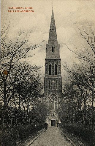
The Roman Catholic Diocese of Achonry is a Roman Catholic diocese in the western part of Ireland. It is one of the five suffragan sees of the Archdiocese of Tuam. The diocese was often called the "bishopric of Luighne" in the Irish annals. It was not established at the Synod of Rathbreasail, but Máel Ruanaid Ua Ruadáin signed as "bishop of Luighne" at the Synod of Kells.

Saint Féchín or Féichín, also known as Mo-Ecca, was a 7th-century Irish saint, chiefly remembered as the founder of the monastery at Fore (Fobar), County Westmeath.
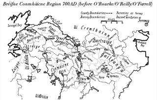
Gailenga was the name of two related peoples and kingdoms found in medieval Ireland in Brega and Connacht.
Nethercross is a feudal title of one of the baronies of Ireland. Originally part of the Lordship of Meath, it was then constituted as part of the County Dublin. Today, is in the modern county of Fingal.
Dolan is a surname of Irish origin. The name Dolan is fairly common today in Ulster, particularly in Cavan, Fermanagh and Tyrone, and also in the Connacht Counties of Roscommon and Galway. The latter is the place of origin of this sept which is a branch of the Ui Máine specifically in the Clonmacnowen Barony in Galway and in the Barony of Athlone in Roscommon.

Cairbre Drom Cliabh was an Irish túath in the ancient confederation of Íochtar Connacht, now County Sligo in the west of Ireland. It is now represented by the barony of Carbury. Also known as Cairbre na Catha. It existed from at least the 6th century to the 16th century AD.
Newcastle is a feudal title of nobility and one of the baronies of Ireland. It was constituted as part of the old county of Dublin. Today, it lies in the modern county of South Dublin. At the heart of the barony is the civil parish of the same name - Newcastle - which is one of eleven civil parishes in the barony. The ruins of the eponymous castle, also known as Newcastle-Lyons, are located in the townland of Newcastle South. The town with the biggest population in the barony is Lucan.

Moygoish is a barony in north County Westmeath, in Ireland, formed by 1672. It is bordered by County Longford to the west and four other Westmeath baronies: Corkaree, Fore, Moyashel and Magheradernon and Rathconrath to the south–west.

Moyashel and Magheradernon is a barony in the centre of County Westmeath, in Ireland, formed by 1672. It is bordered by eight other baronies: Corkaree and Fore, Delvin and Farbill, Fartullagh and Moycashel and Rathconrath and Moygoish.

Farbill is a barony in east County Westmeath, in Ireland. It was formed by 1672. It is bordered by County Meath to the south and east and three other baronies: Fartullagh, Moyashel and Magheradernon and Delvin. The largest centre of population in the barony is the town of Kinnegad.

The Ballisodare River is a river in Ireland, flowing through County Sligo.

Corthoon or Cartrongibbagh is a townland in County Leitrim, Connacht, Ireland. The townland is located in the northern part of the county, close to the borders of County Donegal and County Fermanagh. The main service town is Manorhamilton.

Kilmorgan Church and Burial Ground consists of the remains of a small church, likely from the 17th century, and a now disused burial ground containing a variety of graves including family vaults. It lies in the townland of Kilmorgan(Irish:Cill Mhurchon-The church of Murchon), also giving its name to the Civil-Parish and Half-Parish where it resides. This church half-parish is located along the north-east of the south- Sligo barony of Corran and is part of the Catholic parish of Emlaghfad and Kilmorgan more commonly known as Ballymote parish. The Church of Ireland version is The Union of Emlaghfad and Kilmorgan.