N4 road (Ireland)

Last updated

IRL N4.svg
N4 road
Bóthar N4
Route information
Length198.21 km (123.16 mi)
Location
Country Ireland
Primary
destinations
(bypassed routes in italics)
Highway system
M4 motorway IE.png
M4 motorway
Mótarbhealach M4
Route information
Length62 km (39 mi)
Existed1994–present
HistoryCompleted 1994–2006
Component
highways
IRL N4.svg
Major junctions
From Lucan
Major intersections Motorway Exit 11 Ireland.PNG M6 reduced motorway IE.png
To Kinnegad
Location
Country Ireland
Primary
destinations
Leixlip, Kilcock, Enfield
Highway system
The 2+2 section of the N4. N4 Dromad-Roosky (bright enhance filter).jpg
The 2+2 section of the N4.

The N4 road is a national primary road in Ireland, running from Dublin to the northwest of Ireland and Sligo town. The M6 to Galway diverges from this route after Kinnegad, while the N5 to Westport diverges at Longford town. Most sections of the N4 that are motorway-standard are designated the M4 motorway.

Contents

Road standard

The N4 originates at an intersection with the M50 motorway at Junction 7. This is also Junction 1 of the N/M4. The Liffey Valley Shopping Centre is located at Junction 2. The road has three lanes and a bus lane in each direction between the M50 and Junction 5 which is also the start of the M4 motorway at Leixlip.

The N4 was the only one of the main inter-urban national routes whose dual-carriageway section continued into the city centre; however, the section inside the M50 was re-classified as the R148 in 2012. [1]

Heading west, the PPP motorway section (see below) ends west of Kinnegad, and the motorway terminates 5  km further west; it continues as HQDC and bypasses Mullingar. From the Mullingar bypass to Edgeworthstown, the road is a wide single carriageway with hard shoulders. Between Edgeworthstown and Longford, there is a lower standard single carriageway road. Between Longford and Rooskey single carriageway continues at a higher standard. Dromod and Rooskey were bypassed in late 2007. This section of the road consists of three roundabouts and a Type 2 dual carriageway, i.e.: two lanes in each direction and no hard shoulder. The road resumes as a single carriageway with hard shoulders until it reaches Carrick-on-Shannon, where it becomes a local urban road through five roundabouts, and passing over the River Shannon into County Roscommon. The road becomes a high-quality single carriageway bypass 3  km outside of Boyle town, with periodic alternating overtaking lanes passing Lough Key Forest Park and Ballinafad until it reaches Castlebaldwin. From Castlebaldwin to Collooney the road is a Type 2 dual carriageway. Funding for the expansion of this section was announced in October 2018, and it opened in 2021. [2] The road becomes near-motorway standard dual carriageway again at Collooney, approaching Sligo town.

M4 motorway

The section from Leixlip to the west of Kinnegad is the M4 motorway . The first section of this motorway (Leixlip – Kilcock) was opened on 19 December 1994.[ citation needed ]

Tolled section of the M4 motorway

Under the Government announcement of the pilot projects on 1 June 1999 this project was to be assessed by the NRA for its suitability to be advanced as a Public-private partnership (PPP). Subsequently, the project was included as one of the projects approved under Tranche II of the PPP Roads programme as announced by the NRA in June 2000. The project involved the construction of 39  km of motorway from Kinnegad to Kilcock and is an extension of the Kilcock-Maynooth-Leixlip motorway on the N4/N6 Sligo/Galway to Dublin route. The motorway bypasses the towns of Enfield and Kinnegad.[ citation needed ]

The PPP contract was awarded in March 2003 to the EuroLink Consortium (SIAC Construction Ltd and Cintra - Concesiones de Infraestructuras de Transporte S.A.) and allows for them to collect tolls for 30 years from that date.

This tolled section (from Kilcock to Kinnegad) opened on 12 December 2005, almost a year ahead of schedule. [3] It is the second-most expensive toll road in Ireland (after the Dublin Port Tunnel). A toll of €3.00 (as of 2022) for cars is charged at a toll plaza just west of Kilcock and at smaller toll plazas at on and off-ramps at Enfield. Between Enfield and Kinnegad, no further access to the M4 is possible.[ citation needed ]

Eurolink operates this tolling scheme, the first in Ireland not operated by NTR plc. From 2005 to 2007, Eurolink started to accept several tags issued by other motorways such as M1, M8, eTrip and Dublin Port Tunnel tags.[ citation needed ] On 14 June 2007 NTR plc joined the Nationwide Electronic Toll Payment System introducing their popular EazyPass tags on the system and allowing all other toll plazas in the country (different from those owned by NTR plc) to accept them, [4] meaning that each toll company's electronic tag will work on all toll roads in the State.

In the 1 July 2006 edition of the Meath Chronicle it was claimed that up to 10% of the €420 million road project had "to be ripped up and replaced" shortly after it opened due to rushed construction,[ citation needed ] however this cost would have had to be carried by the toll operators, not the state, as per the contract.

The bypassed former N4 road has been reclassified as the R148.

Motorway reclassification

On 28 August 2009, the Department of Transport implemented the second round of proposed reclassifications of dual carriageways as motorways under the Roads Act 2007. [5] A short section of the N4 between Kinnegad (J12) and McNead's Bridge (J13) was affected by this. This extended the M4 westward by 6.8 km.

Junctions

The route begins as a dual carriageway at junction 7 of the M50, becoming a motorway after junction 5. It then becomes a dual carriageway after junction 13. After Mullingar, it becomes a regular national road.

CountykmmiJunctionDestinationsNotes
County Dublin
1M50-IE confirmatory.svg M 50  Dublin Airport, Dublin Port, Dún Laoghaire Continues as R148 towards Dublin city centre and Palmerstown.
2IRL R113.svg R 113  ‒ Fonthill, Liffey Valley
2aBallyowen LaneWestbound exit only. Exit lane runs parallel to mainline, ending at slip road at junction 3.
3IRL R136.svg R 136  – Ballyowen, Lucan
4IRL R120.svg R 120  – Lucan, Adamstown
4aL 1018 – Dodsboro, Kew ParkOnly Dodsboro is signposted on eastbound approach. Exit lane runs parallel to mainline, ending at slip road at junction 5.
5IRL R148.svg R 148  Celbridge, Leixlip (westbound)Heading eastbound, both destinations are followed by the (East) cardinal direction.

Continues as M4 motorway.

County Meath
6IRL R449.svg R 449  ‒ Celbridge (West), Leixlip (West) Dunboyne
7IRL R406.svg R 406  Maynooth, Naas Straffan
8IRL R148.svg R 148  Kilcock

IRL R407.svg R 407  Clane

Enfield, Trim
IE road sign symbol F-060.svg M4 Toll
9IRL R402.svg R 402  Edenderry, EnfieldToll at westbound entrance and eastbound exit slip roads.
County Kildare Motorway Services Ireland.png Enfield Service Area
County Meath10IRL R401.svg R 401  Kinnegad
County Westmeath 11M6-IE confirmatory.svg M 6  Galway, Athlone Tullamore (N52)
12IRL R148.svg R 148  ‒ Kinnegad, Galway (M6)Westbound entrance and eastbound exit only.
13L 1025 Coralstown LILO junction. Continues as N4 dual carriageway.
14IRL R156.svg R 156  Killucan, The Downs
L 5720LILO junction. Westbound entrance and eastbound exit only.
15IRL N52.svg N 52  ‒ Tullamore, Mullingar (East)
16IRL N52.svg N 52  Dundalk, Mullingar (Centre)
17IRL R394.svg R 394  Castlepollard, Mullingar (West) Mullingar Hospital

Continues as N4 regular national road.

1.000 mi = 1.609 km; 1.000 km = 0.621 mi

Bypasses

Sign in Mullingar marking the opening of the bypass by Taoiseach (and TD for Longford-Westmeath) Albert Reynolds Mullingar bypass sign.jpg
Sign in Mullingar marking the opening of the bypass by Taoiseach (and TD for Longford–Westmeath) Albert Reynolds
Travelling East along the upgraded Lucan Bypass in west Dublin. N4 Eastbound.jpg
Travelling East along the upgraded Lucan Bypass in west Dublin.

Upgrades

J11; M6/M4 junction (prior to redesignation of the N6 - M6). M4 Heading west at J11 (start of the N6 near Kinnegad.jpg
J11; M6/M4 junction (prior to redesignation of the N6 → M6).

In July 2009, an upgrade of the section between the M50 junction and the Leixlip interchange was completed. In this section the road is three lanes in each direction, the median crossings were removed and the junction with the R120 is a fully grade-separated junction. Private accesses and some left turns remain which prevents the section from being designated a motorway. The speed limit is 80 km/h. [8] There are currently no signal-controlled junctions on the N/M4 between the M50 motorway and the Sligo through-pass.

In 2013, a 5  km stretch of dual carriageway with at-grade crossover junctions between the M4 and the Mullingar bypass was upgraded to HQDC.

Construction of a 2+2 road at the 15 km stretch between Collooney and Castlebaldwin began in 2019 to improve road safety. [9] The road was opened on 18 October 2021. [6]

Planned improvements to the route

N4 between Kinnegad and Mullingar; former N4 (now R148) in left of the picture. (This section was redesignated as a motorway in August 2009) N4road4416a.jpg
N4 between Kinnegad and Mullingar; former N4 (now R148) in left of the picture. (This section was redesignated as a motorway in August 2009)

See also

Related Research Articles

<span class="mw-page-title-main">M50 motorway (Ireland)</span> Orbital motorway around Dublin

The M50 motorway is a C-shaped orbital motorway in Dublin and the busiest motorway in Ireland. The current route was built in various sections over the course of 27 years, from 1983 to 2010. It begins at Dublin Port, running northward through the Dublin Port Tunnel and along a portion of the Airport Motorway. It then turns west at its junction with the M1, circling the northern, western and southern suburbs of Dublin, before merging with the M11 at Shankill in South East Dublin. The road forms part of European route E01.

<span class="mw-page-title-main">Roads in Ireland</span> Overview of roads in Ireland

The island of Ireland, comprising Northern Ireland and the Republic of Ireland, has an extensive network of tens of thousands of kilometres of public roads, usually surfaced. These roads have been developed and modernised over centuries, from trackways suitable only for walkers and horses, to surfaced roads including modern motorways. Driving is on the left-hand side of the road. The major routes were established before Irish independence and consequently take little cognisance of the border other than a change of identification number and street furniture. Northern Ireland has had motorways since 1962, and has a well-developed network of primary, secondary and local routes. The Republic started work on its motorway network in the early 1980s; and historically, the road network there was once somewhat less well developed. However, the Celtic Tiger economic boom and an influx of European Union structural funding, saw national roads and regional roads in the Republic come up to international standard quite quickly. In the mid-1990s, for example, the Republic went from having only a few short sections of motorway to a network of motorways, dual carriageways and other improvements on most major routes as part of a National Development Plan. Road construction in Northern Ireland now tends to proceed at a slower pace than in the Republic, although a number of important bypasses and upgrades to dual carriageway have recently been completed or are about to begin.

The N7 road is a national primary road in Ireland, connecting Limerick and Dublin. The majority of the route is motorway standard and is designated as the M7 motorway. At the Rosbrien interchange in Limerick the route continues as the N18 dual carriageway to Shannon and Ennis. The road passes through the midlands of Ireland, and acts as a trunk route out of Dublin for the N8 and N9 national primary routes to Cork and Waterford respectively. It forms part of European route E20.

<span class="mw-page-title-main">N11 road (Ireland)</span> National primary road in Ireland

The N11 road is a national primary road in Ireland, running for 129 km (80 mi) along the east side of Ireland from Dublin to Wexford. It passes close to Bray, Greystones, Wicklow, Arklow, Gorey, and Enniscorthy. Beyond Wexford, the route continues to Rosslare as the N25. The road forms part of European route E01. As of July 2019 the N11/M11 is of dual carriageway or motorway standard from Dublin as far as Oilgate in County Wexford.

<span class="mw-page-title-main">National Development Plan</span> Large infrastructure developments in Ireland

National Development Plan was the title given by the Irish Government to a scheme of organised large-scale expenditure on (mainly) national infrastructure. The first five-year plan ran from 1988 to 1993, the second was a six-year plan from 1994 to 1999 and the third ran as a seven-year plan from 2000 to 2006. A fourth National Development Plan ran from 2007 to 2011. The main elements of the third plan were the development of a national motorway network between the major cities in Ireland. The upgrading of the rail network was a secondary scheme.

<span class="mw-page-title-main">N6 road (Ireland)</span> Road in Ireland

The N6 road is a national primary road in Ireland from junction 11 on the M4 motorway at Kinnegad to Galway city. The N6 and N4 form a continuous motorway or dual carriageway from Dublin city centre to Galway City passing in an east–west direction through the midlands of Ireland. Most of the road is motorway standard with the exception of the Athlone bypass and stretches of urban road in Galway City, which are the only sections of the road that remain designated as N6 dual carriageway. There is one toll on the road outside Galway city. Major upgrades to the road were completed in December 2009 completing the first intercity motorway/dual carriageway in Ireland and the New Junctions of M6 are built and will be 164 km.

The N3 road is a national primary road in the Republic of Ireland, running between Dublin, Cavan and the border with County Fermanagh. The A509 and A46 roads in Northern Ireland form part of an overall route connecting to Enniskillen, and northwest to the border again where the N3 reappears to serve Ballyshannon in County Donegal.

<span class="mw-page-title-main">N5 road (Ireland)</span> Road in Ireland

The N5 road is a national primary road in Ireland, connecting Longford town with Westport. It is the main access route from Dublin to most of County Mayo, including the county's largest towns, Castlebar, Ballina, and Westport.

<span class="mw-page-title-main">N17 road (Ireland)</span> Road between counties Galway and Sligo in Ireland

The N17 road is a national primary road in Ireland, and is part of the Atlantic Corridor route. It begins in County Galway and ends in County Sligo. On 27 September 2017 the southern, Tuam–Galway, section was upgraded to motorway status and designated M17.

<span class="mw-page-title-main">Regional road (Ireland)</span> Class of road in Ireland

A regional road in the Republic of Ireland is a class of road not forming a major route, but nevertheless forming a link in the national route network. There are over 11,600 kilometres of regional roads. Regional roads are numbered with three-digit route numbers, prefixed by "R". The equivalent road category in Northern Ireland are B roads.

<span class="mw-page-title-main">R113 road (Ireland)</span> Road in Ireland

The R113 road is a regional road in Ireland. Located in Dublin, it forms a semi-orbital route around the south of the city. As of 2007, clockwise, it starts at the N31 at Temple Hill in Blackrock and ends at a junction with the N4 at Palmerstown.

<span class="mw-page-title-main">R148 road (Ireland)</span> Road in Ireland

The R148 road is one of Ireland's regional roads which was classified following the opening of a by-passed national primary road.
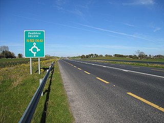
<span class="mw-page-title-main">N52 road (Ireland)</span> Road in Ireland

The N52 road is a national secondary road in Ireland. It links the M7 motorway from just south of Nenagh, County Tipperary to the M1 motorway north of Dundalk in County Louth. The route forms a connection between the north east of Ireland and the mid west traversing the midlands. It interchanges with the M6 at Kilbeggan and at Tyrrellspass, the N4 at Mullingar, the N3 at Kells, and the N2 at Ardee before continuing towards Dundalk.

<span class="mw-page-title-main">Enfield, County Meath</span> Town in Leinster, Ireland

Enfield or Innfield is a town in south County Meath, Ireland, situated between Kilcock and Kinnegad and very close to the border with County Kildare. The town is on the Dublin-Sligo railway line. It is located on the R148 regional road, formerly the N4 national primary road connecting Dublin to Connacht.

<span class="mw-page-title-main">High-quality dual carriageway</span> Road category in Ireland

A High-quality dual carriageway (HQDC) is a road category in Ireland. It is defined as an all-purpose dual carriageway road type built to near motorway standards, but without motorway classification or motorway restrictions. High-quality dual carriageways have full grade-separated access and do not have junctions with minor roads. Such roads in the Republic of Ireland have been built as part of the 2000–2006 and 2007–2013 National Development Plans, including interurban routes from Dublin to other cities.
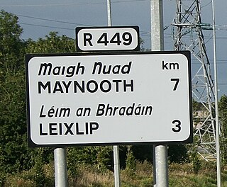
<span class="mw-page-title-main">R449 road (Ireland)</span> Road in Ireland

The R449 road is a regional road in County Kildare, Ireland. It is just 3 km (1.9 mi) long and was completed in 2003 as part of the construction of a grade separated interchange to connect both West Leixlip and North Celbridge to the M4 motorway at Junction 6.

<span class="mw-page-title-main">2+2 road</span> Design of road

A 2+2 road is a specific type of dual-carriageway that exists primarily in Ireland, Sweden, Estonia and Finland, consisting of two lanes in each direction separated by a steel cable barrier.
<span class="mw-page-title-main">M6 motorway (Ireland)</span> Road in Ireland

The M6 motorway is a motorway in Ireland, which runs from Dublin to Galway. The M6 extends from its junction with the M4 at Kinnegad all the way west to the outskirts of Galway City, but the Athlone bypass and the approach to Galway city - while of dual carriageway standard - have not been designated motorway and are still signed as N6. The motorway was officially completed and opened to traffic on 18 December 2009, and was the first city-to-city direct major inter-urban route to be completed in Ireland. The M6 and M4, which form the Galway-Dublin route, consist of a grade-separated 2+2 dual carriageway road with a top speed limit of 120 km/h. At approximately 144 km (90 mi), the M6 is the third longest motorway in the state and will be 159 km.

<span class="mw-page-title-main">Motorways in the Republic of Ireland</span>

In Ireland, the highest category of road is a motorway, indicated by the prefix M followed by a one- or two-digit number. The motorway network consists entirely of motorway-grade dual carriageways and is largely focused upon Dublin. There are also several three-lane motorways, while Ireland's busiest road, the M50, incorporates four-lane, five-lane, and six-lane stretches.

<span class="mw-page-title-main">Farbill</span> Barony in Leinster, Ireland

Farbill is a barony in east County Westmeath, in Ireland. It was formed by 1672. It is bordered by County Meath to the south and east and three other baronies: Fartullagh, Moyashel and Magheradernon and Delvin. The largest centre of population in the barony is the town of Kinnegad.

References

  1. Book (eISB), electronic Irish Statute. "electronic Irish Statute Book (eISB)". www.irishstatutebook.ie. Archived from the original on 7 March 2016. Retrieved 4 June 2019.
  2. "#Budget19 Live: The main points from today's budget". IrishExaminer.ie . 9 October 2018. Archived from the original on 9 October 2018. Retrieved 9 October 2018.
  3. 1 2 Cassidy, Luke (12 December 2005). "Kilcock–Kinnegad road opens ahead of schedule". The Irish Times . Retrieved 14 September 2022.
  4. "Press Releases - National Roads Authority". Archived from the original on 18 November 2007. Retrieved 11 February 2008.
  5. "S.I. No. 255/2009 - Roads Act 2007 (Declaration of Motorways) Order 2009". Irish Statute Book. Archived from the original on 23 November 2017. Retrieved 15 October 2020.
  6. 1 2 Mannion, Teresa (18 October 2021). "Taoiseach opens €140m N4 road in Sligo". RTÉ News . Retrieved 18 October 2021.
  7. Gallagher, Emma (24 August 2021). "Bittersweet day as new N4 dual carriageway finally opens". The Sligo Champion .
  8. "N4 Leixlip to M50 Junction".[ permanent dead link ]
  9. "An Taoiseach and Minister Ross turn sod on N4 Collooney-Castlebaldwin Road and Western Distributor Road". Transport Infrastructure Ireland. 22 February 2019. Retrieved 4 June 2019.

Sources