Bangecuo

Last updated
Bangor Co
Bangecuo 2021-10-11 Sentinel-2 L2A Highlight Optimized Natural Color.jpg
Sentinel-2 image (2021)
Tibet loc rel map.svg
Red pog.svg
Bangor Co
Location Xainza County, Nagqu, Tibet, China
Coordinates 31°44′16.5″N89°28′35.8″E / 31.737917°N 89.476611°E / 31.737917; 89.476611

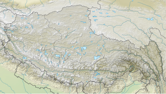
Bangecuo (also spelled as Bangor Co, Tibetan : བྲང་ཁོག་མཚོ, Wylie : brang khog mtsho, ZYPY : Drangkhok Tso; Chinese :班戈错; pinyin :Bāngēcuò) is a graben basin salt lake [1] [2] on the Tibetan Plateau in Xainza County within Nagqu in the Tibet Autonomous Region of China.

Contents

It was reported in 2003 that the water levels of Siling Lake and Bangecuo had increased by 19.34% since 1969. [3]

Siling Lake is another nearby salt lake located west of Bangecuo, [4] around four miles away.

See also

Related Research Articles

<span class="mw-page-title-main">Geography of Tibet</span>

The geography of Tibet consists of the high mountains, lakes and rivers lying between Central, East and South Asia. Traditionally, Western sources have regarded Tibet as being in Central Asia, though today's maps show a trend toward considering all of modern China, including Tibet, to be part of East Asia. Tibet is often called "the roof of the world," comprising tablelands averaging over 4,950 metres above the sea with peaks at 6,000 to 7,500 m, including Mount Everest, on the border with Nepal.

<span class="mw-page-title-main">Tibetan Plateau</span> Plateau in Central, South and East Asia

The Tibetan Plateau, also known as the Qinghai–Tibet Plateau or the Qing–Zang Plateau or as the Himalayan Plateau in India, is a vast elevated plateau located at the intersection of Central, South, and East Asia covering most of the Tibet Autonomous Region, most of Qinghai, western half of Sichuan, Southern Gansu provinces in Western China, southern Xinjiang, Bhutan, the Indian regions of Ladakh and Lahaul and Spiti as well as Gilgit-Baltistan in Pakistan, northwestern Nepal, eastern Tajikistan and southern Kyrgyzstan. It stretches approximately 1,000 kilometres (620 mi) north to south and 2,500 kilometres (1,600 mi) east to west. It is the world's highest and largest plateau above sea level, with an area of 2,500,000 square kilometres (970,000 sq mi). With an average elevation exceeding 4,500 metres (14,800 ft) and being surrounded by imposing mountain ranges that harbor the world's two highest summits, Mount Everest and K2, the Tibetan Plateau is often referred to as "the Roof of the World".

<span class="mw-page-title-main">Qaidam Basin</span> Ecoregion in Qinghai, China

The Qaidam, Tsaidam, or Chaidamu Basin is a hyperarid basin that occupies a large part of Haixi Prefecture in Qinghai Province, China. The basin covers an area of approximately 120,000 km2 (46,000 sq mi), one-fourth of which is covered by saline lakes and playas. Around one third of the basin, about 35,000 km2 (14,000 sq mi), is desert.

<span class="mw-page-title-main">Tanggula Mountains</span> Mountain range in Tibet

The Tanggula, Tangla, Tanglha, or Dangla Mountains is a mountain range in the central part of the Qinghai-Tibet Plateau in Tibet. Administratively, the range is in the Nagqu Prefecture of the Tibet Autonomous Region, with the central section extending into the Tanggula Town and the eastern section entering the Yushu Tibetan Autonomous Prefecture of Qinghai province.

<span class="mw-page-title-main">Siling Lake</span> Lake in Tibet

Siling Lake, is a salt lake in the Tibet Autonomous Region, China to the north of Xainza. Doijiang is located near the lake. Administratively it belongs to Xainza County and Baingoin County of the Nagqu.

<span class="mw-page-title-main">Altyn Tagh fault</span>

The Altyn Tagh Fault (ATF) is a 2,000 km long, active, sinistral strike-slip fault that forms the northwestern boundary of the Tibetan Plateau with the Tarim Basin. It is one of the major sinistral strike-slip structures that together help to accommodate the eastward motion of this zone of thickened crust, relative to the Eurasian Plate. A total displacement of about ~475 km has been estimated for this fault zone since the middle Oligocene, although the amount of displacement, age of initiation and slip rate are disputed.

<span class="mw-page-title-main">Chola Mountains</span> Mountain range in Sichuan Province, China

The Chola Mountains, also romanized as the Trola Mountains, are a northern subrange of the Shaluli Mountains in western Sichuan Province, China. The mountains were once at the centre of the Kingdom of Derge and many remnant Tibetan Buddhist monasteries can be found in the mountain range's valleys.

<span class="mw-page-title-main">Lake Urru</span> Freshwater lake in China

Urru Lake (Tibetan: འུར་རུ་མཚོ, Wylie: ur ru mtsho; Chinese: 吴如错; pinyin: Wúrú Cuò)is a plateau lake in Nagqu Prefecture, Tibet Autonomous Region, southwest of China, located between Nyima County and Xainza County. The lake, which is part of the Siling Lake drainage system, is fed by several rivers and drains eastward into Jargö Lake. It is 33.6 km long and 13.4 km wide and has an area of 342.7 square km.

<span class="mw-page-title-main">High pressure metamorphic terranes along the Bangong-Nujiang Suture Zone</span>

High pressure terranes along the ~1200 km long east-west trending Bangong-Nujiang suture zone (BNS) on the Tibetan Plateau have been extensively mapped and studied. Understanding the geodynamic processes in which these terranes are created is key to understanding the development and subsequent deformation of the BNS and Eurasian deformation as a whole.

<span class="mw-page-title-main">Karakoram fault system</span> Fault system in the Himalayan region across India and Asia

The Karakoram fault is an oblique-slip fault system in the Himalayan region across India and Asia. The slip along the fault accommodates radial expansion of the Himalayan arc, northward indentation of the Pamir Mountains, and eastward lateral extrusion of the Tibetan plateau. Current plate motions suggest that the convergence between the Indian Plate and the Eurasian Plate is around 44±5 mm per year in the western Himalaya-Pamir region and approximately 50±2 mm per year in the eastern Himalayan region.

<span class="mw-page-title-main">Xianshuihe fault system</span> Geological feature in Asia

The Xianshuihe fault system is a major active sinistral (left-lateral) strike-slip fault zone in southwestern China, at the eastern edge of the Tibetan Plateau. It has been responsible for many major earthquakes, and is one of the most seismically active fault zones in this part of China.

Kunlun Volcanic Group, also known as Ashikule Volcanic Field, is a volcanic field in northwestern Tibet. Eight other volcanic fields are also in the area. The field is within a basin that also contains three lakes.

<span class="mw-page-title-main">Paleogeography of the India–Asia collision system</span>

The paleogeography of the India–Asia collision system is the reconstructed geological and geomorphological evolution within the collision zone of the Himalayan orogenic belt. The continental collision between the Indian and Eurasian plate is one of the world's most renowned and most studied convergent systems. However, many mechanisms remain controversial. Some of the highly debated issues include the onset timing of continental collision, the time at which the Tibetan plateau reached its present elevation and how tectonic processes interacted with other geological mechanisms. These mechanisms are crucial for the understanding of Mesozoic and Cenozoic tectonic evolution, paleoclimate and paleontology, such as the interaction between the Himalayas orogenic growth and the Asian monsoon system, as well as the dispersal and speciation of fauna. Various hypotheses have been put forward to explain how the paleogeography of the collision system could have developed. Important ideas include the synchronous collision hypothesis, the Lhasa-plano hypothesis and the southward draining of major river systems.

<span class="mw-page-title-main">Junggar Basin</span> Sedimentary basin in Xinjiang, China

The Junggar Basin, also known as the Dzungarian Basin or Zungarian Basin, is one of the largest sedimentary basins in Northwest China. It is located in Dzungaria in northern Xinjiang, and enclosed by the Tarbagatai Mountains of Kazakhstan in the northwest, the Altai Mountains of Mongolia in the northeast, and the Heavenly Mountains in the south. The geology of Junggar Basin mainly consists of sedimentary rocks underlain by igneous and metamorphic basement rocks. The basement of the basin was largely formed during the development of the Pangea supercontinent during complex tectonic events from Precambrian to late Paleozoic time. The basin developed as a series of foreland basins – in other words, basins developing immediately in front of growing mountain ranges – from Permian time to the Quaternary period. The basin's preserved sedimentary records show that the climate during the Mesozoic era was marked by a transition from humid to arid conditions as monsoonal climatic effects waned. The Junggar basin is rich in geological resources due to effects of volcanism and sedimentary deposition. According to Guinness World Records it is a land location remotest from open sea with great-circle distance of 2,648 km from the nearest open sea at 46°16′8″N86°40′2″E.

The 2021 Maduo earthquake, also known as the 5.22 earthquake struck Madoi County in Qinghai Province, China on 22 May at 02:04 local time. The earthquake had a moment magnitude and surface-wave magnitude of 7.4. Highway bridges, roads and walls collapsed as a result of the earthquake. According to an anonymous source, at least 20 people were killed, 300 were injured, and 13 were missing. Officials stated that there were no deaths but 19 people sustained minor injuries. It was the strongest in China since 2008. It was assigned a maximum intensity of X in Machali, Maduo County on the China seismic intensity scale and Modified Mercalli intensity scale. This earthquake was preceded by another unrelated earthquake that occurred 5 hours earlier in Yunnan.

The 1850 Xichang earthquake rocked Sichuan Province of Qing China on September 12. The earthquake which caused major damage in Xichang county had an estimated moment magnitude of 7.6–7.9 Mw  and a surface wave magnitude of 7.5–7.7 Ms . An estimated 20,650 people died.

The 1923 Renda earthquake occurred on March 24 at 20:40 local time between the counties of Daofu and Luhuo in Sichuan, China. The estimated Ms 7.3 earthquake was assigned a maximum modified Mercalli intensity scale rating of X (Extreme). Severe damage occurred in Sichuan, killing an estimated 4,800 people.

The 1955 Zheduotang earthquake, also known as the Kangding earthquake occurred on April 14 at 09:29:02 local time near the city of Kangding in the Garzê Tibetan Autonomous Prefecture, Sichuan. The earthquake had a moment magnitude of 7.0 and a surface wave magnitude of 7.1 and struck at a depth of 10 km. Severe damage occurred in Kangding with the loss of 70 lives.

<span class="mw-page-title-main">Gomang Co</span>

Gomang Co is a mountain graben basin lake on the Tibetan Plateau in Xainza County within Nagqu in the Tibet Autonomous Region of China. Gomang Co has a Köppen climate classification of existing in a tundra climate. The lake's water level is controlled by its outlet toward Siling Lake, which is north of Gomang Co.

<span class="mw-page-title-main">Dazecuo</span> Meromictic lake in Tibet, China

Dazecuo is one of many inland lakes in Tibet. It is a salt lake on the Tibetan Plateau in Xainza County within Nagqu in the Tibet Autonomous Region of China. It was reported in 2021 that the lake receives "good environmental protection".

References

  1. Meng, Kai and Shi, Xuhua and Wang, Erchie (February 2011). "High-altitude salt lake elevation changes and glacial ablation in Central Tibet, 2000–2010". Chinese Science Bulletin . 57 (5): 525–534. doi: 10.1007/s11434-011-4849-5 . S2CID   53638685.{{cite journal}}: CS1 maint: multiple names: authors list (link)
  2. Wang, Can; Wang, Hailei; Song, Gao; Zheng, Mianping (February 2019). "Grain size of surface sediments in Selin Co (central Tibet) linked to water depth and offshore distance". Journal of Paleolimnology. 61(2):1-13. DOI:10.1007/s10933-018-0054-8
  3. Yong, Qu. Shelincuo and Bangecuo extensional lake basins in the northern pa rt of Tibet and present chasmic activities. Semantic Scholar. S2CID   131135903.
  4. Doin, Marie-Pierre; Twardzik, Cédric; Ducret, Gabriel; Lasserre, Cécile; Guillaso, Stéphane; Jianbao, Sun (2015). "InSAR measurement of the deformation around Siling Co Lake: Inferences on the lower crust viscosity in central Tibet". Journal of Geophysical Research: Solid Earth. American Geophysical Union (AGU). 120 (7): 5290–5310. Bibcode:2015JGRB..120.5290D. doi: 10.1002/2014jb011768 . ISSN   2169-9313. S2CID   128466292.

Further reading