
North Lanarkshire is one of the 32 council areas of Scotland. It borders the north-east of the Glasgow City council area and contains many of Glasgow's suburbs, commuter towns, and villages. It also borders East Dunbartonshire, Falkirk, Stirling, South Lanarkshire, and West Lothian. The council area covers parts of the historic counties of Dunbartonshire, Lanarkshire, and Stirlingshire. The council is based in Motherwell.

The Forth and Clyde Canal is a canal opened in 1790, crossing central Scotland; it provided a route for the seagoing vessels of the day between the Firth of Forth and the Firth of Clyde at the narrowest part of the Scottish Lowlands. This allowed navigation from Edinburgh on the east coast to the port of Glasgow on the west coast. The canal is 35 miles (56 km) long and it runs from the River Carron at Grangemouth to the River Clyde at Bowling, and had an important basin at Port Dundas in Glasgow.
The Avon is a river largely in the Falkirk council area of Scotland.

Lanarkshire, also called the County of Lanark, is a historic county, lieutenancy area and registration county in the Central Lowlands of Scotland. The county is no longer used for local government purposes, but gives its name to the two modern council areas of North Lanarkshire and South Lanarkshire.

Stirlingshire or the County of Stirling is a historic county and registration county of Scotland. Its county town is Stirling.
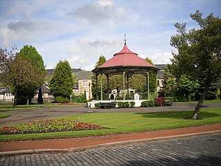
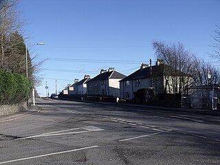
Kilsyth is a town and civil parish in North Lanarkshire, roughly halfway between Glasgow and Stirling in Scotland. The estimated population is 10,380. The town is famous for the Battle of Kilsyth and the religious revivals of the 18th, 19th, and 20th centuries. The town now has links with Cumbernauld at one time being part of Cumbernauld and Kilsyth District Council. The towns also have the same members of parliament at Holyrood and Westminster.

Colzium House and Estate is about 500 metres to the north-east of Kilsyth, North Lanarkshire, Scotland. The present house dates from 1783 and was extended and modernised in 1861. The name may mean "defile leap".

The Battle of Kilsyth, fought on 15 August 1645 near Kilsyth, was an engagement of the Wars of the Three Kingdoms. The largest battle of the conflict in Scotland, it resulted in victory for the Royalist general Montrose over the forces of the Covenanter-dominated Scottish Parliament, and marked the end of General William Baillie's pursuit of the Royalists.

The River Kelvin is a tributary of the River Clyde in northern and northeastern Glasgow, Scotland. It rises on the moor south east of the village of Banton, east of Kilsyth. At almost 22 miles (35 km) long, it initially flows south to Dullatur Bog where it falls into a man made trench and takes a ninety degree turn flowing west through Strathkelvin and along the northern boundary of the bog parallel with the Forth and Clyde Canal.

The Monkland Canal was a 12+1⁄4-mile-long (19.7 km) canal designed to bring coal from the mining areas of Monklands to Glasgow in Scotland. In the course of a long and difficult construction process, it was opened progressively as short sections were completed, from 1771. It reached Gartcraig in 1782, and in 1794 it reached its full originally planned extent, from pits at Calderbank to a basin at Townhead in Glasgow; at first this was in two sections with a 96-foot (29 m) vertical interval between them at Blackhill; coal was unloaded and carted to the lower section and loaded onto a fresh barge. Locks were later constructed linking the two sections, and the canal was also connected to the Forth and Clyde Canal, giving additional business potential.

Banton is a small village situated near Kilsyth in North Lanarkshire, Scotland.
Kelvinhead is a small hamlet in the vicinity of the village of Banton in Scotland. Located close to the source of the River Kelvin, it is little more than a collection of a few houses along the A803 road between Kilsyth and Banknock.

The Forth and Clyde canal pathway runs between the Firth of Forth and the Firth of Clyde and is a 106-kilometre-long (66 mi) footpath and cycleway that runs across Scotland, between Bowling, west of Glasgow, and Lochrin Basin in Edinburgh. The path runs on the towpaths of the Forth & Clyde and Union Canals and is entirely off road. The path is well maintained and its surface is generally good, although there are some stretches particularly between Falkirk and the outskirts of Edinburgh where wet weather leads to muddy conditions unsuitable for road intended bicycles. It is well used by walkers and cyclists, and designated as one of Scotland's Great Trails by NatureScot. It also forms part of the National Cycle Network, being designated as Route 754. Sustrans advises that the path is best followed from the Clyde to the Forth because the prevailing wind is from the south west. Much of the path is also suitable for experienced horseriders, although in some places low bridges, narrow aqueducts and gates may restrict access for horses.

The Black Loch is a small freshwater loch or reservoir in the Falkirk council area, Scotland. It is near the village of Limerigg and close to the boundary with North Lanarkshire.

The Luggie Water is one of two streams which flow out of Cumbernauld. The Scottish New Town’s name derives from the Gaelic for "the meeting of the waters", which possibly refers to the Luggie Water and the Red Burn, both of which run through Cumbernauld but which never meet.
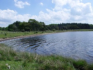
Hillend Loch or Hillend Reservoir is an artificial lake located to the east of Caldercruix in North Lanarkshire, Scotland owned by Scottish Canals. It is bordered on its south shore by the A89 road.
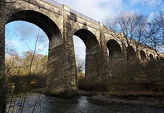
The Kelvin Valley Railway was an independent railway designed to connect Kilsyth, an important mining town in central Scotland, with the railway network. It connected Kilsyth to Kirkintilloch and thence over other railways to the ironworks of Coatbridge, and to Maryhill, connecting onwards to the Queen's Dock at Stobcross.
The Kilsyth and Bonnybridge Railway was a railway line in central Scotland, built to exploit the mineral extractive industries in the area; it opened in 1888. A passenger service was run, but bus competition overwhelmed it after 1920 and the passenger service closed in 1935. The goods and mineral traffic continued, but it was dependent on the industries it served, and when they declined so did the business on the railway; it closed in 1964 and none of it is now in railway use.

The Red Burn is one of two main streams which flow out of Cumbernauld. The Scottish New Town’s name derives from the Gaelic for "the meeting of the waters" and there is broad agreement that one of these waters is the Red Burn.

