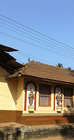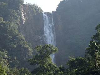
Uttara Kannada is a district in the Indian state of Karnataka. It is a major coastal district of Karnataka, and is the third largest district in Karnataka. It is bordered by the state of Goa and Belagavi districts to the north, Dharwad District and Haveri District to the east, Shivamogga District, and Udupi District to the south, and the Arabian Sea to the west.
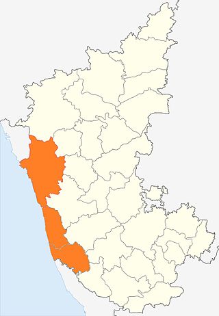
Kanara or Canara, also known as Karavali is the historically significant stretch of land situated by the southwestern coast of India, alongside the Arabian Sea in the present-day Indian state of Karnataka. The subregion comprises three civil districts, namely: Uttara Kannada, Udupi, and Dakshina Kannada. Kassergode was included prior to the States Reorganisation Act.

Dakshina Kannada district is a district of Karnataka state in India, with its headquarters in the coastal city of Mangalore. It is part of the larger Tulu Nadu region. The district covers an area nestled in between the Western Ghats to its east and the Arabian Sea to its west. Dakshina Kannada receives abundant rainfall during the Indian monsoon. It is bordered by Udupi district to the north, Chikmagalur district to the northeast, Hassan district to the east, Kodagu to the southeast and Kasaragod district of Kerala to the south. According to the 2011 census of India, Dakshina Kannada district had a population of 2,083,625. It is the only district in Karnataka state to have all modes of transport like road, rail, water and air due to the presence of a major hub, Mangalore. This financial district is also known as the Cradle of Indian banking.

South Canara was a district of the Madras Presidency of British India, located at 13.00°N 75.40°E. It comprised the towns of Kassergode and Udipi and adjacent villages, with the administration at Mangalore city. South Canara was one of the most heterogeneous areas of Madras Presidency, with Tulu, Malayalam, Kannada, Konkani, Marathi, Urdu, and Beary languages being spoken side by side. It was succeeded by the Tulu-speaking areas of Dakshina Kannada district, the Malayalam-speaking area of Kasaragod district and the Amindivi islands sub-division of the Laccadives, in the year 1956.
Puttur (Pronunciation:) is a city in Dakshina Kannada district, in Karnataka state of India. The Puttur Shree Mahalingeshwara Temple is located here.
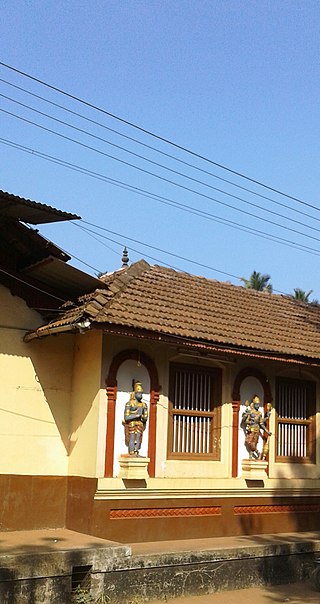
Bantwal is a suburb of Mangalore in Dakshina Kannada district, Karnataka, India, and the headquarters of Bantwal taluk. It is located 25 km (16 mi) East of Mangalore city center. BC Road-Kaikamba of Bantwal is one of the fastest developing areas in Dakshina Kannada district of Karnataka.

Hassan is one of the 31 districts of Karnataka, India. The district headquarter is Hassan. It was carved out from Mysore district in the year 1866, during the Commissioner's Rule of Mysore (1831-81).

Udupi district is an administrative subdivision in the Karnataka state of India, with the district headquarters in the city of Udupi. It is situated in the Canara old north malabar coastal region, there are seven taluks, 233 villages and 21 towns in Udupi district. The three northern tehsils of Udupi, Kundapur and Karkala, were partitioned from Dakshina Kannada district to form Udupi district on 25 August 1997. Moodabidri was officially declared as new tehsil (taluk), separated from Karkala with effect from 11 January 2018.

Uppala is a town and Headquarters of Manjeshwaram Taluk in Kasaragod district, Kerala, India. It is geographically located midway from Kasaragod to Mangalore. Easy geographical access and lack of major towns nearby are the key reasons for the town to develop exponentially, especially in the past decade. The population of Manjeshwaram Taluk alone was over 268,642 as of 2011. Uppala is 22 km north of Kasaragod and one of the fastest growing urban settlements in Kasaragod district. It is well known as an important trade hub in the northernmost part of Kerala state.
Kasaragod is one of the 14 districts in the southern Indian state of Kerala. Its northern border Thalappady is located just 10 km south to Ullal, which is the southernmost portion of the major port city Mangalore, on the southwestern Malabar coast of India.
Alike or Aalike is a village in Bantwal taluk of Dakshina Kannada district, Karnataka, India. The languages spoken are Tulu, Kannada, Beary, Urdu, and Konkani. According to the 2011 census it has a population of 5840 living in 1041 households. Its main agriculture product is arecanut growing.
Joida is a town located in the Uttara Kannada district in the Indian state of Karnataka. The town is the headquarters of the eponymous taluk. Earlier it was known as Supa taluka but as Supa village got submerged due to dam built across river Kali, Joida taluka came into existence. Joida town has a Post office, branch of nationalised banks and a Police station.
Bekoor is a village near Uppala town in Kasaragod district in the state of Kerala, India. This locality is located in eastern Uppala, in Uppala-Bayar road, which connects Uppala with Paivalike, Bayar, and leads to Kanyana, Vittal and Puttur in dakshina Kannada district, Karnataka. It is around 3 km from Kaikamba junction and 1 km from Sonkal.
Hirebandadi is a village in the southern state of Karnataka, India. It is located in the Puttur taluk of Dakshina Kannada district. It mostly consists of paddy fields and areca nut plantations. It has numerous streams cutting across the region and lies along the banks of the Netravati River.
Kanyana is a village in the southern state of Karnataka, India. It is located in the Bantwal Taluk of Dakshina Kannada district in Karnataka. The majority of the population are Hindus, Catholics and Muslims and the main languages spoken are Tulu, Kannada, Beary, Malayalam and Konkani.
Manchi is a village in the southern state of Karnataka, India. The village has most of the lands under agriculture. Over 90% of people are literate. nearest town is B.C Road which is 12 km from Manchi. In Manchi there is a primary school established in 1950 and a high school. Roads connect B.C Road, Vitla, Mangalore and Kalladka. It is located in the Bantwal taluk of Dakshina Kannada district in Karnataka. The office of the gram panchayath is in Kukkaje.
Punacha is a village in the southern state of Karnataka, India. It is located in the Bantwal taluk of Dakshina Kannada district in Karnataka.

Uppinangady or Ubar is a town in the Dakshina Kannada district in the state of Karnataka. It is surrounded by the Kumaradhara River on one side and Nethravathi River on the other. When the town's two surrounding rivers rise during the rainy season and meet, this is called the "Sangam" which is a Sanskrit word for confluence. The Sangam is a major event as people from the surrounding villages crowd the river banks to witness the merge. The population of Uppinangady is 7,172.
Veerakamba is a village in the southern state of Karnataka, India. It is located in the Bantwal taluk of Dakshina Kannada district in Karnataka.
Patrame is a small, rural panchayat village on the left (east) bank of the Netravati River in Karnataka, India. Administratively, it is under Belthangady taluk, Dakshina Kannada district, Karnataka. Patrame is the only village in its gram panchayat. The village of Patrame is 26 km from its taluk headquarters Belthangady, and 8 km by road from Dharmasthala.
